
Over the last week or so thunderstorm activity has been relatively subdued over most of Tamil Nadu with only feeble rainfall activity seen at times over places in North TN. Couple of days back parts of Vellore district recorded light rains which was the only note worthy incident this week though Chennai has been recording passing showers late in the night in a few areas.
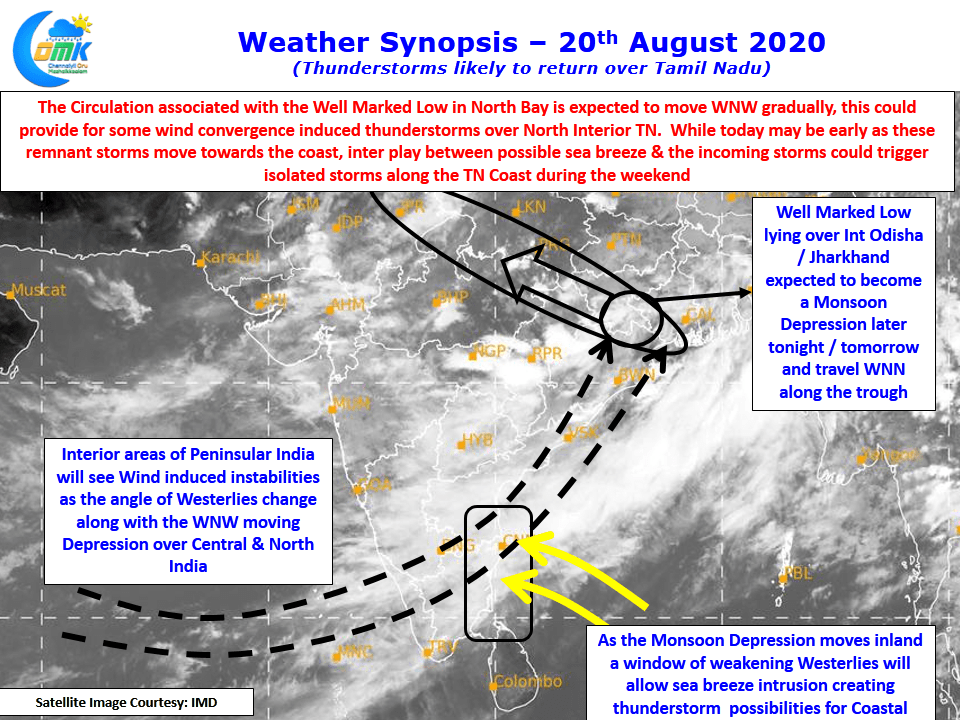
With back to back low happening in North Bay Monsoon continues to be active over East, Central India while converging winds have brought heavy spells of rains to the desert state of Rajasthan and parts of NW India. The well marked low now currently lies over North Interior Odisha & adjoining parts of Jharkhand and is likely to move in a WNW direction along the monsoon trough intensifying into a Monsoon depression later tonight or tomorrow morning.
In the meanwhile there is some good news on the thunderstorms front for Tamil Nadu. As the depression moves inland a combination of factors is likely to create conducive conditions for thunderstorms to return back to Tamil Nadu. While today may be a tad early though there is a slight chance of some thunderstorm activity over North TN. From tomorrow we could possibly see the arrival of sea breeze over coastal areas which could trigger some storms along the coastal areas in a few places.
Also the movement of depression will change the angle of westerlies and weakening it as well a tad to provide some platform for thunderstorms to form in the interiors. The interplay between remnant sea breeze front in the coastal areas & the incoming thunderstorms from the west could provide for some action in places like Chennai over the weekend.