
After a couple of days of slightly weak thunderstorm activity things are gradually picking up over Tamil Nadu. Yesterday thought thunderstorms were not widespread & restricted to mostly North & NW TN areas, Pallipattu, right on the border of Andhra Pradesh, recorded more than 15 cms from slow moving storms. Falling under the Mid Tropospheric East West Shear Zone conditions, storms formed in the area and struggled under poor steering winds thereby dumping heavy rains at almost all the places where the formed around the AP & TN Border.
In the meanwhile satellite image indicates mostly dry conditions over large parts of Indian Sub Continent except Peninsular India where atmospheric instabilities continue to keep conditions conducive for thunderstorms to develop. With no synoptic conditions seen to revive rains over North & NW India it is a matter of time before IMD starts announcing the withdrawal of Southwest Monsoon over rest of Rajasthan & states like Punjab, Haryana, J&K etc. A possible bay pulse may keep the monsoon going over parts of Central India nevertheless overall withdrawal dynamics will start picking up pace from now on.
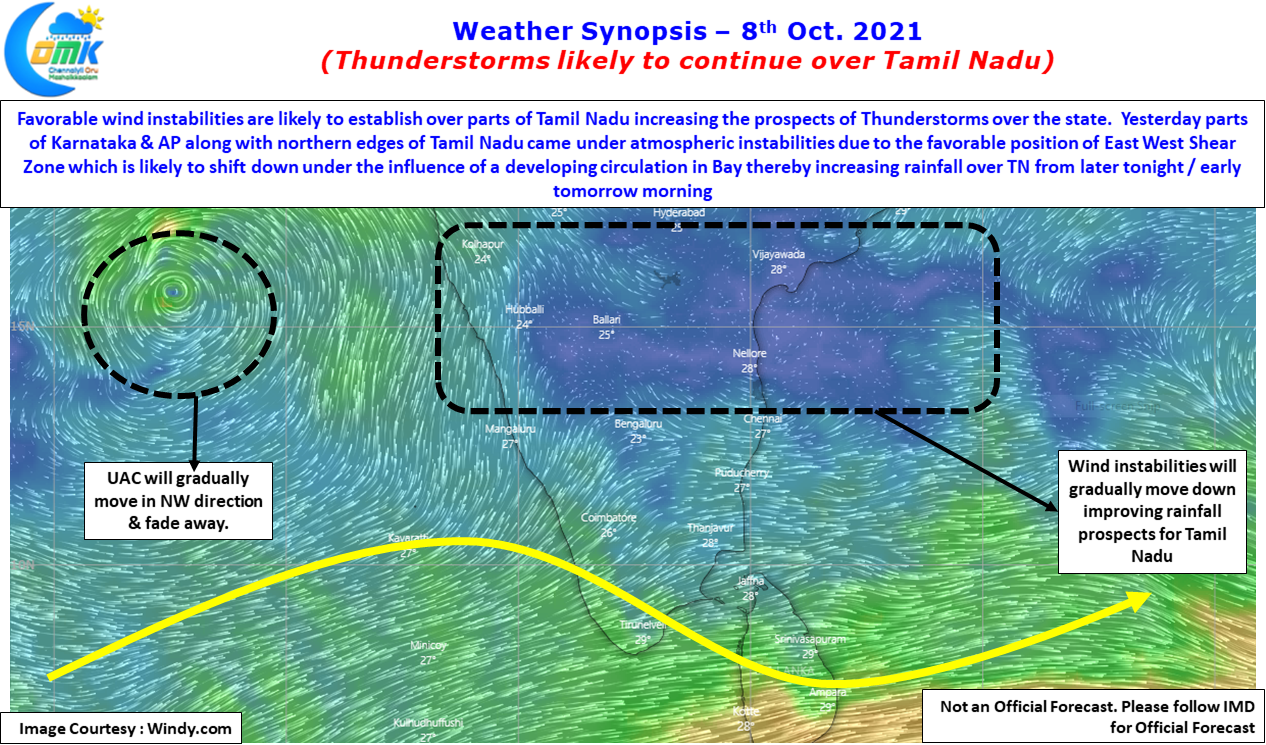
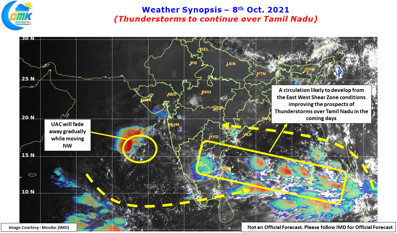

Yesterday weather models judged the conditions well in terms of picking up the East West Shear zone over the Rayalaseema region & adjoining areas of South Interior Karnataka & extreme parts of North Tamil Nadu. The heaviest thunderstorm activity also stayed in this region with places around Chittoor getting good rains during the late night hours. Parts of Chennai & suburbs received light passing spell of showers as the day broke but they were isolated in nature & was not heavy either.
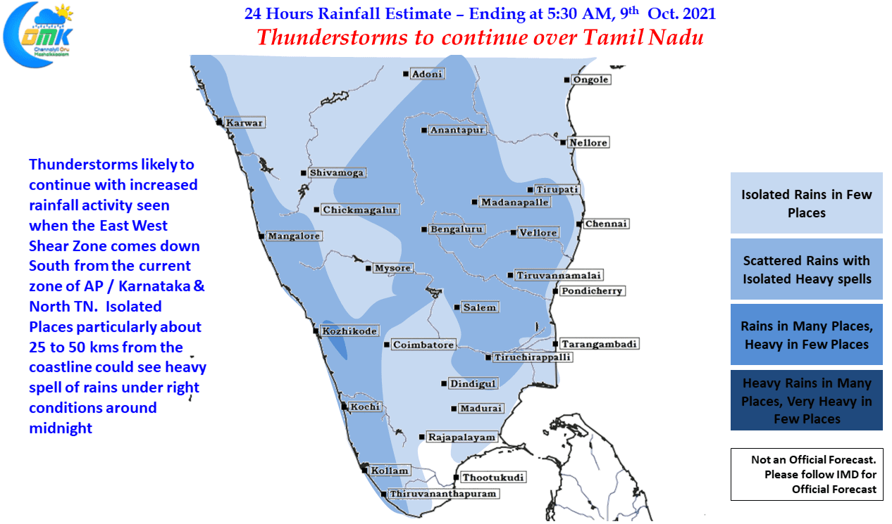
While today may be a bit early for Tamil Nadu to benefit from the East West Shear Zone that is expected to climb down in latitude over the next couple of days, prospects of thunderstorms can only improve from today for Tamil Nadu. The next couple of days places in North & NW Tamil Nadu may enjoy the better spells while slowly almost all of the state will benefit from this upcoming spell of rains influenced by East West Shear zone sitting favorably. Meanwhile it will not come as a surprise to see if both the IMD observatories touch nearly 3/4th of the October quota of rains before the first fortnight of October ends.