
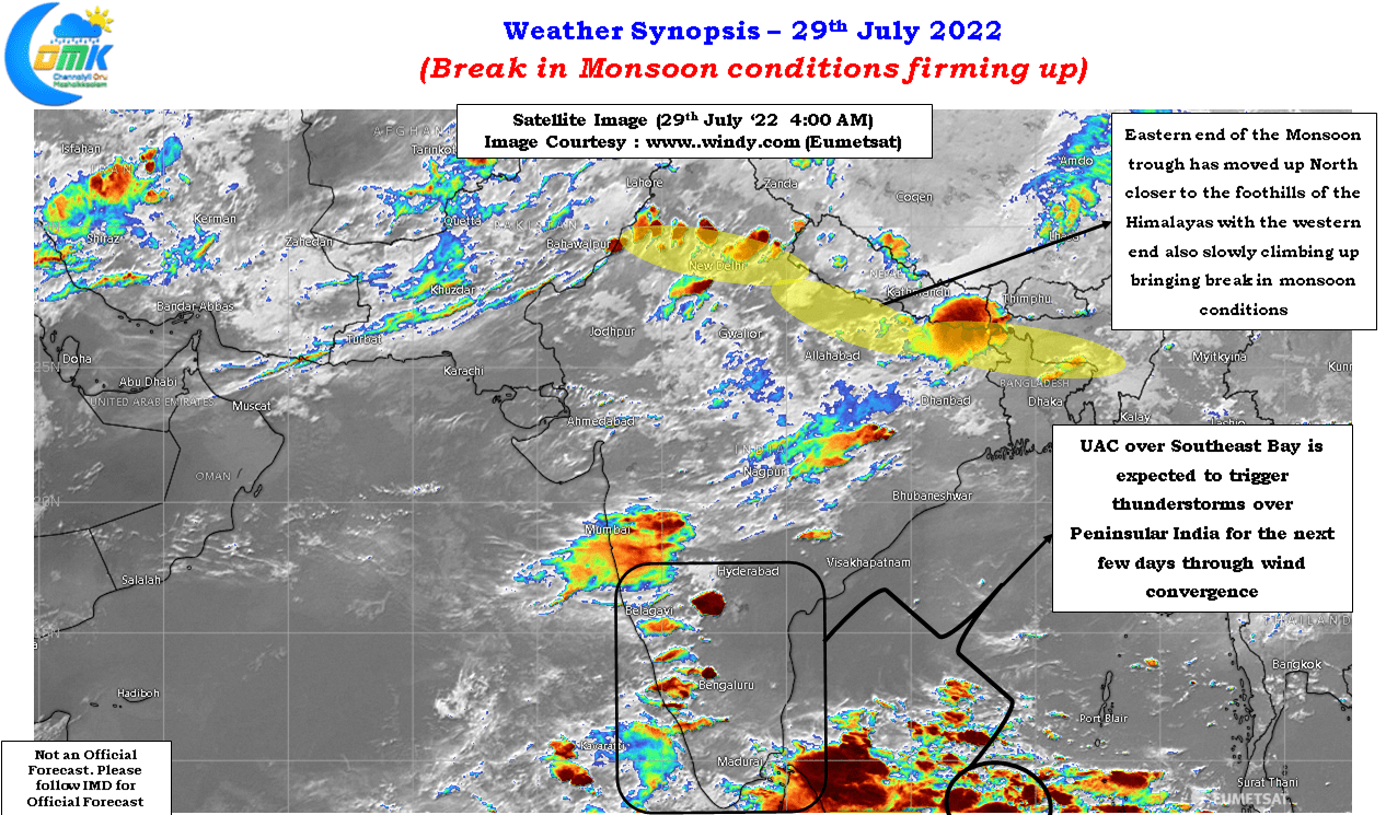
Southwest Monsoon has been heading towards a break in monsoon period with the Eastern end of the monsoon trough already shifting closer to the foothils of the Himalayas. The Westen end of the monsoon trough is expected to also shift North in the next 24 to 48 hours or so which will signify break in monsoon during the early days of August. The standardized rainfall index over the core monsoon region as maintained by IMD went below -1 for the first time since end June. Three consecutive days of -1 or lower in the Standardized Rainfall Index indicates a break in monsoon period.
In the meanwhile the last couple of days have seen an uptick of thunderstorm activity over Peninsular India with many places in Tamil Nadu and Interior Karnataka coming under moderate to intense thunderstorms under the influence of a North-South Trough. The wind convergence created by the presence of an Upper Air Cyclonic Circulation over the South Bay has been providing conducive conditions for thunderstorms to thrive with pseudo Easterlies and Westerlies meeting over places closer to the Ghats.
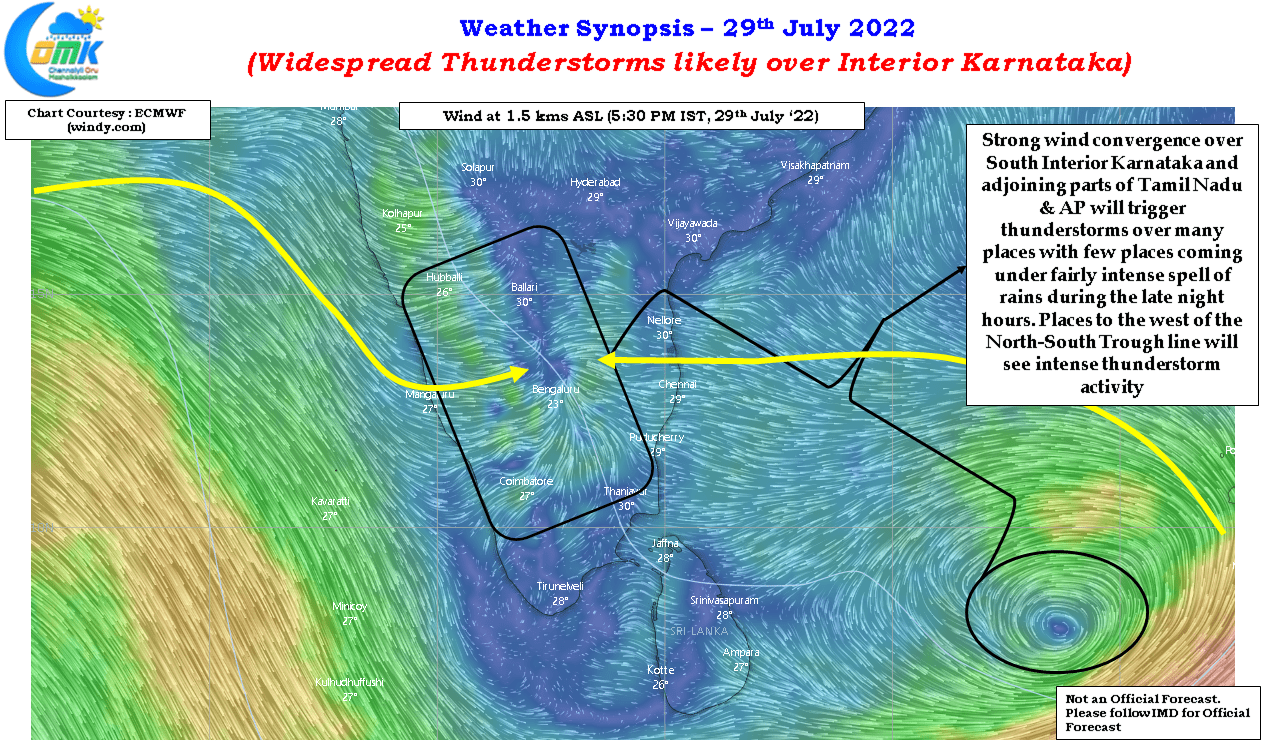
The pseduo Easterlies has shifted the convergence zone to the interior areas which has resulted in reduction of thunderstorms over coastal places like Chennai. While until this weekend coastal areas may stay quiet early next week as the circulation climbs up the convergence zone will start shifting East towards the coast under the influence of strengthening Westerlies bringing back rains over Chennai and rest of the coastal areas between Pulicat and Delta. As this circulation climbs up gaining latitude it may eventually descend into a possible Low Pressure Area over the Central Bay dragging down the monsoon trough in the bargain bringing back some momentum to monsoon, though all these will depend on favorable tropical wave support.
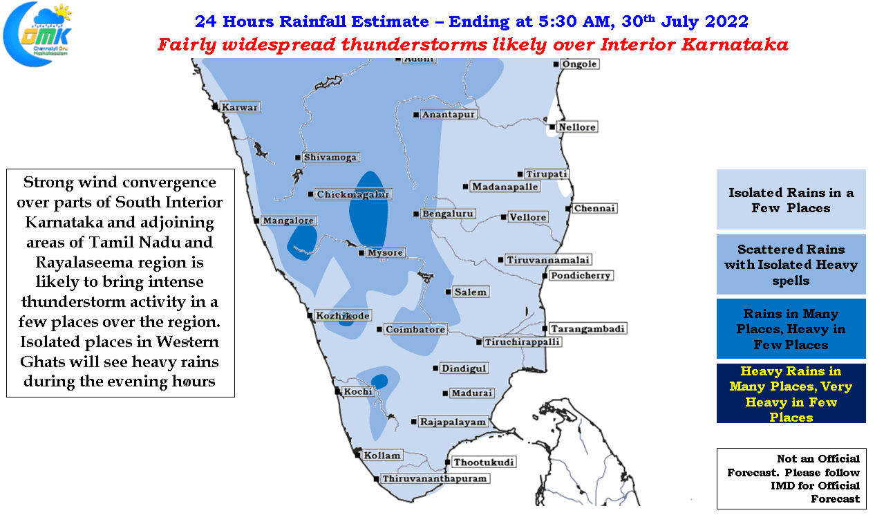
Today though the best conditions for thunderstorms as indicated by weather models fall over South Interior Karnataka and adjoining areas of Tamil Nadu and Rayalaseema. This is likely to bring fairly widespread thunderstorms over places like Bengaluru / Mysuru etc with one or two places depending on localized conditions coming under intense spell of rains during the late evening / night hours. Places along the Western Ghats will continue to see thunderstorms under the influence of the circulation in Bay