
2023 is likely to be a year of transition, after a few years of cool regime in the form of La Nina the ocean dynamics is gradually changing to a warm regime with Pacific warming up and most weather models upbeat about a quick transition to El Nino and some models even hinting at a very strong El Nino episode. We will have to wait and watch to see how much of the outlooks by weather models turn into reality and whether the ocean and atmosphere work in tandem. Remember it always takes two to tango and it might be pertinent to remember the last El Nino episode was expected to start in 2014 and it did not take off due to ocean and atmosphere singing from different hymn sheets.
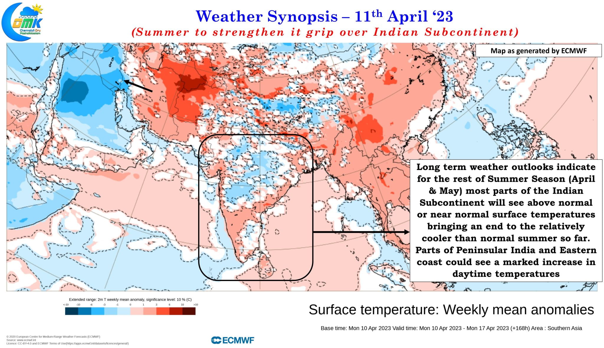
In the mean while on the Indian Summer front while it is not exactly a transition from cool to warm regime for the Indian subcontinent certainly things are likely to heat up with weather models in the medium term indicating a pronounced increase in daytime temperatures over most parts of India. So far the temperatures have stayed slightly below normal with summer not yet showing up in full force not only over Tamil Nadu but most parts of the country including some of the early pace setters like Vidharbha, Odisha etc.
The remaining days of summer season (March to May as classified by IMD) going by weather models is expected to see daytime temperatures stay near normal or above normal. The first phase of this increased temperatures is expected to start from today with maximum temperatures increasing by a couple of degrees over most parts of Peninsular India. Towards the end of the week, from Friday onwards there is a very high chance of parts of Andhra Pradesh around Rayalaseema region to come under heat wave conditions, though we may have to wait and watch if IMD indeed gives out a heat wave warning. During this period weather models are consistent about most places in the AP & TS states to see daytime temperatures stay 3 to 5 degrees above normal.
Closer home Tamil Nadu is also expected to see an increase in temperatures in sync with the rest of the places along the East Coast of Peninsular India with the interior places expected to see maximum temperatures touch 40°C while Chennai and suburbs may see maximum temperatures touch 37 / 38°C which will be once again 4 or 5 degrees higher than the temperatures that have been prevailing since the start of April. Hopefully a stronger temperature gradient may allow for better sea breeze penetration over coastal places like Chennai bringing some much needed respite during the evening hours though the humidity will remain to make it uncomfortable.
Not only weather models are indicating an increase in day time temperatures but overall Indian subcontinent is expected to move into much more drier conditions for the rest of April with weather models consistent about the next fortnight seeing below normal rains in the country including Peninsular India. This would also mean clearer skies enhancing the day time temperatures along with it. The tropical wave chart pretty much shows how suppressed atmospheric conditions are expected to prevail over the Indian Sub Continent in the coming days.
Effectively it is now that time of the year when nature offers you hot water through the pipes without the need for a water heater.