
The moody Southwest Monsoon continues to swing back and forth with alternating active and weak phases for Peninsular India. These constant mood swings has also meant the 1st half of monsoon has not seen a classic break period. The first classic break in monsoon period is almost upon us looking at how things are shaping up. Satellite image indicates most of the Indian sub continent devoid of any deep convection. Equatorial Bay though is an exception where a developing shear zone is influencing things.
The absence of classic Break in Monsoon so far has also meant leeward plains of TN has seen sub par SWM 2025 so far. A look at the daily rainfall graph will show 1st fortnight of July was very poor for the state. Things picked up during the 2nd fortnight of July when a shear zone developed in South Bay. This brought about decent rains to parts of North TN though parts of Chennai did miss out. Subsequently with monsoon dynamics picking up action shifted to Peninsular West Coast.
Possibly for the first time leeward plains of TN can look forward to a widespread rainfall event this SWM season. A combination of Break in Monsoon conditions with a Shear Zone over Equatorial bay sets things nicely. Over the next week to 10 days as a fresh MISO starts taking shape leeward plains of Peninsular India may get much needed rains. Districts like Karur, Trichy, Madurai, Virudhunagar can finally look forward to an active spell of thunderstorms.
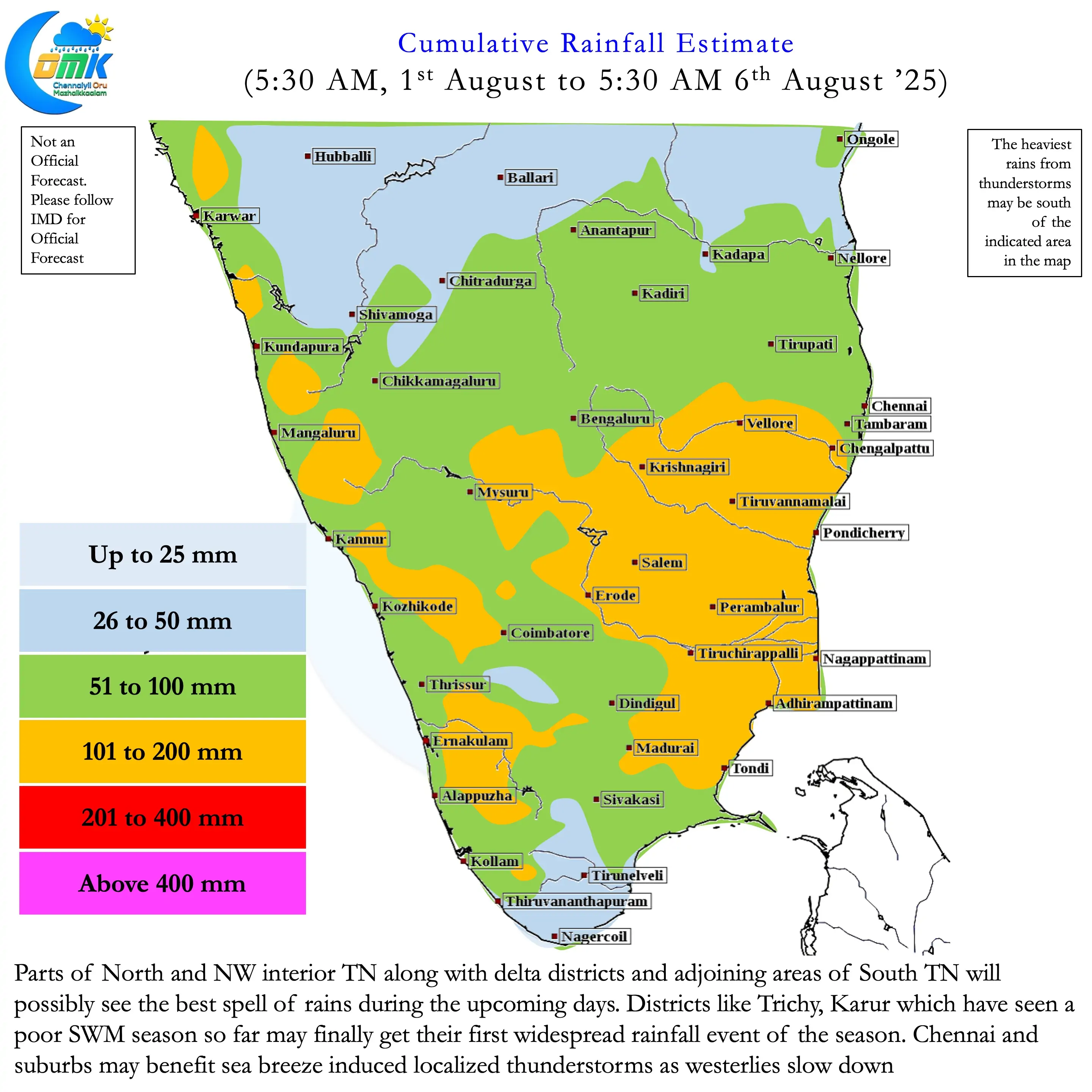
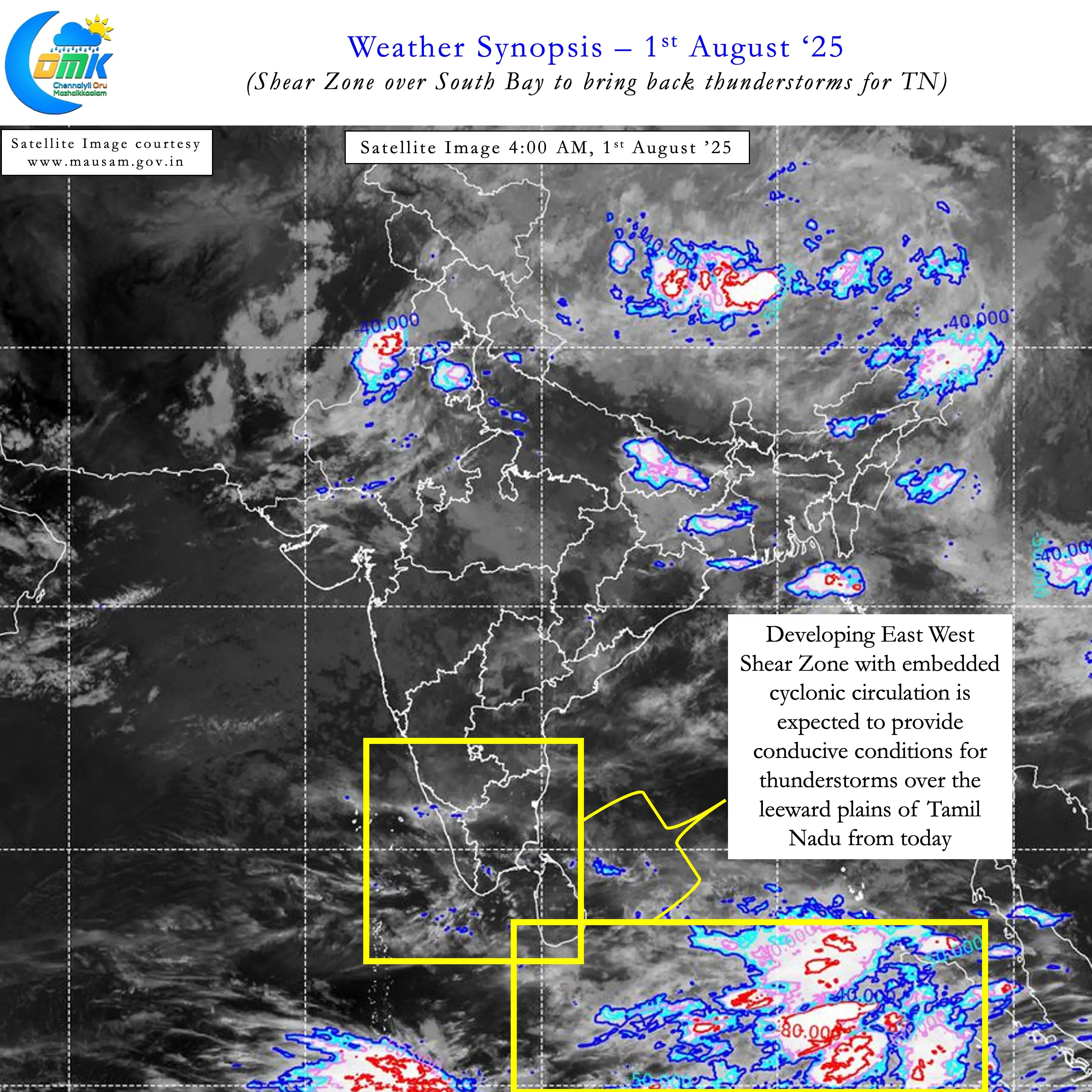


Weather models indicate the shear zone with an embedded circulation may linger around Equatorial / South Bay for the next few days. With westerlies weakening on account of break in monsoon it sets the stage for convective thunderstorms over the leeward plains. Slow moving thunderstorms that could dump a lot of rains under right conditions. As we always mention impact zones may vary depending on how real life wind convergence happens compared to model estimates. But all in all until mid August leeward plains of TN can look forward to a spell of season defining rains.
For places like Chennai a lot hinges on not only how winds shape up but the genesis of interior thunderstorms. If both the wind steering and genesis location are in line then Chennai could see a couple of days of intense thunderstorm activity. But this phase of intense thunderstorms may potentially happen next week. Until then parts of South TN, delta districts, Central TN and adjoining areas of North TN may benefit the most. Overall there is a fair degree of confidence except for districts like Thoothukudi and Ramanathapuram most districts of TN will flip the seasonal negative anomaly by mid August. Starting from today we can expect an increase in intensity of thunderstorms and spatial spread as well.