
During the Southwest Monsoon on most occasions rains swing like a pendulum. When the West coast and the Ghats are active places in the East coast like North TN remain quiet. When monsoon goes through a break period it is the leeward plains that get active while West coast remains quiet. At times though when an area of disturbance forms in South Bay rains may happen on both sides. The rains along the west coast and Ghats happens due to the moisture push from Westerlies. At the same time instability due to wind convergence through the circulation triggers thunderstorms over the leeward plains.
The next couple of days we may see a situation when both sides of Peninsular Coast may see rainfall activity. After a lull we saw the return of monsoon dynamics over Peninsular India for the last couple of days. The daily rainfall chart for Kerala saw its second highest peak since the start of statistical Monsoon season yesterday. Yesterday saw parts of North TN come under rains with few places recording more than 7 cms. With weak steering thunderstorms were slow to move resulting in the same set of places getting the rains.
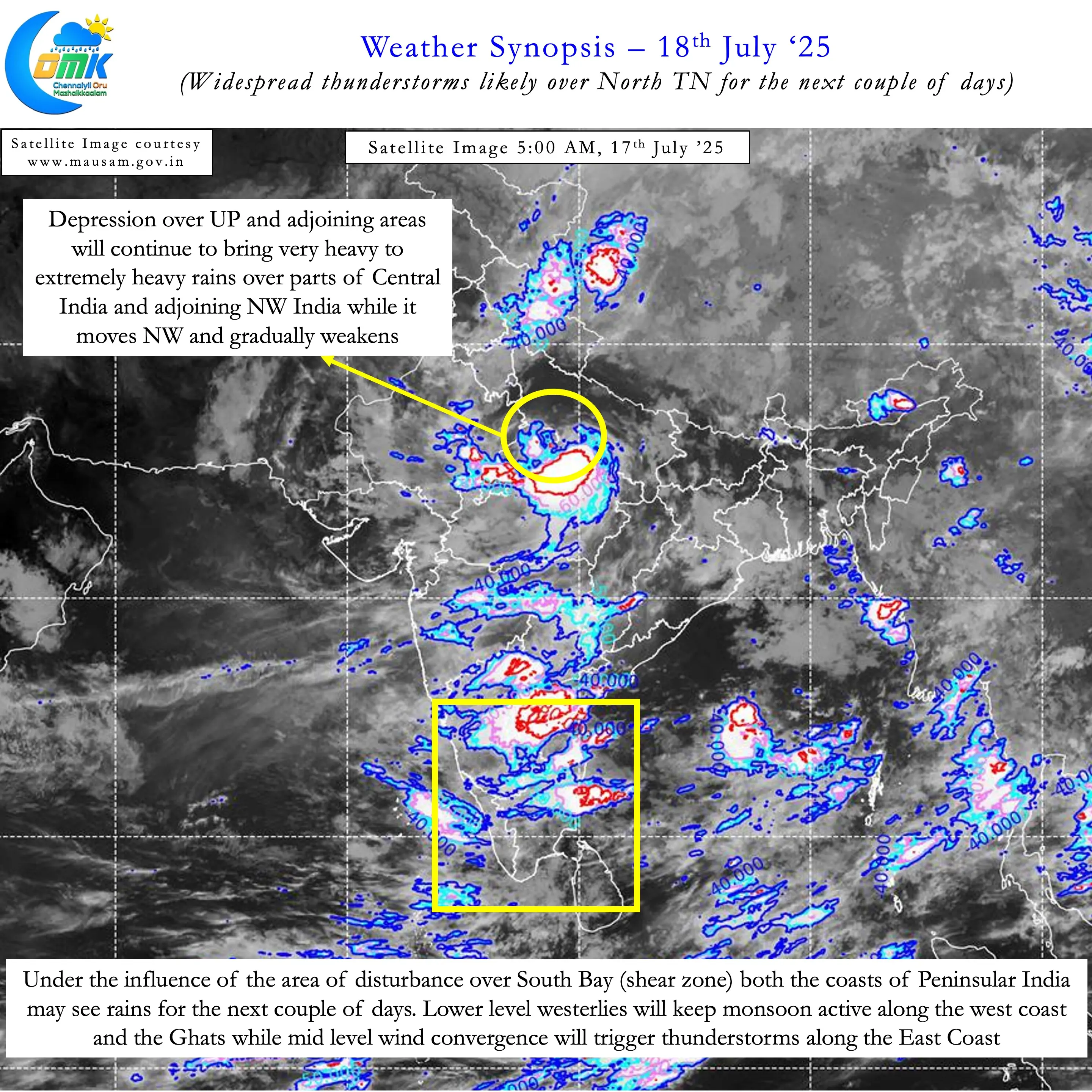
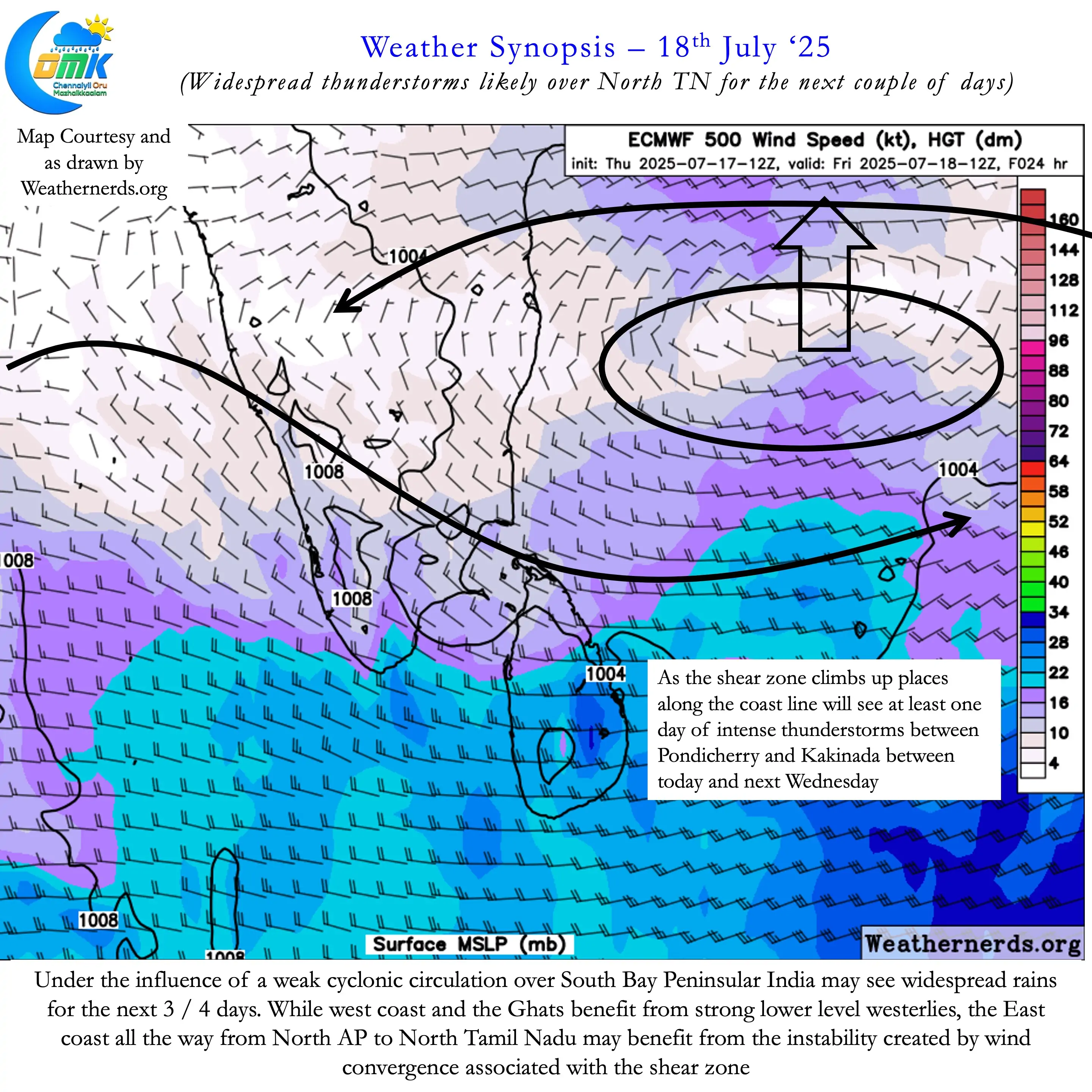
The weak mid level East West shear zone prevailing over South Bay has played a crucial role in these rains. On the one hand strengthening westerlies aided by the fresh MISO pulse has started to push moisture along Peninsular West Coast. On the other hand the East West Shear Zone makes it conducive for thunderstorms over the leeward plains of East Coast. Over the next 3 / 4 days we may see the coastal stretch between Pondicherry and Kakinada receive some much needed rains.
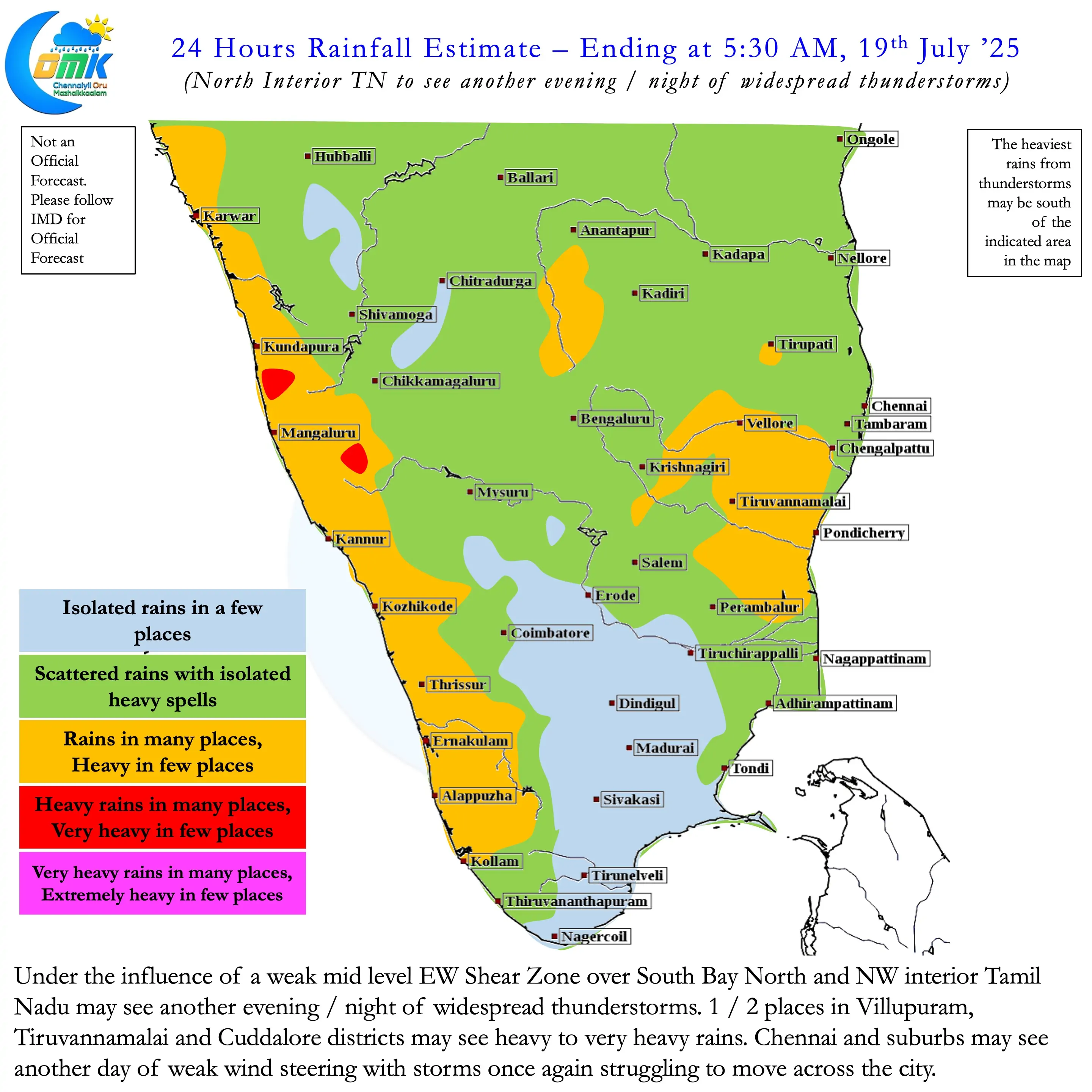
As the Shear Zone climbs up the heaviest rainfall zone will also gradually climb up. During this phase North TN may see widespread rains until possibly Monday. While interior areas may see good rains on most days coastal areas may see at least one day of rains as the disturbance moves up. Chennai and suburbs fell victim to the poor steering of storms yesterday. With the storms not crossing the coast bulk of the rains fell about 50 kms away from the coast line. Similar condition may exist today also though it is expected to improve compared to yesterday.
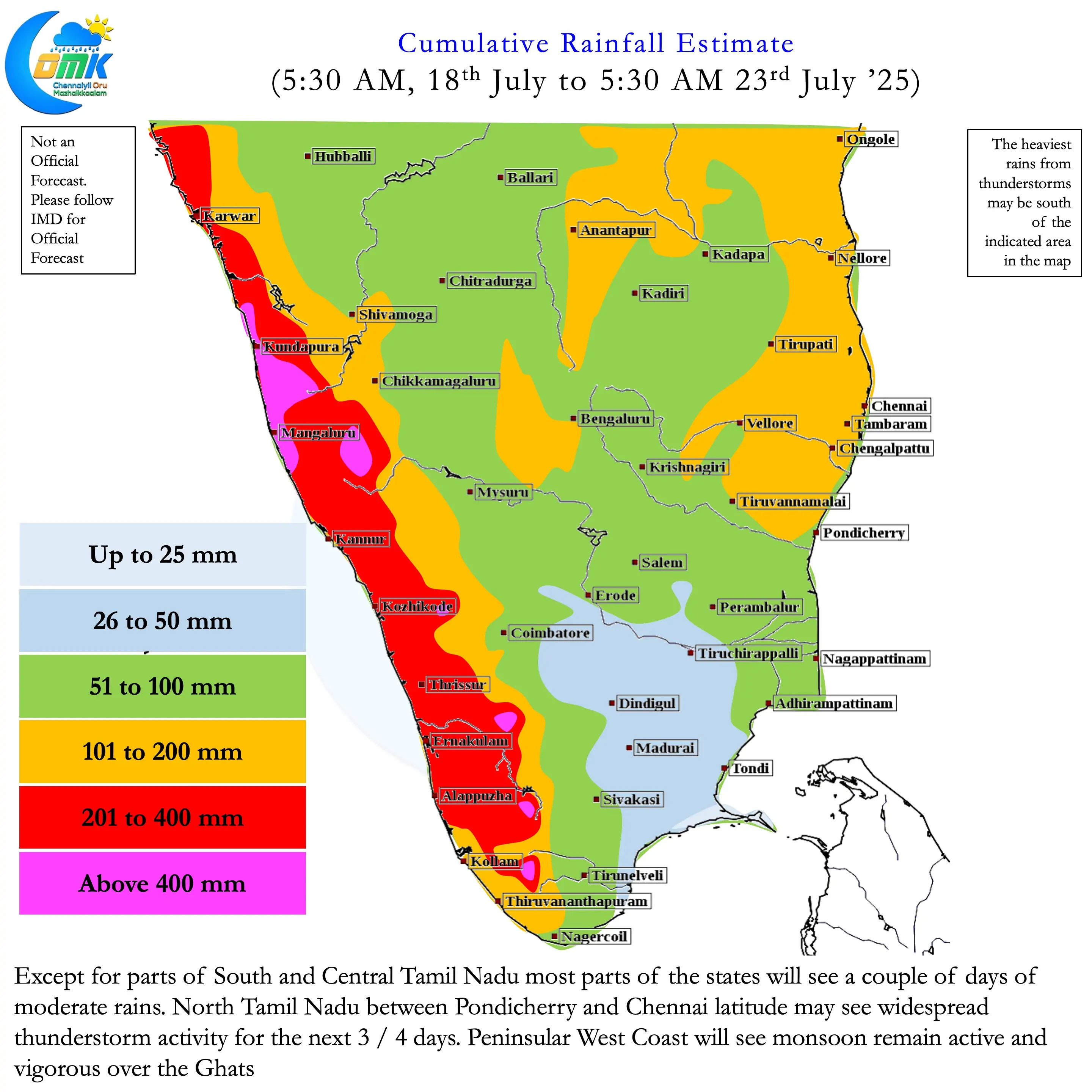
Except for South and Central TN most of TN will see good rains over the next 3 / 4 days. North TN may be the biggest beneficiary along with adjoining areas of South AP. Between today and Monday Chennai and subrubs may see at least one day of widespread rains . Today’s post also carries an estimated cumulative rainfall map. But we would suggest to keep a tab on the COMK Estimated Rainfall Range Table which has more options.