
As we get into the second half of the Southwest Monsoon season slowly but steadily the soil saturation across the Indian sub continent starts to increase more and more, particularly the river basins, under the influence of the regular rains that has happened since the onset of monsoon. To give a perspective the water run off potential between say the 1st week of June and 1st week of September becomes vastly different due to the monsoon rains during the interevening period. While an extreme rainfall episode might trigger a flooding incident during the early days of monsoon, as we get into August and September even a moderately heavy rainfall episode has higher chance to trigger a flooding episode due to higher level of soil saturation triggering higher water run off than say during the month of June.
One needs to keep a close watch on any rainfall episode that may happen during the months of August & September. Additionally the preceding episodes of heavy / extreme rains along with increased soil saturation tends to drastically increase the risk of landslides as well. It is not wrong to say any rains during the Northeast Monsoon season over these ghats and catchment areas due to favorable LPA / Cyclone tracks triggers heavy inflows because of the very high soil saturation levels after the Southwest Monsoon season. The 2021 floods over parts of Rayalaseema happened not only because of the heavy rains during the Northeast Monsoon season but also on account of the nearly 30% excess rains that happened during the preceding Southwest Monsoon season.
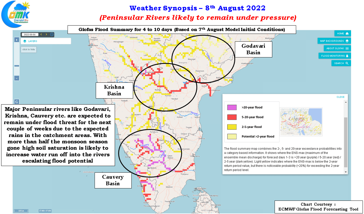
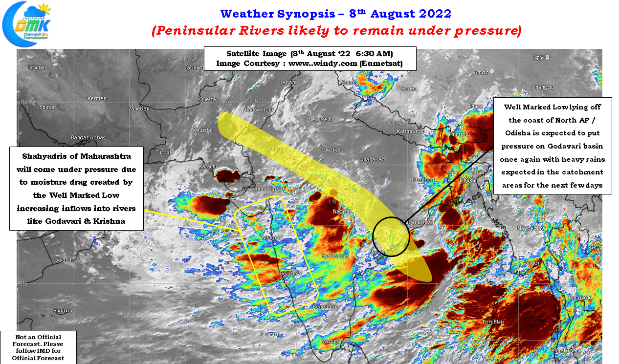
It is in this context the current episode of active monsoon conditions need to be closely observed. For a start once again the Well Marked Low has dragged the Monsoon trough to the northern parts of Peninsular India by parking itself off the North AP / Odisha coast. This is likely to once again trigger good rains over the catchment areas of Krishna & Godavari for the next few days increasing the flooding risk once again for these basins. With most dams already full or nearing FRL the cumulative outflow is likely to increase drastically with each day of continuing rains irrespective of the intensity. The Global Flood Forecasting System of ECMWF (GLOFAS) is indeed picking up this risk as it continues to show flooding risk both in the short and medium term time frames.
Cauvery is likely to also remain under pressure on account of good rains not only in the catchment areas of Western Ghats but also in rivers like Shimisha which are downstream of Krishnaraja Sagara dam thereby bringing heavy inflows into Mettur in addition to the inflows that come out of upstream dams due to rains in the Western Ghats. Adding to it we have Bhavanisagar at near FRL and Amaravathi also getting closer to FRL the inflows from these rivers downstream of Mettur is also likely to be a worry.