
Many may remember Fire and Ice the poem written by Robert Frost. He uses the words Fire and Ice as a metaphor to talk about destructive forces. If you ask a weather blogger about Fire and Ice possibly the quickest reference could be to summer. A period when the land not only gets scorched under the afternoon sun but also gets cooled by thunderstorms. It is also the period when we get to hailstorms at many places. In a way it is similar to the poem by Robert Frost. Both come with its own set of risks. Heat with its own associated risk and thunderstorms with the risk of lightning.
For the past couple of months the detailed updates in the blog has almost followed the pattern of alternating between rains and heat. But for the first time we are at a stage where both heat and rains are talk of the town. We are at the cusp of seasonal change of winds from Easterlies to Westerlies. The fading Easterlies though have set the platform for a period of rains over many parts of Peninsular India. While it has not been abnormally hot the temperatures have certainly soared up over many places. The day starts with clear skies followed by mid morning heat peaking by afternoon. Thunderstorms follow this bringing rains and relief.
Coastal areas like Chennai though do not benefit much from this convective development of thunderstorms. Primarily because the prevailing Easterlies make the wind steering unfavourable. Interior areas though benefit from with wind discontinuity prevailing due the westerlies strengthening and pushing back the Easterlies. Peninsular West Coast saw summer thunderstorms peak by 1st week of April which would mean roughly around 4th week of May we can look forward to conditions getting favourable for Monsoon onset over Kerala.
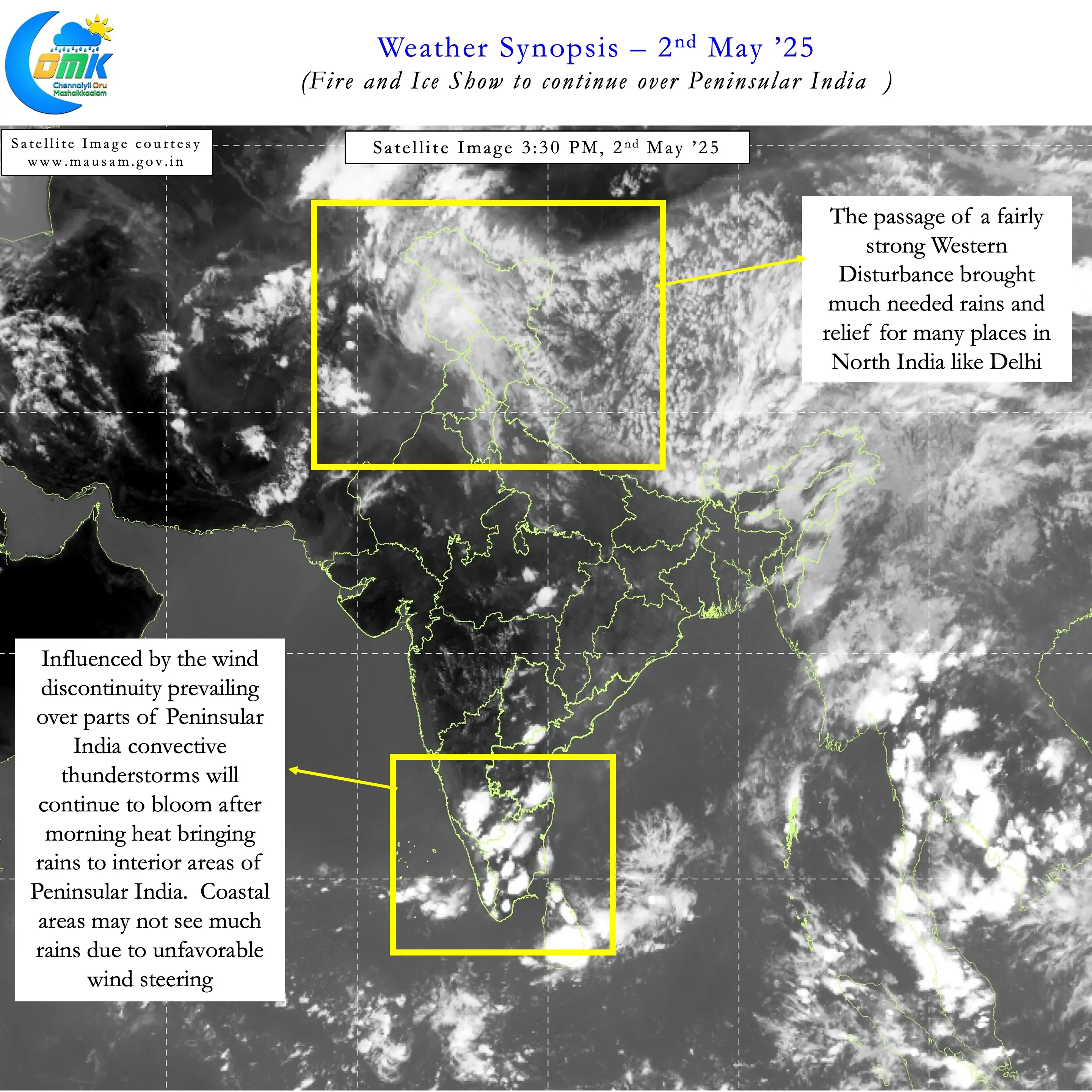
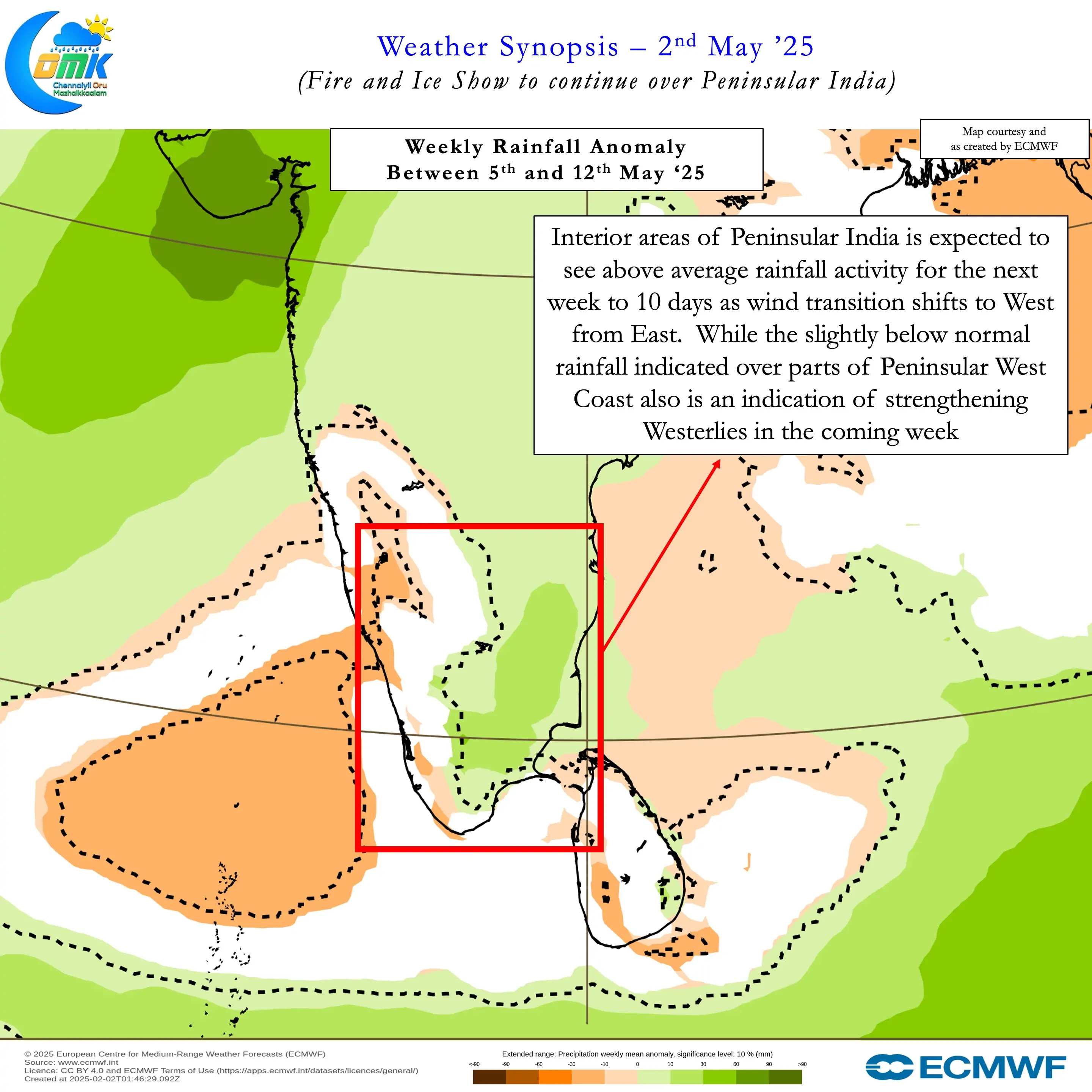
In the meanwhile interior areas of Peninsular India, including interior Tamil Nadu, may benefit from the wind transition. South Interior Karnataka, adjoining areas of NW Interior Tamil Nadu and places along the Eastern Ghats benefit the most from these transition season thunderstorms. Over the next couple of weeks heat will continue to be the name of the game. But an active spell of thunderstorms over the interior areas may bring relief and rains on a regular basis. Coastal places like Chennai may need to wait for freak circumstances or improved westerly steering closer to monsoon onset.
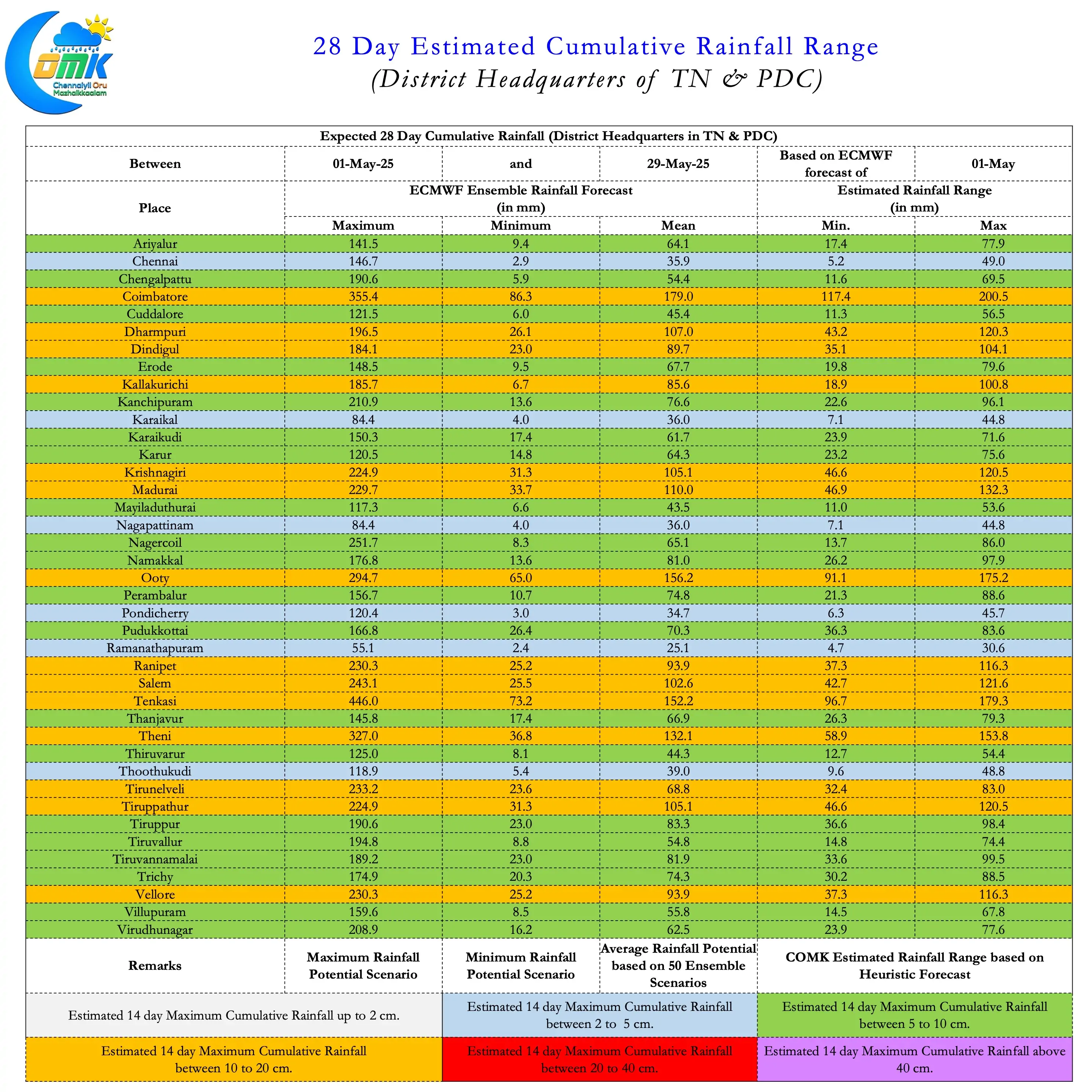
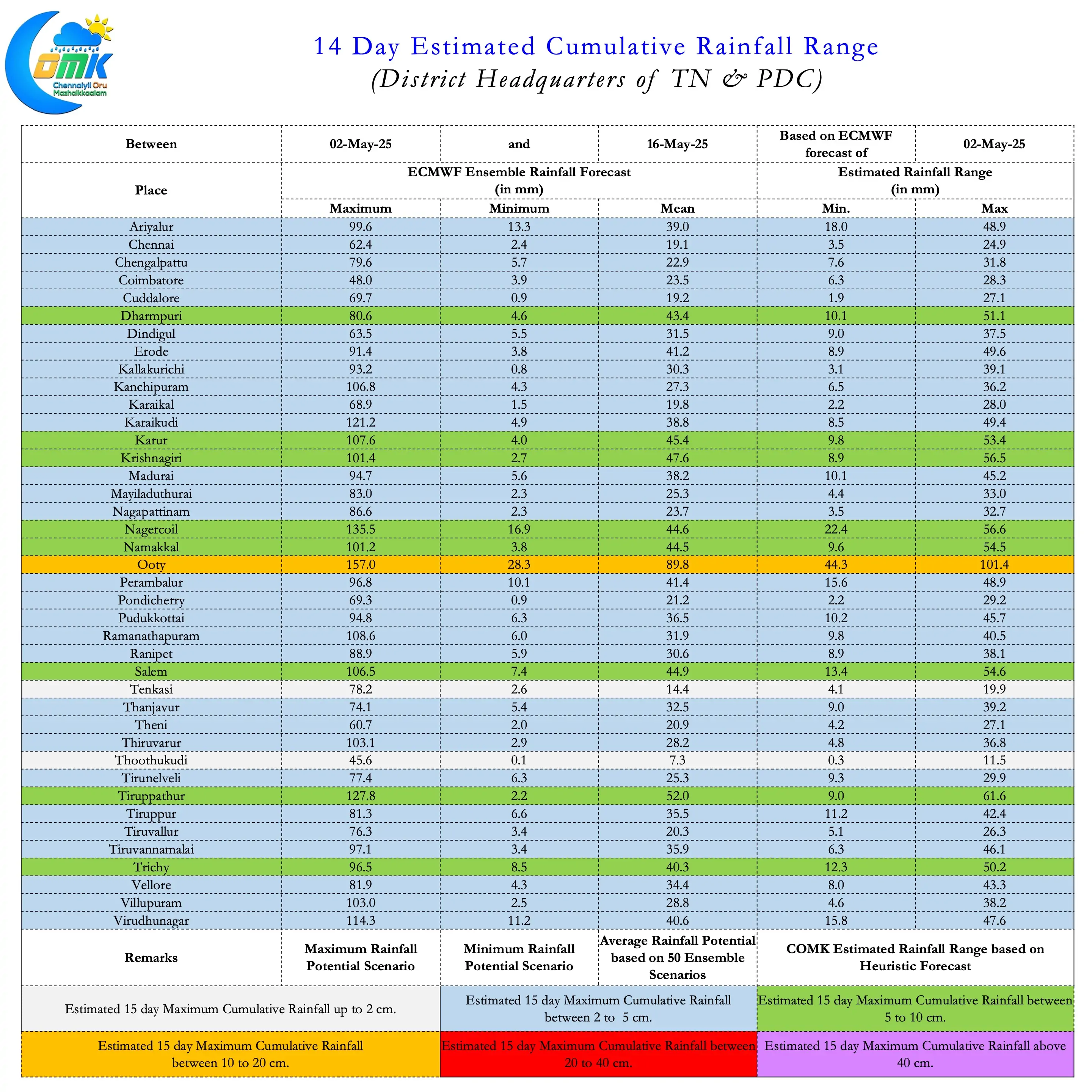
All in all the period of Fire and Ice is set to continue for the interiors with some pockets of West and NW Interior TN in line to accumulate as high as 25 cms over the next 2 / 3 weeks. Though MJO continues to remain weak and struggling against the base ENSO state transition favourable support from Kelvin is likely to enhance the thunderstorm impact.