

There is an old saying “All Good things must come to an end”. For the citizens of coastal Tamil Nadu Easterlies do qualify as a good thing. Not only do they bring the much needed Northeast Monsoon season for Tamil Nadu. It also plays a crucial modulating role in temperatures during March and April. In broad terms one can qualify May to September as the period dominated by Westerlies. More often than not Easterlies dominate the period November to March. April and October are the two transition months when the wind regimes make season shift.
This seasonal shift is also a precursor to the arrival of Monsoon as well. Westerlies bring in Southwest Monsoon while Easterlies bring in Northeast Monsoon. It also becomes essential to point out the role of transition season tropical disturbances. During most years summer cyclones or post monsoon cyclones tend to be the trigger to flip the winds. Occasionally this trigger is provided by weaker circulations also. We have also seen in a few years the transition happening with a delay in the absence of favourable conditions. The LPA during the first half of April brought the first phase of westerlies which spiked the heat over North TN.
Over the next 3 / 4 days under Easterlies could bring some rains for parts of Tamil Nadu. A weak cyclonic circulation lingering over the Comorin Sea area is likely to play a supporting role. While parts of South TN can expect moderate rains coastal stretch between Chennai and Delta may see light rains in a few places. This could bring some much needed respite from heat until middle of next week. A 50:50 chance for a possible interaction between mid level westerlies and lower level Easterlies could bring surprise rains to one or two places around Chennai.
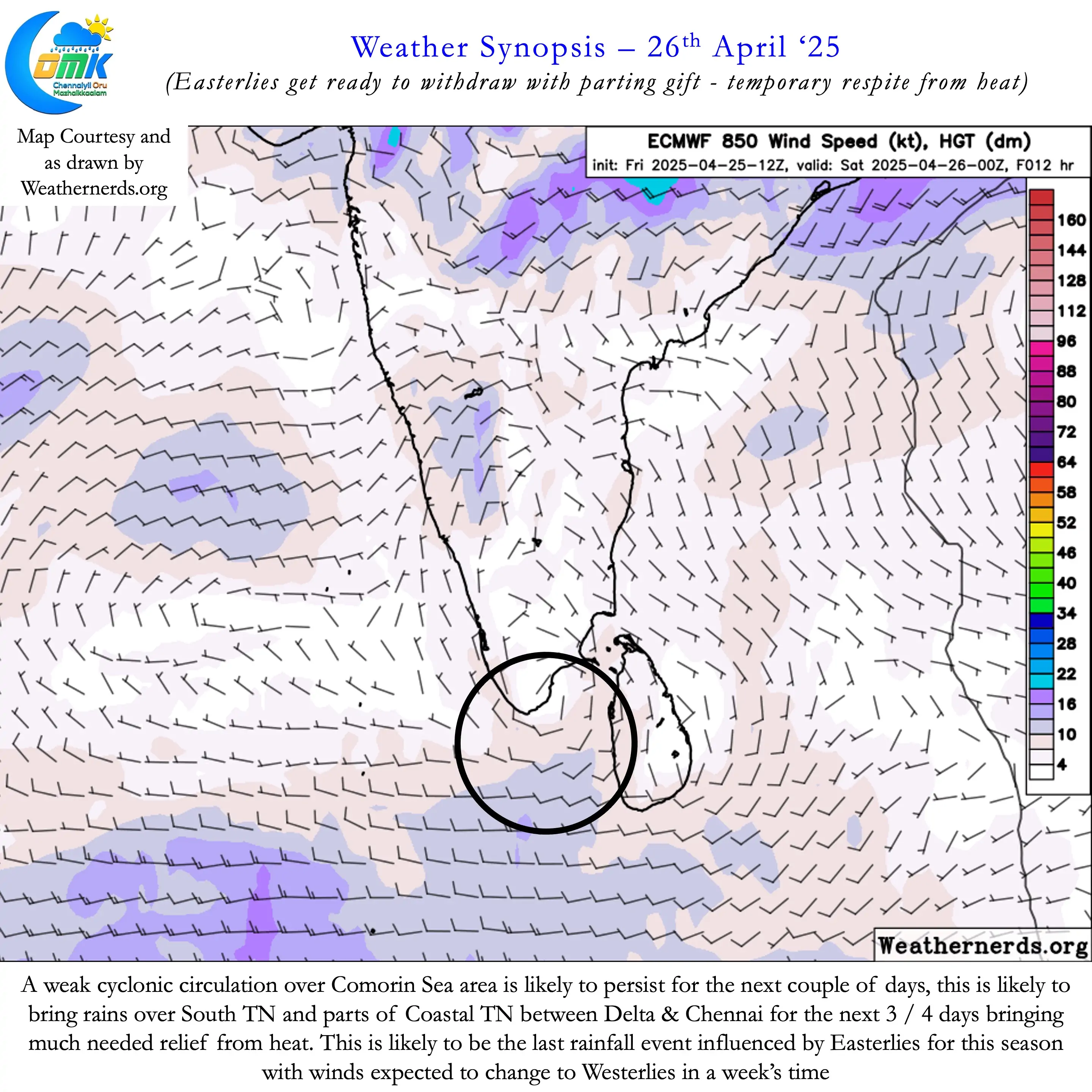
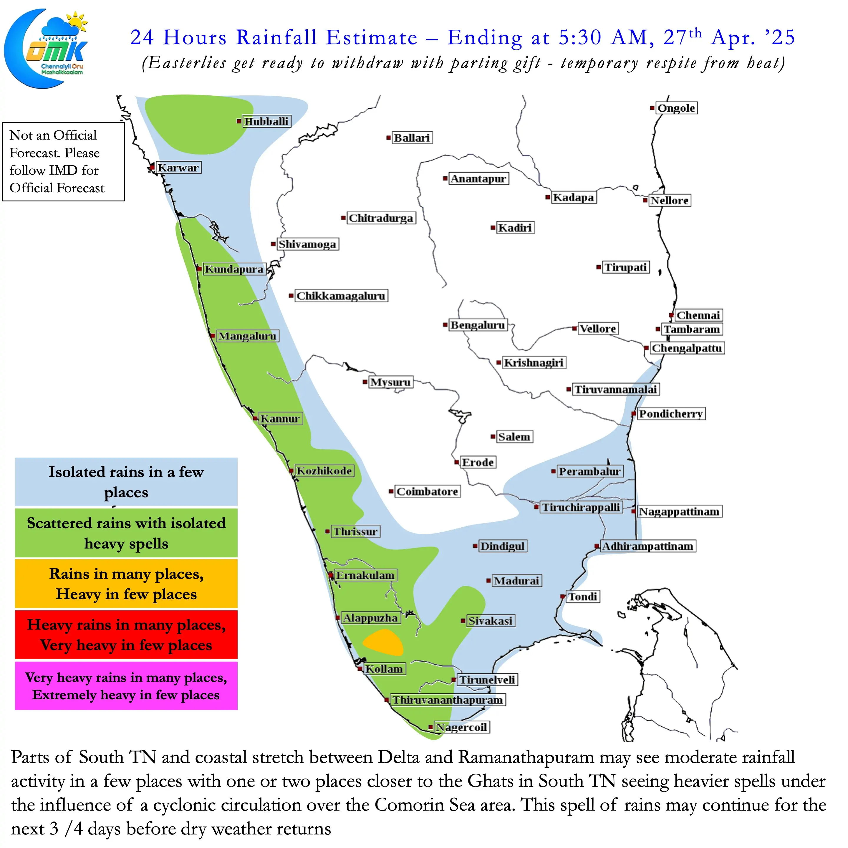
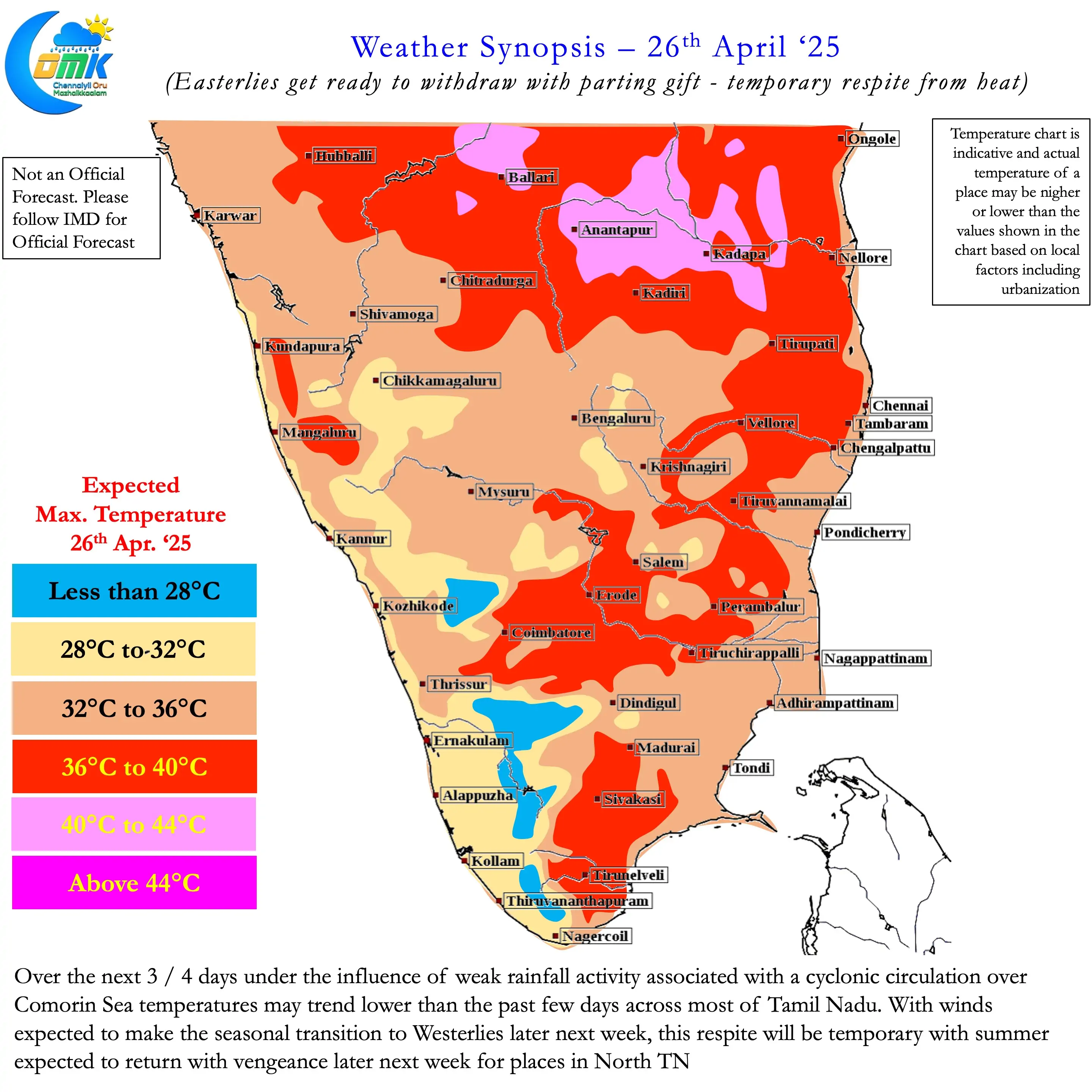
In all probability this could be the last rainfall episode under the influence of Easterlies. Weather models indicate a gradual shift to Westerlies from later next week at lower levels. This could mean heat will return back after this spell of rains. Not only would it return but return with vengeance. As we often mention the hottest period for Chennai is when Westerlies are at their strongest. This happens when Monsoon onset is close by or happening and when there is a cyclone in North Bay. When westerlies are very strong the influence of sea breeze becomes negligible spiking the afternoon heat.
Over the past few days while we have not actually seen sea breeze influence become negligible but it has struggled to move across the city areas of Chennai. This resulted in the suburbs of Chennai seeing nearly 3 degrees higher afternoon temperatures compared to city areas. Once the Westerlies start to firm up sea breeze will gradually start getting delayed. This could mean more hours of peak heat stress for coastal Tamil Nadu as westerlies bring land heat for longer hours.
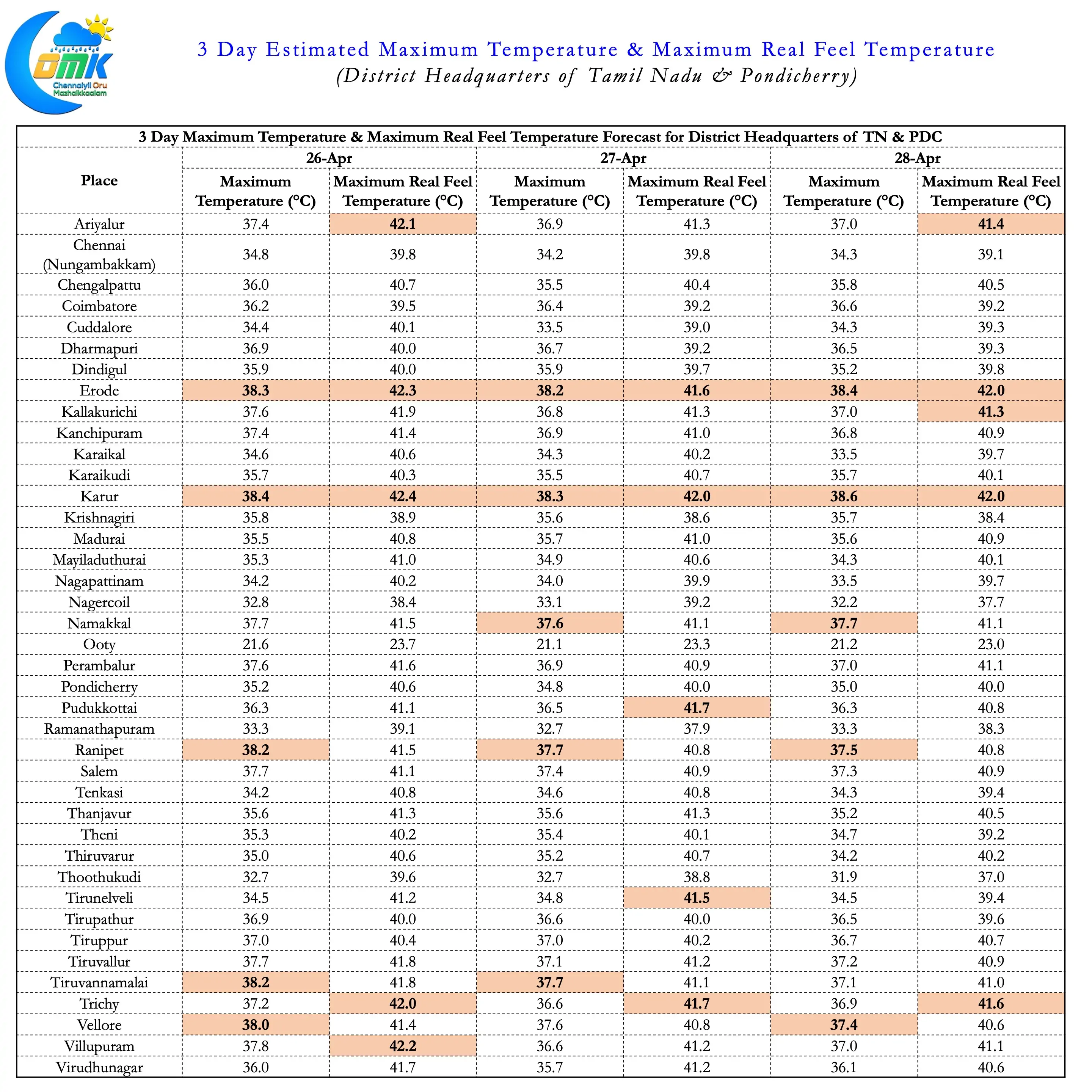
Starting today a 3 day Estimated Maximum Temperature and Maximum Real Feel Temperature for the district quarters of TN & PDC is being published. The Maximum Real Feel Temperature is a much better reflection of real time conditions taking humidity into account. This estimated temperature is an amalgamation of multiple weather model forecasts.