

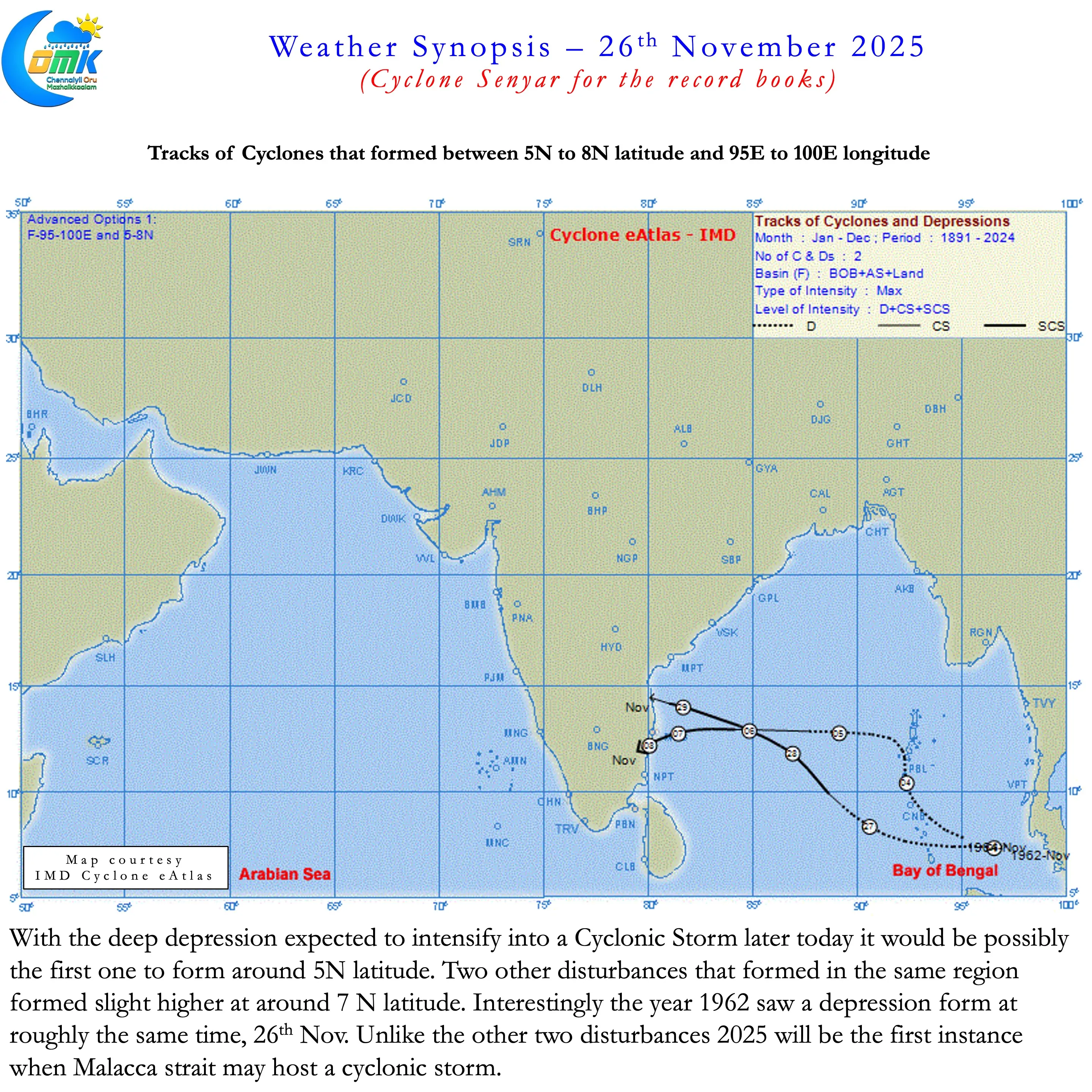
One of the interesting things about weather blogging is monitoring events that are unique. Over the next 12 to 36 hours the current generation of weather watchers may be witness to two historic events unfolding. The first of the one is likely to happen in the next 12 hours or so. Since record keeping in the late 1800s Strait of Malacca has not hosted a cyclone so far. The deep depression over Strait of Malacca is expected to intensify into a Cyclonic Storm later today. That would make Cyclone Senyar as the first cyclonic storm to form over the Strait of Malacca.
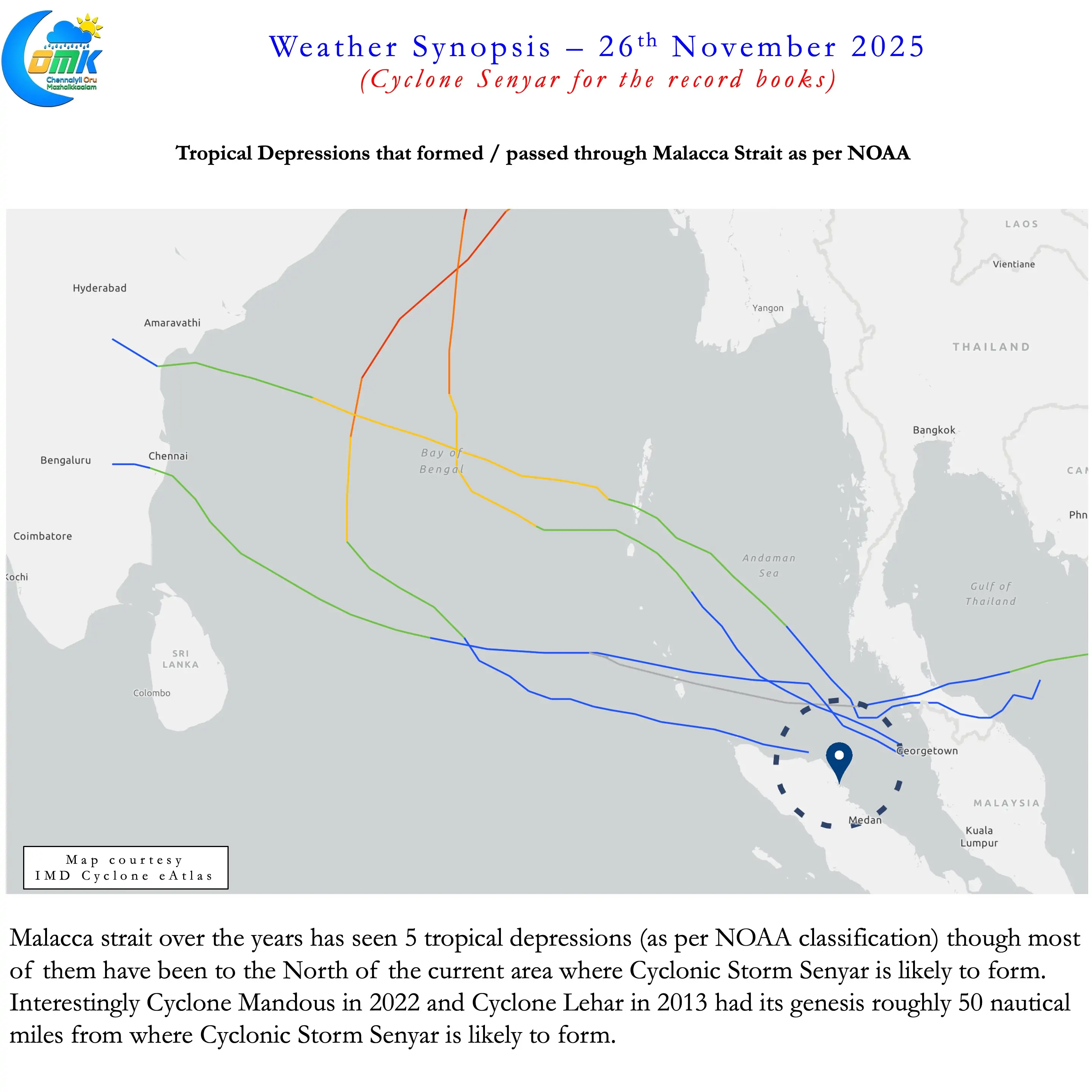
Very rarely we see cyclones at such low latitude. The closest to the Equator in North Indian ocean was Agni. Similarly no cyclone / depression has formed at such low latitudes near Sumatra. The closest have all formed around 7N latitude in the same region making it closer to the open waters of Andaman Sea. Interestingly in 1962 a cyclonic storm had its genesis on 26th November slightly North of the area where Cyclone Senyar is likely to form. Another interesting point of note here is two recent cyclones Mandous and Lehar had its origin as tropical depressions about 50 nautical miles away from the current deep depression.
Way back in 2018 we had put a post on simultaneous twin cyclones in North Indian Ocean. It was the time when we had the Cyclone pair Luban and Titli at the same time. At the time of creating the post all the pairs featured one in Arabian Sea and the other in Bay of Bengal. For the first time Arabian Sea hosted a twin cyclone in 2019 when Maha and Kyarr happened during late October. 2023 saw Cyclones Tej and Hamoon happen at the same time. This year during Cyclone Montha we had a simultaneous depression in Arabian Sea as well. Are we seeing increasing twin depressions / cyclones in North Indian Ocean?
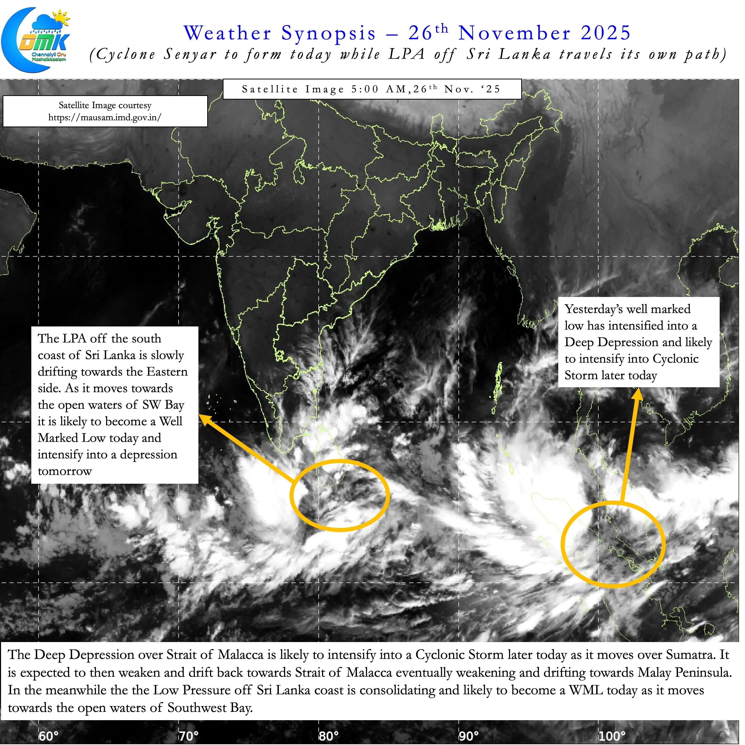
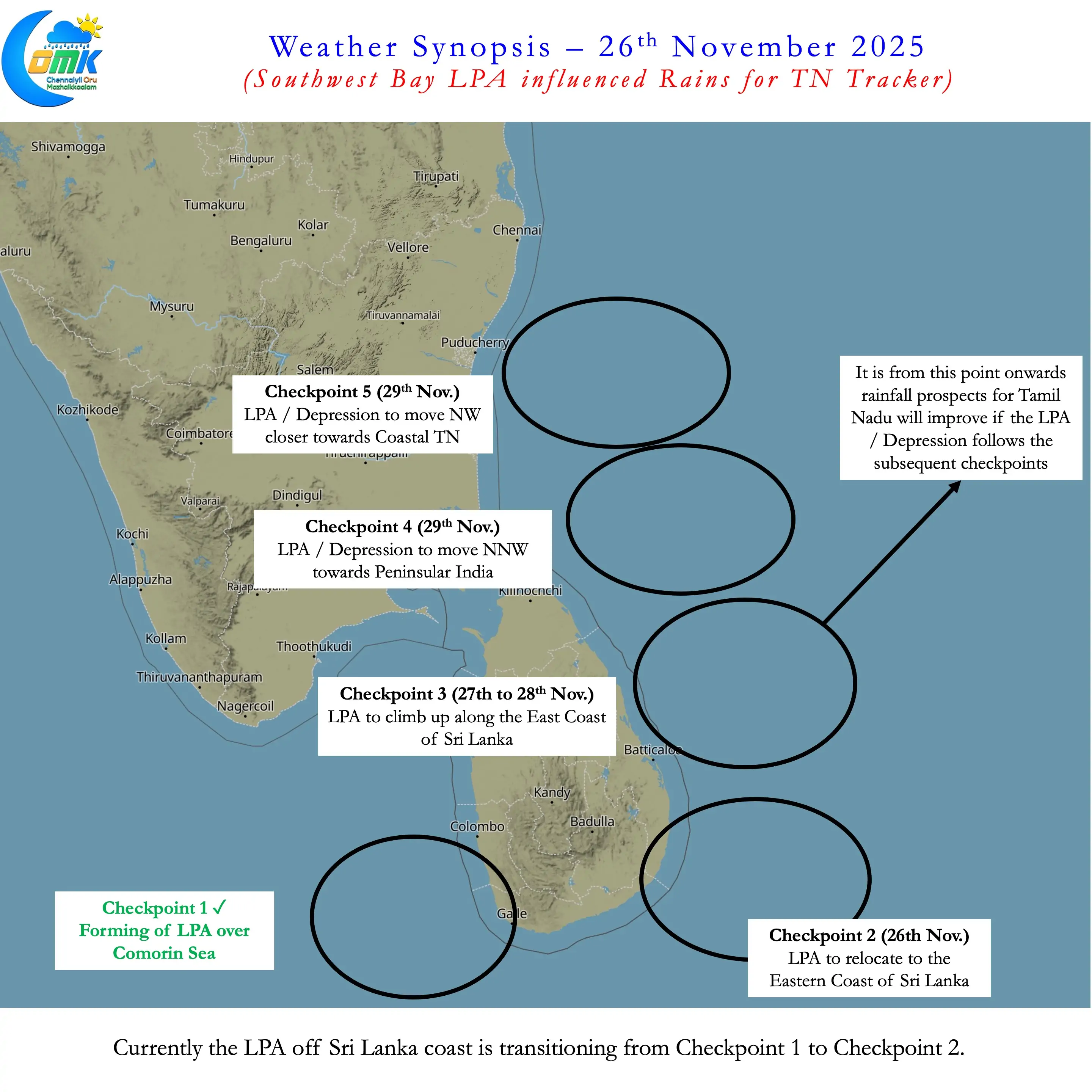
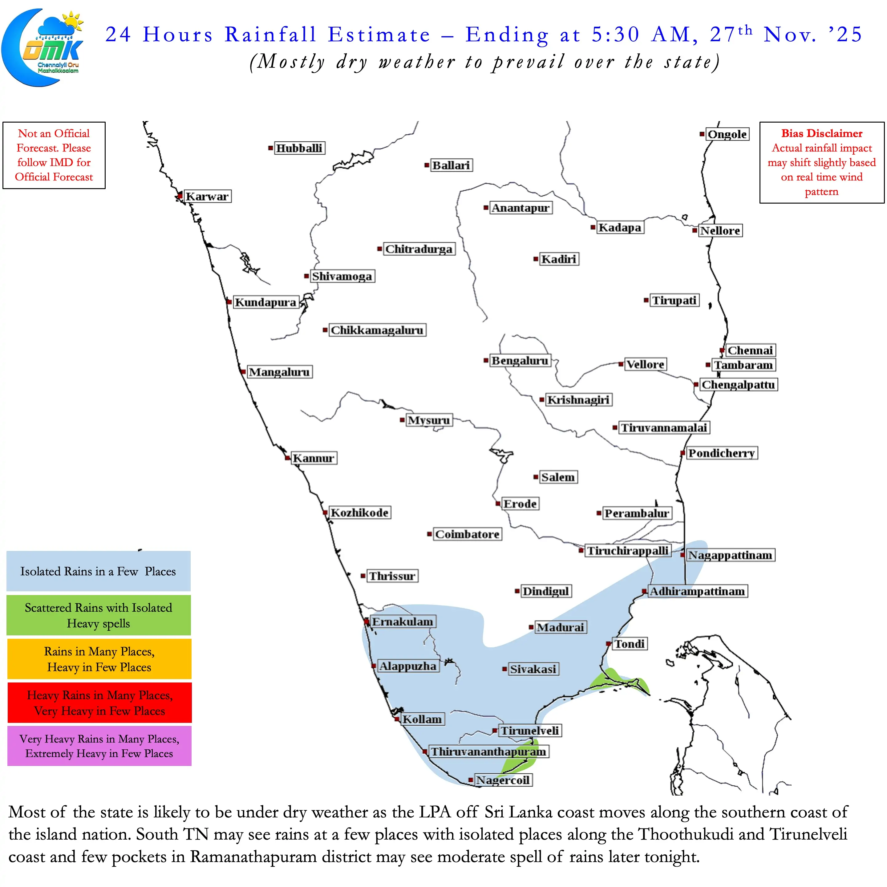
If things pan out as per weather model forecast tomorrow we may see another historical event. Bay of Bengal and adjoining areas may host its first twin depressions. While Cyclone Senyar may continue to persist around Sumatra the LPA off Sri Lanka may intensify into a depression. That would make NEM 2025 truly historic indeed. But for most the absence of rains and long dry spell may be the first memory.
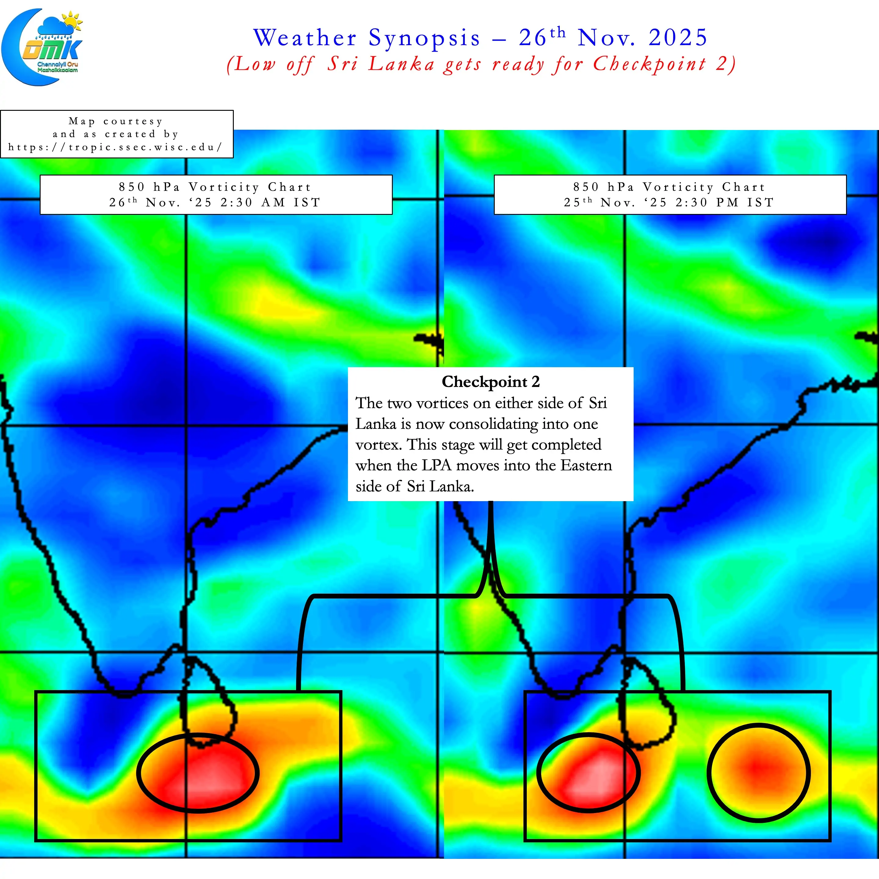
On the topic of LPA off Sri Lanka it may be noted we are in between Checkpoints 1 and 2. Real time observations indicate the vortex seems to slowly nudge towards the eastern coast of Sri Lanka. The 2nd checkpoint for us to tick is the LPA shifting to the East of Sri Lanka. This would bring it to the open waters of SW bay allowing for intensification. After this would be the possible northward movement along the East Coast of Sri Lanka. When we start seeing check point 3 happening that is the time we can start looking at rainfall prospects for Tamil Nadu. Until then it is wait and watch.
On the immediate front dry weather is likely to prevail over most of Tamil Nadu over the next 24 to 36 hours. South TN may see isolated rains today with mostly rains sticking to places right along the coast between Rameswaram and Koodankulam.