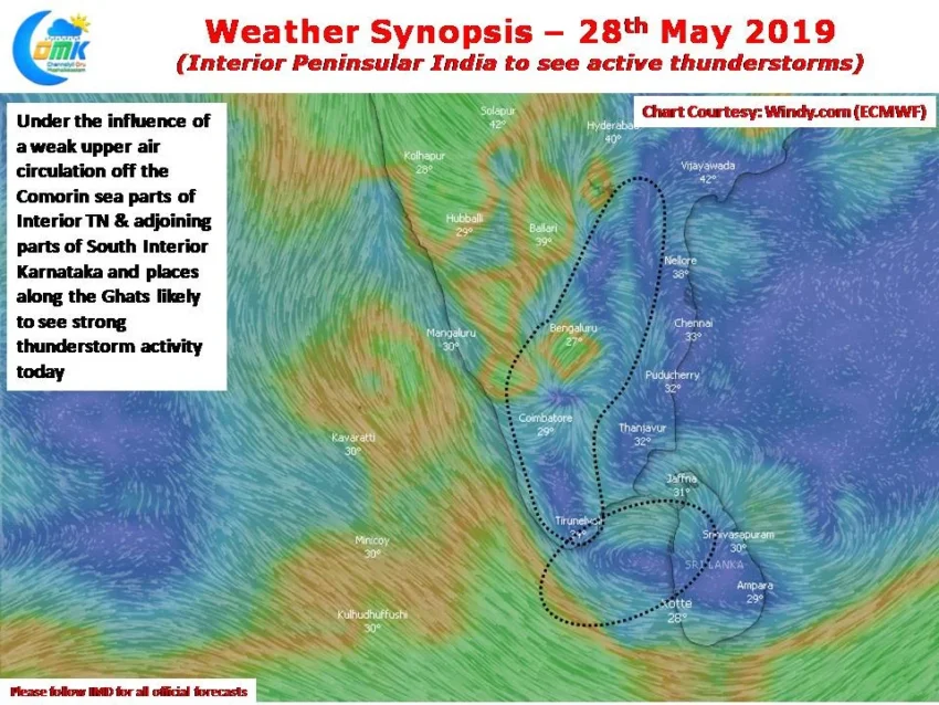
The last few days have seen many places in interior Peninsular India record good evening thunderstorms. On Sunday Bangalore saw many trees uprooted as a high intensity thunderstorm lashed the metropolis and surrounding parts of Karnataka. As the country waits for the onset of Southwest Monsoon the Bay branch is showing signs of building some…
Author: Chennaiyil Oru Mazhaikkaalam
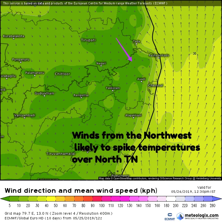
Heat wave conditions in North TN
With monsoon dynamics stuttering and stalling as it tries to build some momentum to move into Indian Sub continent summer has been par for course until now in Tamil Nadu. Even yesterday the IMD observatory at Nungambakkam recorded 2 degrees below normal aided by the sea breeze arrival at mid morning. Today though weather models…
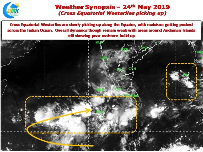
Thunderstorms likely over Interior Parts
The last week of May is upon us when typically large parts of Bay & associated areas of Indian Sub Continent sees Monsoon Dynamics prevail. Between 15th & 20th May almost all of Andaman Islands would be under Southwest Monsoon while the Sri Lankan west coast will start seeing monsoon dynamics between 20th & 25th….
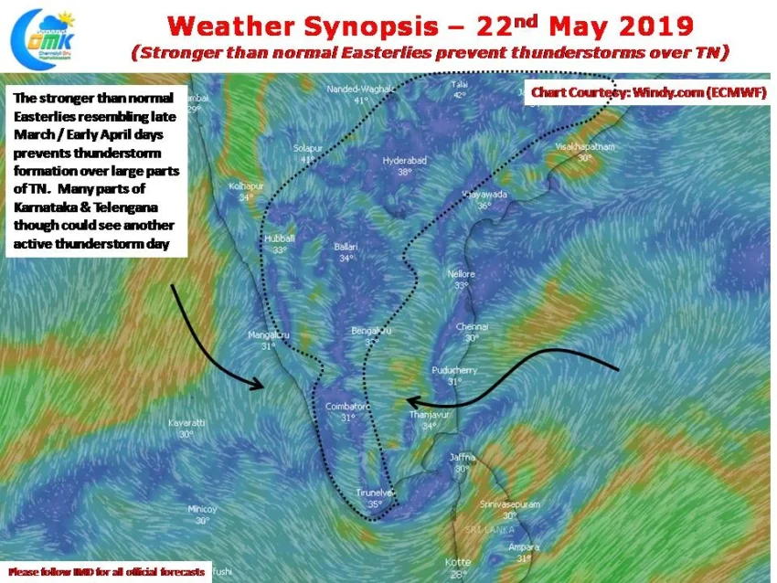
Stronger than normal Easterlies prevent thunderstorms over TN
While focus is always on summer and monsoons more often than not there are many areas of Tamil Nadu that look forward to the thunderstorm season. Especially parts of Kongu belt which come under the Leeward side of Western Ghats during Southwest Monsoon and too far away during normal Northeast Monsoon time get their majority…
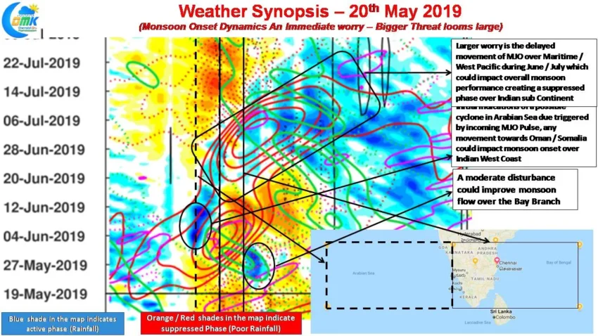
Weak Monsoon Dynamics A Worry – But Larger Threat Ahead (COMK SWM Series – 1)
As we get closer to the last week of May the most talked about phrase among weather watchers of the Indian Sub Continent is Monsoon Onset. Would it be on time over Kerala? How active would the onset spell be? Will it cover the entire country without any stall scenario? For the agrarian community of…