
The last week of May is upon us when typically large parts of Bay & associated areas of Indian Sub Continent sees Monsoon Dynamics prevail. Between 15th & 20th May almost all of Andaman Islands would be under Southwest Monsoon while the Sri Lankan west coast will start seeing monsoon dynamics between 20th & 25th.
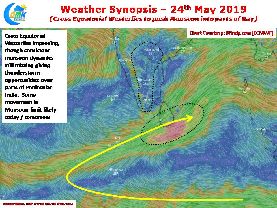
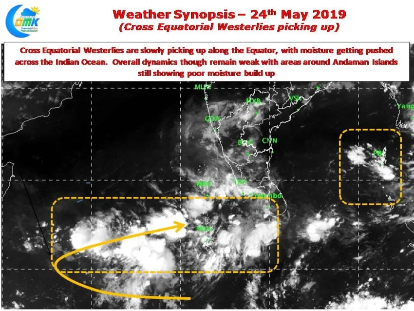
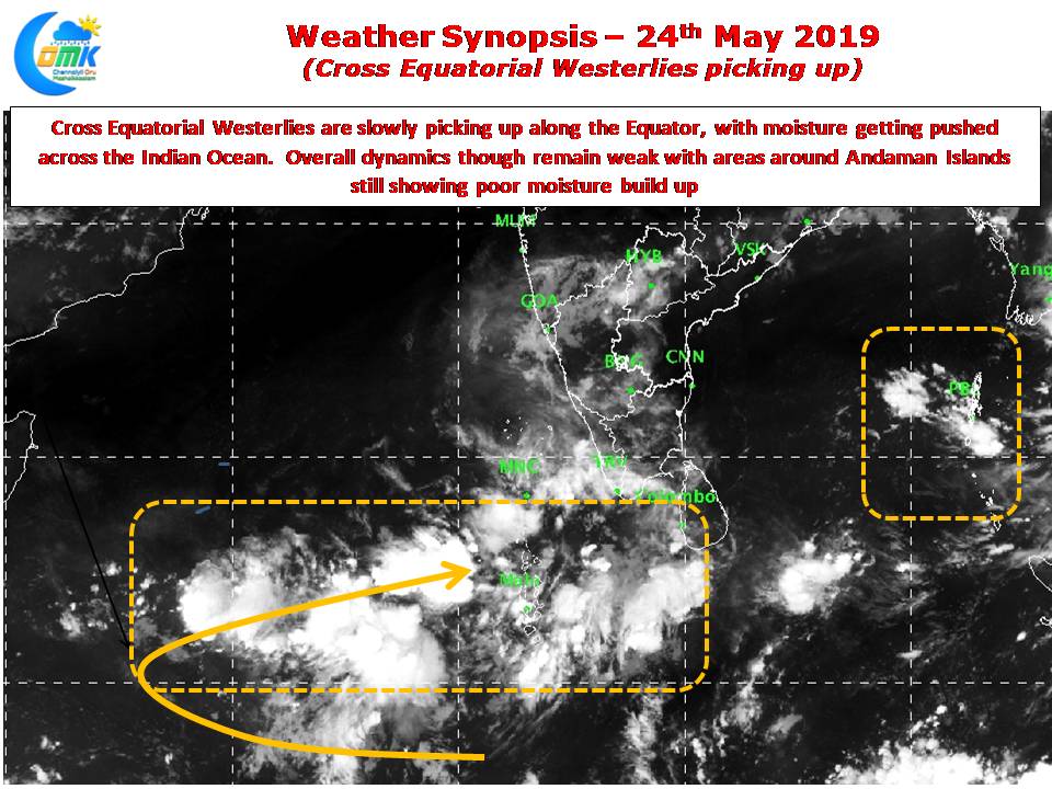
Things are running slightly behind schedule this year with only areas around Nicobar Islands currently under Monsoon dynamics though the rains recorded in the region for the past couple of days hardly resemble active monsoon phase. Satellite images & Wind charts indicate Cross Equatorial Westerlies improving over the Indian Ocean along the Equator. Though the monsoon dynamics are not consistent we may see some northward movement of the Monsoon limit in the next couple of days but it remains to be seen if Sri Lanka will see any monsoon onset before the weekend.
This inconsistent monsoon dynamics has resulted in thunderstorms over Peninsular India continue. This year’s thunderstorm season has been sub par so far and the current spell of thunderstorm activity could be the last batch of pre monsoon thunderstorms before monsoon dynamics pick up. Interior parts of TN will see moderate thunderstorm activity with places along the Western Ghats & West Interior TN benefiting more compared to the rest of the state.