
Fits and Starts
periods of activity mixed with periods when nothing happens
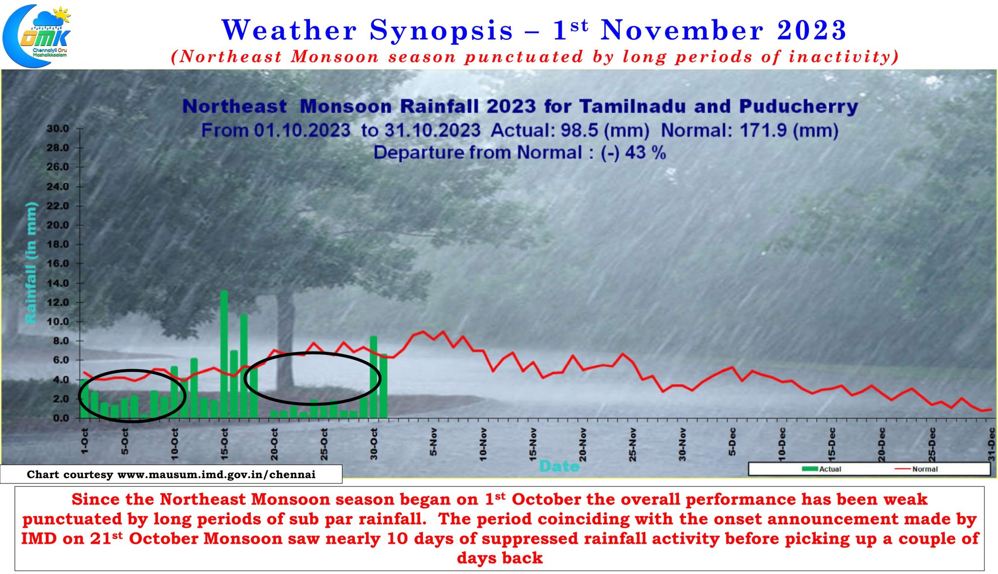
It is an understatement to say this year’s Northeast Monsoon is happening in fits and starts that is reflecting in an overall seasonal performance that stands at a deficit of 43% for the first month of the season. The statistical season coincided with weak rainfall activity as Southwest Monsoon had a late surge under favorable conditions subsequently LWD thunderstorms over the interior areas perked up the numbers briefly before the twin cyclones brought about another long period of suppressed rainfall activity. Ironically it is this period that coincided with the NEM onset announcement made by IMD on 21st October.
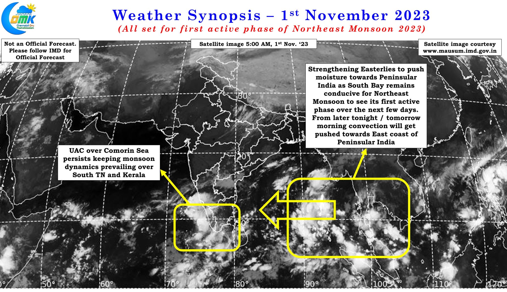
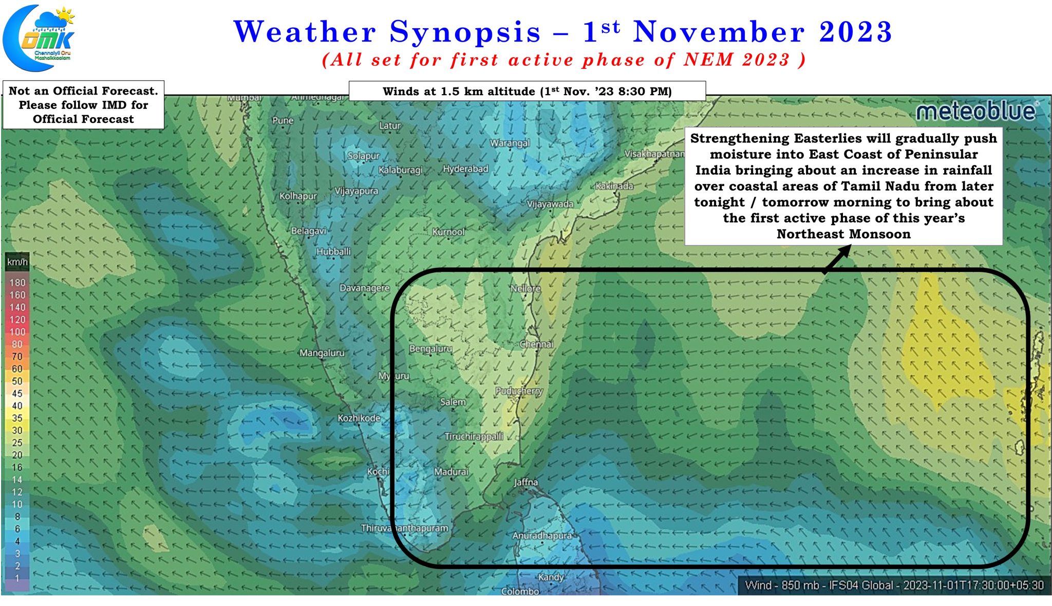
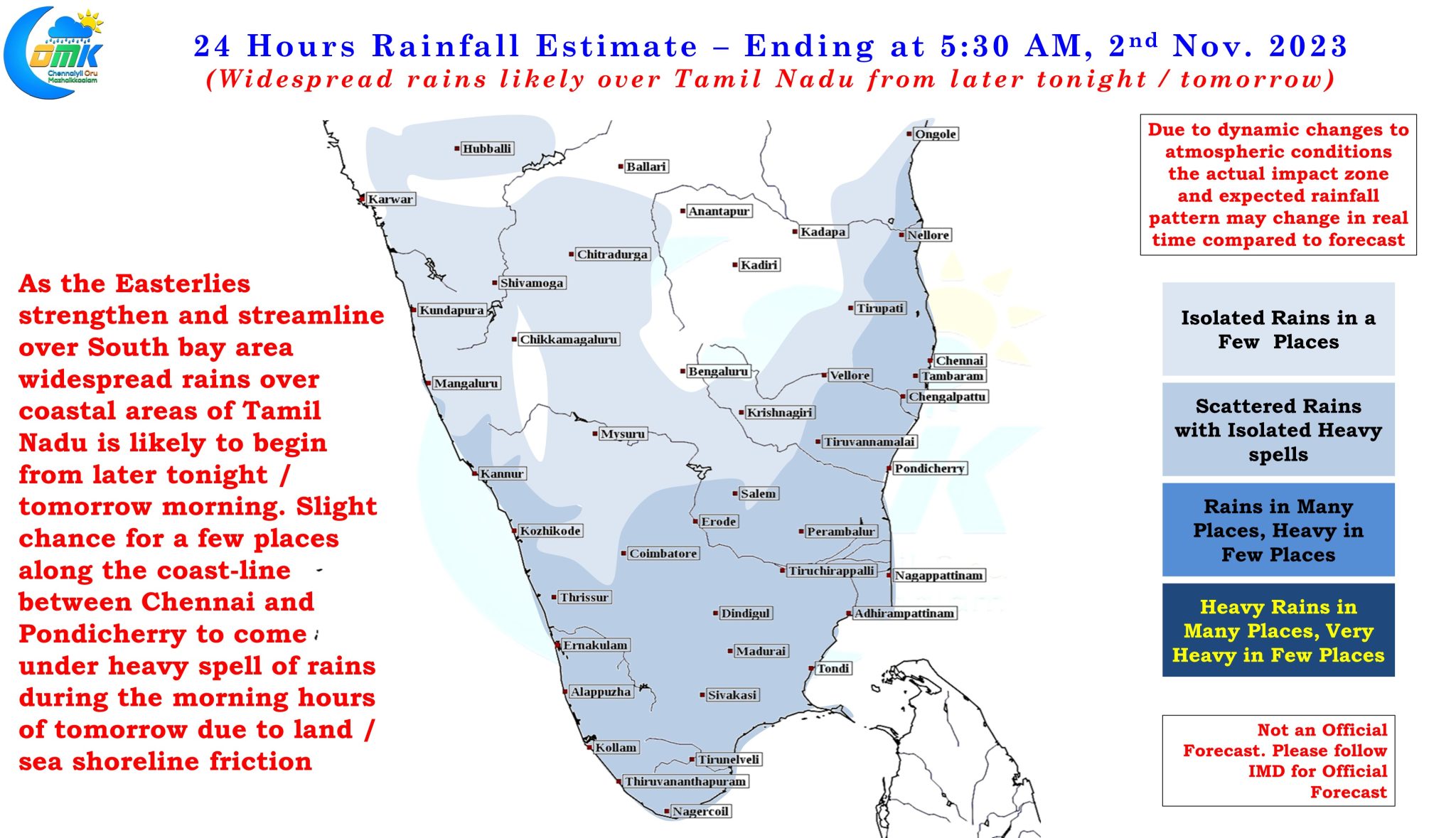
But there is always light at the end of the tunnel. There are strong indications the first trough, and possibly the lowest point of NEM 2023, is behind us as favorable conditions in the form of strengthening Easterlies could lead to the first active phase of the season. The last couple of days have seen an increase in rainfall activity with even Chennai and suburbs seeing isolated heavy spell of rains while South Tamil Nadu and parts of Delta districts have seen rains at many places particularly closer to the coast. Wind charts indicate the lower level Easterlies have not only strengthened but are now more streamlined to bring moisture from across the Bay towards the east coast of Peninsular India.
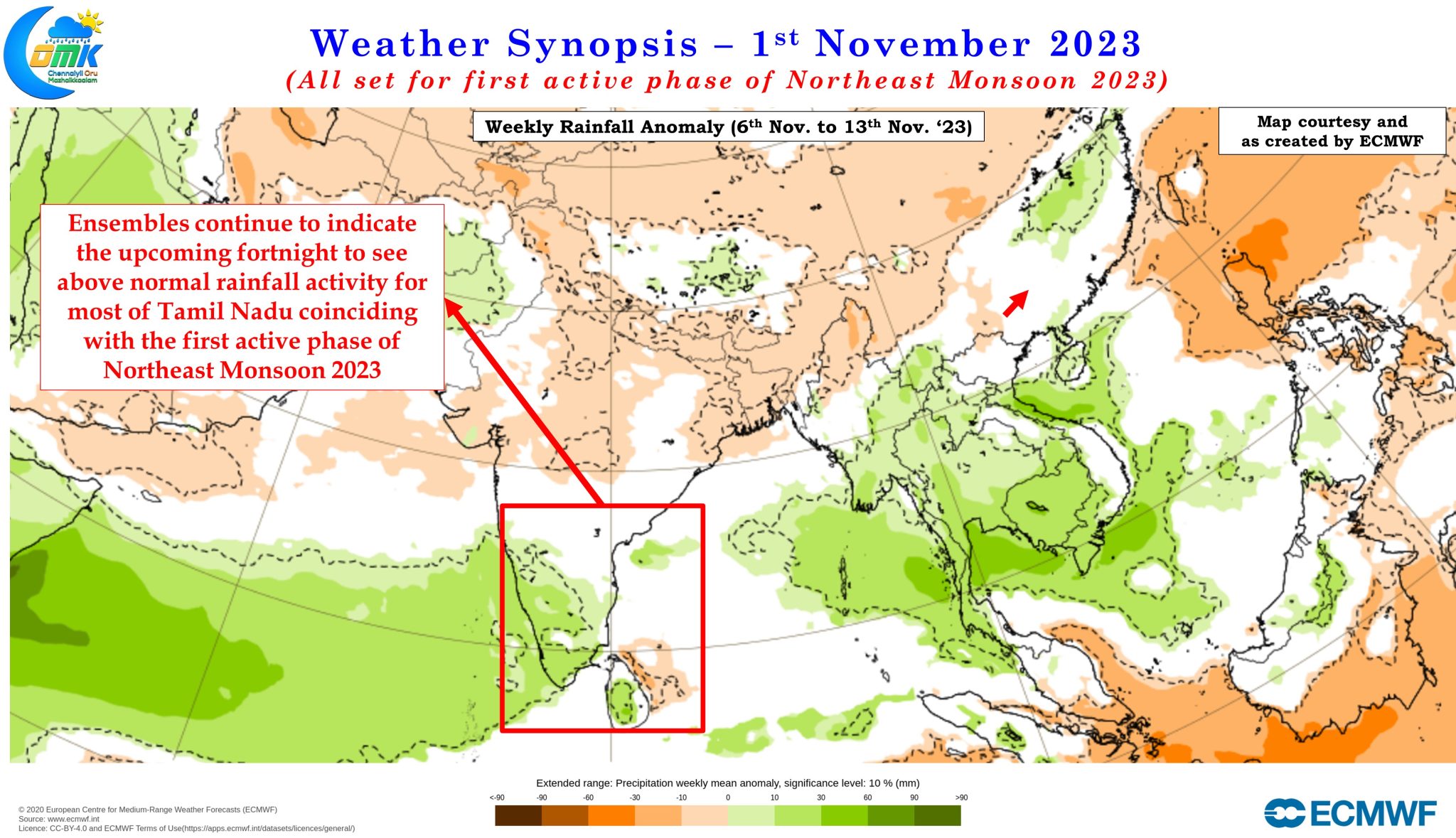
In what could be the first Easterly wave of the season, though there is still a chance this could turn out to become a possible trough of low / LPA early next week, conditions are favorable to bring widespread rains along the coast of Tamil Nadu from later tonight or tomorrow. The persisting weak UAC over the Comorin Sea area is expected to support penetration of moisture into southern parts of Peninsular India increasing the possibility of rains for South TN and Kerala over the next couple of days. As the convection associated with the Easterly wave moves closer to Peninsular India the rainfall quantum over North Coastal Tamil Nadu can see an increase in about 48 to 60 hours or so from the time of this post. Long term ensembles have been consistent for the past week or so about 2nd week of November seeing above normal rains across all of Tamil Nadu and Kerala.
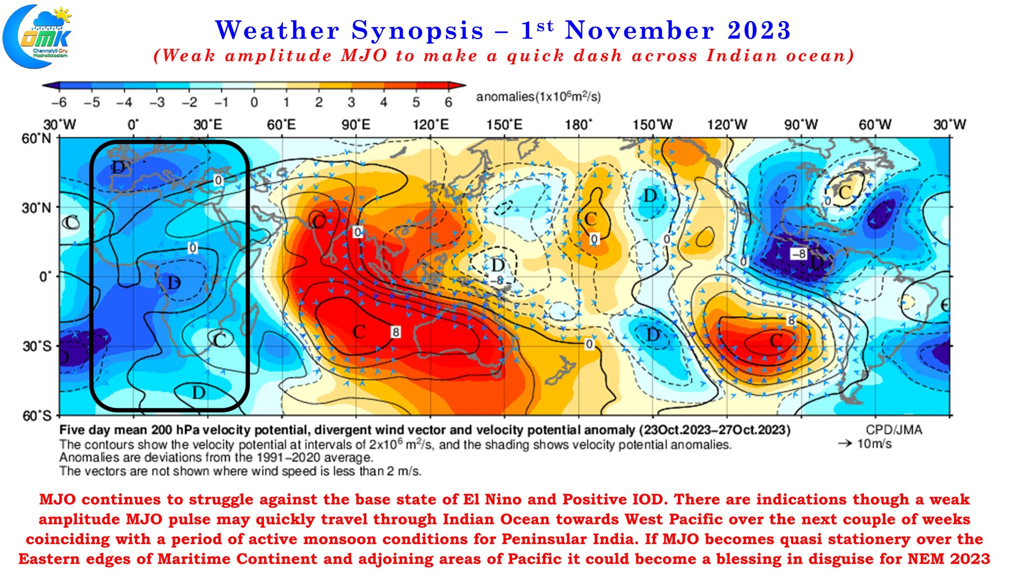
Looking at larger scale dynamics MJO continues to struggle against the base state of El Nino and Positive IOD. There is a very high chance MJO might make a quick dash across the Indian Ocean, substantially weakening in the process, as it tries to get back to normal global circuit routine. The slight shift of MJO wave from Type 2 to Type 1 over the past few days is an indication of MJO trying to move in a more canonical fashion on the global circuit. It remains to be see if MJO would succeed in this as the past two occasions in July and September the global circuit did not happen instead it ended up parked over the eastern edges of Maritime Continent and adjoining areas of West Pacific. If a similar scenario happens this time around, though this time around MJO may be quasi stationery slightly further East compared to the past couple of occasions, it could turn out to be a blessing in disguise for Northeast Monsoon.
Starting tonight or possibly tomorrow morning the rains are expected to become more widespread over the coastal areas of Tamil Nadu. South Tamil Nadu and delta areas are better placed for rains today and tomorrow while North Coastal Tamil Nadu may see the better spells during the weekend. There is a slight chance a few places right along the coastline between Chennai and Pondicherry may come under heavy spell of rains during the morning hours of tomorrow due to land / sea friction as the Easterlies dip along the coastline. Chennai and suburbs may see isolated light to moderate rains during the morning hours of today with increase in intensity seen around midnight / early tomorrow morning.