
Northeast Monsoon 2021 continues to chug along nicely influenced by the Low Pressure Area that has sort of parked itself like a Lorry stuck in a Dead End unable to turn around. With October coming to an end the rainfall accumulation for the month has been nearly 23 cms which is about 5 cms more than the Long Period Average for the month. Considering it is more than 50% of the total seasonal average during Northeast Monsoon period it has been a good month overall. As a matter of fact this year’s rainfall accumulation during the month of October is the highest since 2014 when 25 cms was recorded over Tamil Nadu & Pondicherry.
Satellite images indicate increased convection off North Tamil Nadu coast due to the slight Northward shift of the Low Pressure Area which continues to remain around the Comorin Sea area. This nudge to the North is expected to create better wind pattern for North TN to come under the rain bands. Last night saw rain bands extend right across the coastal stretch of TN all the way from Chennai to Kanyakumari with the most intense clouding seen between Pondy & Delta.
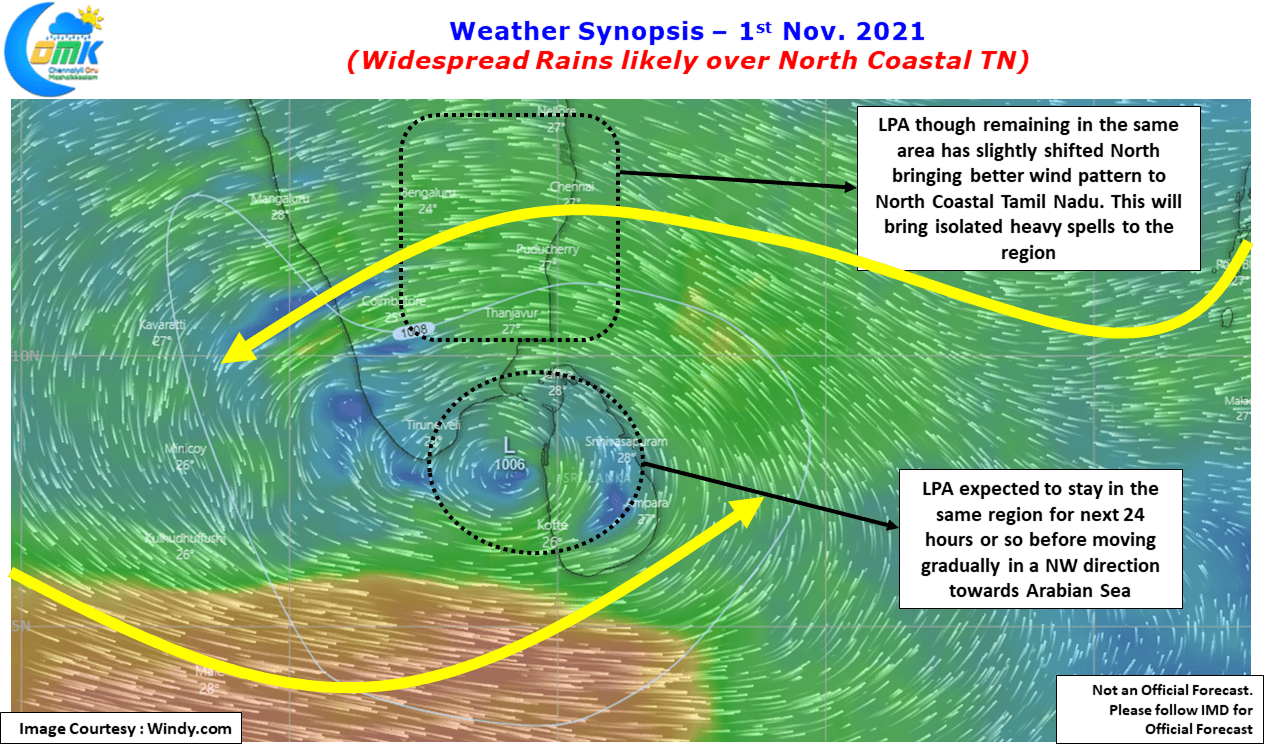
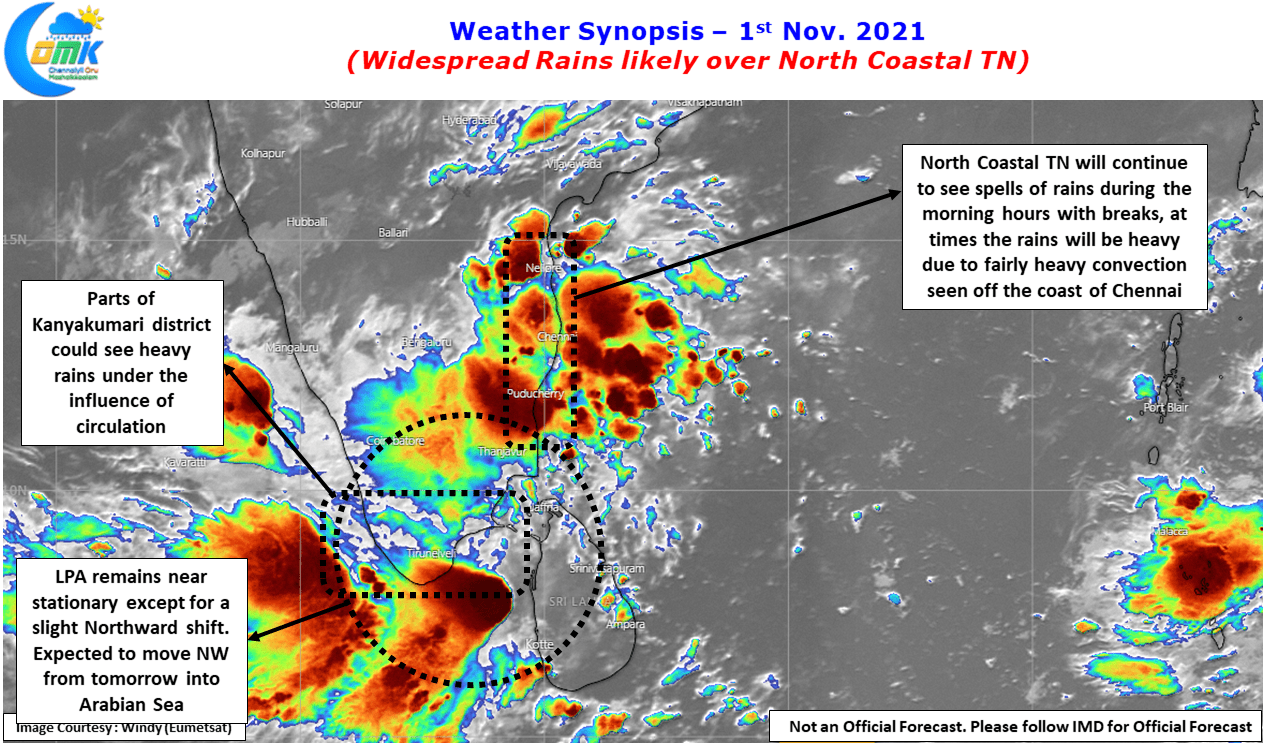
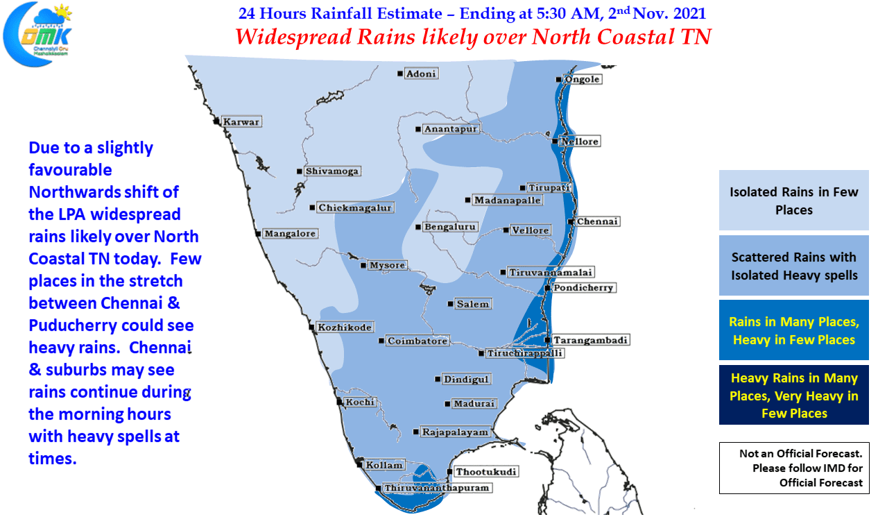
Today looking at how things are the likely hotspot could be between Chennai & Pondicherry on account of this northward shift of the LPA. Weather models indicate the LPA to remain quasi stationary for the next 24 hours or so before moving slightly to the NW in search of the open waters of Arabian Sea. As long as the system remains in the SE part of Arabian sea it will continue to remain in a favorable location for rains to continue over Tamil Nadu for the next few days.
Today Chennai may see on and off spell of rains which could be heavy at times, particularly during the morning hours and overall most places in North Coastal TN could see moderate rainfall activity. The stretch between Pondy & Chennai may see heavy rains in a few places.