
Over the past few years instances of extreme rainfall episodes are becoming pronounced, 2015 Chennai Floods, 2018 Floods over Kerala & Karnataka, 2020 Cuddalore Floods are a few examples of some of these extreme rainfall episodes when rains meant for months are falling in a mere days. The challenge before the Weather Community is not just giving long term updates but also give warning sufficiently in advance about some of these extreme rainfall episodes which are likely to bring forth large scale environmental disasters.
The parliamentary standing committee on Science & Technology in its last meeting with various weather agencies had raised this as one of the key concerns. In the days to come the long term weather outlook should not be just probabilities of rains against long term averages but also include probabilities of extreme rainfall episodes as well.

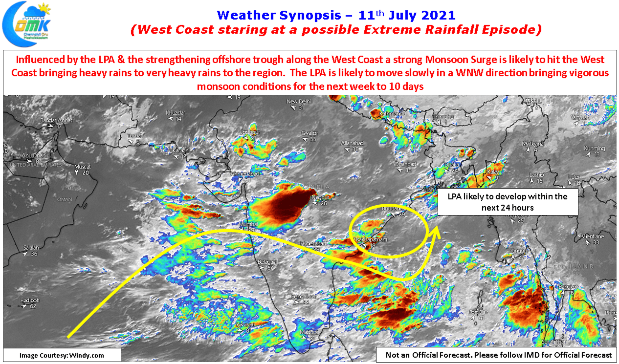
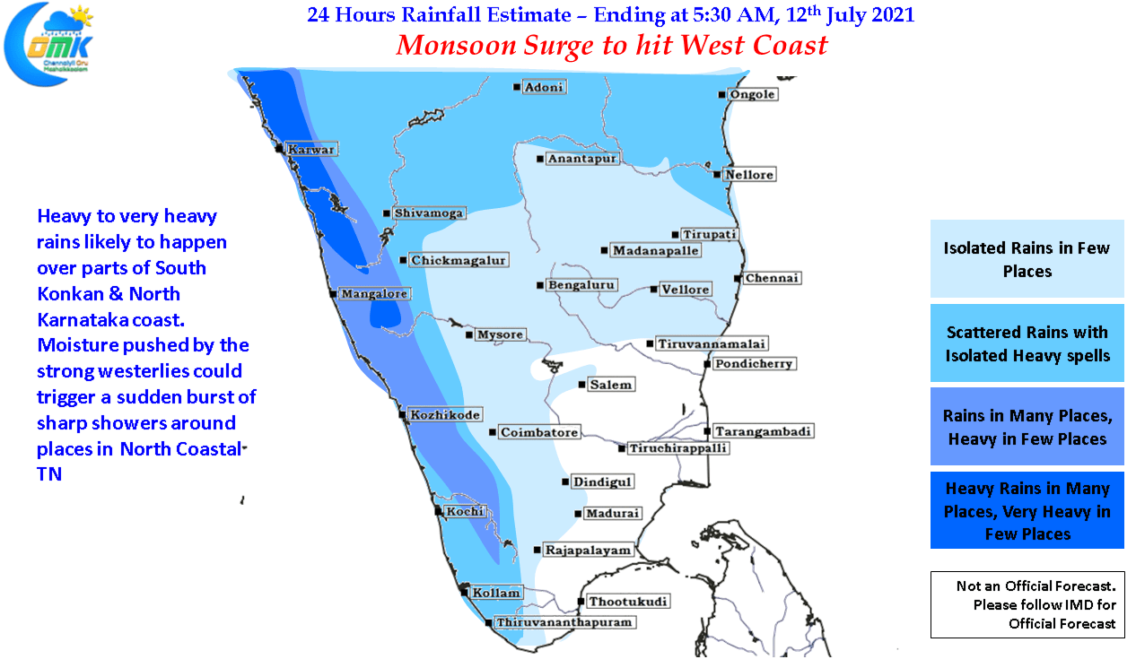
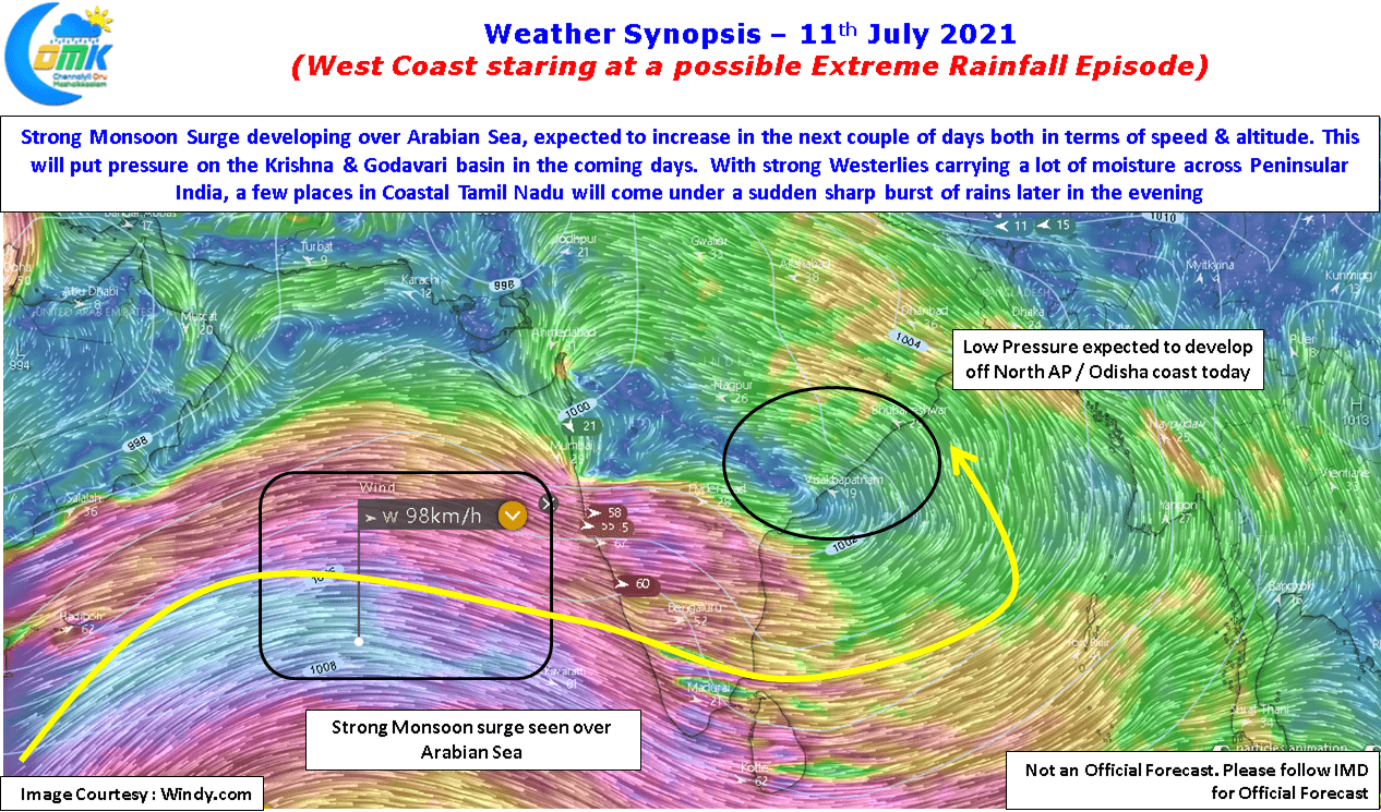
We are possibly staring at one more extreme rainfall episode as a strong Monsoon surge is expected to hit the west coast aided by the developing Low Pressure Area in Central Bay adjoining North AP & South Odisha Coast. With models expecting the Low to move slowly across the northern parts of Peninsular India & Central India over the next week to 10 days there could be vigorous monsoon conditions along the west coast additionally enhanced by the strengthening off shore trough in response to the developing Low. In particular with the Shahayadris & Western Ghats in Karnataka likely to come under extreme rainfall episodes we may see lot of pressure on the Krishna & Godavari basin in the coming week to 10 days.
Meanwhile thanks to a lot of moisture being pushed across Peninsular India parts of North Coastal TN may see sudden sharp showers as isolated thunderstorms develop, but on the back of very strong Westerlies they will get pushed away fast so it could be a case of one street getting rains while the next road may remain dry.