
Adebe Bikila is a name that is possibly not as famous as Jesse Owens if one were to look at Olympic legends of the yesteryears. Bikila was the first Ethiopian Olympic Medalist winning gold in Men’s Marathon at the 1960 and 1964 Olympics. During the 1960 Rome Olympics not he broke the world record while running barefoot. One may wonder why the mention of a marathoner while a weak monsoon has been prevailing over Peninsular India.
“Monsoon is a Marathon”. It needs to sustain itself for four months between June and September. During this period it needs to pace itself like marathon runners. At times we may see weak monsoon conditions due to tropical wave transits. We must also remember just like Indian Summer Monsoon many other places North of Equator also sees its wettest time of the year between June and September. So it is essential for the tropical waves to travel around the globe to provide support. Intraseasonal oscillation is an inherent part of Southwest Monsoon.
After starting with a bang through early onset Southwest Monsoon has now hit the brakes. Brakes were hit even before the traditional onset date of MOK. The Peninsular branch has been stuck at the same place since May 26th. The Northeast branch has been puttering along slowly covering almost all of the region yesterday. Looking at how weak monsoon is and model forecast for the next few days the current stall will eventually match the normal onset schedule. Currently the monsoon propagation is ahead of the 10th June markers. This dull phase may eventually mean when it is time for the 15th June markers it may be near normal.
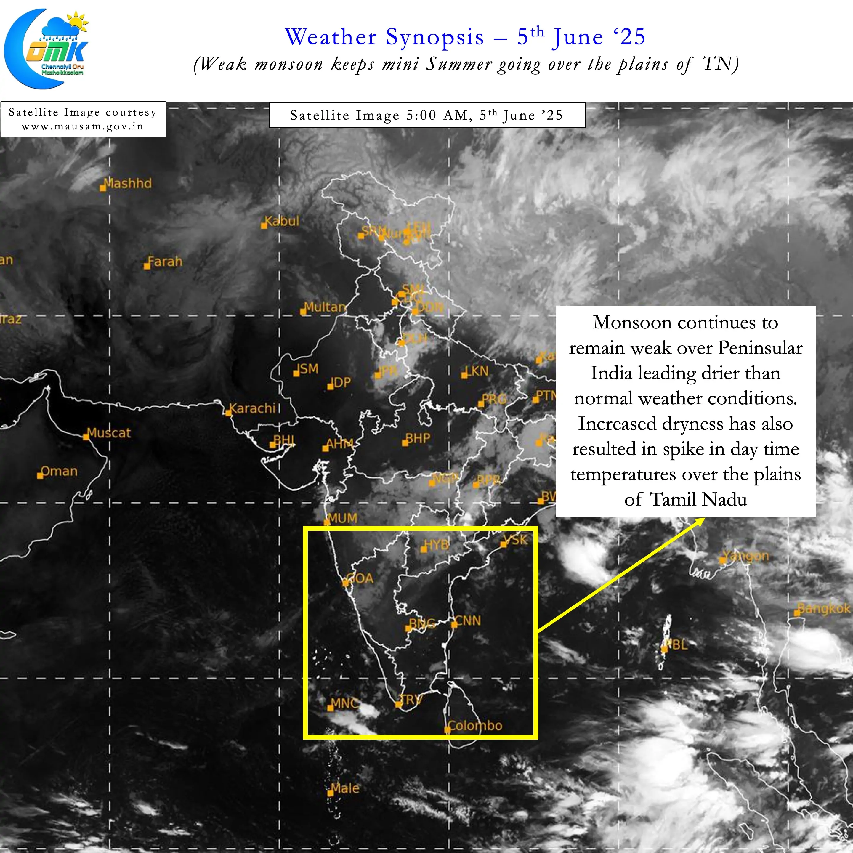
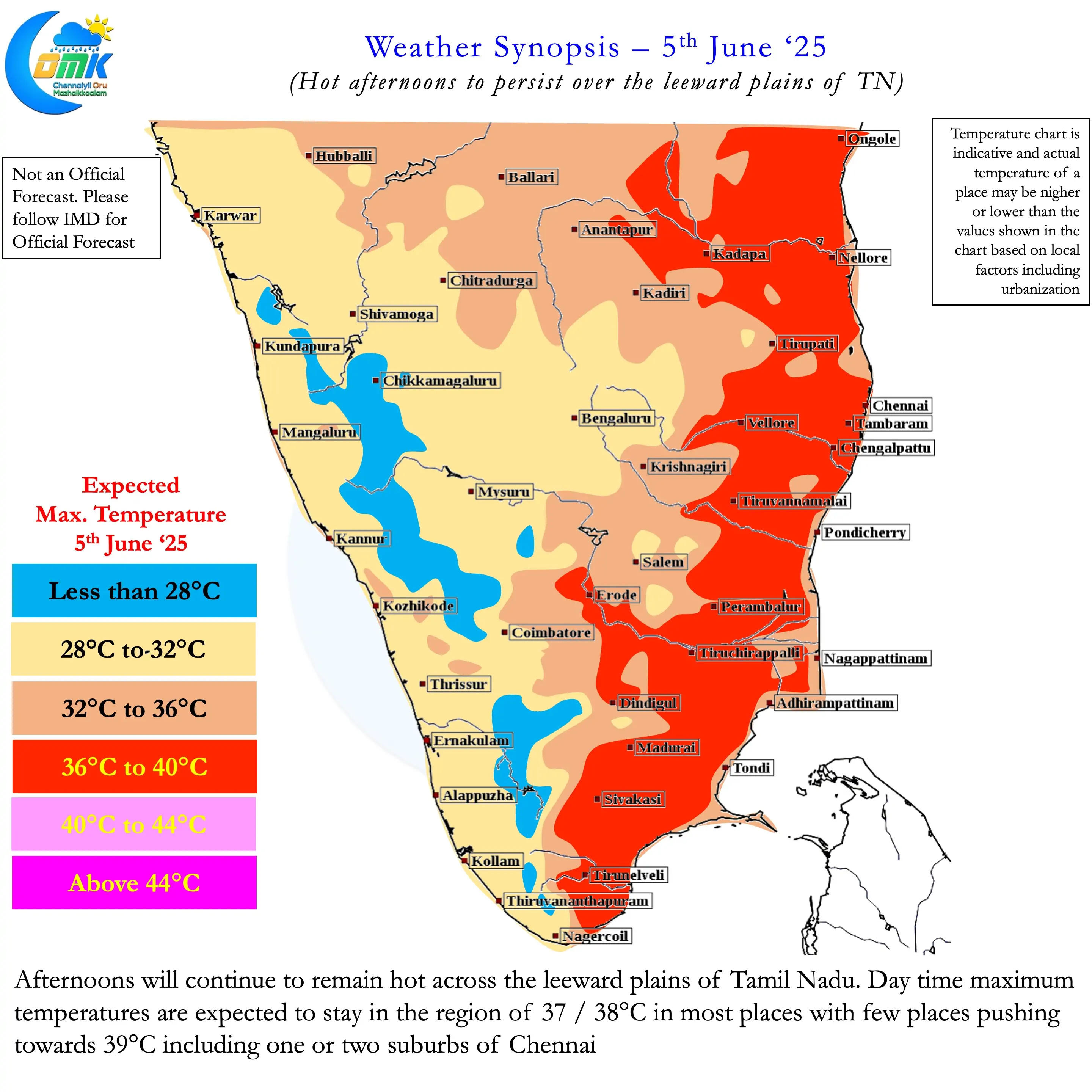
The weak monsoon conditions have brought about an increase in temperatures over the plains of Tamil Nadu. When monsoon is strong despite stiff Westerlies the presence of moisture acts as an insulation from heat for the plains of Tamil Nadu. But with drier conditions now prevailing temperatures have spiked up to near normal or slightly above normal range. For the past couple of days most of Chennai and suburbs have been hitting a max of 38 / 39°C. This has been the case for many places in the leeward plains of Tamil Nadu.
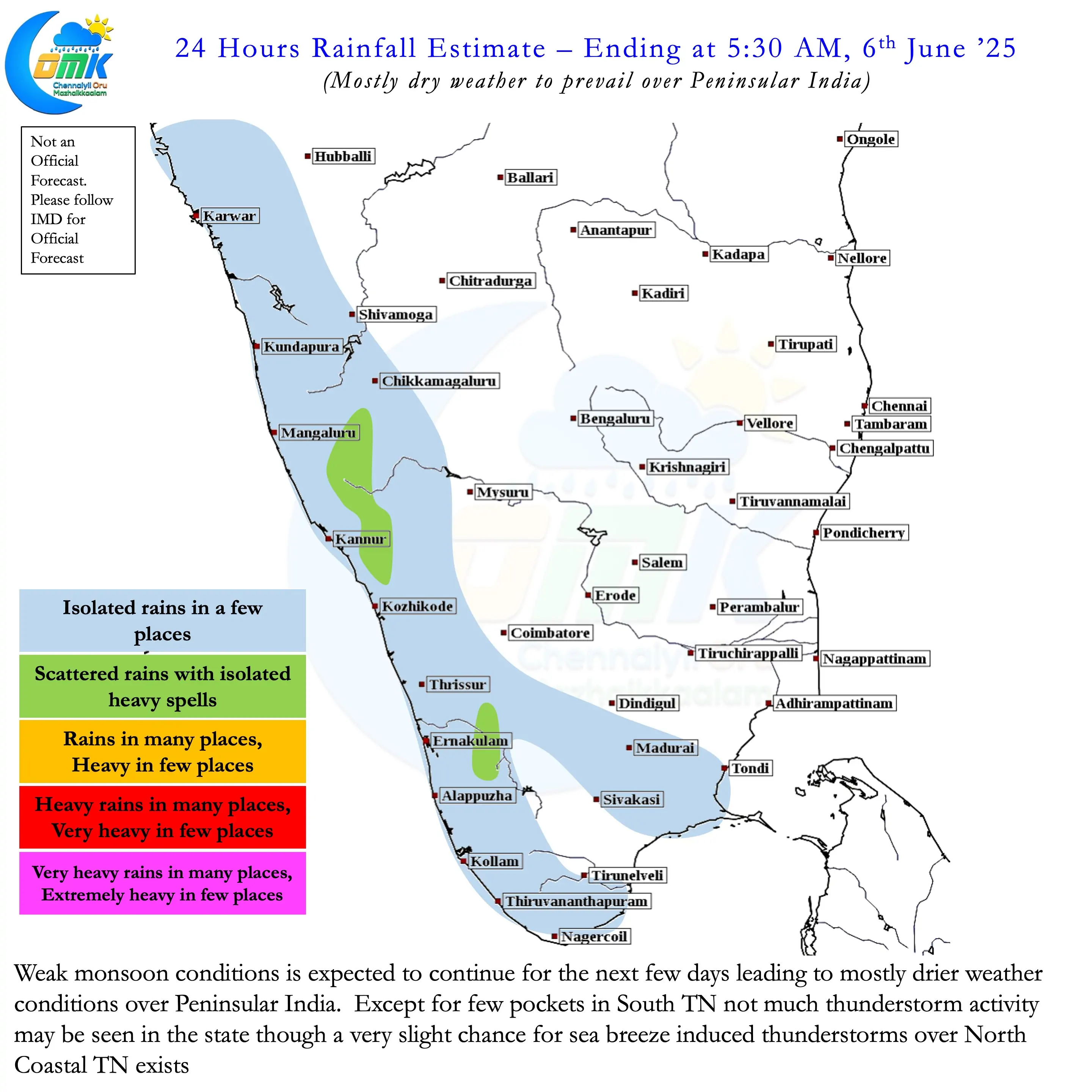
The convective thunderstorms during the evening hours has been very isolated for the past couple of days due to larger scale suppression. If convective thunderstorms are more widespread it could mitigate some of the heat associated with weak monsoon conditions. Weather models indicate thunderstorms may continue to remain isolated for the next few days. The development of an Upper Air Cyclonic Circulation may bring a change in fortunes next week. From Sunday or Monday we can see some increased rainfall activity over North TN. By middle of next week except for South TN most parts of the state may receive some rains. Until then it is going to mini summer for the leeward plains of Tamil Nadu.
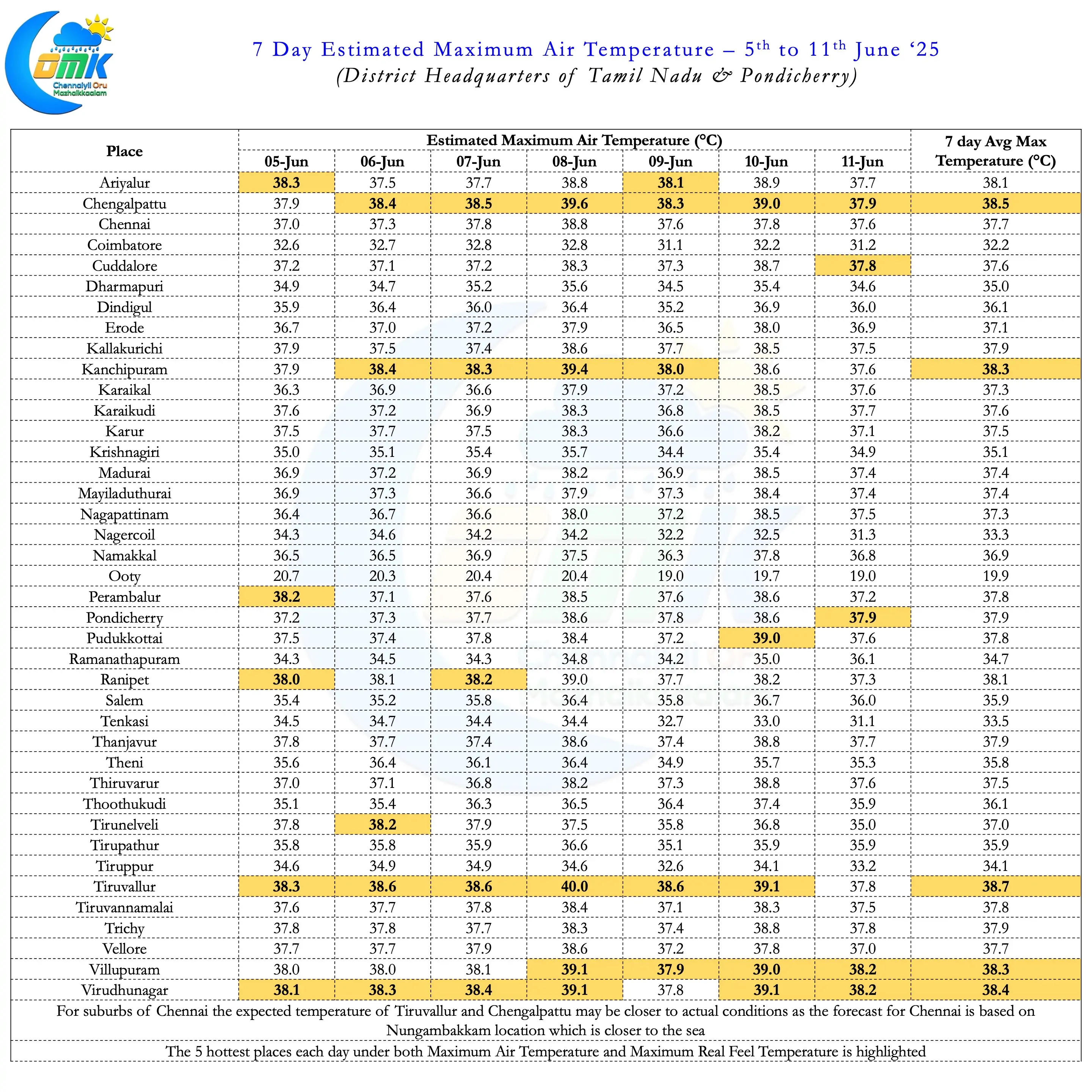
As always keep a tab on the estimated rainfall range page to know what is in store for not only the various district HQs of TN & PDC but also select places in Peninsular India for Monsoon rains as well.