
One of the words most popularised by Dr S R Ramanan was “Veppasalanam”. “வெப்பசலனம் காரனமாக மழை” is a phrase that owes so much to Dr Ramanan. Tamil is such a beautiful language that understood water cycle very early. “வான்முகந்த நீர் மழை பொழியவும் மழைப் பொழிந்த நீர் கடல் பரப்பவும் மாரி பெய்யும் பருவம் போல் நீரின்றும் நிலத்து ஏற்றவும் நிலத்தினின்று நீர்ப்பரப்பவும் அளந்து அறியாப் பல பண்டம்” – பட்டினப்பாலை. Veppasalanam as a word pretty much sums up this convective process.
It is also imperative to point out while convective process is essential for Veppasalanam thunderstorms winds also play a crucial role. Wind Shear, Wind Convergence are very essential for thunderstorms to develop from the convective trigger. Sea breeze induced thunderstorms owe a lot to Wind shear between Easterlies and Westerlies. Similarly we have seen wind convergence play a crucial role in thunderstorms during monsoon period as well.
After a strong start Monsoon dynamics has gone weak over the past few days. If one were to look at Monsoon performance after 1st June it is at -25% overall for the country. While NW India and East India are in positive Central India and SPI are in large negative. To get the monsoon dynamics going we will need a Tropical Disturbance. More often than not a Monsoon Low provides that trigger. The period before the formation of a low also is an ideal period for Veppasalanam Thunderstorms.
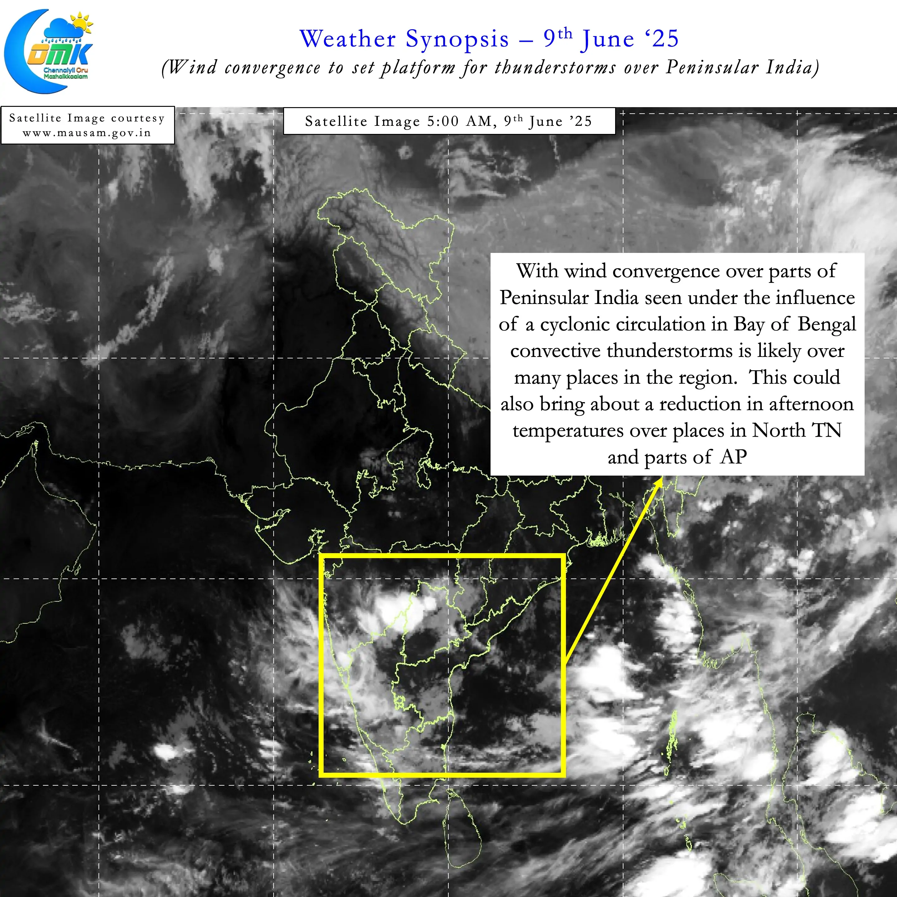
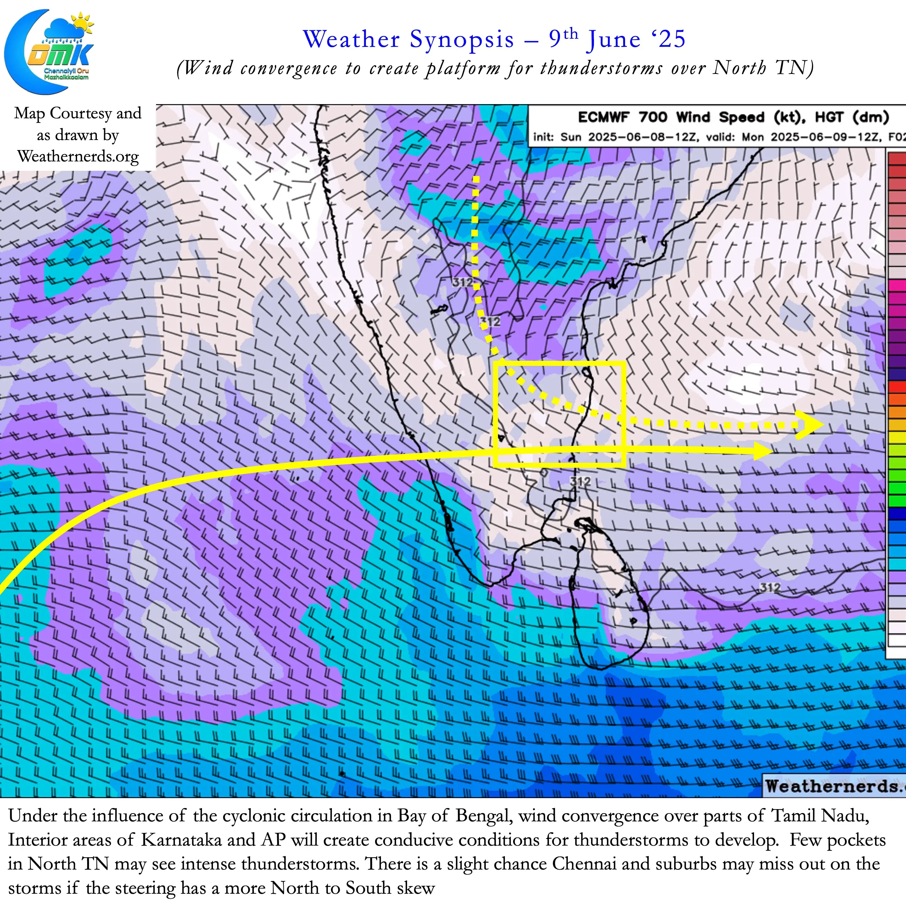
Wind convergence influenced by the cyclonic circulation provides the platform for thunderstorms. Remnant moisture from the west supplies the fuel. And in manu instances sea breeze front acts like the match stick to create the combustion. Yesterday saw thunderstorms return over many places in North Interior Tamil Nadu. Even parts of Chennai saw sea breeze induced thunderstorms bring relief from heat during late afternoon.
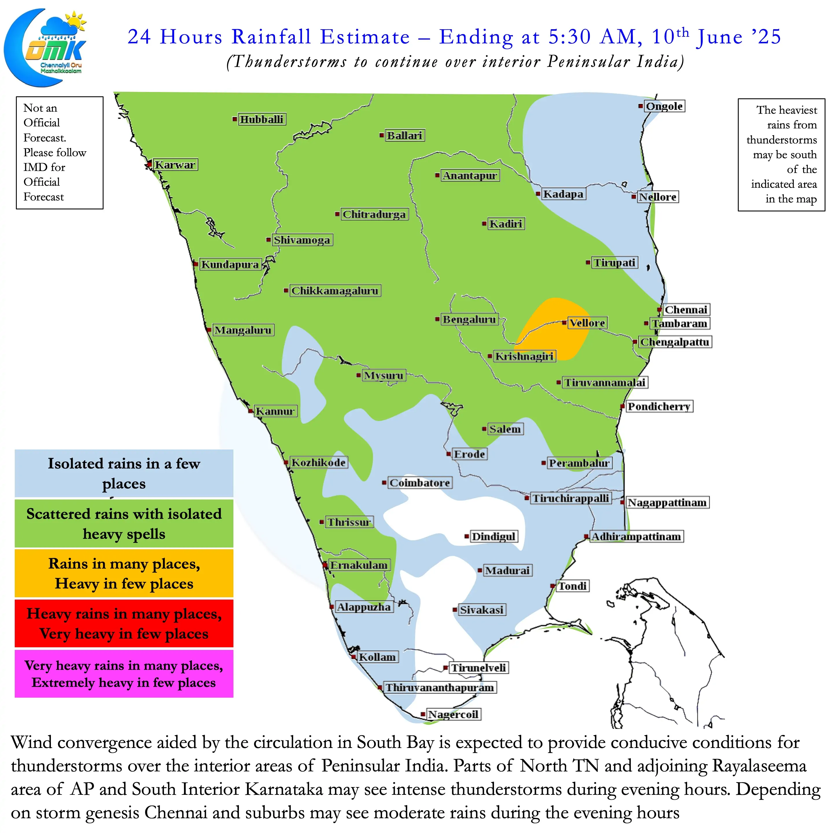
Over the next few days until an LPA possibly forms in Bay of Bengal we may see thunderstorms return over Peninsular India. Gradually from today more places in TN, Karnataka and AP may see rains from these thunderstorms. Like yesterday North Interior TN may be best placed for rains today during the evening hours. From tomorrow there is a good chance even delta districts may see some rains. As the circulation deepens parts of South TN also may see much needed rains for a day or two.
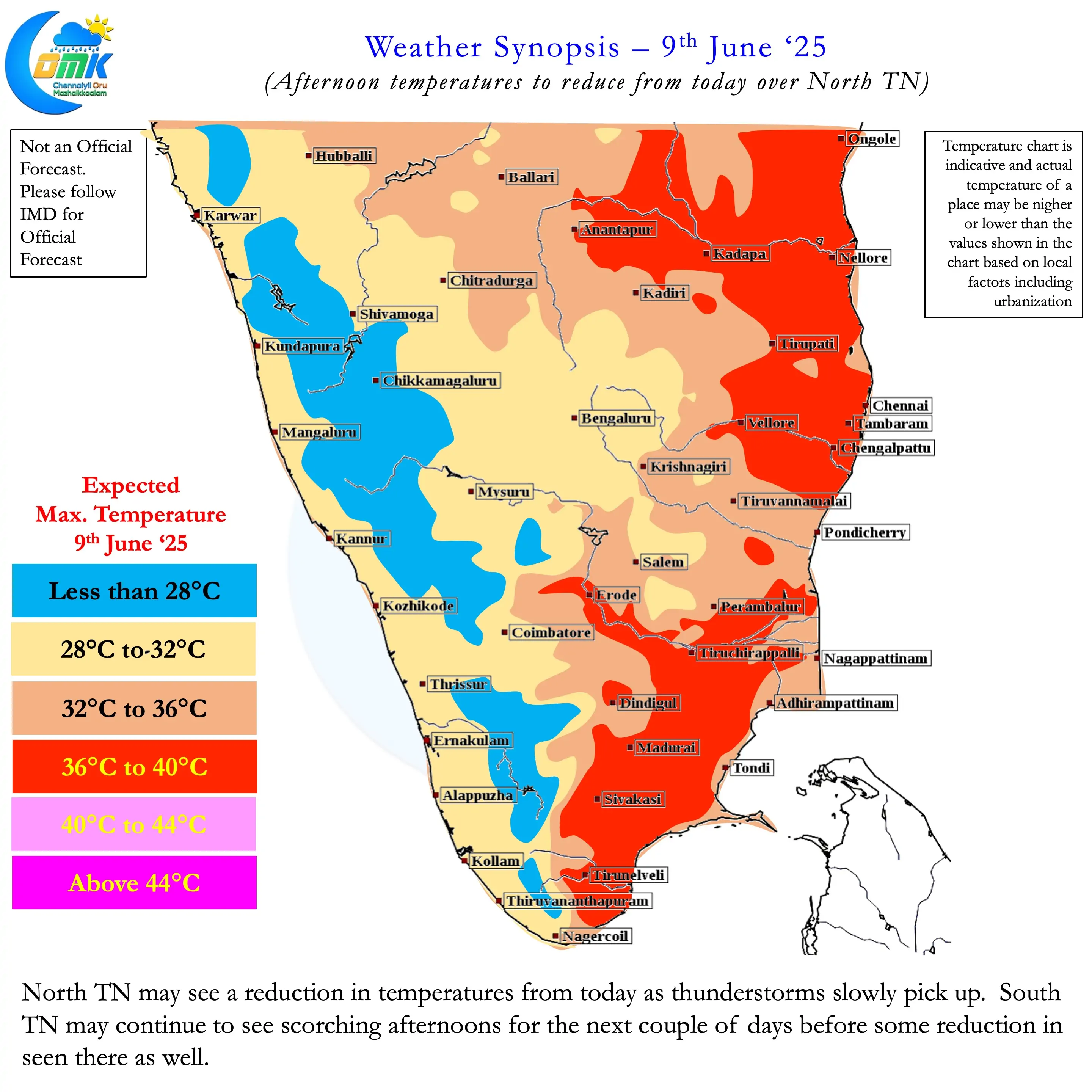
Favourable conditions will prevail until Friday possibly which may bring bulk of June average to the leeward plains of TN. While the steering may not favour Chennai and suburbs today there is a good chance sea breeze induced storms may bring rains. Starting from today till Friday there is a high possibility Chennai and suburbs may see widespread thunderstorm activity at least once. The return of storms will also bring about a reduction in afternoon temperatures from today over the plains.
As always the COMK Estimated Rainfall Range page may give a good idea on what to expect in terms of Rains.