
Exactly 6 years ago Cyclone Vardah one of the five Cyclones to have made a direct touchdown over Chennai peaking up to Category 1 in the Saffir Simpson scale made landfall over Chennai bringing the city to a complete standstill. It is important to mention here about two powerful cyclones that did come very close to Chennai though not necessarily making a direct touchdown over Chennai. The 1984 Sriharikota Cyclone one of the strongest to hit this part of the country that made a loop very close to Chennai bringing extreme floods to North TN & South coastal AP. The May 1940 cyclone that touched the coast near Pulicat and intensified further as it headed north towards Central Andhra Pradesh. It is also worth mentioning here November 1966 was an extremely rare month that saw two cyclones of Category 1 intensity come very close to Chennai, the first one around 1st week making landfall near Kalpakkam and the second one making landfall directly over Chennai during the last week of the month.
Unlike Cyclone Vardah the city has been recovering fast from the after effects of Cyclone Mandous which made landfall roughly 48 hours earlier over Mahabalipuram coast. Though the intensity of Mandous is no way comparable to Vardah one must appreciate the efforts taken by the large volume of unsung heroes from not only Greater Chennai Corporation but also from TNEB who worked round the clock making efforts beyond the call of duty to ensure the city recovers fast. An important part of climate resilience is being adequately prepared for disasters.
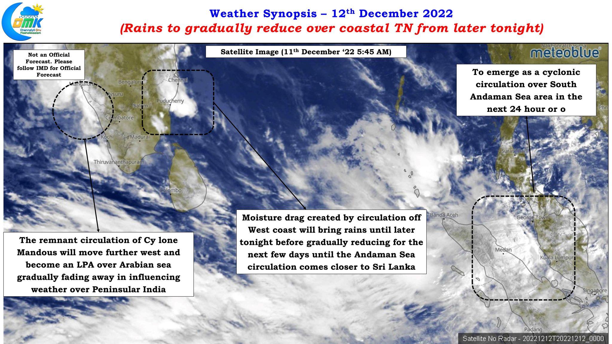
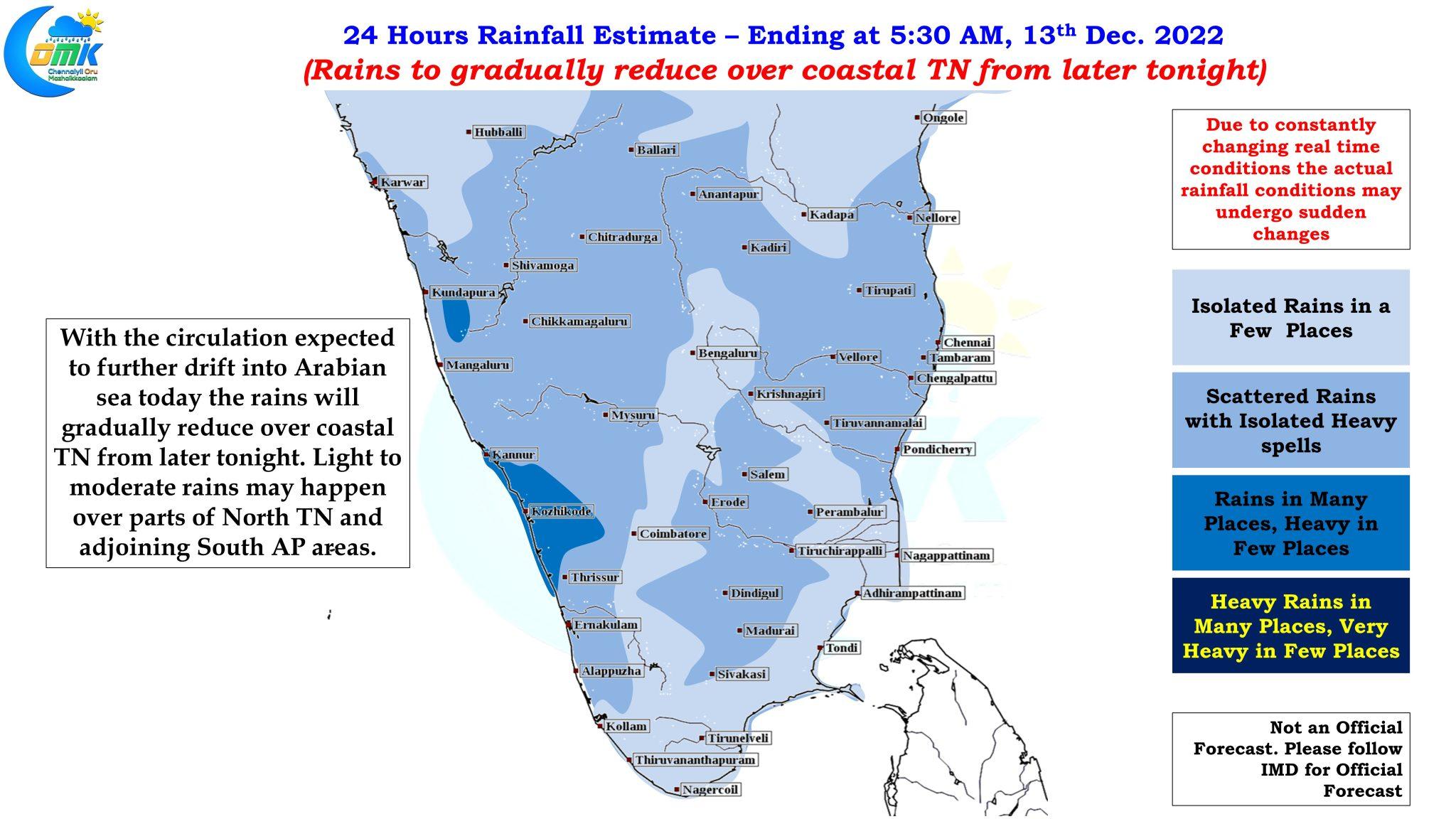
The remnant circulation of Cyclone Mandous and its remnant, currently lies as a circulation off the coast of Kerala and is expected to move further west regenerating once again as an LPA in the process. But it is expected to fade away in its influence of weather over peninsular India from today. Yesterday and today coastal areas of Tamil Nadu and also interior areas of North TN saw rains from the effect of moisture dragged by this circulation, this is expected to continue until later tonight before the rains gradually reduce from these areas as the circulation moves further west.
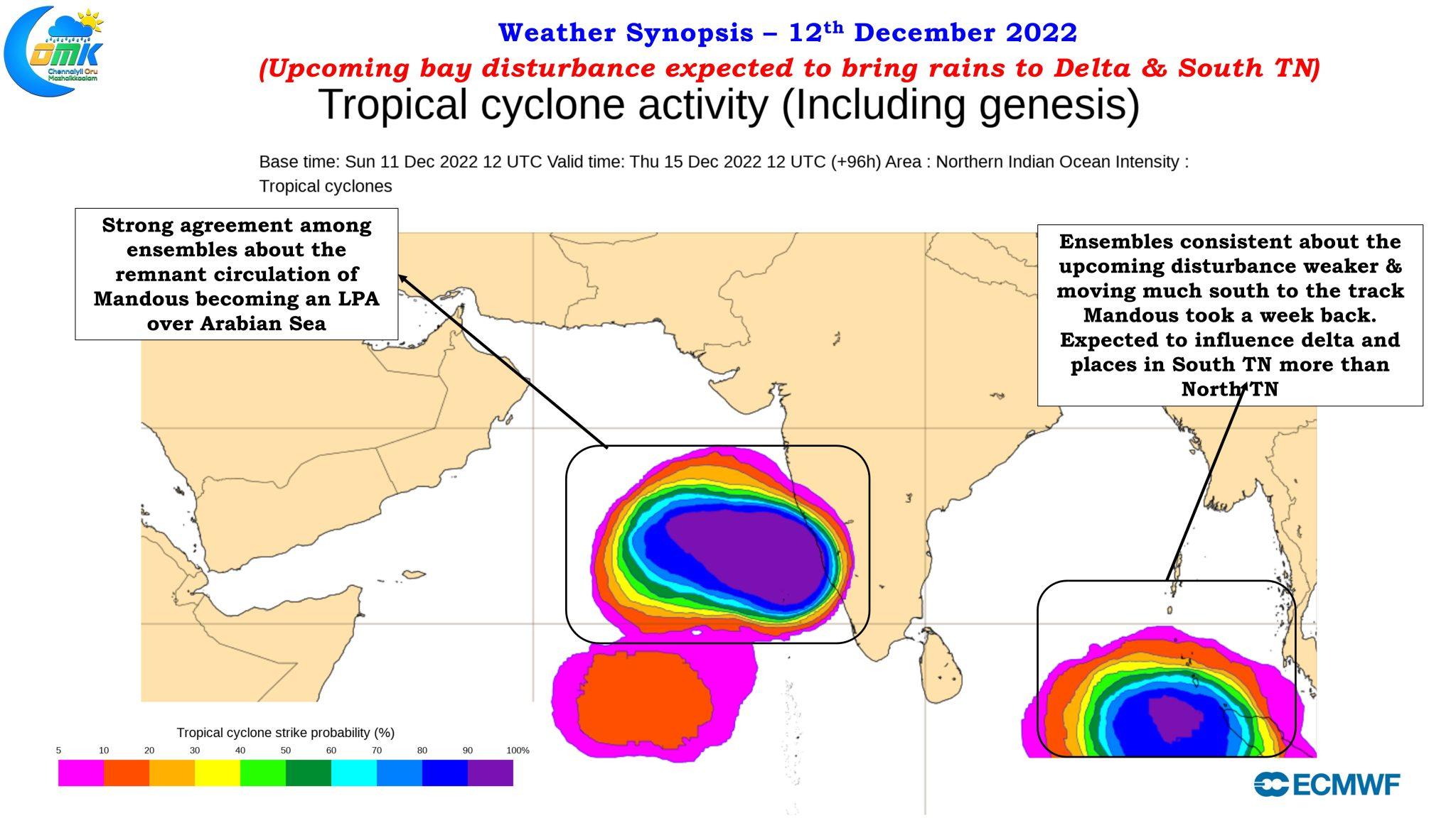
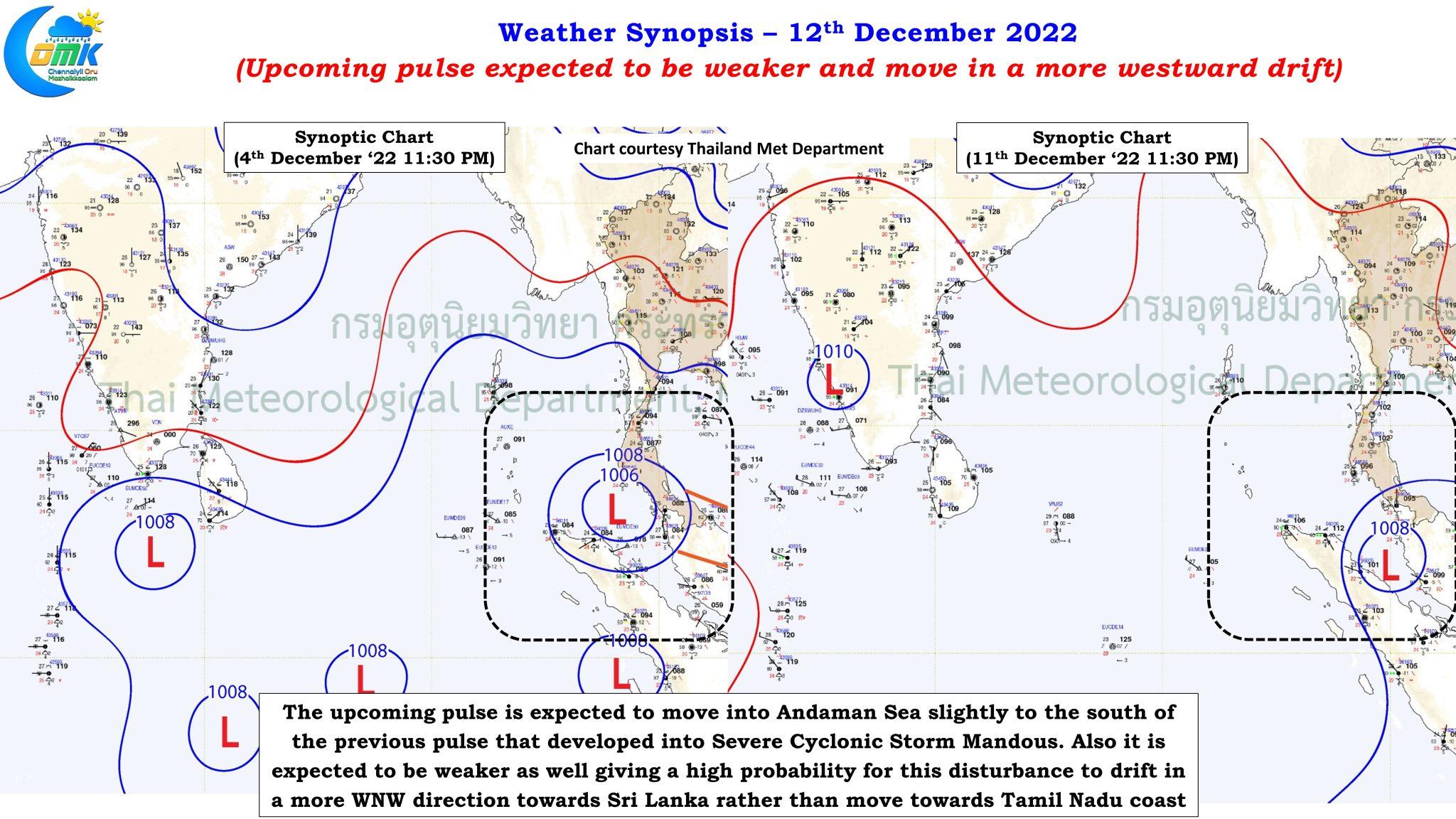
The chatter though has now shifted to the next bay disturbance with many wondering if back to back cyclones are going to hit Chennai. In a way the first paragraph also answers the question about how often one gets to see back to back cyclone hit Greater Chennai region and not just a remembrance about Cyclone Vardah alone. The biggest driver of this chatter is now some of the media channels which seem to have found a fascination for the animated “Sangu Chakkarams” in the windy app and end up showing any and every circulation without wanting to make an effort to understand how weather models work. The ensembles are fairly consistent about both the current remnant circulation of Mandous emerging as an LPA over Arabian Sea and also the upcoming one coming into Andaman Sea this week emerging as a weak circulation compared to the state at which the pulse triggering Cyclone Mandous entered into Andaman Sea.
Look a little deeper with the synoptic charts a week back and last night one can clearly see the upcoming pulse is moving into Andaman Sea at an area slightly south of where the Mandous pulse entered. This subtle change is also going to influence how this circulation is expected to behave. As we get closer to the equator the influence of Coriolis forces reduces preventing the circulation to generate sufficient spin to intensify. This is likely to ensure the upcoming pulse is likely to take a more westward track towards Sri Lanka coast than a more pronounced NW track which was taken by Cyclone Mandous. The ensembles showing a weaker intensity trend compared to last week’s disturbance in a way also confirms this scenario along with a more pronounced westward track towards Sri Lanka. This would mean the heavier spell of rains from the upcoming disturbance may favor delta districts and South TN more than north coastal TN (north of Mahabalipuram) which have pretty much completed not only the NEM quota but also the annual quota of rains over many places.
On the immediate rain front as the remnant Cyclone Mandous circulation moves further west its influence is expected to fade and along with it a reduction in the rains is also likely from later tonight. Tonight and wee hours of tomorrow may see some rains under the influence of moisture drag by Easterlies before a spell of drier winds from North take control while the next disturbance slowly evolves over equatorial Bay waters. This could bring a few days of dry weather not only over north coastal TN but also most of the peninsular India for 3 / 4 days before rains return again towards the end of the week as the incoming pulse gets closer to Srilankan coast.
Chennai and suburbs may see on and off moderate spells of rains as the last batch of storms move across towards interior areas before rains reducing from tomorrow.