
Bringing much cheer Northeast Monsoon showed signs of stuttering to life once again with many places along the coast of Tamil Nadu and South AP recording light to moderate rains from yesterday evening. While there remains inherent doubts on how active this phase of Northeast Monsoon will be it makes a lot of sense to enjoy what ever rains come our way from now until end of the season.
While Chennai Nungambakkam recorded only6 mm until 5:30 AM in the morning, southern suburbs like Kelambakkam has recorded moderate rains over night. Tondi & Adirampattinam recorded 23 and 25 mm respectively as most parts of Coastal TN recorded rains from yesterday evening.
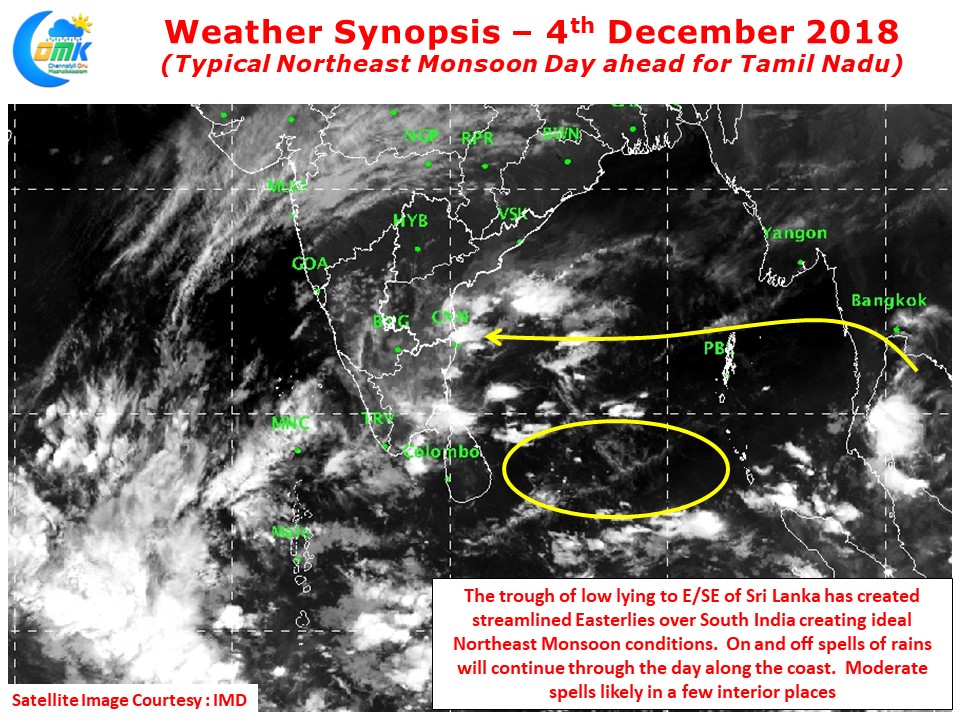
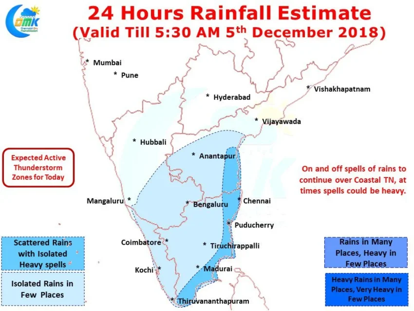
With the Trough of Low persisting to the East / Southeast of Sri Lanka we are seeing streamlined Easterlies all the way from Indo China to Tamil Nadu Coast right across the Bay of Bengal. This would mean today could be a typical Northeast Monsoon Day for most of Tamil Nadu. While Coastal areas will receive on and off spells of rains cloudy skies could prevail over Interior areas of the state.
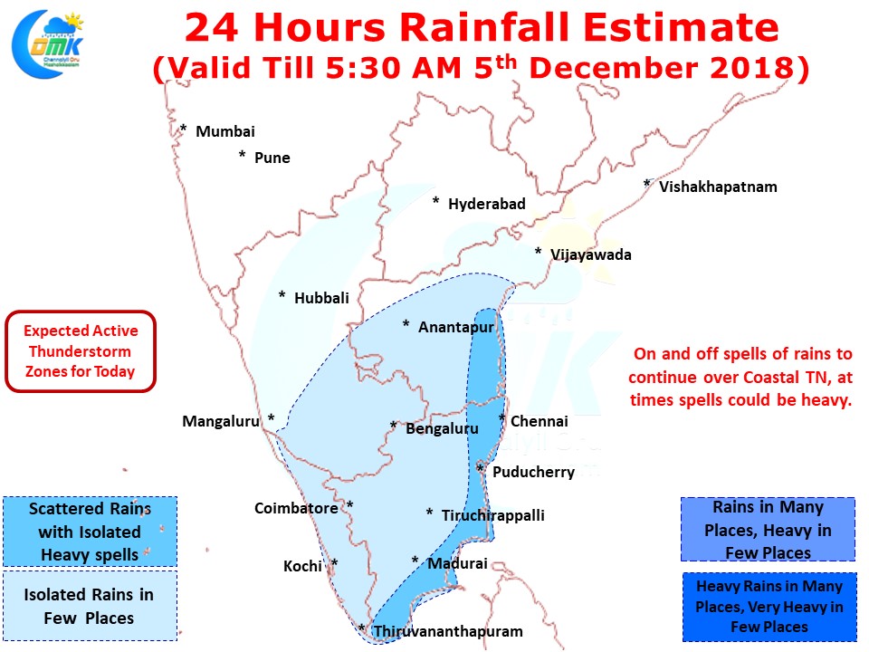
Coastal areas are likely to see moderate to heavy spells of rains at times. In particular parts of North TN and South Coastal AP could see isolated heavy rains in a few places. Interior areas are likely to see some thunderstorms through moisture incursion, especially around South TN few places could see moderate rains as remnant moisture travels across the interior places.