
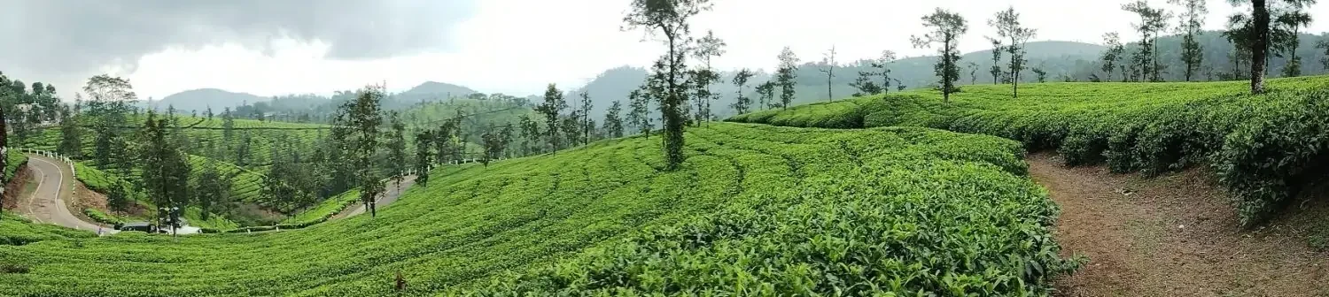
It is that time of the year when a large part of the country looks forward to the winter season. But there is one small part of the country that looks at the transition season through a different lens. The Peninsular east coast starts the countdown towards the arrival of Northeast Monsoon. Bloggers from across Tamil Nadu start looking for signs in weather charts. Each run from each model is analysed for changes / signs to understand what in store.
While the coast looks forward to Northeast Monsoon interior areas of Peninsular India look at immediate window of transition season. The couple of weeks when winds gradually change from West to East. Places in NW Interior TN like Krishnagiri / Dharmapuri parts of Erode, Salem and Coimbatore closer to the Ghats benefit from these thunderstorms. Also South Interior Karnataka including places like Bengaluru sees bulk of its rains during these transition seasons.
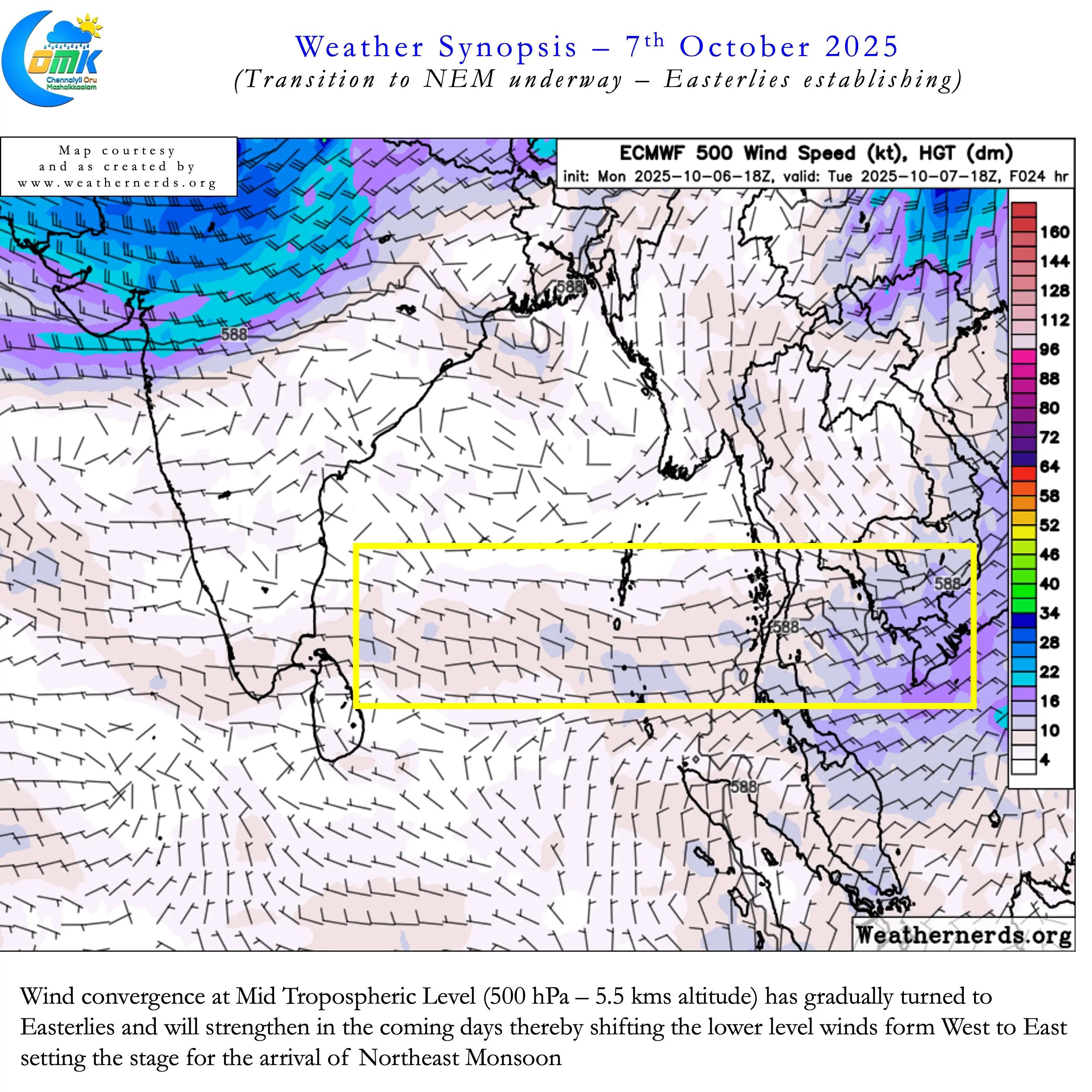
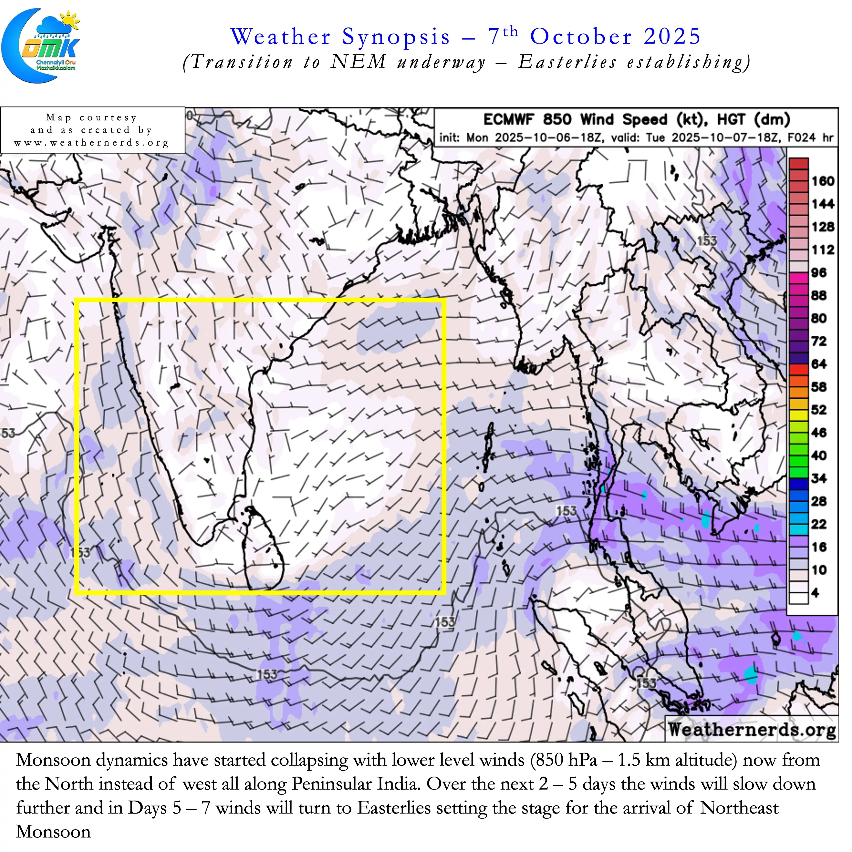
Looking at the weather models mid levels winds have already started to turn Easterly. Though these are not yet streamlined it is certainly an indication of the seasonal shift. At lower levels most of Peninsular West coast has started seeing winds from NNW rather than west. Gradually lower level winds will start slowing down confirming the collapse of Monsoon dynamics. Satellite image pretty much confirms that Monsoon is in its final leg. It is a matter of time the withdrawal over Central and West India starts picking up later this week.
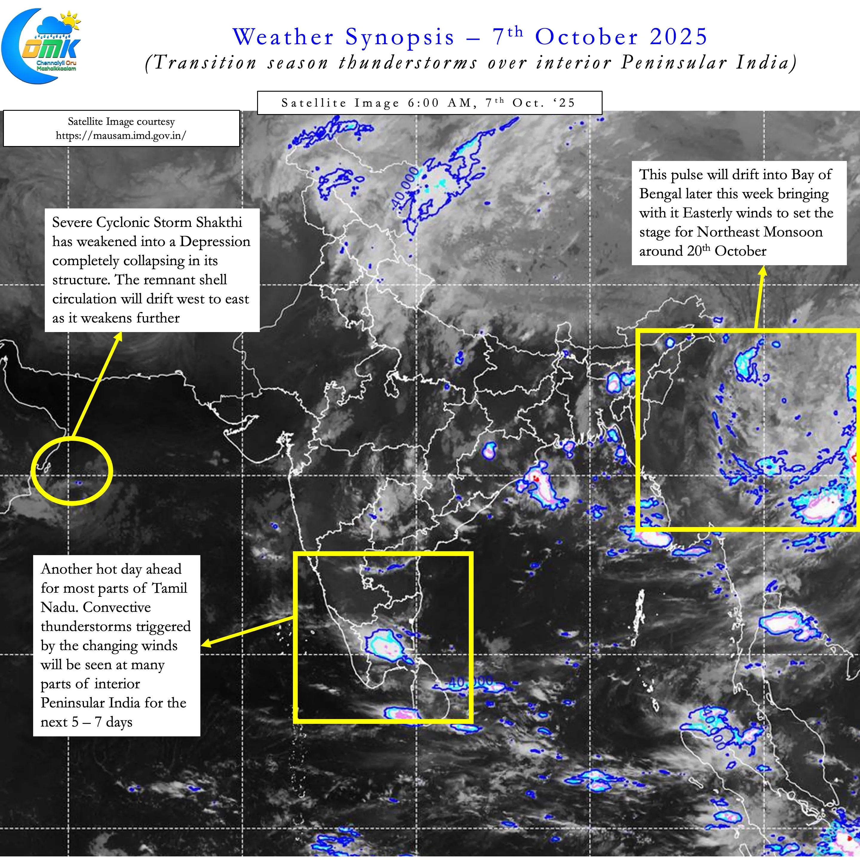
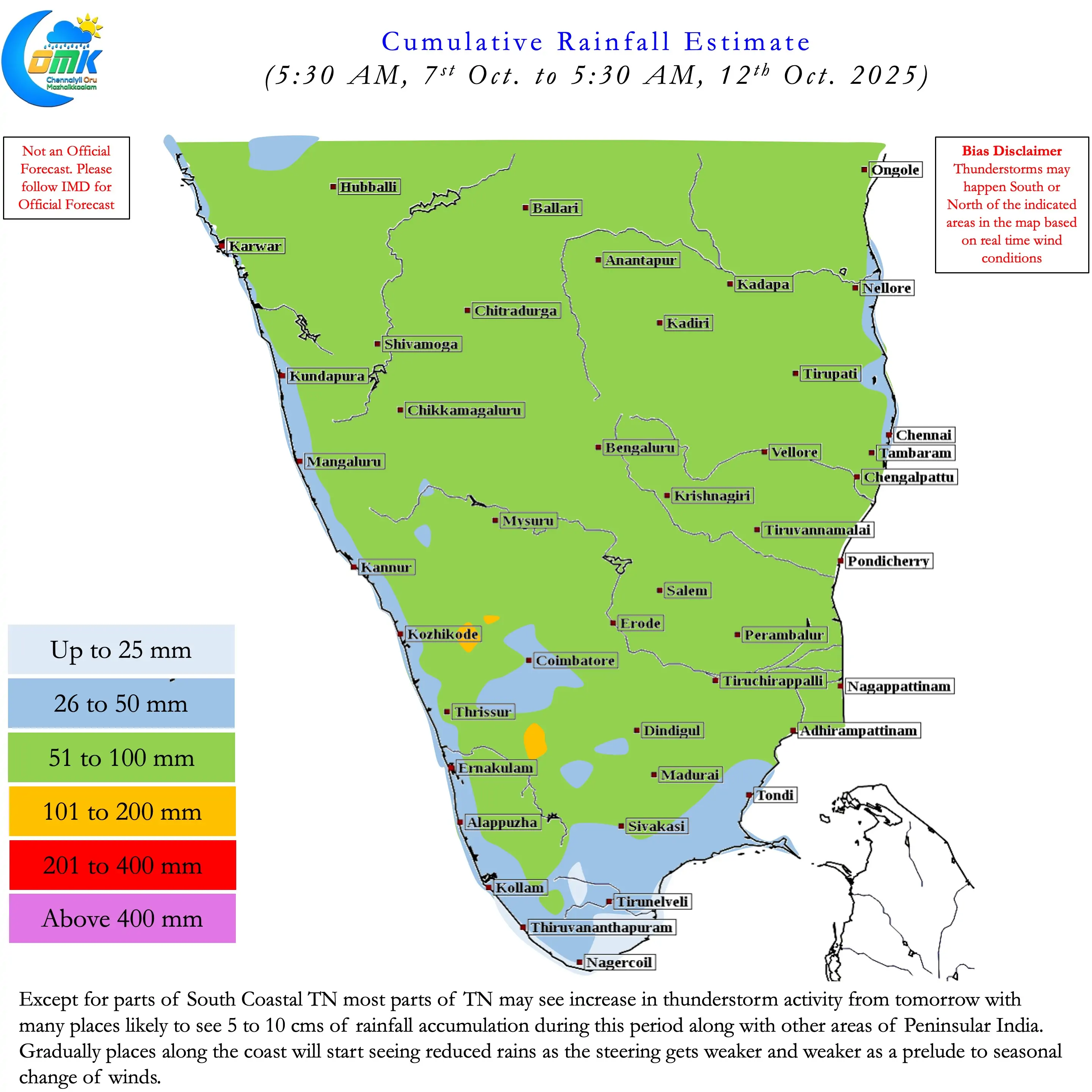
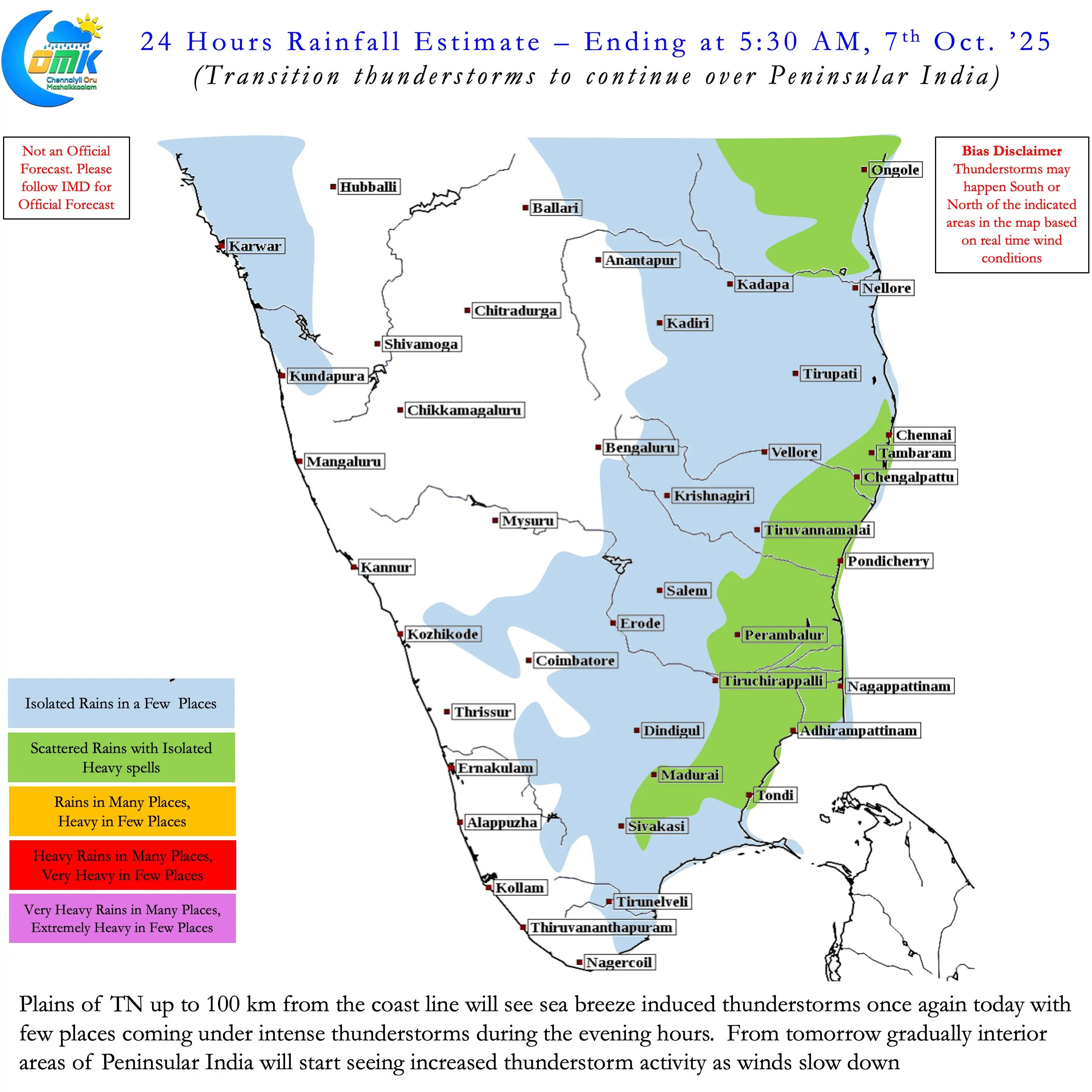
Sub seasonal weather outputs indicate except for the remnant circulation of Cylone Shakthi there is unlikely to be any major tropical disturbance over the Indian Sub continent. This in a way is an indicator that Southwest Monsoon has completed its life cycle for this year. Place along the west coast may not see any monsoon rains from now on. These places may see withdrawal thunderstorms over the next week to 10 days. Subsequently it is going to be a transition towards winter.
Sea breeze induced thunderstorms over Coastal Tamil Nadu is another confirmation of weakening monsoon dynamics. Today also places along the coast may once again see sea breeze induced thunderstorms. Gradually as westerlies weaken interior areas will start seeing more thunderstorm activity. Thunderstorms under poor steering that remain mostly stationery dumping a lot of rains. Coastal areas will see a reduction in thunderstorm activity as it gets ready for Northeast Monsoon possibly two weeks from now.