
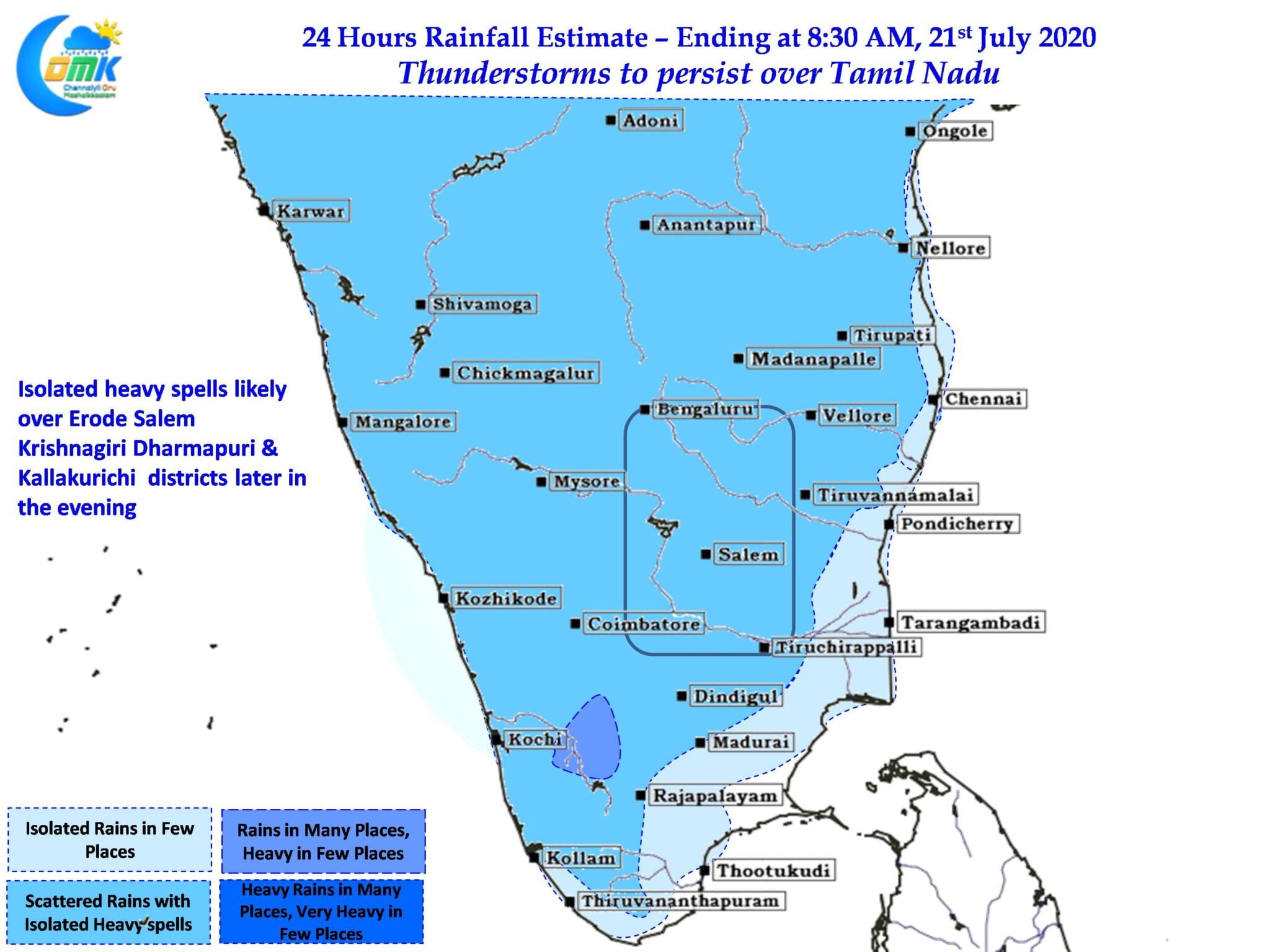
With Monsoon going back to its shell over the weekend thunderstorms have started to improve over Tamil Nadu. Most parts of Chennai recorded rare morning rains during southwest monsoon period. Not often one gets to see rains after day break in coastal places like Chennai especially during the month of July. Interestingly the storms that gave Chennai rains could be traced to remnant thunderstorms lingering over the Bay to the NE of Chennai.

Satellite image indicates the state of Southwest Monsoon with Monsoon Jet dipping SE to the latitudes lower than Indian Sub Continent there by keeping away active monsoon convection away from the West Coast of India. With clearer skies expected today over interior parts of Peninsular India we can expect some bit of convective trigger of thunder cells through the lifting of air particles by day time heating mechanism.

Weather charts also indicate a convergence of Southerlies & Westerlies over interior parts of Tamil Nadu which could create conducive conditions for thunderstorms to develop & sustain for a longer period of time. This could mean possible thunderstorms over districts like Kallakurichi, Perambalur, Salem, Tiruvannamalai etc during the afternoon hours.

Interestingly unlike yesterday when the wind patterns were not beneficial for coastal places to benefit from storms moving in from the interior areas, today we could possibly see some bit of movement which could bring possible rains to places like Chennai.