
The last couple of days have seen thunderstorms slowly pick up over Tamil Nadu even though Monsoon has been fairly active over the West Coast until yesterday. Day before saw many places along the Ghats record heavy to very heavy rains as Monsoon surge aided by the Well Marked Low off Gujarat coast hit the Western Ghats. Since yesterday there has been a visible reduction in the monsoon surge and also movement of the monsoon trough towards the Foothills of the Himalayas.

Satellite images indicate parts of NE and the Terai plans of Bihar & adjoining Nepal under rain clouds indicative of the Monsoon Trough moving up. In the meanwhile down south over Bay a weak circulation like feature is likely to aid thunderstorm development over the East coast of Peninsular India with many places in Tamil Nadu, Andhra Pradesh, South Interior Karnataka likely to see late afternoon / evening thunderstorms.

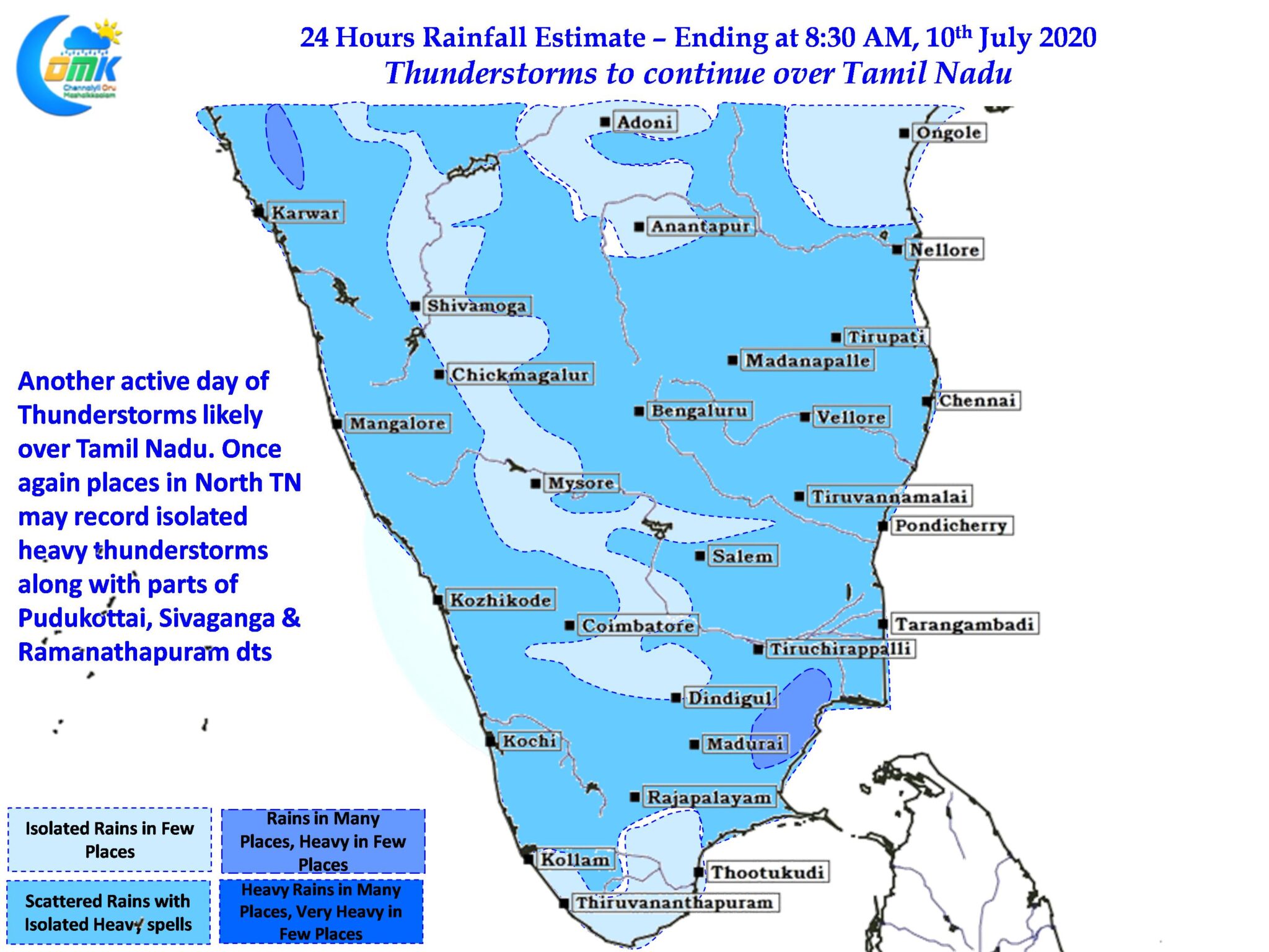
With Westerlies weakening conditions may be conducive for development of thunderstorms in the interior areas particularly around the Broken Eastern Ghats. A broad wind convergence type of zone is seen over North TN & adjoining parts of Rayalaseema & Karnataka which is likely to trigger heavy thunderstorms in one or two places over this region. Similarly parts of Pudukottai, Sivaganga & Ramanathapuram could see intense thunderstorms in a few places due to the winds converging from the West created by mountains like Anaimudi / Kolukkumalai.
As far as Chennai goes for the next few days chance for rains for the city & suburbs exist almost every single day, what translates into reality remains to be seen.