

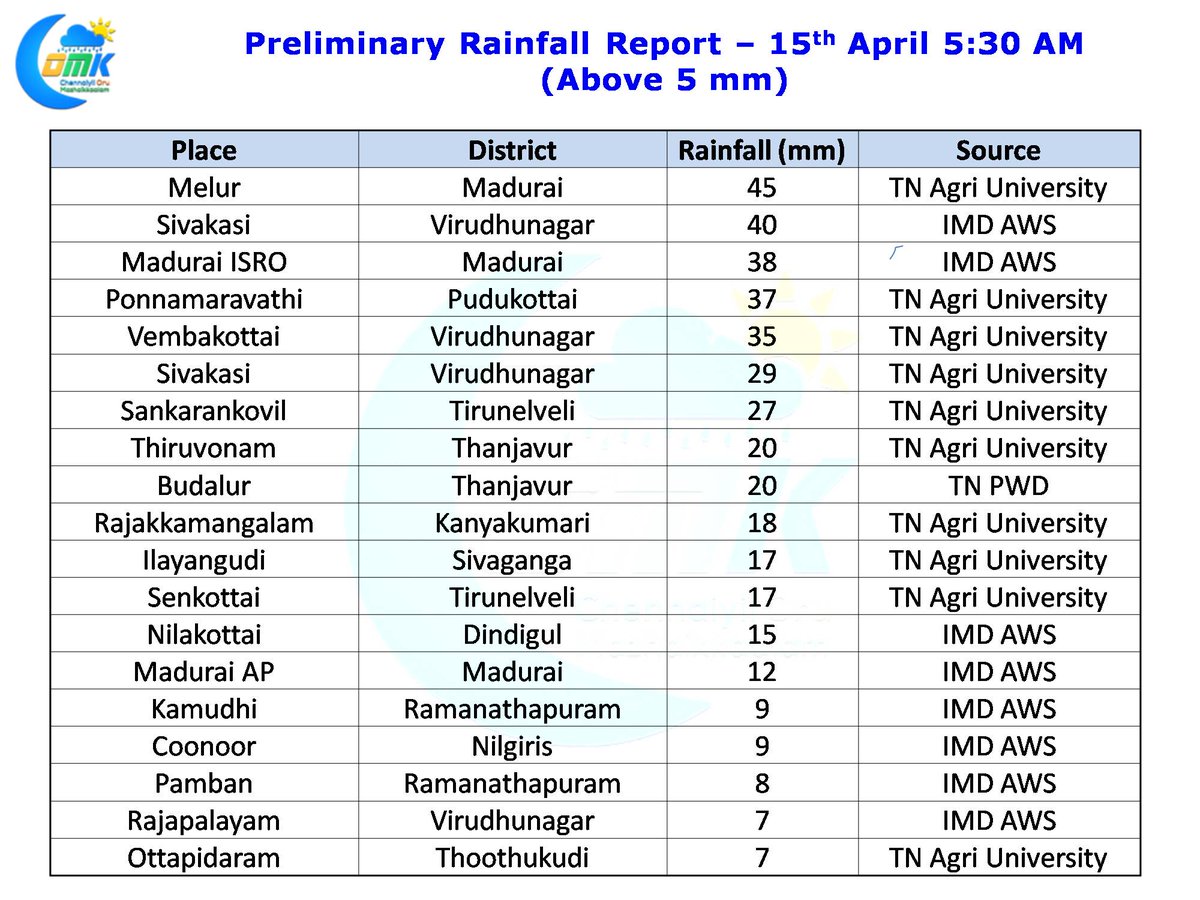
After nearly a week of thunderstorm activity over Tamil Nadu and in particular South TN we are likely to see things slow down in the coming days. Yesterday saw parts of Delta districts receive light to moderate rains while districts like Virudhunagar in South Tamil Nadu recorded moderate to heavy thunderstorms along with parts of Madurai district.
The last couple of days saw the circulation in Equatorial waters lie off Sri Lanka in the Comorin Sea area which created conducive conditions for thunderstorms to develop over many places of Tamil Nadu. In particular the places along the ghats recorded good rains as moisture from the East was getting trapped by some of the taller ranges of Western Ghats.
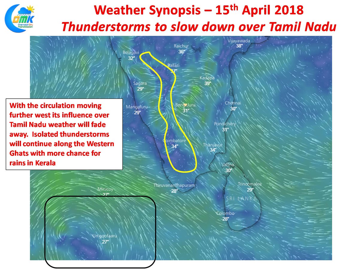
With the circulation now moving West into the Arabian branch of Equatorial waters as mentioned in the opening remarks of the post its influence will slowly start to fade. While isolated places along the Western Ghats is likely to see thunderstorm activity under the effect of converging winds during the afternoon / evening over the next couple of days places in Kerala are better placed to enjoy thunderstorm activity. Coastal places of Tamil Nadu might see some light rains or passing showers in one or two places today and tomorrow morning which will also fade away subsequently. With thunderstorm activity slowing down we can see an increase in temperature in the coming days. Starting from Tuesday models indicate temperatures to notch up by a degree or so during the day time.