
The last few days have seen subdued thunderstorm activity over most parts of Tamil Nadu though occasionally one or two places enjoy a good spell of rains like parts of Villuppuram, Cuddalore dts & Pondicherry last evening. On the other side west coast had seen some heavy rains all the way from Gujarat to Kerala influenced by Strong Monsoon surge and a near stationary low off Gujarat Coast.
The weather bloggers of Chennai could be broadly divided into two categories. The ones for whom tracking Thunderstorms over Tamil Nadu are like an addiction. This set of people during Monsoon Surge conditions at times suffer from withdrawal syndromes in the absence of any thunderstorm opportunities for TN and end up as an extremely frustrated lot. The second set of bloggers are those who have attained Zen status after years of tracking thunderstorms over Tamil Nadu, they understand the ebbs & flows of rainfall pattern and realize one can derive happiness & satisfaction by not just tracking Thunderstorms over Tamil Nadu but enjoy the Monsoon Phenomenon as a whole over the Indian Sub Continent.

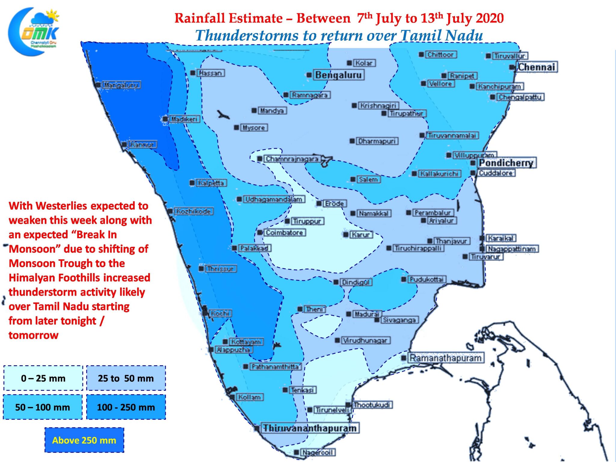
Once you attain Zen status every spell of rain that comes in your place is treasured and enjoyed. One such possibility is ahead for most parts of Tamil Nadu with Monsoon likely to head for a Break in Phase. Weather models indicate Westerlies to weaken from today over the Southern parts of Peninsular India which will provide for wind induced thunderstorms over Tamil Nadu.

In another key factor in the Thunderstorm equation for Tamil Nadu IMD expects the Monsoon Trough to shift to the Himalayan Foothills this week after the current Low off Gujarat Coast weakens. The best period of thunderstorms for Tamil Nadu normally coincides with the Break In Monsoon Conditions. With Break in Monsoon conditions coming in we can expect better prospects for places like Chennai to enjoy a couple of very good spell of thunderstorms this week.