
The last couple of days have seen moderate to fairly intense thunderstorms over parts of Tamil Nadu. On Sunday parts of Pudukottai district recorded good rains with Gandharvakottai recording 5 cms while yestereday parts of Vellore, Krishnagiri, Dharmapuri, Tiruvannamalai, Karur & Tiruchirappalli districts recorded rains. The IMD AWS as Sirugumani KVK, west of Trichy, recorded 11 cms of which nearly 8 cms fell in one hour between 10:30 & 11:30 PM.
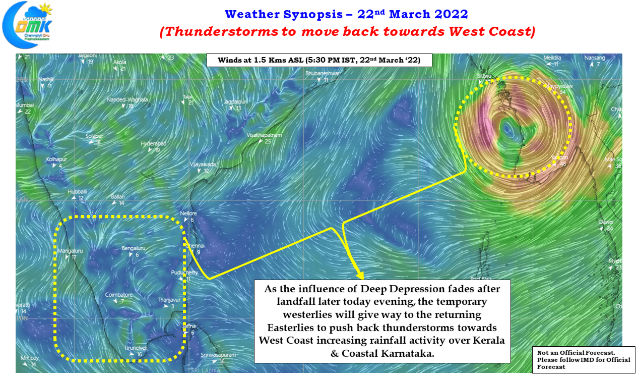
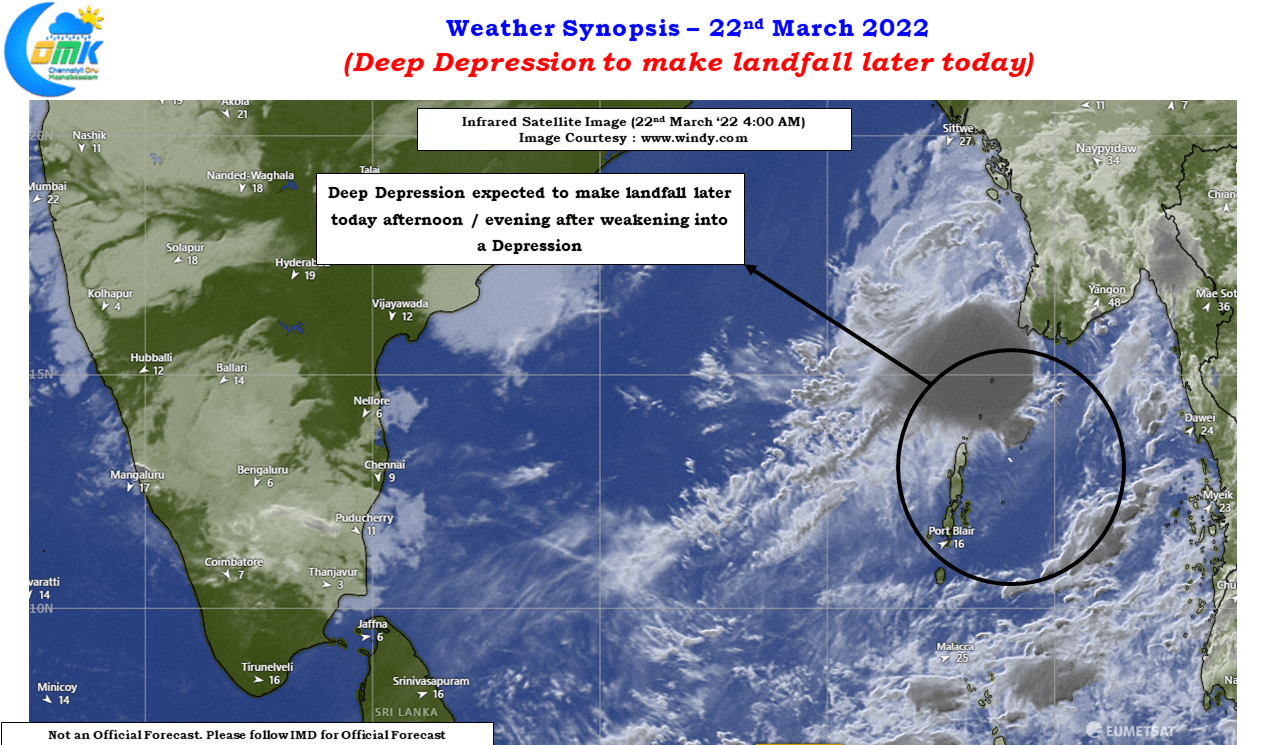
With IMD now expecting the Bay disturbance to remain a Deep Depression & possibly make landfall over the Myanmar coast as a depression later today afternoon / evening things will slowly turn back to normal in Peninsular India as well. The temporary strengthening of Westerlies mean thunderstorms nearly pushed to the East Coast. As the influence of the Deep Depression in Bay of Bengal fades away the Easterlies will gradually move in pushing back the thunderstorms to the West Coast increasing rainfall activity over Kerala & Coastal Karnataka.
As March gives way to April we will slowly see the Westerlies strengthen on a more permanent basis bringing along with it LWD conditions and associated Veppasalanam thunderstorms over interior areas of Peninsular India. The pre monsoon & post monsoon thunderstorm season is the best period of rains for few parts of Interior TN & adjoining areas of Karnataka.

Today we might see thunderstorms closer to the Western Ghats with parts of Dindigul, Madurai, Theni, Tiruppur, Pollachi, Coimbatore & Nilgiris dts seeing moderate to intense spell of rains in one or two places. While the thunderstorms will continue in isolated places along the Western Ghats in Tamil Nadu the more intense thunderstorm activity will shift to Kerala & adjoining parts of Coastal Karnataka from tomorrow.