
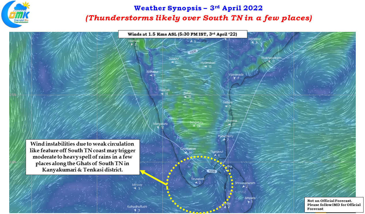
Yesterday saw thunderstorms return to parts of Tamil Nadu including some inteiror areas like parts of Delta, Virudhunagar, Sivagangai & Pudukottai districts under the influence of a weak circulation like feature seen at lower atmosphere off the South TN coast. Few places along the Ghats in Tenkasi district recorded very good rains during the evening hours. With the state seeing hot conditions during the afternoon hours at most places these rains have come as a welcome relief in some of the areas.
Today weather models indicate the circulation like feature & associated wind instabilities to be present off the coast of South TN providing opportunity once again to places in South TN to receive some rains with a few places along the Ghats better placed to record moderate to heavy spell of rains during the evening hours. The clear skies during the morning hours possibly makes it conducive for the convective process to develop through the day while the wind instability provides the trigger for thunderstorms to develop and strike at a few places where localized conditions are good.
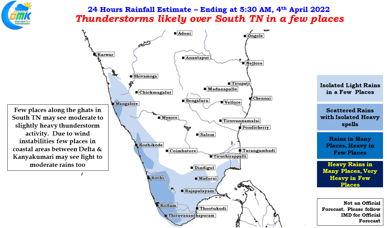
Not much likely for places in North Tamil Nadu like Chennai where mostly dry coditions are likely to prevail. While temperatures may stay closer to normal the high humidity will continue to make afternoons uncomfortable. At this time of the year it is tough for North Coastal places to come under thunderstorms unless larger scale weather dynamics come into play. With models expecting a possible Low Pressure Area in South Bay next week, it remains to be seen if it will bring cloudy skies or a possible spell of rains for North TN