
Thanjavur 415 mm , Cholavaram 349 mm, Kalasapakkam 328.6 mm
Devala 392 mm, Avalanche 322 mm
July & August are traditionally the strongest months for Southwest Monsoon. August on an average sees about 4 Monsoon Low bringing about at least one monsoon surge during the month. But many would possibly not believe if the numbers given above are for the month of August 2021 from the TNSMART data. In a freak case of extremely poor monsoon during August for places in the Ghats of Tamil Nadu, Avalanche which has scored above 300 mm in 24 hours many a times has just about crossed 300 mm for the entire month of August. Devala another place which traditionally receives extreme rains during peak monsoon surge ended up accumulating less than 400 mm for the entire month of August. To give a perspective the Top 3 stations from the leeward areas of Tamil Nadu, Thanjavur, Cholavaram (Tiruvallur) & Kalasapakkam (Tiruvannamalai) recorded more rains than Avalanche in Nilgiris dt during the month.
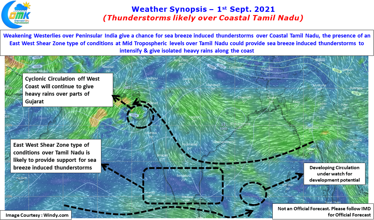
While Monsoon showed up for a couple of days last week, things have once again slowed down over the southern parts of Peninsular India though it has not yet effectively collapsed like how most of August was. With a cyclonic circulation seen over West India off North Konkan coast that is creating vortex like conditions heavy rains may happen over parts of North Konkan & Gujarat before the circulation drifts further west. Weather models indicate possibly another circulation from Bay to happen in a few days time. With MJO likely to evolve as a fresh pulse over Indian Ocean one needs to see if this development could enhance the overall monsoon dynamics.

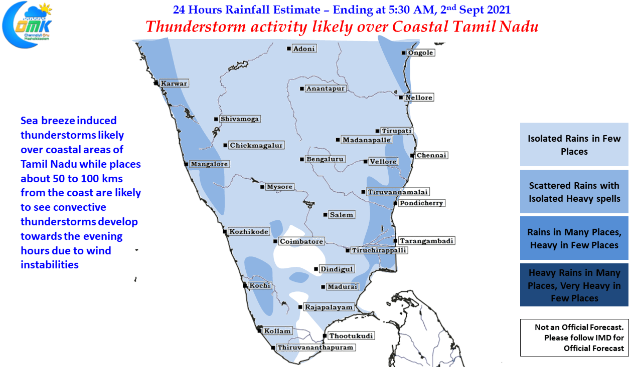
Meanwhile yesterday few places in Coastal Tamil Nadu saw sea breeze induced thunderstorms indicative of the weakening westerlies over southern parts of Peninsular India. Similar conditions are expected today as well going by weather models. Additionally at Mid Tropospheric Levels (500 hPa – 5.5 kms ASL) there exists a wind instability in the form of East West Shear Zone type of conditions, possibly an elongated circulation in the making, which is likely to provide conducive conditions for sea breeze induced thunderstorms to intensify. Places along the coast up to 75 to 100 kms from the coast line are ideally placed to enjoy the rains today with Pondicherry to Karaikal belt in line for isolated intense thunderstorms in one or two places.