
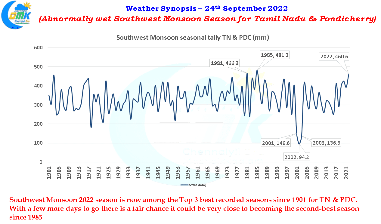
Since the start of the second week of September rains, both over the core monsoon areas and thunderstorms over the leeward areas, have slowed down over most of Tamil Nadu. But despite this slow down during what is effectively the rainiest period during the Southwest Monsoon season this year has been abnormally wet with 56% excess rains compared to the long period average as on 23rd September. To give a perspective the realized rainfall during September is only 69.1 mm against the Long period average of 86 mm for the first 23 days. Dig a little deeper and you will realize the last 16 days has brought only 16.9 mm against a normal expected rainfall of 62 mm a deficit of more than 72% in the last fortnight. If not for this poor fortnight SWM 2022 could have ended up as the first recorded season to touch 500 mm surpassing the highest seasonal tally of 481.3 mm so far recorded in 1985.
In a way the late season flourish of Monsoon dynamics over Gangetic Plains and Central India on the back of a supportive intra seasonal oscillation from the North propogating MISO has resulted in the reduction of not only convective thunderstorms over the leeward areas of Peninsular India but also the monsoon areas as well along the coast and the Ghats. Since 14th September even the daily rainfall chart for Kerala has been below average on a daily basis. Yesterday among the IMD observatories in Kerala only Alappuzha recorded at least 1 mm with all other stations recording no rainfal except Kochi which recorded traces.
It remains to be seen whether this suppressed fortnight and break in rains in a way is nature’s way of balancing things so that when it is time for Northeast Monsoon 2022 the effect of any extreme rainfall instances is not as aggravated as say 2021 which pretty much saw good rains continue right from the start of Southwest Monsoon till 3rd week of November resulting in not only localized flooding in the coastal areas of TN but also interior areas of Peninsular India and also one or two places in the High Ranges as well.
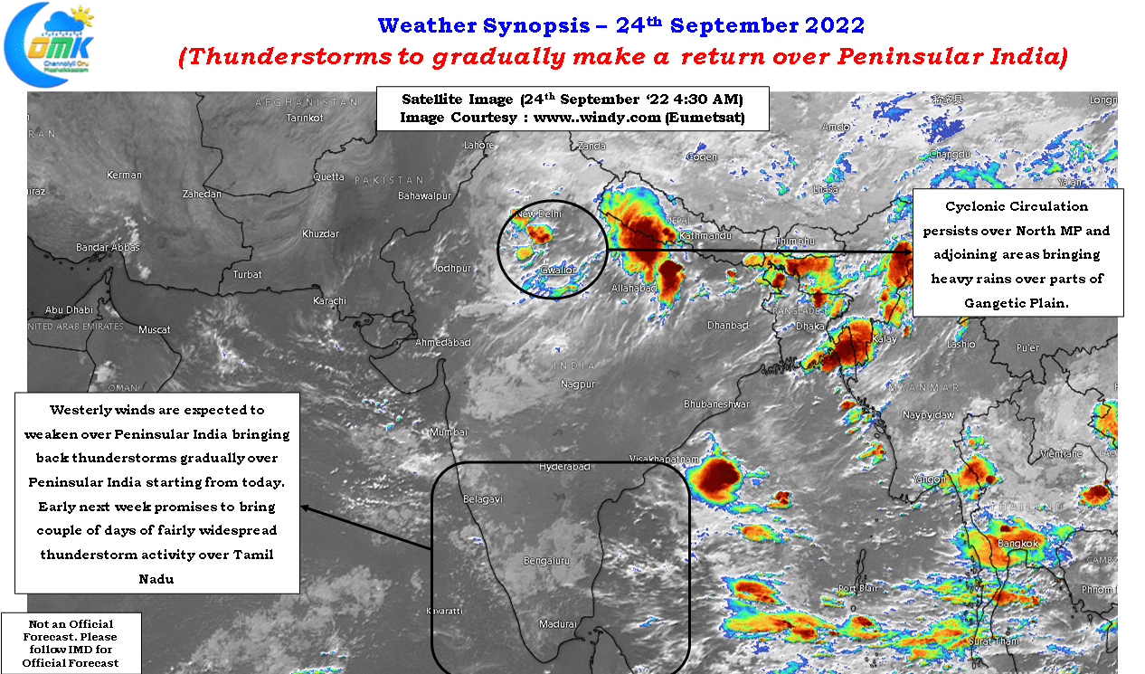
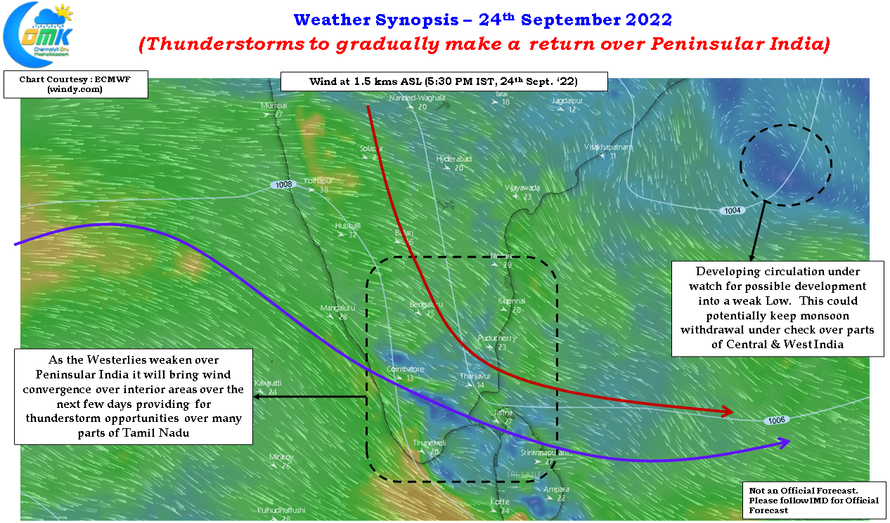
Any talk of Northeast Monsoon is still a bit early as of now with monsoon dynamics continuing to hold sway over Central India and Gangetic Plains. While one cyclonic circulation continues to persist over Madhya Pradesh and its adjoining areas there is a possibility of another developing cyclonic circulation in Bay could descend into a weak Low thereby retaining the stranglehold of Monsoon dynamics of Central India and parts of West India. This could mean a fluid state of atmospheric conditions which is likely to influence the overall withdrawal dynamics and arrival of Northeast Monsoon. We will continue to keep a watch on the arrival of favorable tropical waves that could bring about a sudden change in dynamics and associated seasonal shift in winds from West to East.
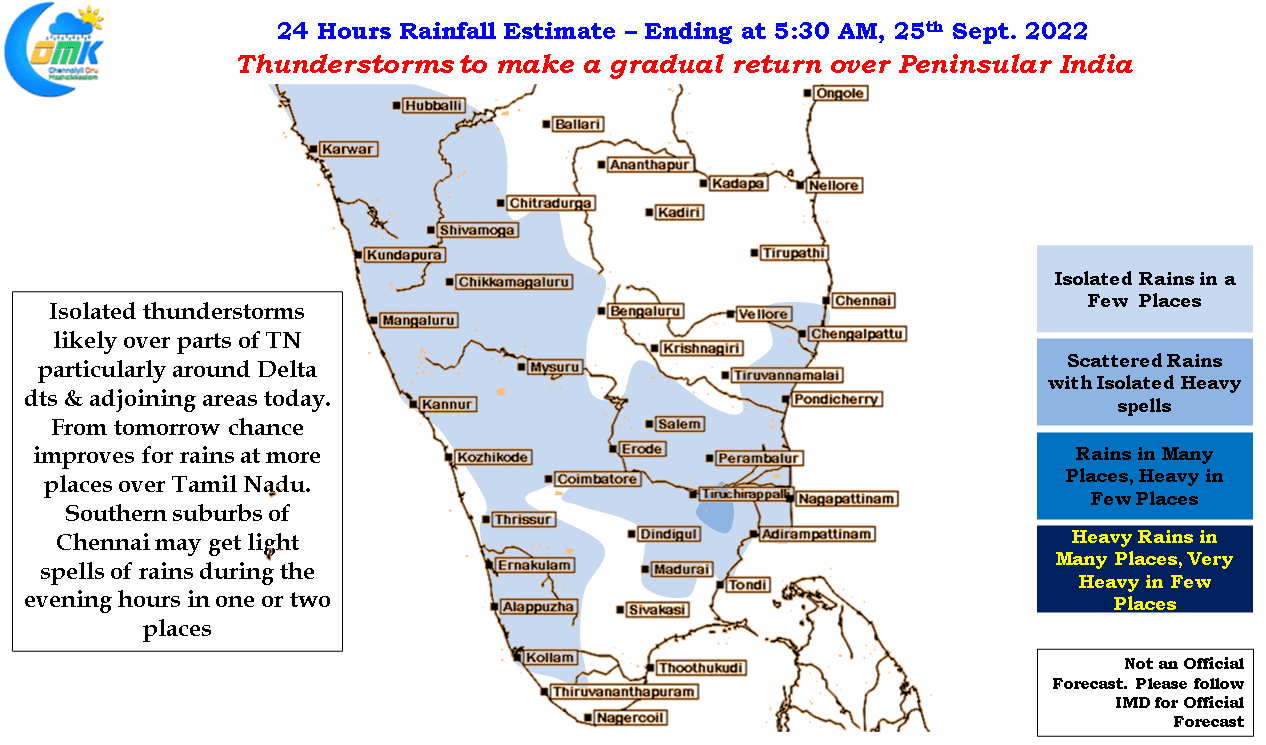
In the meanwhile the intervening period between two circulations is likely to trigger a bout of thunderstorm activity over Peninsular India starting from today with things picking up gradually as the weakening westerlies and developing circulation in Bay bringing wind convergence and associated thunderstorms. In a way this period of thunderstorms is likely to bring some bit of cheer for the farming community in the interior areas who predominantly depend on rainfed cropping. While today could be a tad early for good rains things indeed pick up from tomorrow with early next week promising to bring atleast two good days of fairly widespread thunderstorm activity over most parts of Tamil Nadu including Chennai and suburbs.