
The last couple of days Tamil Nadu has been seen thunderstorms in many parts of the state. Yesterday places in Delta like Thanjavur, Kumbakonam, Nagapattinam along with parts of Tiruvannamalai and Villupuram district recorded moderate to heavy spells of thunderstorm late in the evening.

While Chennai may have missed the Rains during the weekend it is a welcome relief for many other places of the state. Like everyone else it has been disappointing for the weather bloggers as well to miss out on what was the best spell of thunderstorms over the last few days.

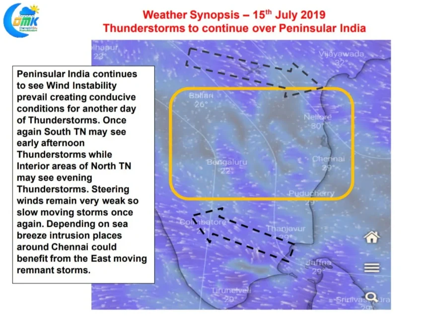
Satellite image today morning shows the the absence of remnant thunderstorms over Tamilnadu unlike the past couple of days where rains happened early in the morning giving cloudy skies during the morning hours. This could create the right temperature gradient for sea breeze to intrude into North Coastal Tamilnadu. This is likely to make a crucial difference to the thunderstorms probability for places like Chennai today.

Weather models indicate Peninsular India to remain under zone of wind in stability at about 5.5 kilometres above sea level altitude. This weak wind zone is likely to trigger thunderstorms late in the evening. As was the case for the past couple of days South Tamilnadu / Delta could see thunderstorms in the afternoon created by sea breeze intrusion. Interior Tamilnadu and the adjoining parts of Rayalaseema and South Interior Karnataka could see thunderstorms develop around evening and move roughly in a west to east direction. The interaction between the east moving thunderstorms and the possible sea breeze front closer to the cost could turn favourable for places in North coastal Tamilnadu.
We once again wish to reiterate steering of thunderstorms are very complex and any small change in parameters during the course of the day code alter the impact area drastically.