

Thursday saw one of the best days of thunderstorms this week over Tamil Nadu as many places over Erode, Salem, Krishnagiri & Dharmapuri districts recorded good rains while Vedasandur in Dindigul recorded 15 cms for 24 hours ending at 8:30 AM on Friday. While it was expected yesterday could be the turn of North Tamil Nadu as weather models indicated possible wind instabilities over the region along with improved wind steering which could benefit coastal places, neither of them were pronounced and an overall subdued thunderstorm activity was the result with bulk of rains staying well above Chennai latitude.
Today once again weather models indicate weak westerlies and satellite images show fairly clear skies over most parts of TN due to the absence of remnant thunderstorms that lingered till the morning hours which has been the case for the past few days. Over the past few weeks since the onset of Southwest Monsoon 2020 there is a fairly clear pattern showing up in the wind charts. The moisture laden westerlies get deflected by a few tall peaks like Kolukkumalai, Anaimudi, Doddabetta which then converge back over leeward areas of Tamil Nadu. When ever this convergence happens the interior areas of TN falling under this convergence zone enjoy a good spell of thunderstorms. While this does not happen when the surge is strong, when the westerlies are gentle the chances are very high.
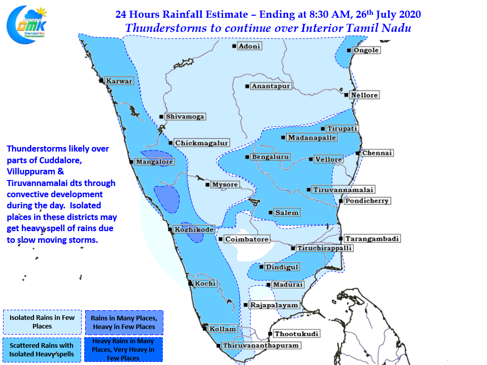
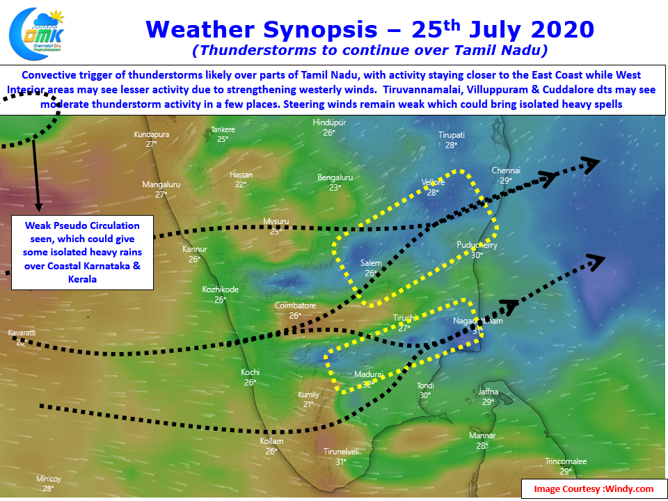
Today parts of Villuppuram, Kallakurichi, Salem, Tiruvannamalai & Cuddalore dts along with parts of Thanjavur & Pudukottai districts come under this convergence zone bringing possibility of thunderstorms to these areas. With steering winds expected to remain weak today as well slow moving storms are the order of the day bringing heavy spell of rains in isolated places.
As far as Chennai goes we have decided to leave it to nature on what is in store for the city.