
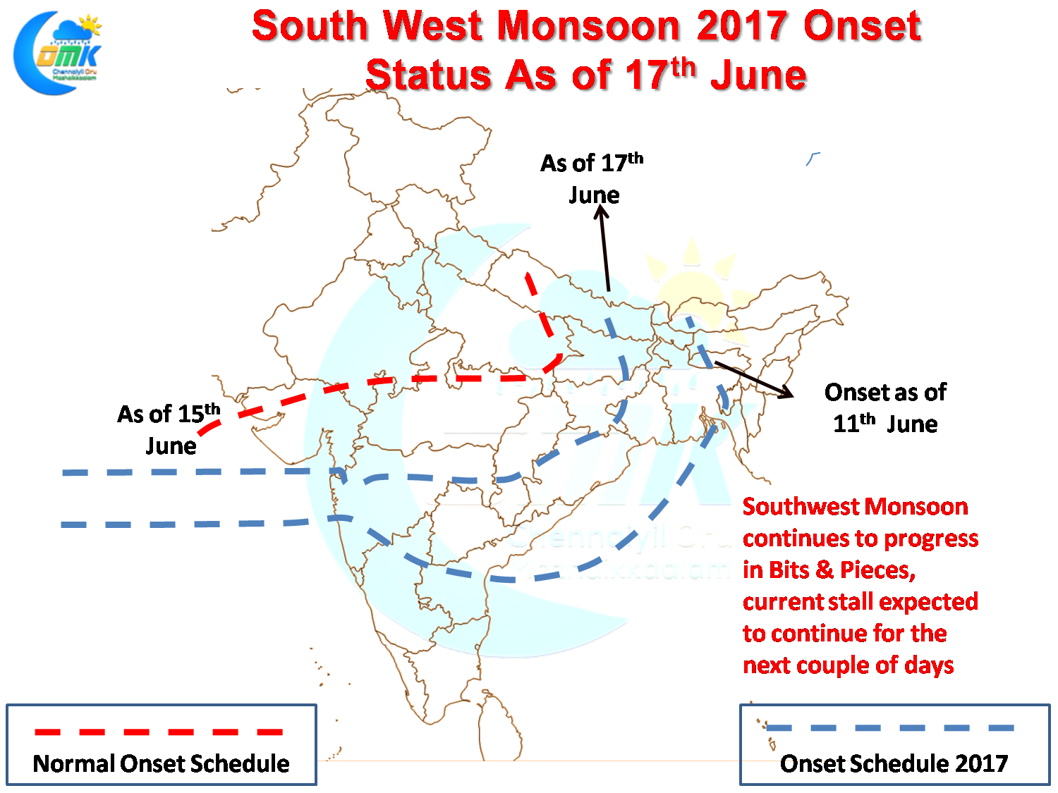
Southwest Monsoon continues to make progress in bits and pieces over India with the monsoon currently going through another stall process for the last few days. With no progress expected in the next two or three days we are possibly going to see some parts of Central India and West India witness monsoon onset almost a week behind schedule. Areas that have seen monsoon make onset are not faring very well either with many districts in Kerala & Karnataka still to show positive anomaly for this season.
While Monsoon remains weak, the favorable presence of wind instability has given some good rains to the Northern parts of Deccan Plateau region like Interior Maharashtra, Telengana etc. With the presence of a wind shear zone in the region today also we are likely to see parts of Coastal Andhra & Telengana get some good rains. After poor couple of seasons these rains will go a long way for the erstwhile composite Andhra Pradesh.

Yesterday despite conditions appearing fairly well on paper most parts of South India witnessed fairly dry conditions though parts of Coastal Andhra around Nellore region got some moderate thunderstorms around midnight. Things look well placed today as well with the possibility of wind instability developing on account of the confluence of dry Northerlies and Moist Westerlies over parts of the Interior Peninsula around Rayalseema / Int. Karnataka region.
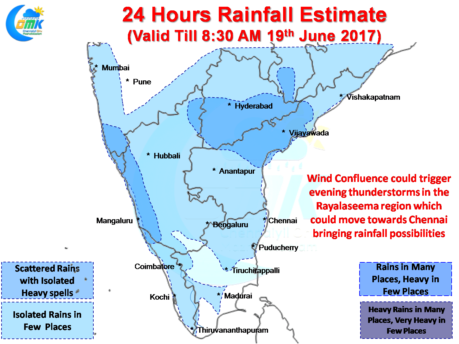
As is the case during Southwest Monsoon these thunderstorms form in the interiors and make its journey towards the coast during the later part of the day. North Coastal Tamil Nadu including Chennai could possibly be the beneficiary of some spells of rains as these thunderstorms cross coast on its way towards Bay of Bengal.
Powered by WPeMatico