
Yesterday saw parts of Chennai & Suburbs record moderate thunderstorm activity triggered by a perfectly placed sea breeze front in the late afternoon. Yesterday’s radar was a classic case of how sea breeze could trigger thunderstorms on its own as places around Guindy, Chromepet saw light rains around 4 PM in the evening.
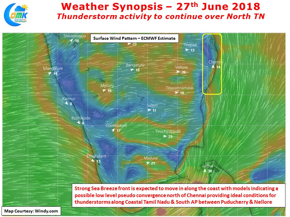
If one were to look at the wind charts today ECMWF indicates a fairly strong sea breeze front to move in along the coast to the South and North of Chennai. A couple of more triggers look positive as far as the thunderstorm activity making the conditions little more conducive compared to yesterday. The first one is models indicate sea breeze to climb in latitude as well or in other words vertical lift which will make it ideal for it to interact with the incoming Westerlies. Also there is likely to be a pseudo lower level convergence slightly to the North of Chennai creating an overall positive environment for Thunderstorm activity.
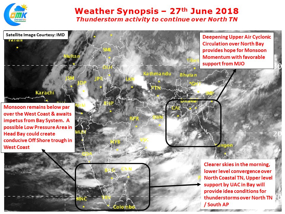
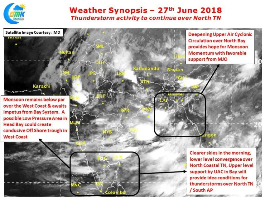
In this context we should also thank the deepening circulation over Head Bay. Many a thunderstorm event over Chennai has seen synoptic support from a disturbance over the North Bay. The current thunderstorm activity also owes its influence to the developing circulation off Bangladesh. With possibly support from incoming MJO this circulation in Bay of Bengal holds the key for monsoon to pick up momentum in the coming days. Depending on the path it takes it could trigger an active phase of monsoon over large parts of the Indian Subcontinent. But with some models indicating the current MJO movement over Indian ocean to be weak and short-lived it remains to be seen how things could evolve.