

Last night saw parts of Chennai & Suburbs record light to moderate rains as midnight thunderstorms bloomed closer to the coast. While the city areas were left to enjoy the scraps both places to the North & south of Chennai recorded moderate rains. Since the start of Southwest Monsoon in June most of the leeward areas of Tamil Nadu except for possibly parts of Tiruvannamalai, Dharmapuri & Krishnagiri dts have recorded good rains. Though August has been relatively weak compared to the previous two months things indeed look up for August to also follow June & July & ending up with above average rains going by how weather models are indicating things to shape up for the rest of the month.
With the Low Pressure weakening & fading away faster than originally estimated by weather models the monsoon surge expected by many during the month of August so far has remained only on paper & in the various precipitation outputs of weather models. It is always essential to look at the overall dynamics & try to delve deeper into the underlying causative factors before coming to a conclusion / inference. There might be instances where our understanding could go wrong due to mistakes in how we have surmised the evolving situations & factors but nevertheless it is always imperative to keep ploughing regularly while doing necessary course corrections as and when we hit a stumbling block in the form of wrong inferences. This is by far the best learning one could derive rather than look at charts & coming to easy conclusions.
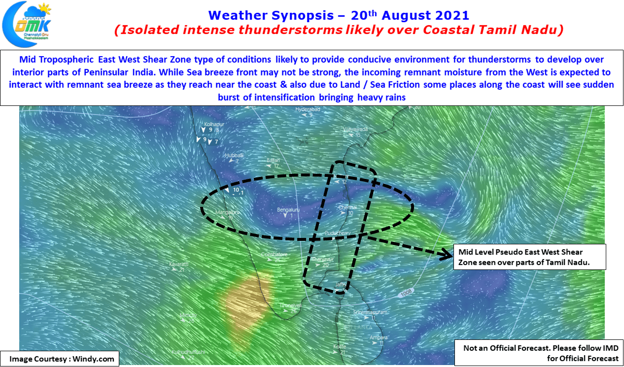
In the meanwhile widespread thunderstorms over leeward areas of Tamil Nadu are likely to pick up from tomorrow with weekend promising to be a good spell of rains for large parts of the state. But today could be a day where one or two places in the Coastal Tamil Nadu stretch see intense thunderstorm activity later in the night. With the circulation weakening sea breeze intrusion is likely to happen along the coast, though it is not expected to become a strong front to trigger storms on its own except for some isolated sharp spells, it is expected to wait along the coast for the incoming remnant moisture from the West which undergoes its own metamorphosis during the day through convective process.
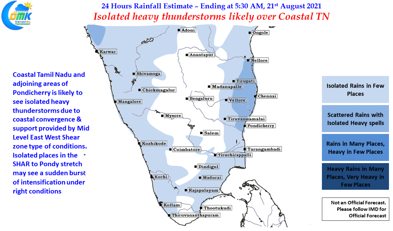
This interaction between the sea breeze moisture waiting along the coast & incoming remnant moisture from the west is likely to trigger storms along the coast. A few places will see these thunderstorms bloom due to Land / Sea Friction. Additionally the presence of an East West Shear Zone type of conditions over Tamil Nadu & adjoining parts of Andhra Pradesh will make conditions conducive for developing storms to amplify bringing isolated places in the SHAR to Pondicherry stretch, the exact place benefitting from this sudden burst of intensification will depend on localized conditions & possibly will not be picked up by global scale models accurately. Nevertheless the next couple of days promises to be good days for thunderstorms over Tamil Nadu