
Better late than never is a famous English saying. This could be ideal in the current context of northeast monsoon onset over the eastern coast of Peninsular India. With IMD confirming the withdrawal of southwest monsoon over the entire country on Sunday the stage is now set for the arrival of northeast monsoon which is the lifeline for most parts of Tamil Nadu that sits on the leeward side during southwest monsoon. While the normal onset date for northeast monsoon is 20th October, this year the development of cyclonic storm Sitrang meant a delay as wind patterns were affected by the north moving cyclonic storm that has dissipated rapidly after making landfall over the Bangladesh coast effecitvely becoming only the 18th cyclone to cross Bangla coast during the month of October and the first one since 2008 according to the cyclone eAtlas of IMD.
Satellite images confirm how quickly the remnant circulation of Sitrang lost its shape and structre as northeast India like most of the Indian sub continent is seeing clear weather. The equatorial westerlies has been bringing in some convection over parts of Sri Lanka and extreme southern parts of Tamil Nadu which has been seeing some rains, particularly around the ghats of Kanyakumari district which saw a poor southwest monsoon season overall.
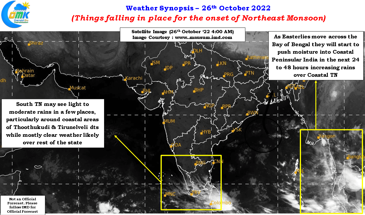
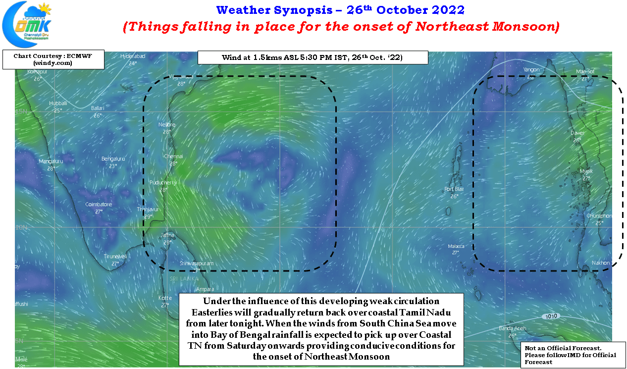
In the meanwhile the rapid dissipation of the remnant circulation of Sitrang in a way will help conditions become conducive for the onset of northeast monsoon over the east coast of peninsular India. While over the next couple of days easterlies are expected to gradually return over the coastal areas of Tamil Nadu under the influence of a weak circulation developing in southwest Bay things are expected to pick up by the weekend when streamlined easterlies move in from south China sea bringing with it moisture setting up the stage for the onset of northeast monsoon.
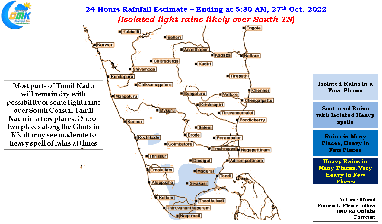
Today parts of south Tamil Nadu could see some light rains with one or two places along the ghats seeing moderate to heavy spell of rains at times. Coastal places like Chennai may start seeing cloudy skies from later tonight with rains making a return possibly later tomorrow night or early Friday morning gradually leading up to the onset phase which could bring potentially one or two days of fairly widespread heavy rains over most places along the coast of Tamil Nadu and south Andhra Pradesh.