
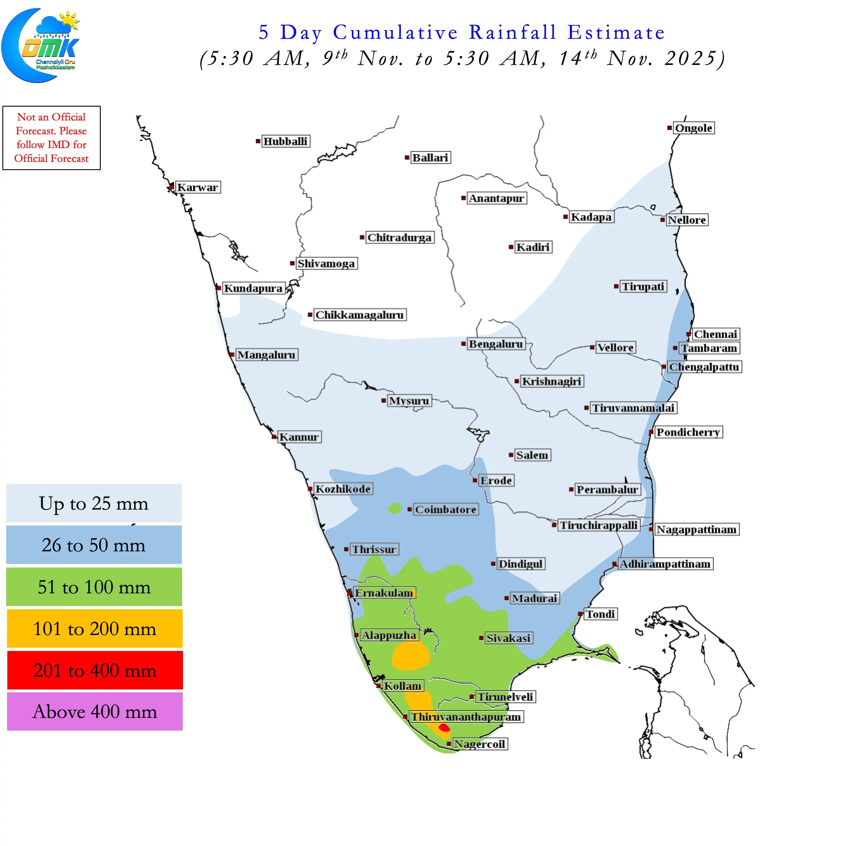
It has been more than two weeks since the daily rainfall graph for TN & PDC saw a positive anomaly day. 23rd October was the last when the actual daily rainfall was higher than the long period average. The first three weeks NEM 2025 started off like a sprinter. It’s no wonder it started gasping for breath by the 3rd week of October when Montha started taking shape. After more than 2 weeks now we can start looking forward to revival of NEM 2025. Things are certainly falling in place with Indian Ocean coming out of the Wes Pacific shadow.
Over the course of these two weeks West Pacific enjoyed the benefit of MJO stuck over MTC and adjoining West Pac region. A train of strong typhoons starting with Melissa was the effect of this stationery MJO. The last of the strong typhoon is Fong Wong which is on its way for a landfall of Northern Philippines. Typhoon Kalamaegi that wrecked havoc over parts of Philippines and Vietnam is now about to enter East Bay. This train of Typhoons also meant Easterlies were disturbed over Bay of Bengal resulting in complete collapse of NEM dynamics.
MJO’s interaction with the La Nina base state is triggering a potential collapse in MJO. The transit of Kelvin already resulted in enhanced thunderstorms over parts of Tamil Nadu earlier this week. Now things will look up with the potential influence of Equatorial Rossby wave over Indian Ocean. With ER playing a major role the tracks of disturbances may be more WNW / West. When MJO is the driver there is a higher chance for NW / NNW movement.
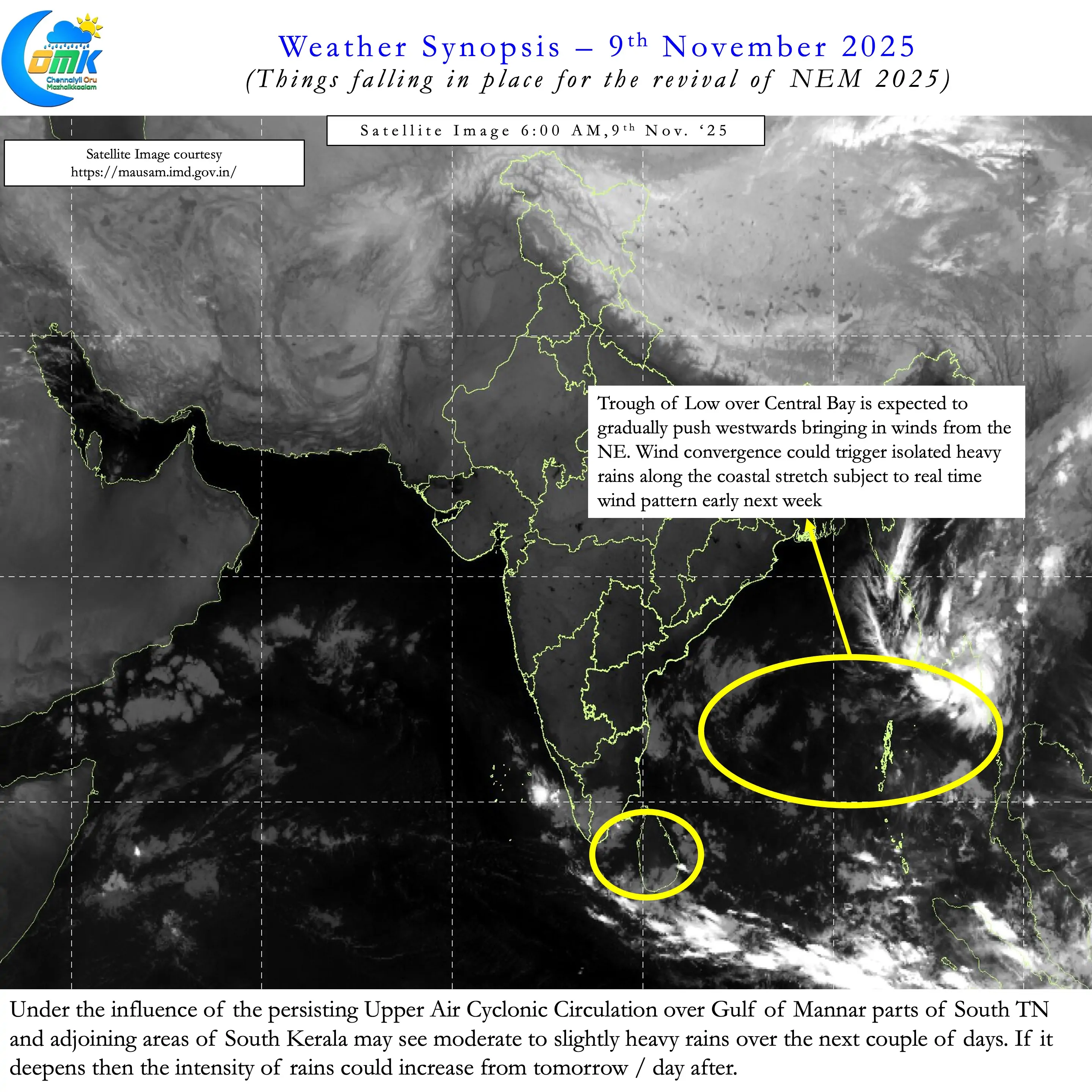
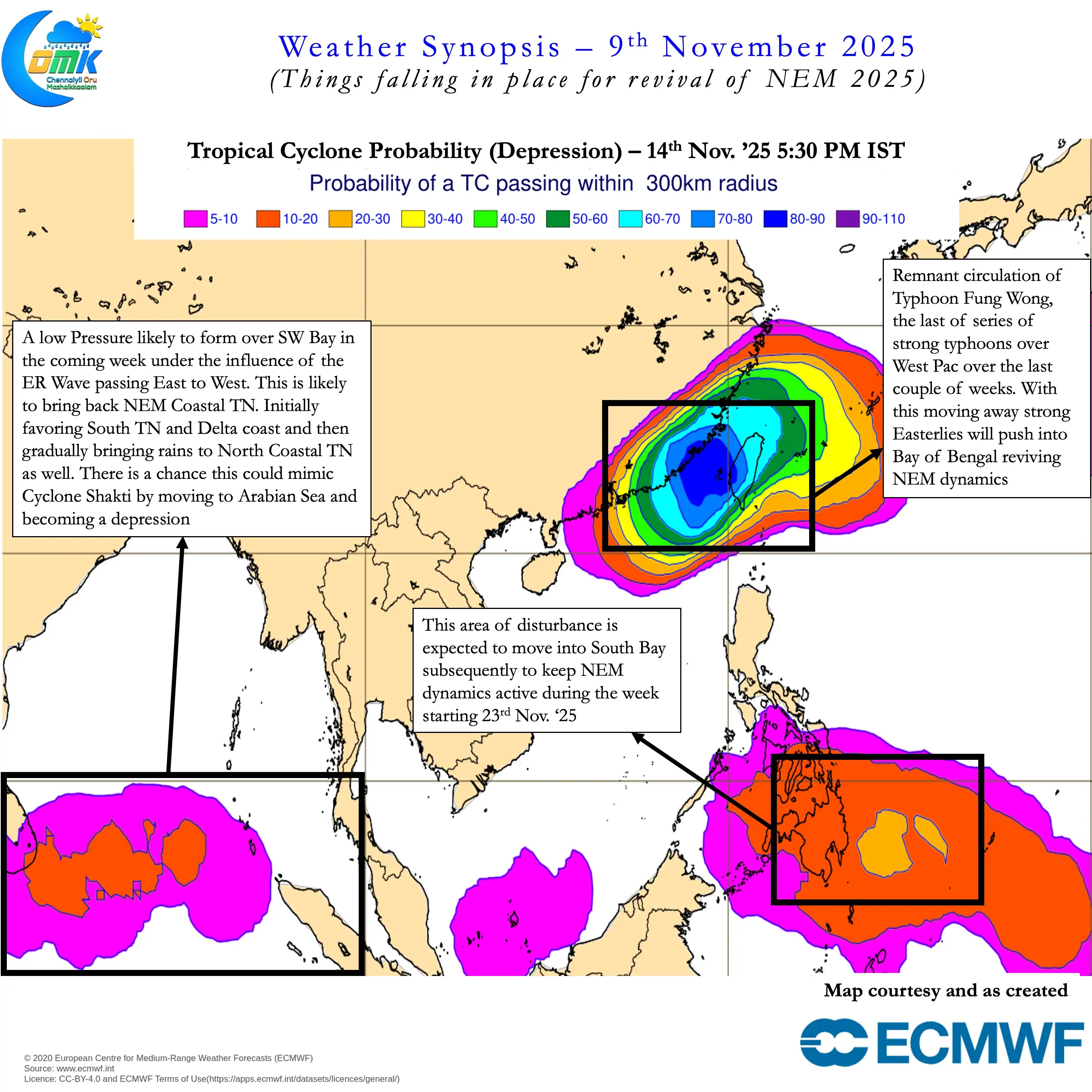
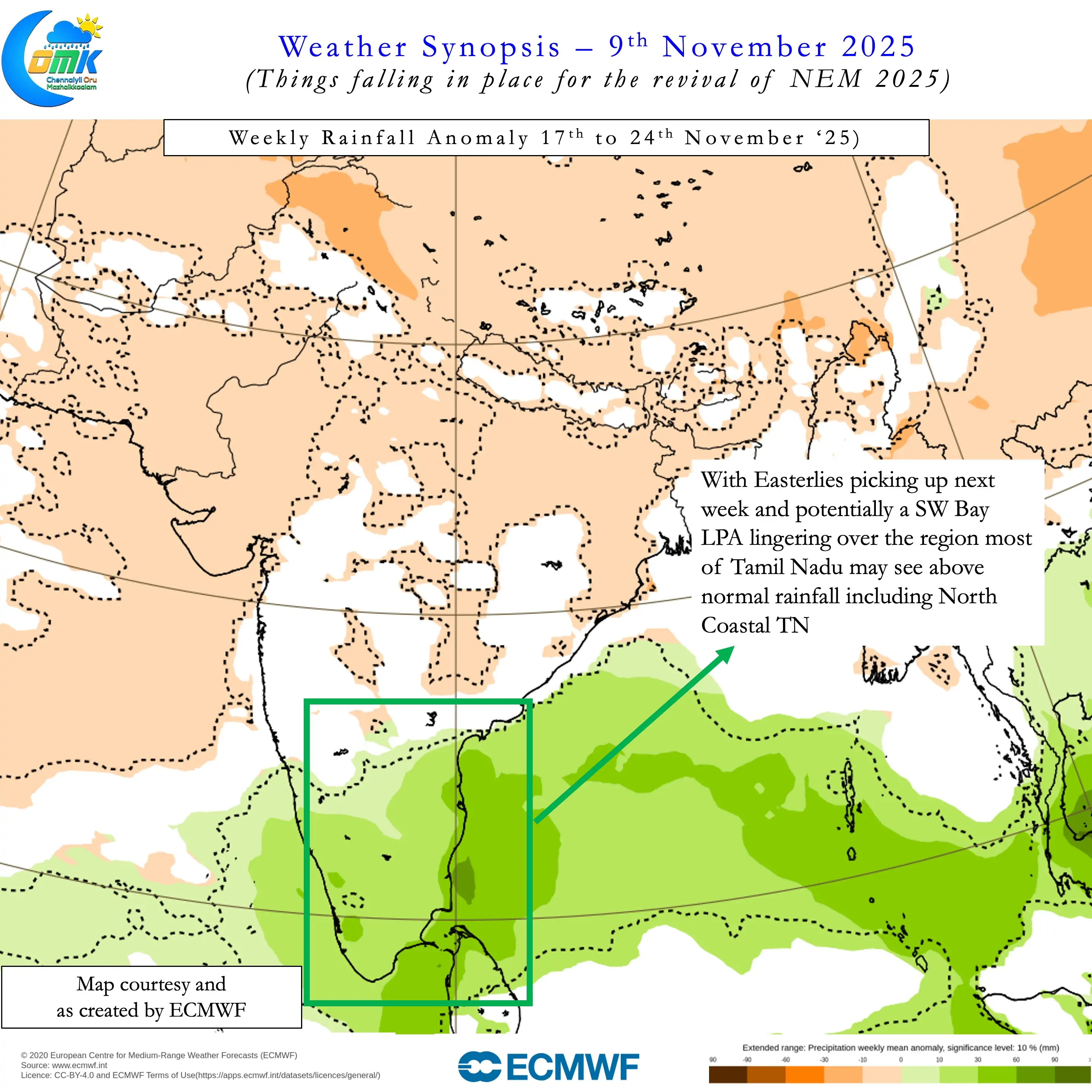
The trough of low currently and the UAC may start interacting to create a LPA over South Bay next week. This could potentially linger for a few days keeping the NEM pot going until the last week of November. The week starting 23rd November may be the period when Bay throws up the next cyclone of the season. As of now we can wait for things to fall in place for this disturbance. Until then our focus can remain on the Trough of Low and UAC.
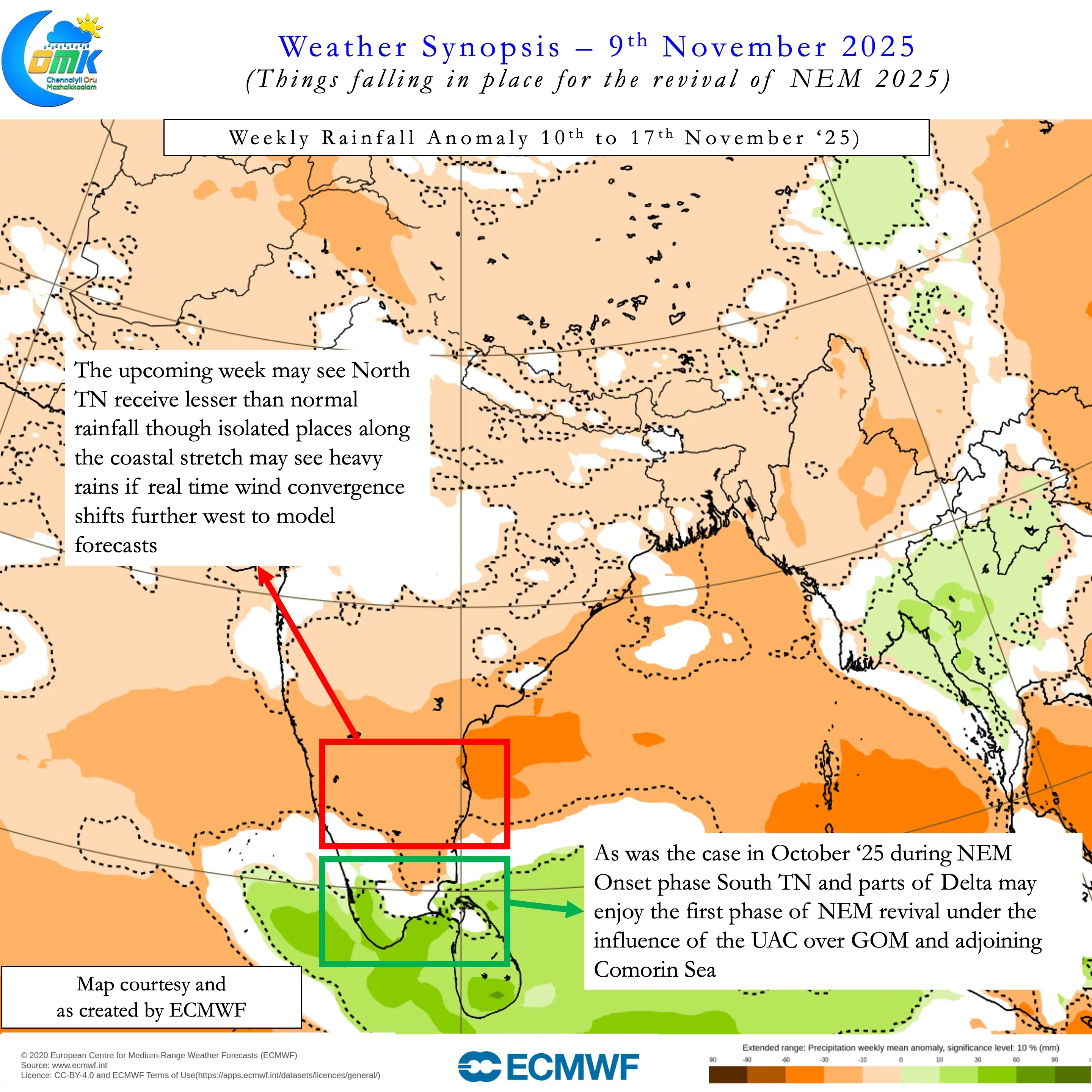
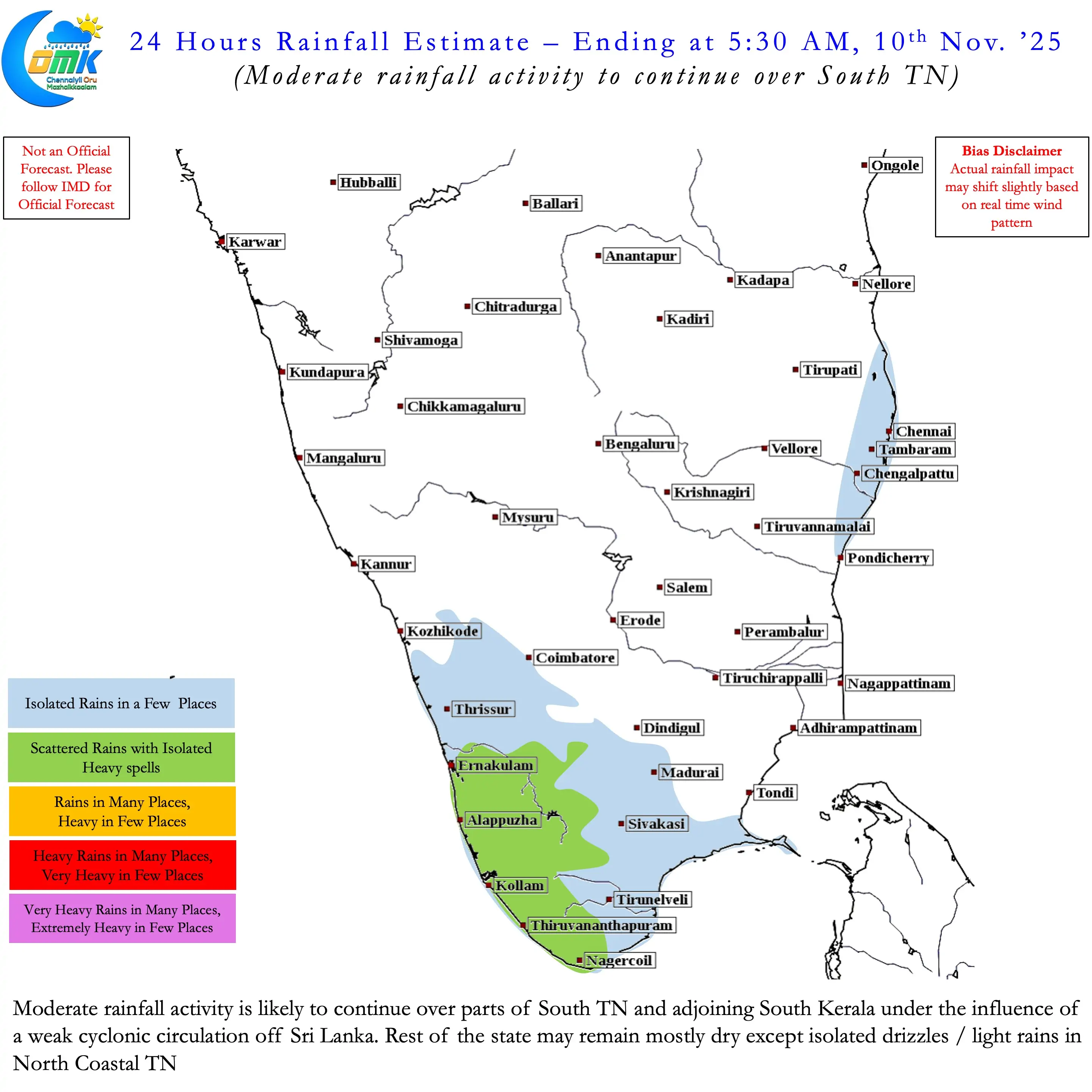
As was the case during onset phase South TN and parts of Delta may benefit first from the revival as well. As Easterlies pick up pace when Typhoon Fong Wong moves away North Coastal TN will see a revival of rains. But a few places along the coast including North Coastal TN may see heavy rains if wind convergence from the Trough of Low becomes favourable. Wind convergence driven rains are purely a matter of chance. So in a way we can say NEM could revive towards 2nd half of next week for North Coastal TN including Chennai.
NEM 2025 is taking a fresh guard once again. With potentially fresh MJO pulse likely to impact Indian Ocean one more time the season is still young. A lot of districts have moved into negative zone after a poor two weeks. But there is enough time still for NEM 2025 to end positive across the state by the time season ends statistically on 31st December. We will take one week at a time and see how things move.