
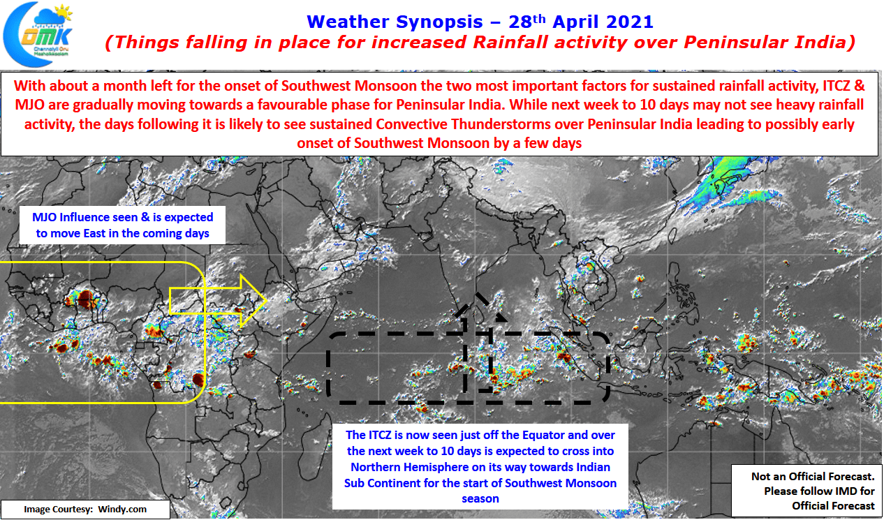
With just about a month left for the onset of Southwest Monsoon over Indian Mainland, or for that matter a couple of weeks before it checks in over Andaman Islands its time to look forward to tracking whether conditions are falling in place for the largest global annual weather event to show up over the Indian Sub Continent.

But as we know while we track the progress of Southwest Monsoon onset the prelude to this is changing wind patterns, increase in thunderstorm activity over interior areas of Peninsular India etc are sort of milestones indicating progress. One such key milestone is the movement of ITCZ into Northern Hemisphere. The crossing of ITCZ over Equator is sort of the first milestone in this journey. Satellite images along with wind charts indicate the ITCZ straddling the Equator and weather models indicate the coming days should see ITCZ move into Northern Hemisphere in about 7 to 10 days time.
Additionally another hugely favorable development is also expected to sync along with this journey of ITCZ into Northern Hemisphere is the arrival of the King of Tropical Waves, MJO, into the Indian Ocean Basin. With ITCZ gradually showing up to the North of Equator the influence of MJO also is likely to skew towards Northern Indian Ocean making it favorable for rainfall activity to increase & possibly bring forth the monsoon winds into Arabian Sea area.
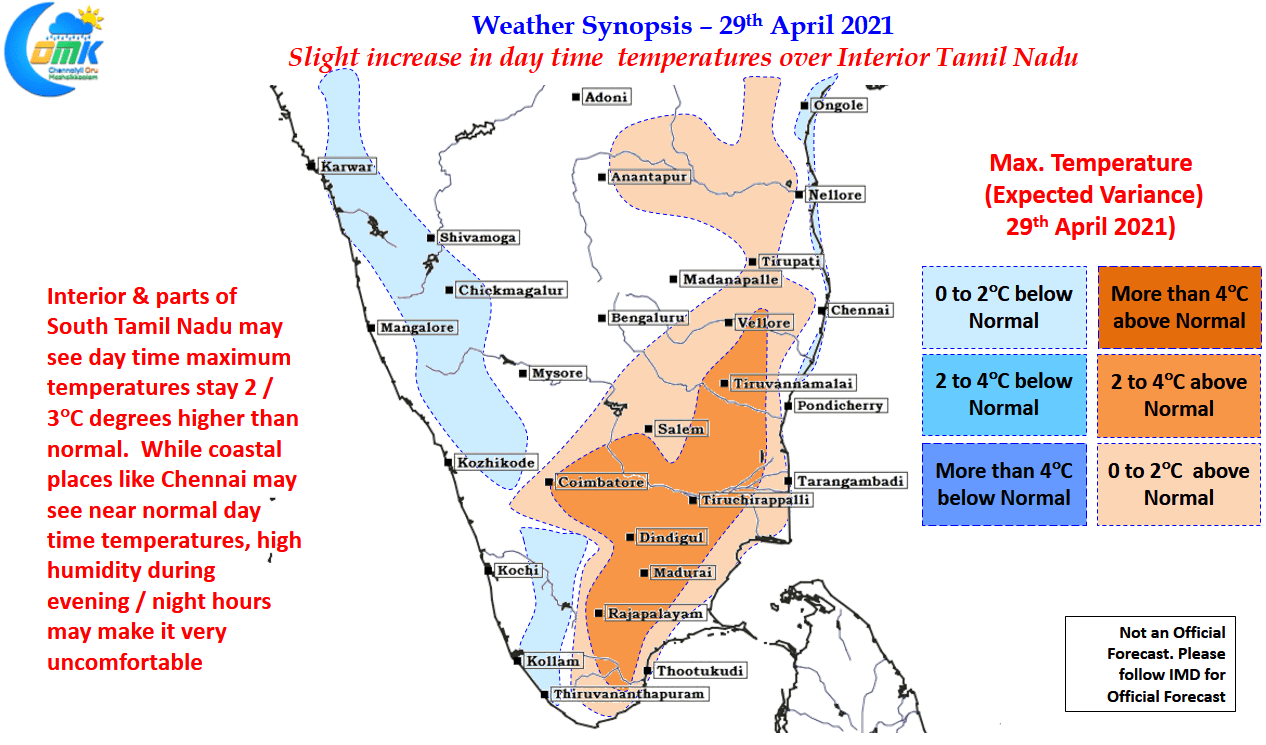
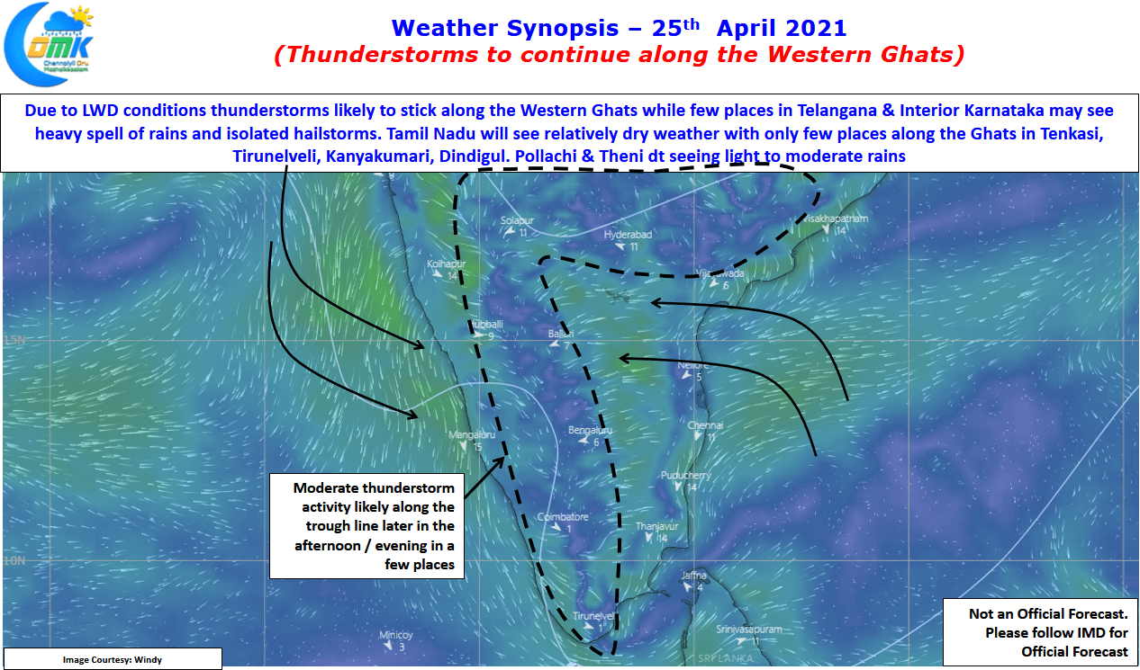
In the meanwhile dry weather may continue over large parts of Tamil Nadu with rains sticking to places along the ghats for the next couple of days under favorable wind patterns. But things will change next week for the better. On the temperature front the persistence of Easterlies mean coastal areas may see day time temperature stay near normal though high humidity may make evenings & nights uncomfortable. Interior Tamil Nadu though could see day time maximum temperatures stay couple of degrees above normal until early next week.