
On 14th September IMD announced the start of SWM withdrawal from the country as parts of Rajasthan saw reversal of winds. A couple of days later IMD announced further withdrawal from some more parts of Rajasthan and parts of Gujarat. Under the revised SWM withdrawal guidelines 17th September is the normal date for the first monsoon withdrawal. So 2025 saw monsoon start withdrawing a couple of days before normal.
In recent times 2022, 2021, 2016, 2010, 2005 all have one thing in common in addition to prevailing negative IOD conditions. All saw SWM withdrawal slow down / stall at some point of time due to late season monsoon circulations. In a way during negative IOD years more often than not the Monsoon withdrawal may stutter due to the regular arrival of pulses from South China Sea. This is turn feeds moisture into Central India as the monsoon lows tend to take a more WNW path.
At this point one can sense a bit of butterfly in the stomach moment for those waiting for NEM. Interestingly while monsoon withdrawal indeed goes through stutter / slow progress the end is pretty swift. Towards middle of October on most occasions under negative IOD years the last phase is extremely quick leading to simultaneous onset of Northeast Monsoon over Peninsular India. Looking at sub seasonal outlooks 2025 could be no different. But talk about Northeast Monsoon could wait at this moment.
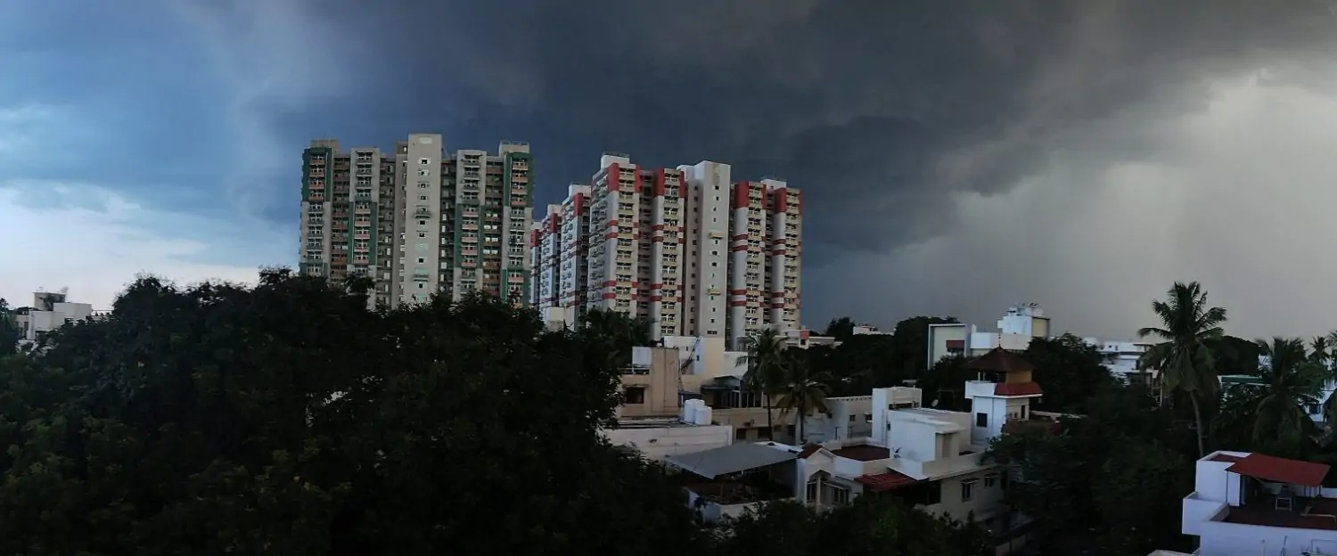
The last few days brought about widespread thunderstorm activity over the leeward plains of TN. With 20.5 mm on \ 19th September TN & PDC saw its highest single day rainfall for this years SWM Season. Parts of Chennai has seen another very good year of SWM rainfall. The COMK personal weather station at Anna Nagar / Padi crossed 800 mm for SWM season today morning. This is the 3rd consecutive year SWM rainfall cross 800 mm. But with a fresh monsoon low expected over North Bay it is time for some reduction in rains.
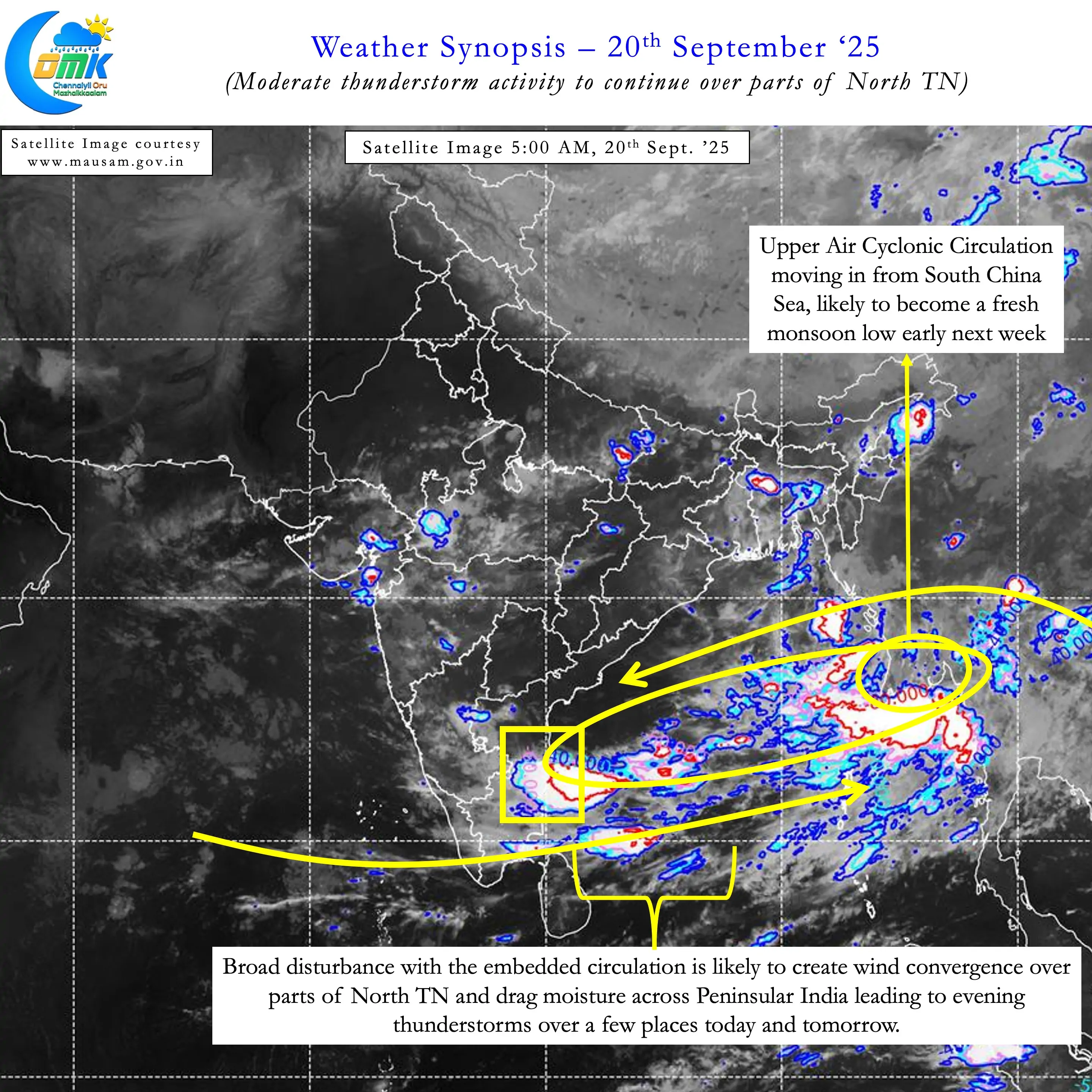
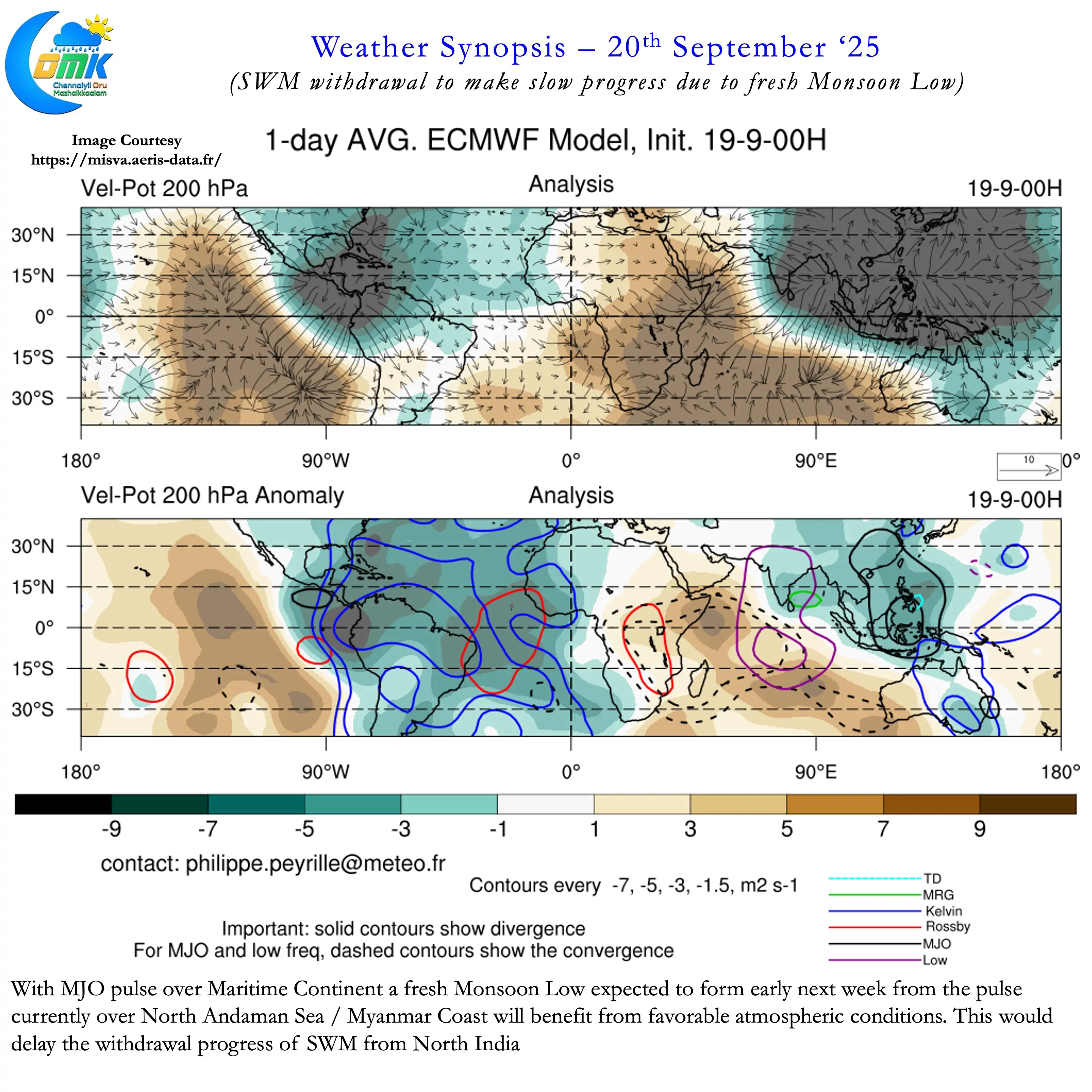
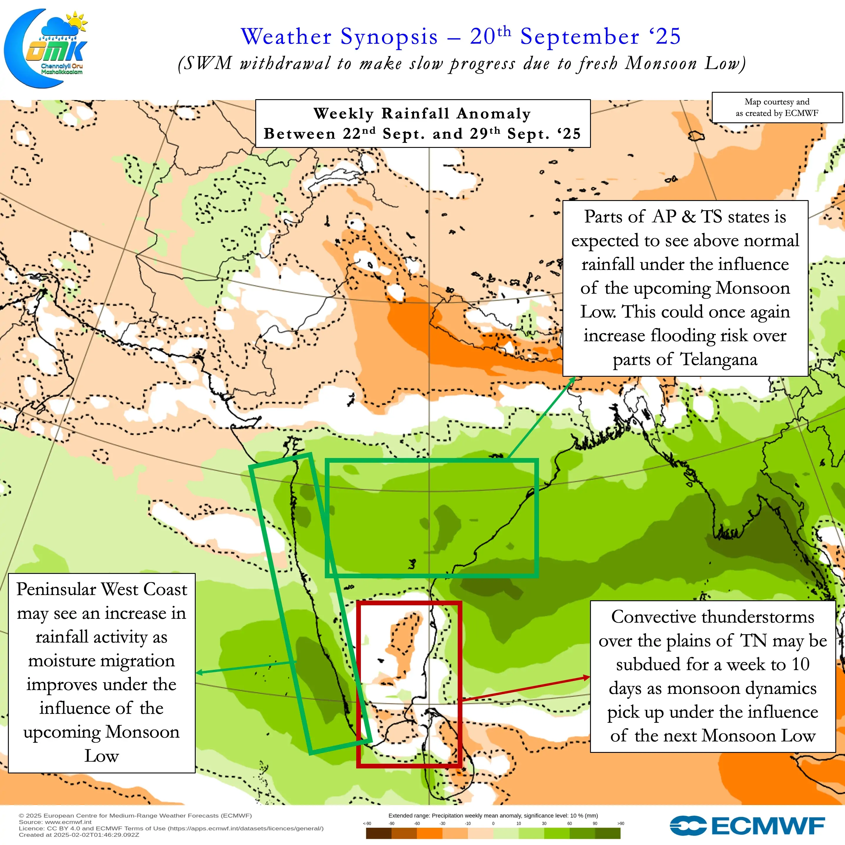
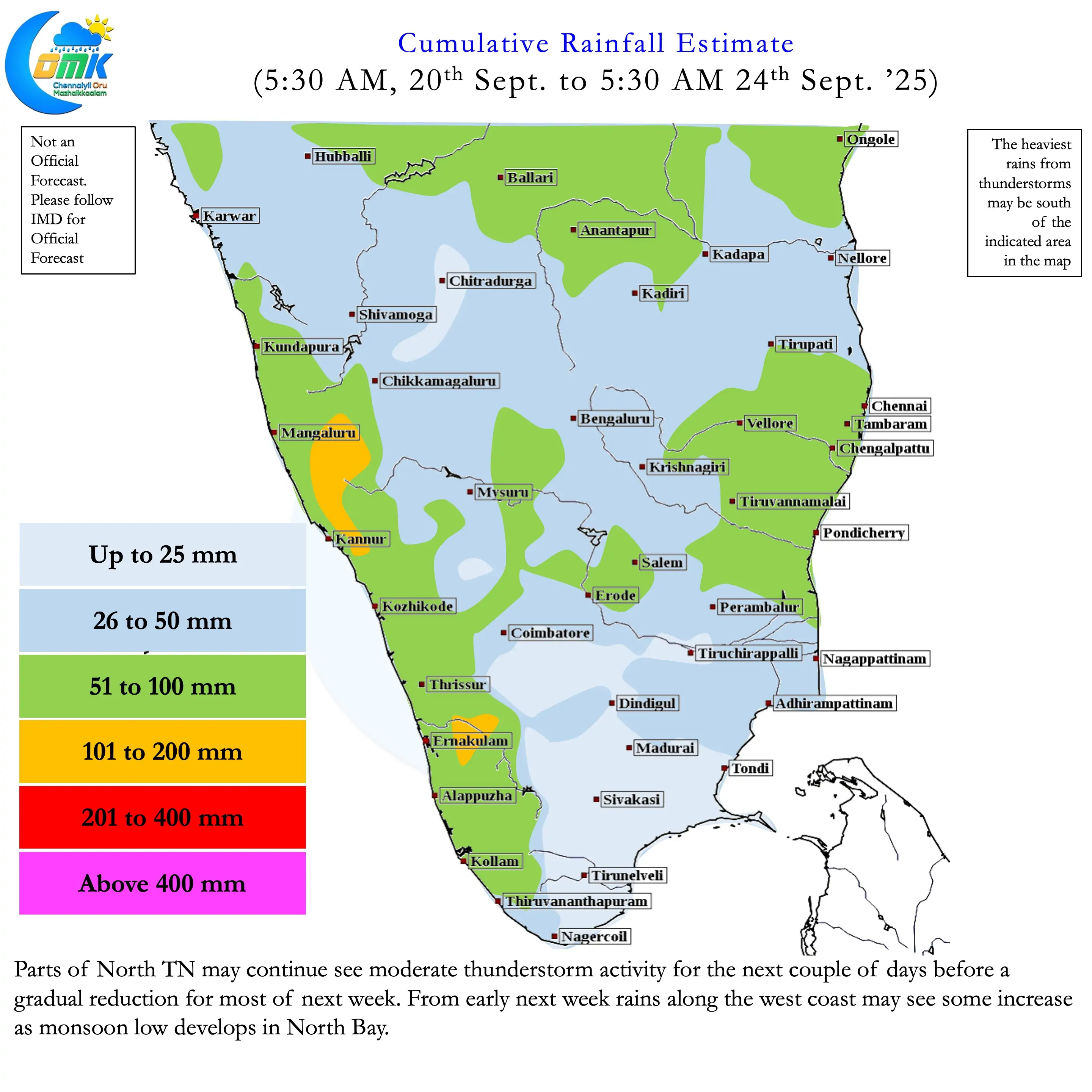
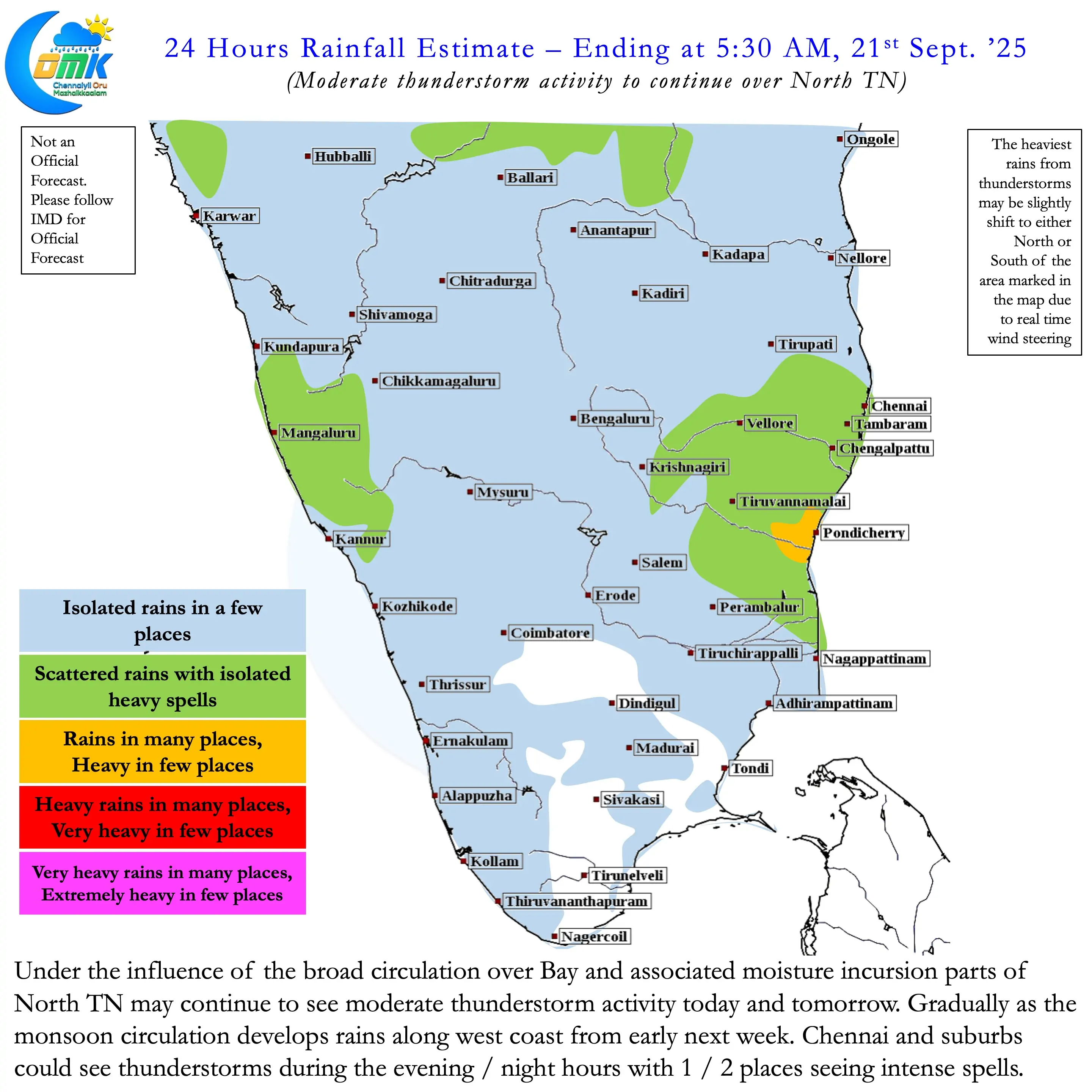
Today and tomorrow parts of North TN may see moderate thunderstorm activity. Isolated places between Pondy and Chennai may see intense thunderstorm activity during the evening hours. Moisture dragged across by the broad circulation is likely to provide the base for these thunderstorms. As the circulation over North Andaman / Myanmar coast deepens westerly winds is likely to strengthen. This in turn would mean reduced thunderstorm activity over the plains of TN. But parts of North Coastal TN may not see complete cessation of rains as moisture migrates across Peninsular India.
Over the next week we can see some increased rainfall activity along the Peninsular West Coast. While it may bring back the rains the intensity may not be very high. It may also not be enough to flip the seasonal performance for states like Kerala which is in negative. Two areas that may need to be cautions though are Telangana and Gujarat. Telangana may once again see widespread heavy rains leading to increased flooding risk next week. While weather models do not indicate any extreme rains over Gujarat we have seen in the past when late September circulation reaches Gujarat / Rajasthan they tend to dump a lot of rains.