
It is often remarked while weather works in pattern, particularly large scale dynamics, every year is a learning due to how subtle change in dynamics can drastically alter the outcome. Southwest Monsoon this year is on its way to providing another classic case study with fast changing dynamics. After what looked like an early and strong onset it has been a poor few days not only from the perspective of Monsoon over Peninsular India but even the Bay branch which has been sluggish after making onset over the Andamans it has been very slow in moving North.
With larger scale unfavorable factors now expected to govern the monsoon dynamics for the next couple of weeks while we can expect some up tick in the rains over Peninsular India due to a probable circulation in Bay of Bengal next week the overall monsoon dynamics is expected to remain weak at least until the second fortnight of June. Most weather models are indicative of fairly suppressed atmospheric conditions over Peninsular India for the upcoming week to 10 days which might reflect in above average thunderstorm activity and below average monsoon activity.
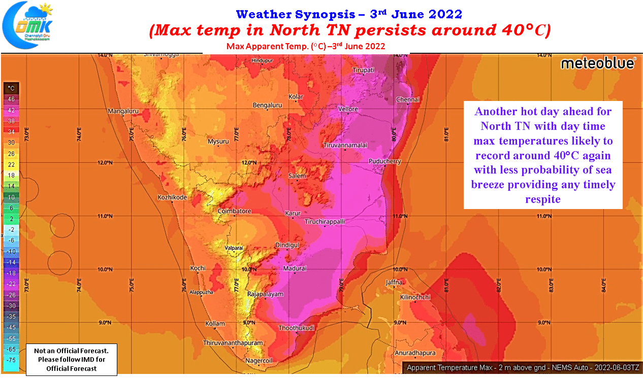

The last few days have seen hot afternoons persist over North Tamil Nadu, with mostlyl Chennai and suburbs remaining the hottest part of the state. The IMD observatory at Meenambakkam for the past couple of days has been recording the highest maximum temperature in the state indicative of the conditions around North Coastal Tamil Nadu. While today and tomorrow could see similar conditions next week we might see some respite due to the possible UAC which might bring cloudy skies and possibly few spell of rains as well around North Coastal TN.
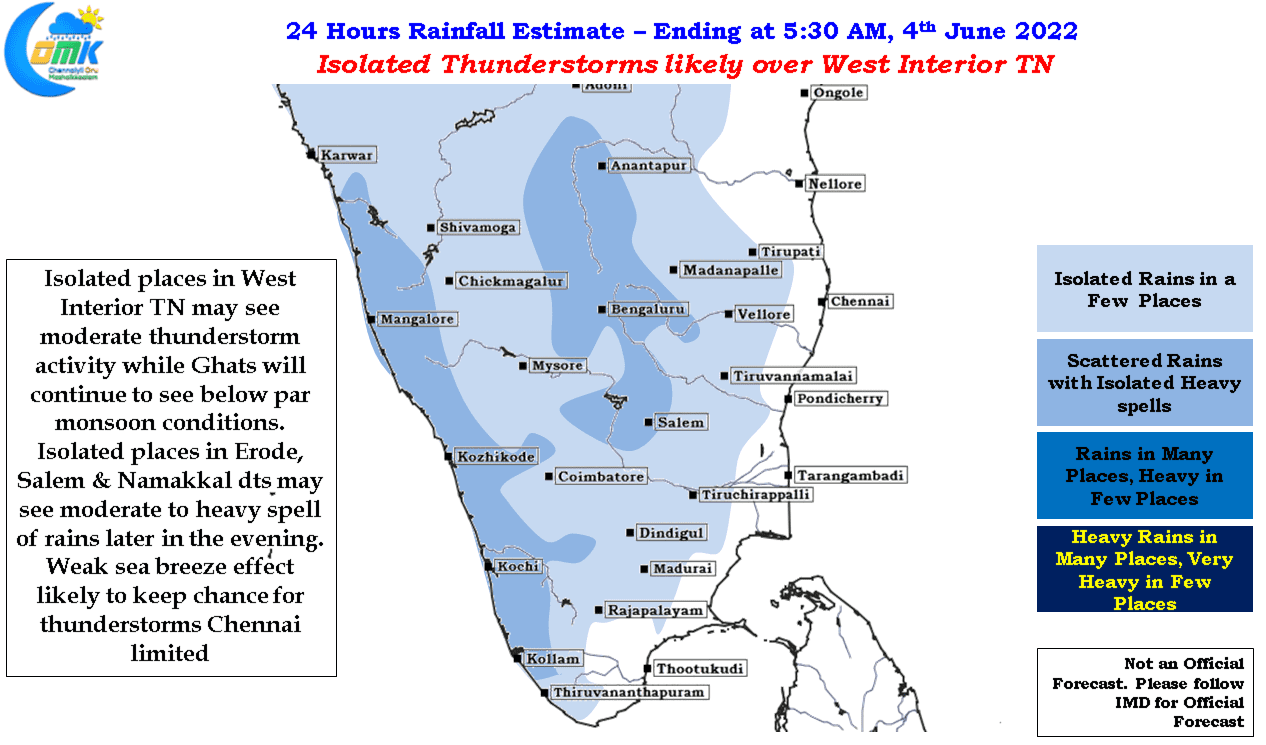
Today though weather models indicate sea breeze to remain weak like the past couple of days on the face of stiff westerlies which will once again mean less chance for any thunderstorm activity around Chennai and suburbs. West interior Tamil Nadu though could see some thunderstorms with isolated places in Erode, Salem and Namakkal district in line for a moderate to heavy spell of rains later in the evening.