
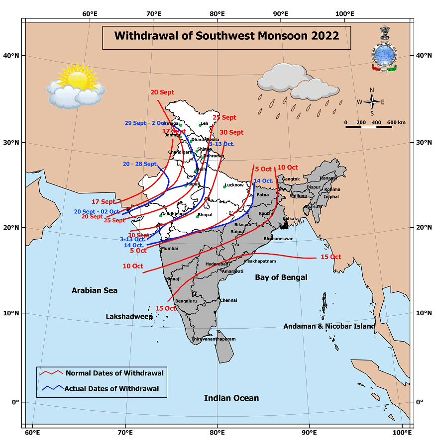
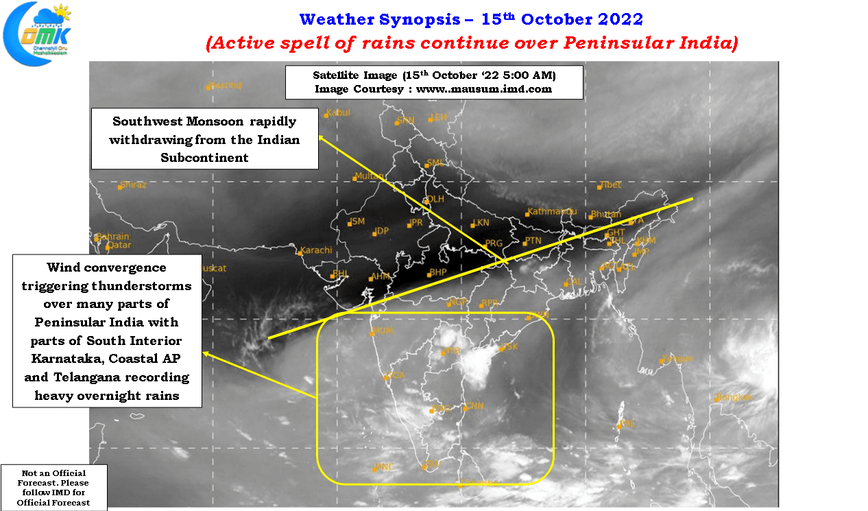
After a lull of nearly 10 days Monsoon withdrawal picked up pace yesterday with IMD announcing the withdrawal of Southwests Monsoon from remaining parts of Uttarakhand, Uttar Pradesh & Gujarat; most parts of Madhya Pradesh and some parts of Bihar, Jharkhand, Chhattisgarh & Maharashtra. Looking at the satellite image we could see further withdrawal today over more parts of East India and possibly all of Central India. Parts of West India around Maharashtra has been seeing withdrawl thunderstorms and is only a matter of time before these places also see Monsoon withdrawal.
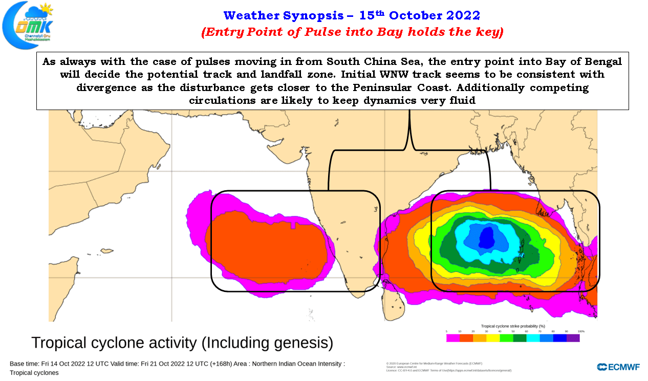
It is apt to point out here today, 15th of October, is when under normal conditions Southwest Monsoon would have withdrawn over all of Indian sub continent except for the places covered by Northeast Monsoon in Peninsular India. But La Nina years are known for delayed withdrawal on account of the ITCZ not willing to climb down as swiftly as possibly El Nino years. In a way the back to back pulses moving into Bay from the South China Sea is also a reason for holding the ITCZ firmly.
Staying with pulses the past couple of days have shown how taking weather models on face value could lead to comical situations as transition dynamics continues to wreak havoc on weather model initial conditions and further progress. If GFS was showing a possible super cyclone making landfall around every beach in East India one run of ICON showed 3 active circulations around Peninsular India indicating how complex the dynamics are currently. It is in this context it becomes pertinent to note until the entry of the pulse into Bay of Bengal and likely genesis it is not advisable to assume likely track and landfall though there is a fair bit of consistency on the pulse taking a W/NW track during its initial days irrespective of intensity and genesis.
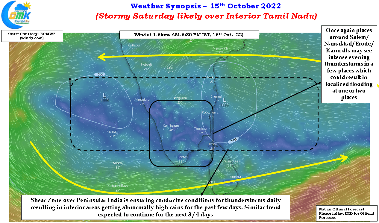
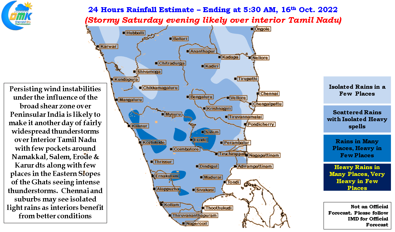
With so much fluidity the proverb “One in the hand is better than two in the bush” comes to mind and it makes sense to track the current weather events without worrying too much about events a week or so later. The first week of October saw relatively subdued rainfall activity over most parts of Tamil picking up subsequently with past couple of days under the influence of a broad shear zone over Peninsular India particularly active with some intense thunderstorm activitiy over the interior areas of Tamil Nadu and parts of Karnataka, Rayalseema and Telangana. With the shear zone persisting it appears once again interior parts of Peninsular India is likely to see a stormy Saturday evening. This could potentially mean localized flooding in a few pockets of Tamil Nadu around the districts of Salem, Namakkal, Erode and Karur due to intense thunderstorms later today evening / tonight.
While Chennai may see light rains during the night / early morning hours, the next couple of days will be mostly interior show with coastal areas coming into the groove once again early next week as Easterlies strengthen further.