
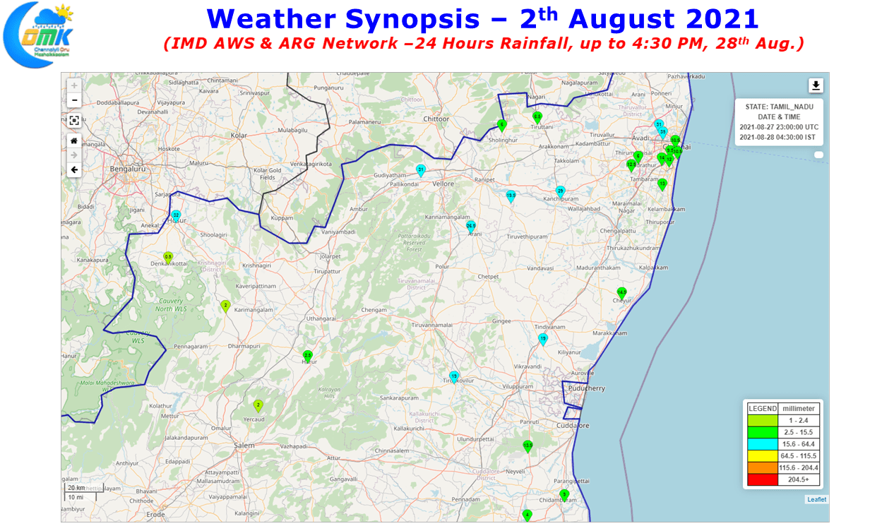
Yesterday saw moderate rains at many places of North Tamil Nadu including Chennai & Suburbs with parts of Tiruvannamalai district seeing fairly intense spell of rains at times. In North Chennai & Suburbs the IMD rain guages at Villivakkam, Puzhal recorded more than 3 cms of rains from the early evening spell while as the evening gave way to night southern parts of the city & southern suburbs started to receive the heavier spells indicative of the shifting convection & possibly the wind pattern which started to move towards WNW to ESE direction.
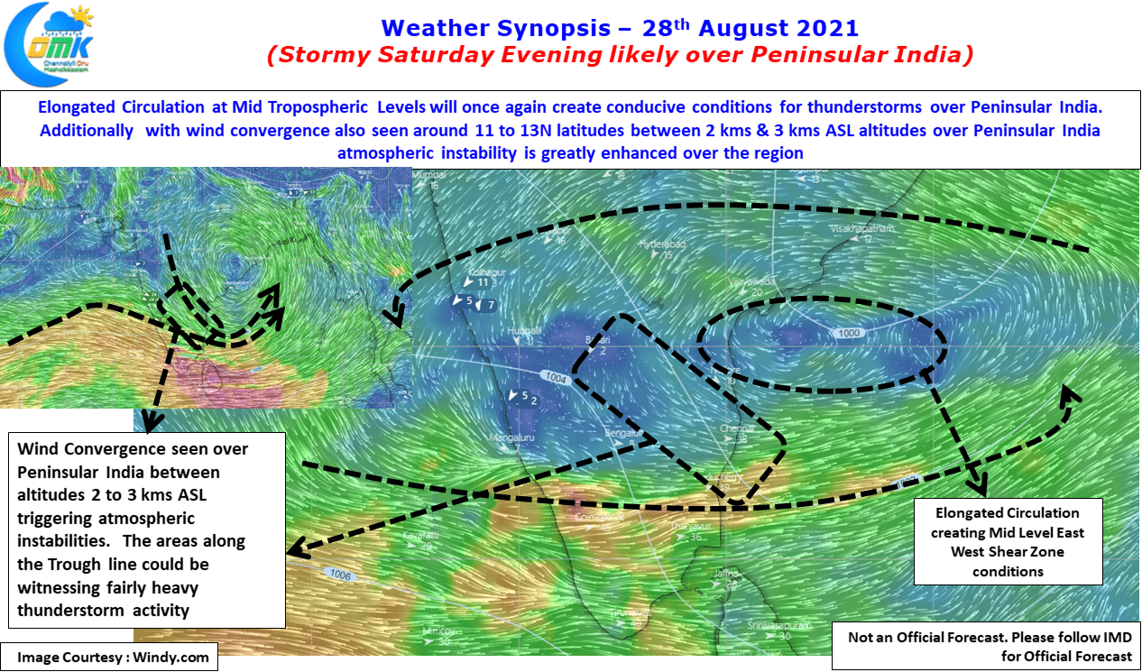
Today models indicate the winds to take a slightly poleward direction change making it NW to SE over most parts of Peninsular India possibly due the convergence effect seen between 2 kms & 3 kms above sea level altitudes across North Tamil Nadu, South Interior Karnataka & Adjoining parts of South Andhra Pradesh. This could mean once again the stretch around 13 N latitude will remain the hotspot for thunderstorms on what promises to be another fairly widespread day of thunderstorms. Unlike yesterday today the convergence is seen to shift slightly to the South making the best conditions available between 11N & 13 N latitude.

The elongated circulation at Mid Tropospheric levels (5.5 kms ASL, 500 hPa) continuing to persist over the Bay of Bengal conducive conditions are likely over Peninsular India for thunderstorms to thrive today as well. While this elongated circulation will eventually descend into a Low Pressure Area in about 12 to 36 hours from now enhancing monsoon flow in the process. But before that today & to some extent tomorrow too will see thunderstorms over many parts of Tamil Nadu, particularly North & Northwest Tamil Nadu giving good rains in the process. From later tomorrow night once the monsoon flow picks up & the westerlies strengthen there will be a lull in thunderstorms for a few days with action once again expected to pick up towards the second half of next week.
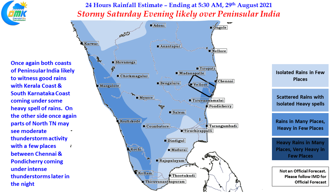
As far as Chennai goes today with weather models expecting the convection to move in a NW to SE direction & convergence zone being between 11N & 13N the southern areas of the city & southern suburbs possibly will benefit more from thunderstorms compared to Northern areas & Northern suburbs which benefitted for the past couple of days.