
addiction
an inability to stop doing or using something, especially something harmful:
Cambridge Dictionary
Many might take offence if we call Weather Tracking as an addiction to not just bloggers but many meteorologists around the globe. But if one were to look in a slightly more detached manner this could possibly fall under what William Glasser calls Positive Addiction. In a way treating weather tracking as a positive addition is a way to continue this passion all along rather than just looking at weather charts during monsoon or cyclone times. Following weather right through the year including off seasons at times gives us a bonus like the current event unfolding over many parts of the Indian Sub Continent.
We are in the second fortnight of March, West coast of India has been reeling under summer conditions, climatology will possibly say rest of the Indian Sub Continent should also be looking forward to Summer. But a combination of events have brought out a rainfall event that is not often seen during the month of March with IMD issuing rainfall warnings to pretty much every state in the country. Places in Telangana like Vikarabad decided to behave like Gulmarg as hailstorms accompanied rains over parts of Peninsular India. Even parts of Chennai received rains during the early morning hours with the COMK automatic weather station at Anna Nagar recording 10.4 mm.
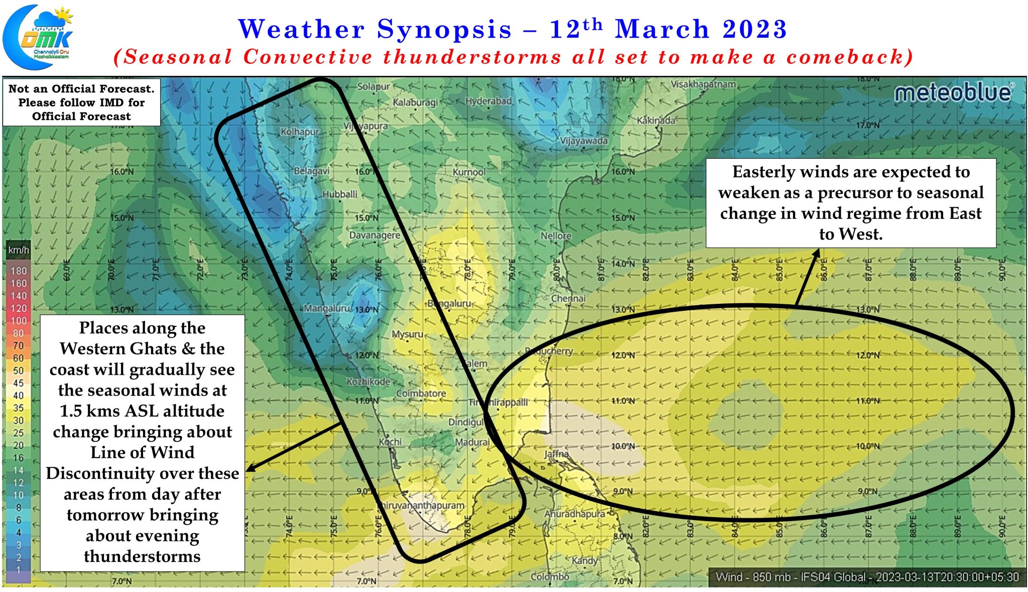
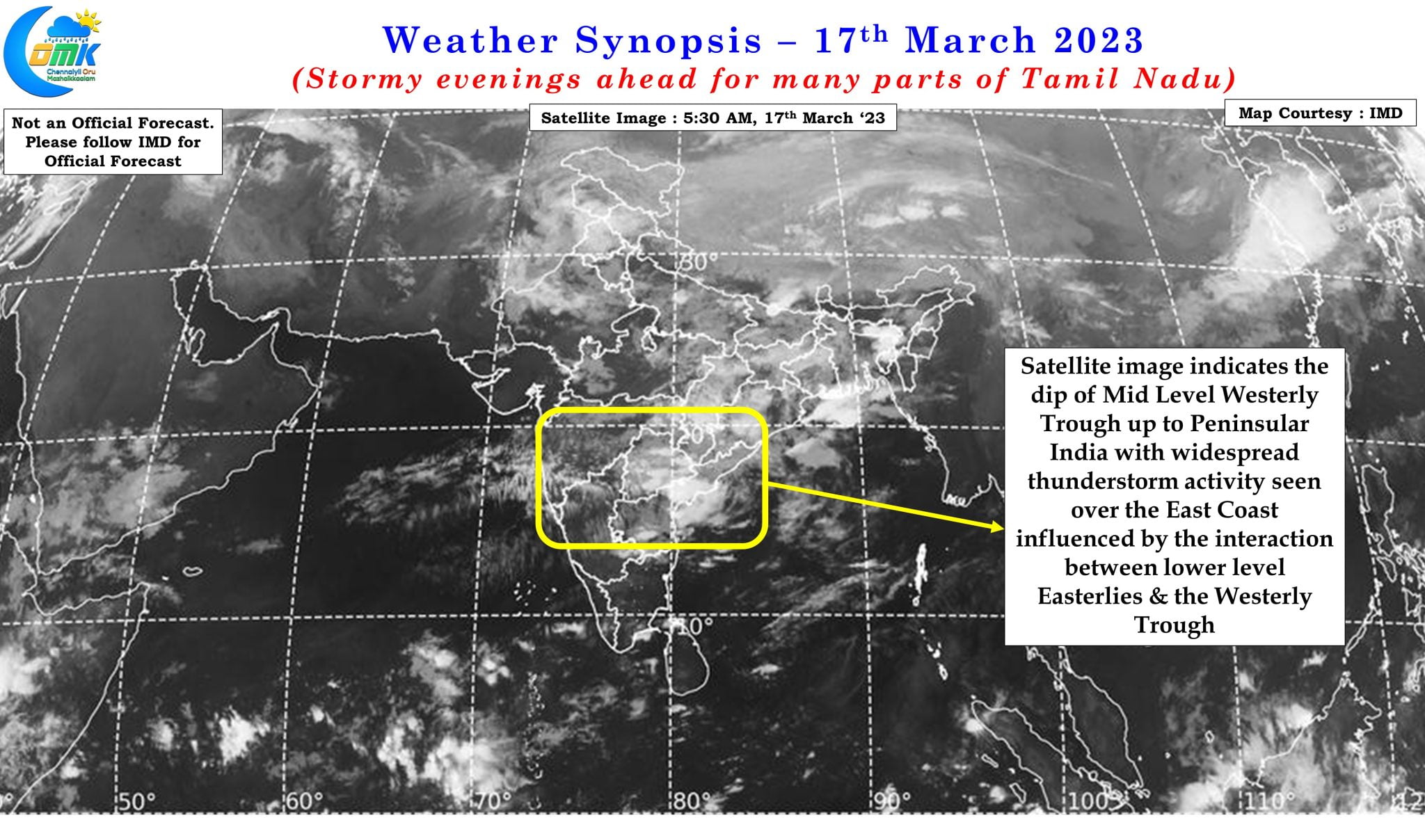
The abnormal dip in the Mid Latitude Westerly trough, dipping well into the southern parts of Peninsular India, in a way has provided the platform for convective thunderstorms to develop over large areas of the Indian Sub Continent with the moisture brought by the lower level Easterlies providing the necessary combustion for thunderstorms to intensify and enhance by a large magnitude. Additionally the arrival of seasonal LWD conditions has dovetailed nicely into this equation creating conducive conditions for interior areas to see thunderstorms as well.
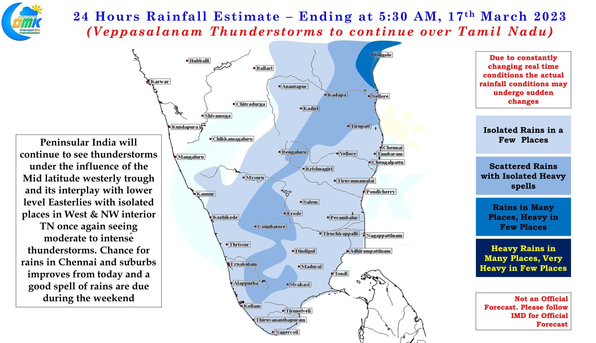
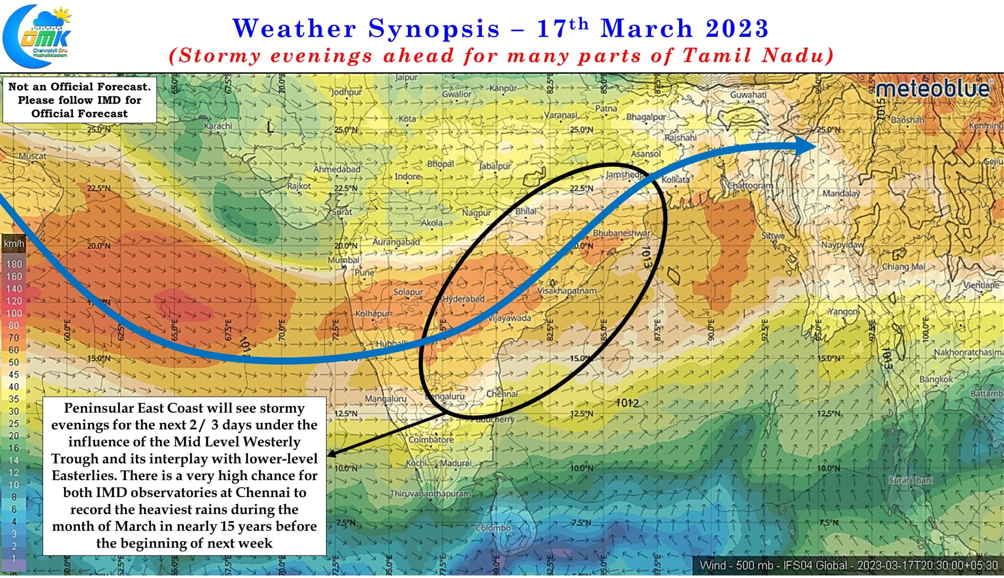
On Wednesday thunderstorms were closer to the Ghats while yesterday it nudged slightly to the East with places closer to the Eastern Ghats also coming under rains. As the trough moves West to East the area under rains is also expected to gradually shift East with the next 2 / 3 days promising to bring fairly widespread rains all along the East Coast of India all the way from Delta to West Bengal and further onto Northeast of India upto the Eastern edge of India over Arunachal Pradesh. While the heaviest of the rains are likely to happen over Coastal Andhra Pradesh and adjoining parts of Odisha there is a fair possibility for North Coastal Tamil Nadu also to catch a spell or two of moderate to intense thunderstorm activity
In the past decade March has been mostly dry for Chennai with only 2013 and 2018 seeing some bit of rains. 2023 has a very high potential for recording the highest rains during the month of March since 2008 which saw the highest recorded rains ever during the month of March when Chennai Meenambakkam recorded 175 mm and Chennai Nungambakkam recorded 159 mm. That year Chennai AP recorded two days of more than 5 cms during March and to give a perspective the long period Average for March is not even 10 mm.