
24 hours is a long time in weather. Ask the people of Odisha when a stalled super cyclone created for 24 hours after making landfall in the year 1999. Ask the people of Chennai when a stalled Michaung brought the city to its knees 2 years back. 1st week of December is slowly turning out to be a period of extreme rainfall events during Northeast Monsoon. In an almost repeat of 2015 the stalled Deep Depression of the coast of Chennai battered the city.
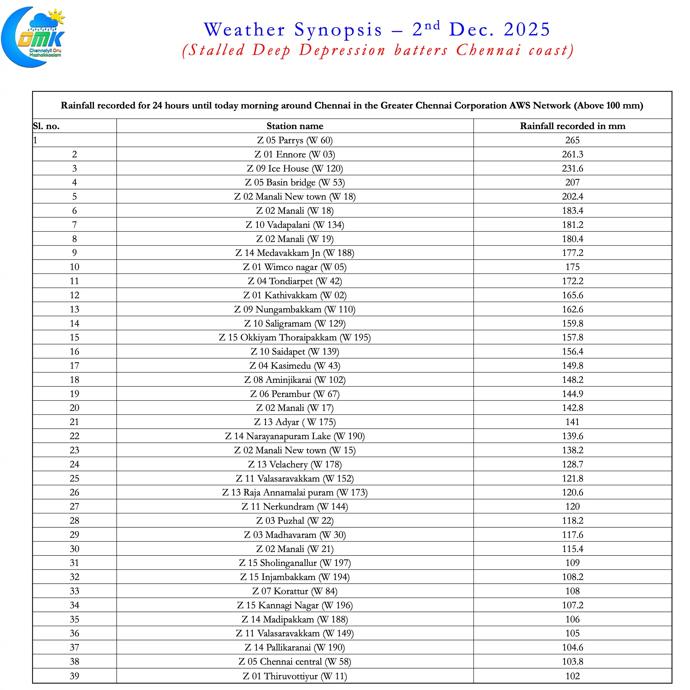
Many places, particularly to the North recorded more than 15 cms. The IMD observatory at Nungambakkam recorded 172 mm cutting the seasonal deficit from 233 mm to about 65 mm in one day. Similarly the IMD observatory at Chennai AP recorded 85 mm cutting the seasonal deficit from 111 mm to about 35 mm. After yesterday’s rains Chennai Nungambakkam IMD observatory has crossed the annual average rainfall. Chennai AP observatory still needs about 20 cms to reach its annual average. Chennai’s 26% seasonal deficit is likely to be recovered by tomorrow.
Cyclone Ditwah will end up yet another “Study Material” from NEM. After spending nearly 2 days over the Sri Lankan landmass it weakened in the open sea. Dry Air pretty much vaporise what ever convection it was holding by the time it reached east of Delta. But it was retaining its structure right through its journey along the coast of TN. Just as it weakened into a Deep Depression it got an unlikely ally. An incoming westerly trough giving it something to breathe on. Additionally the travel over waters for the previous 48 hours also gave a bit of bite to the structure.
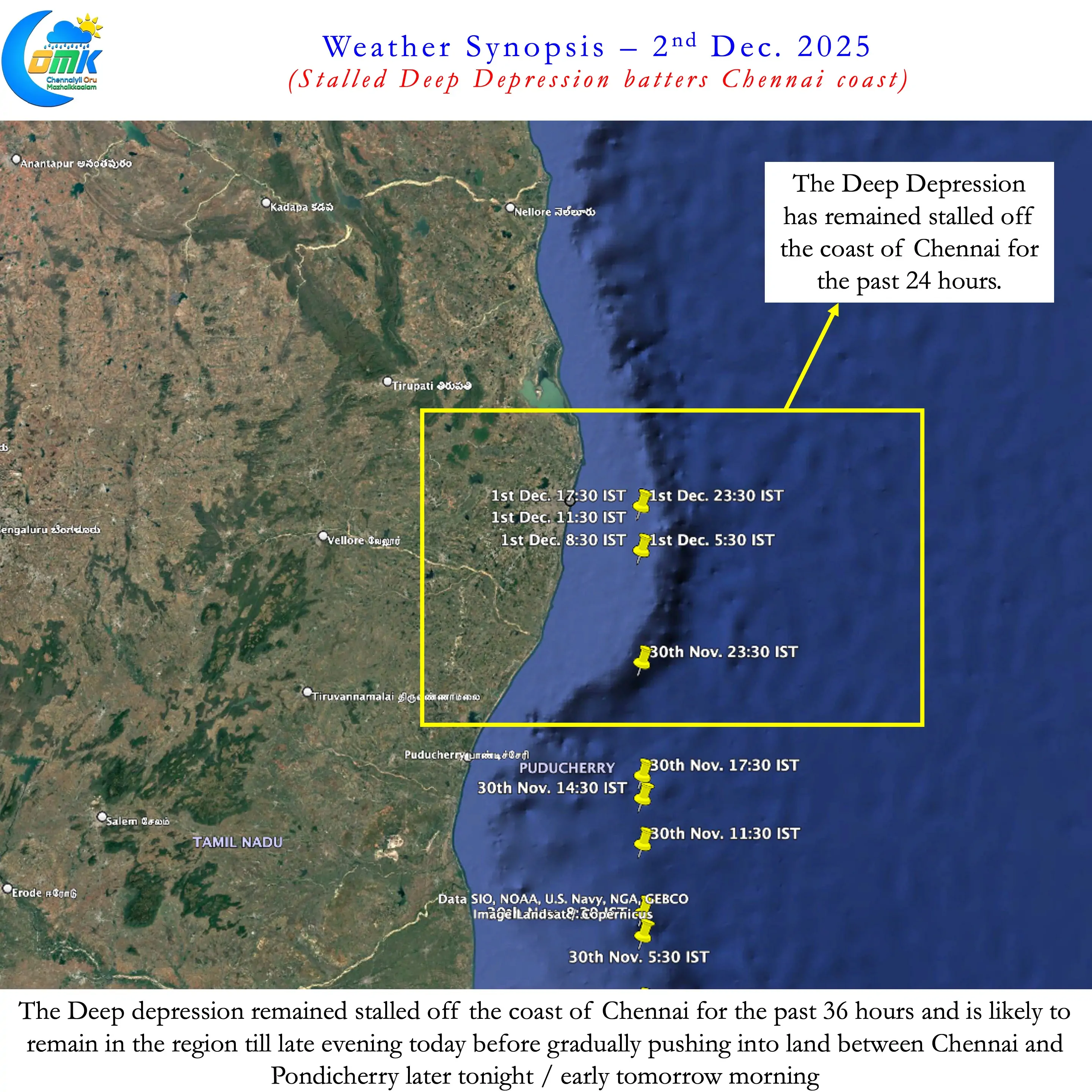
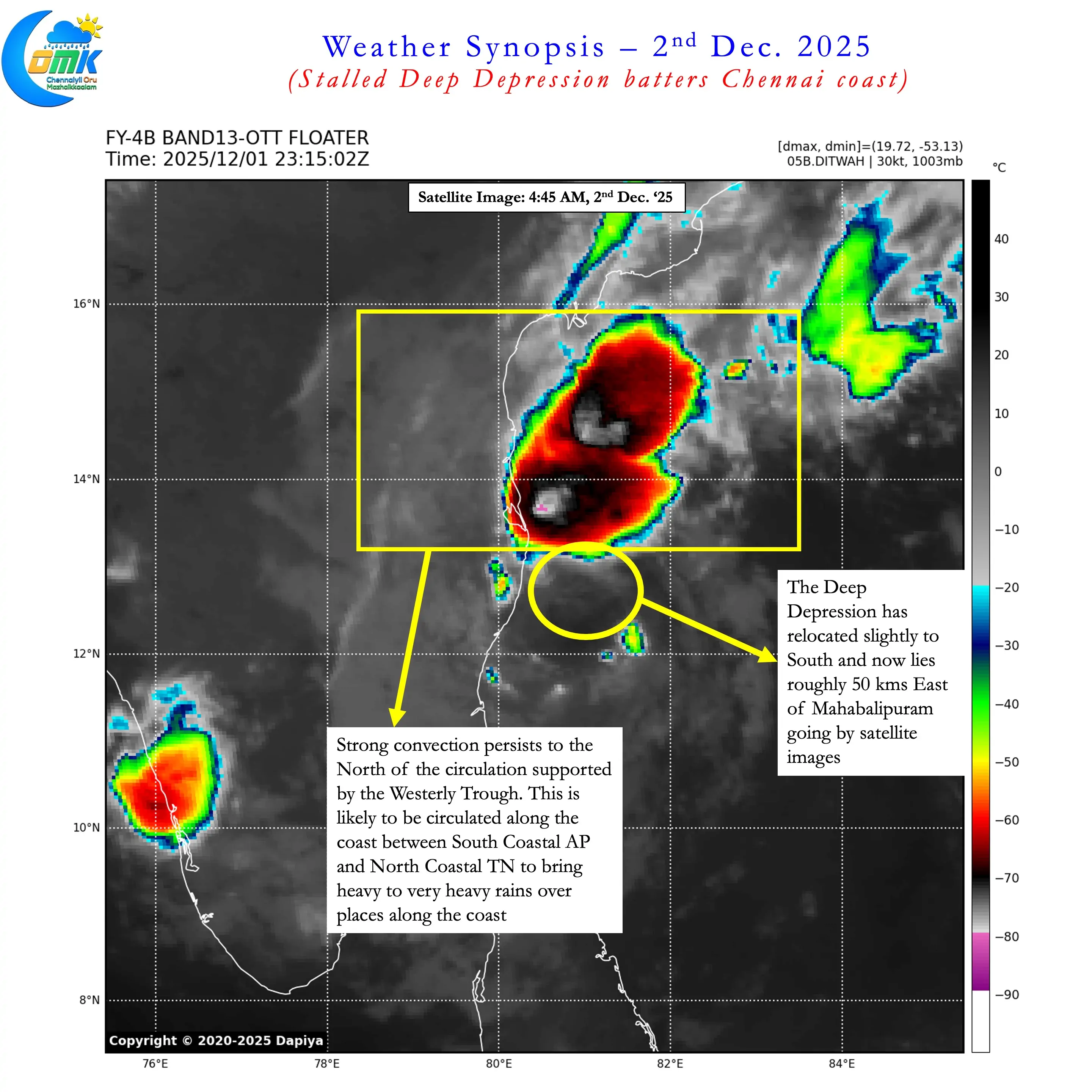
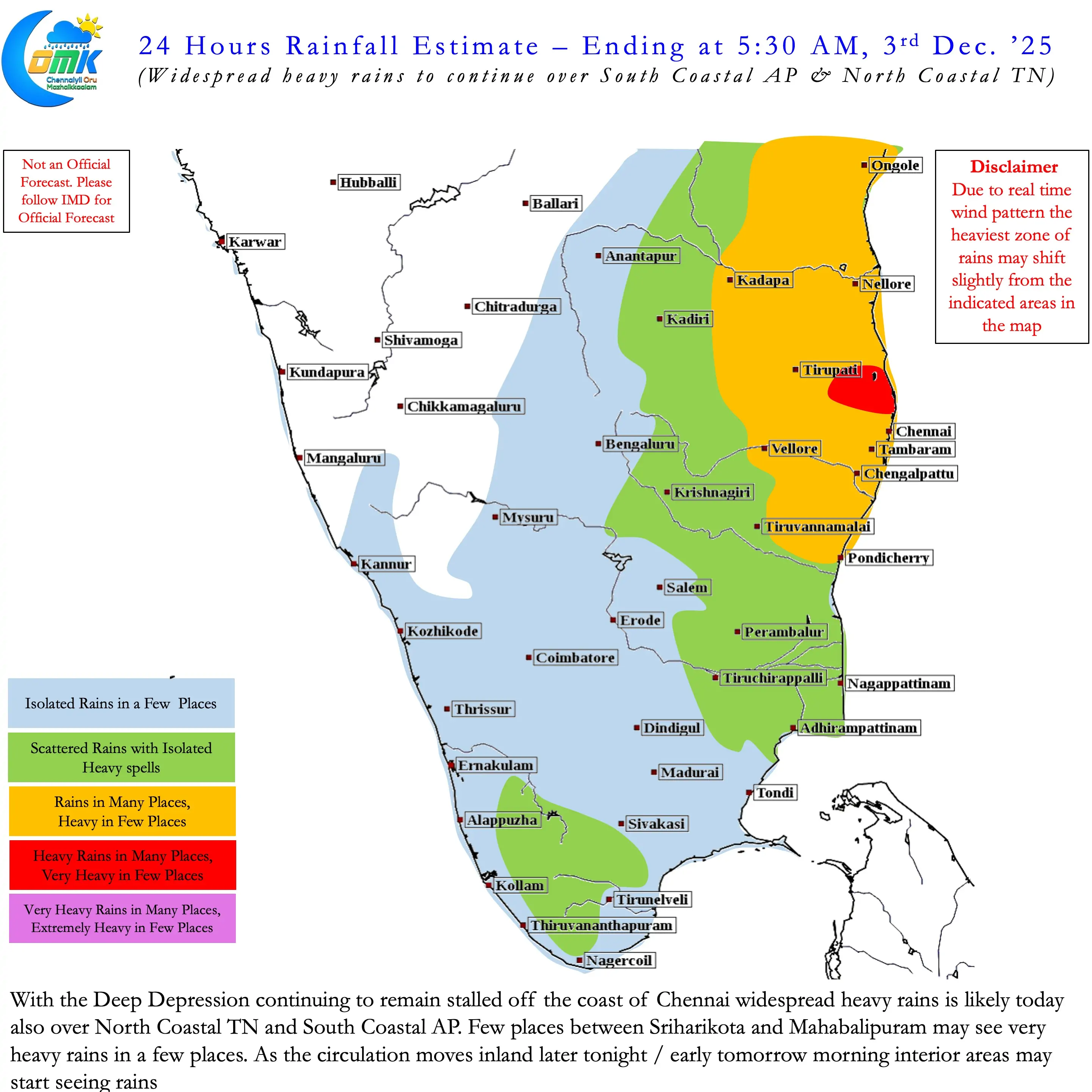
This resulted in a stalled Deep Depression off the coast of Chennai constantly recycling moisture. Most parts of Chennai received widespread heavy rains. Some places right along the coast line over North Chennai and places like Parrys got extremely heavy rains. The convection remained close to the centre. This meant rains were restricted to South Coastal AP and North Coastal TN. A small stretch between Sriharikota and Mahabalipuram bore the brunt of this stalled deep depression.
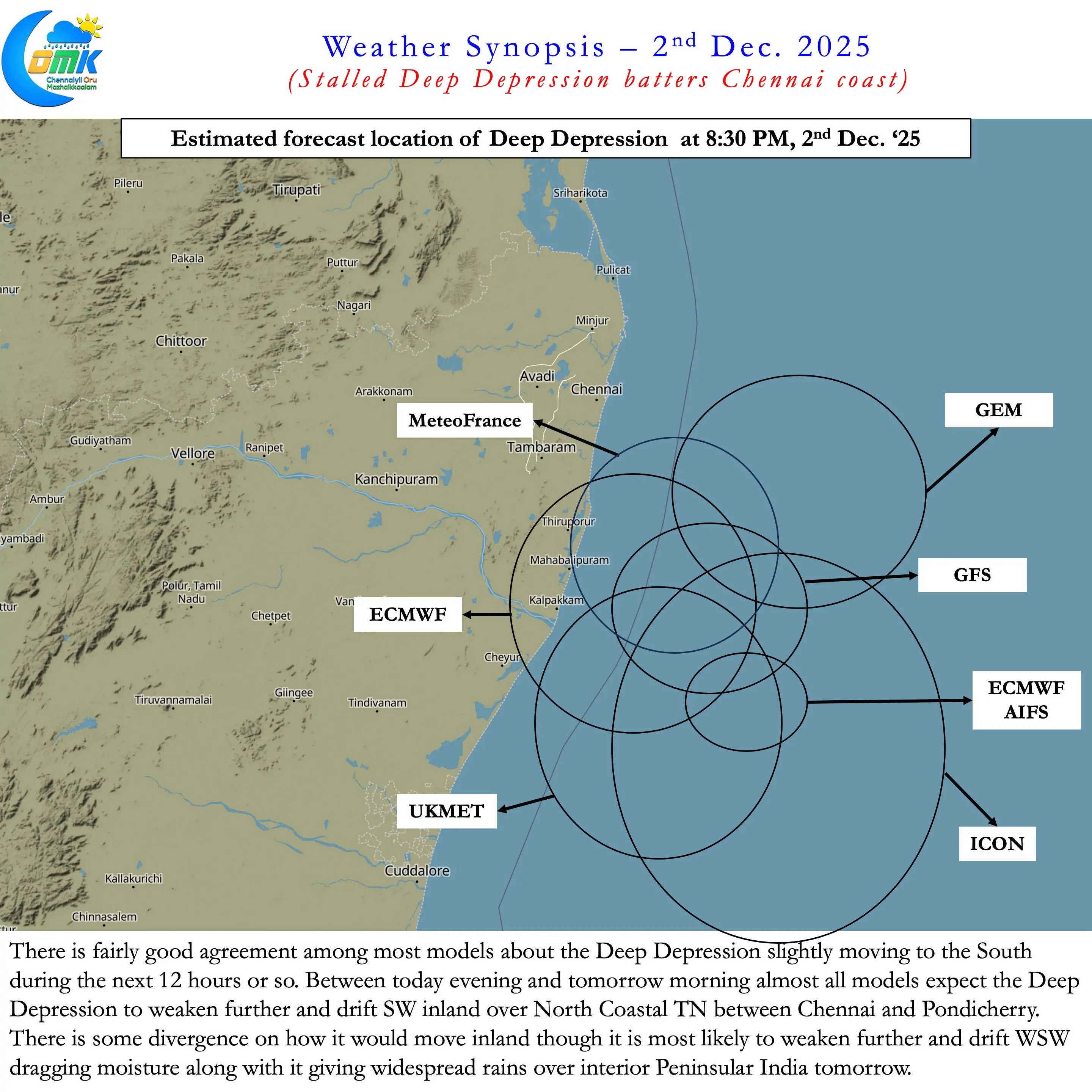
Weather models are now in sync for the deep depression to move slightly to the south and possibly interact with the land later today evening / night. Most models are in agreement that after land interaction it may weaken and drift inland between Chennai and Pondicherry into North TN in a SW movement. This is likely to drag the moisture along with it to bring rains over interior areas of Peninsular India tomorrow. Coastal places between Sriharikota and Mahabalipuram is vulnerable to heavy / very heavy rains for the next 24 hours. Gradually from later tonight we can expect the rains to slow down. Until then we may have to sit tight and brace for spells of rains that will keep getting recycled along the coastline.