
Northeast Monsoon this year has seen short burst of active monsoon interspersed with longer spell of dry weather. Large parts of the first fortnight of November saw dry weather conditions. 2nd fortnight slowly saw Monsoon get back on track with Cyclonic Storm Ditwah tilting the seasonal rainfall charts for many districts. This is visible in the daily rainfall chart for Tamil Nadu and Pondicherry. Since Ditwah most parts of the states have gone back to dry weather conditions.
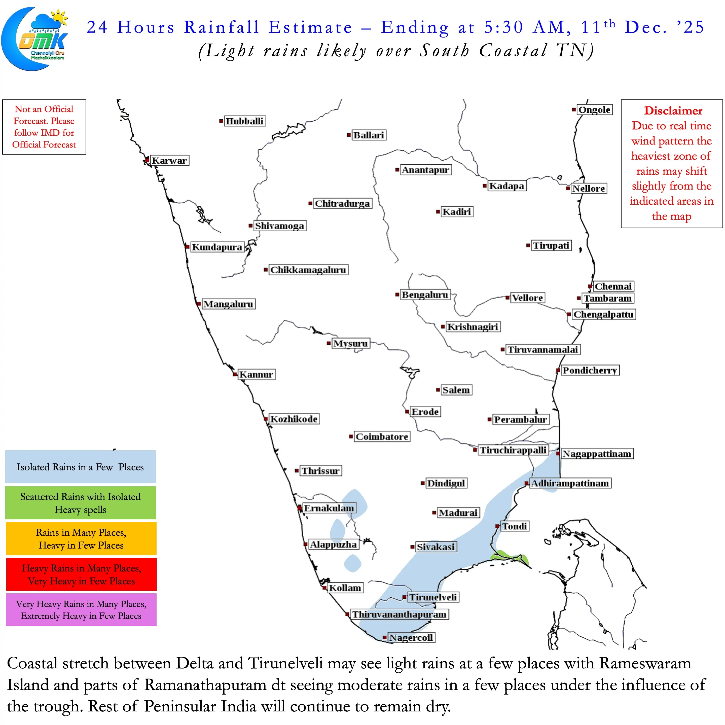
The only exception was places along the coastline over parts of Delta and South TN.A weak trough of Easterlies has brought some light / moderate rains since yesterday. This is likely to continue for the next 12 to 18 hours or so. Weather models continue to indicate a possible weak disturbance to develop over South Bay towards the end of this week. But overall atmospheric conditions seem to be leaning towards a spell of dry weather. This dry weather will possibly lead to clearer skies bringing about a reduction in night time temperatures. Most models are fairly in sync with a gradual reduction in night time temperatures from today.
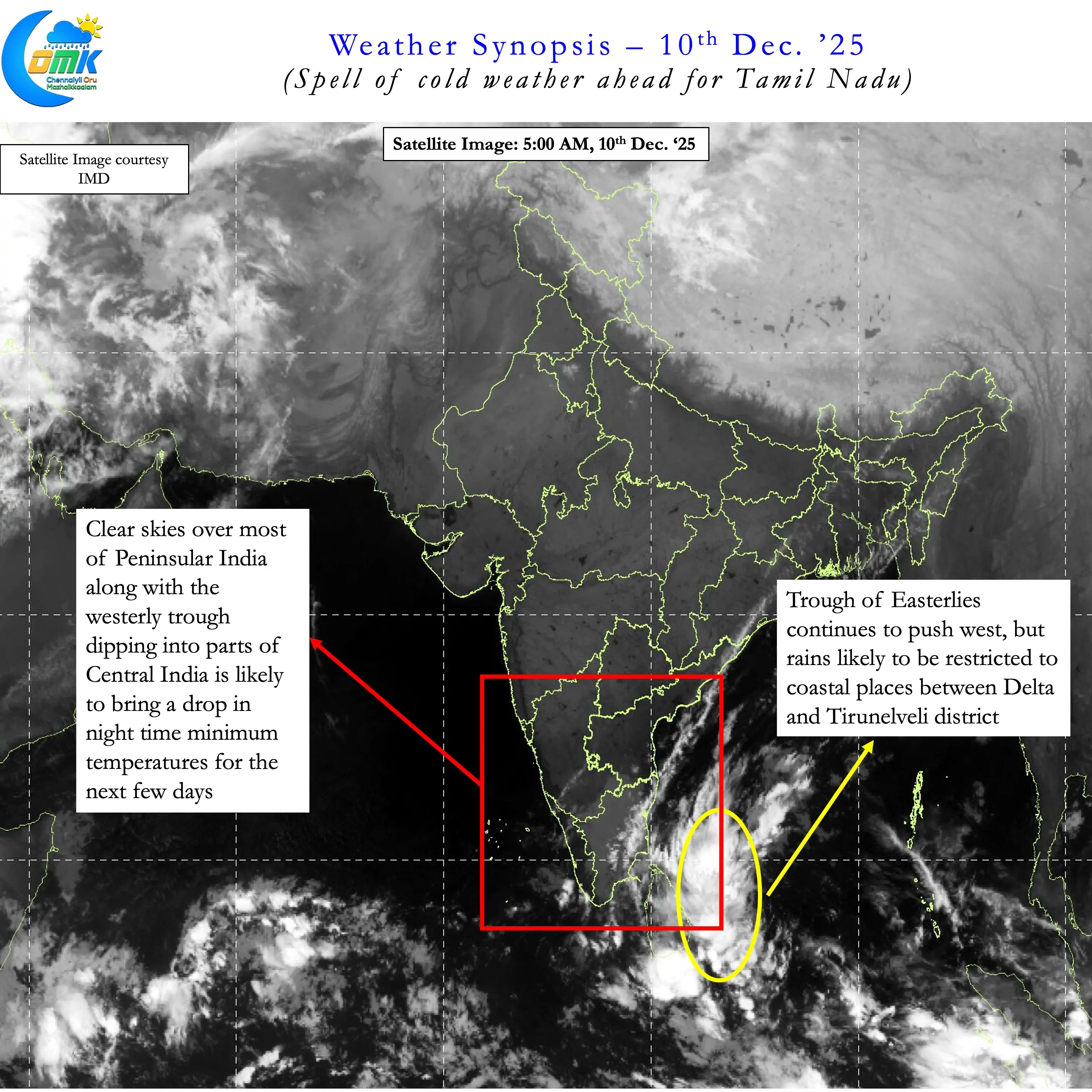
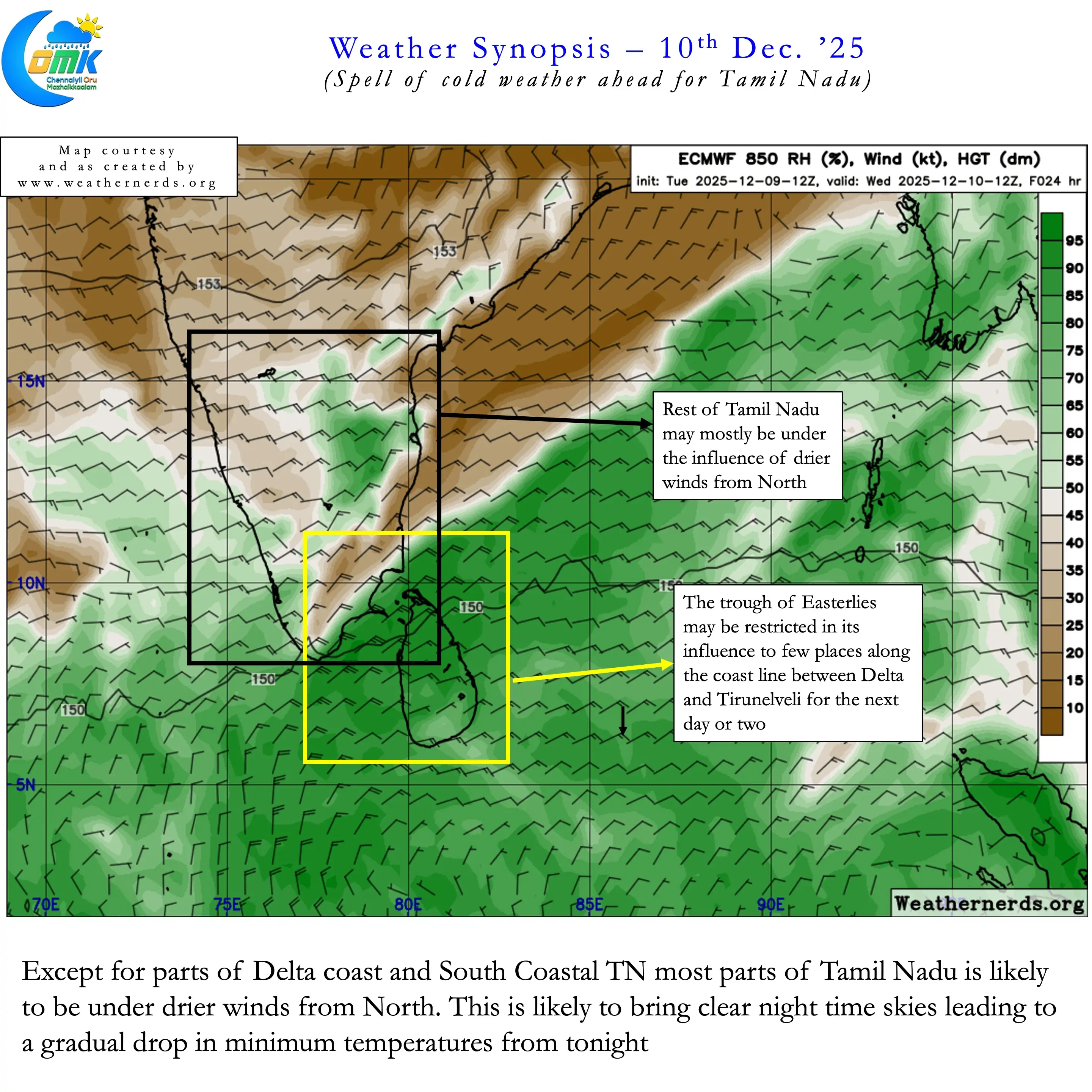
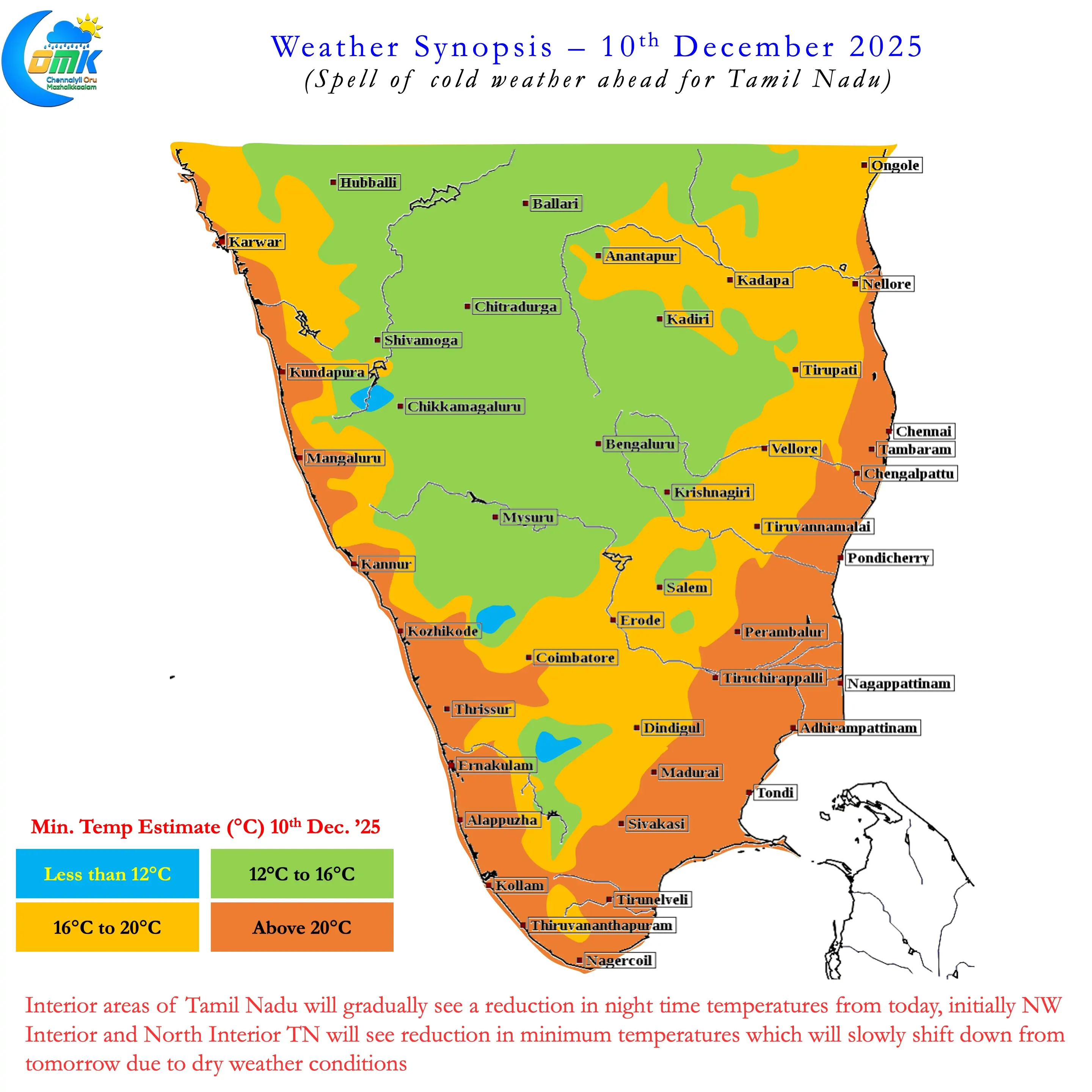
Initially parts of NW Interior TN adjoining South Interior Karnataka and Rayalaseema region of AP may see reduction. From tomorrow more places in North TN may come under drier weather conditions and dip in night time temperatures. This spell of cold weather is likely to continue until Monday before returning Easterlies may push back temperatures to normal. But how strong the Easterlies return and could the potentially bring back rains is a question we may have to wait for an answer.
With things picking up south of Equator due to the developing secondary ITCZ weather models may struggle with transition dynamics. Nevertheless over the next few days we can look forward to some cool nippy nights. Few places in the state may see 4 to 6°C below normal temperatures around the weekend.