
After many days of delay finally Southwest Monsoon for the current year has started withdrawing from the Indian Sub Continent. IMD through its bulletin announced the withdrawal of Monsoon from parts of Punjab, Haryana & North Rajasthan. These areas are expected to see Monsoon withdrawal around 1st of September effectively meaning for the current year Monsoon has started withdrawing more than a month behind schedule.

Though Monsoon withdrawal has started more than a month behind schedule it does not translate directly into delayed Onset of Northeast Monsoon. Over the next few days we can expect a rapid withdrawal of Monsoon from rest of North India & most of Central India. Weather models indicate a possible pulse to move into Central Bay with a weak probability of it developing into an organized disturbance. This development needs to be monitored for possible upset of the withdrawal apple cart.
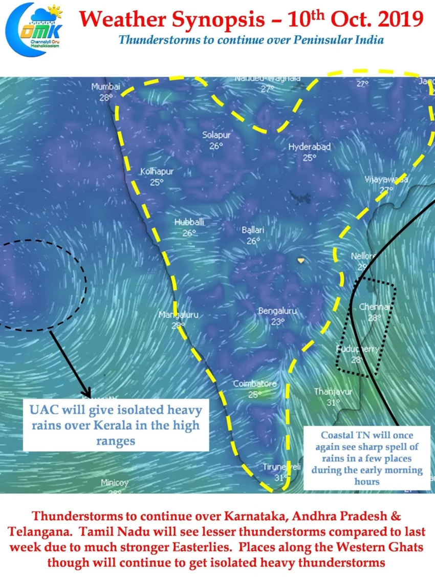
In the meanwhile Peninsular India continues to enjoy from this state of chaos thrown by the transition season. Parts of Interior Karnataka are seeing intense thunderstorms almost on daily basis. Shimsa. a tributary of Cauvery has been seeing record inflows bringing in more than 2 TMC into Mettur without any major contribution from either Kabini or KRS.

Today once again we will see interior parts of Karnataka, AP & Telangana see moderate to heavy thunderstorm activity. With Easterlies strengthening across TN today could see lesser thunderstorm activity though coastal areas may see sharp showers. Places along the Western Ghats & those adjoining Karnataka / Rayalaseema could see thunderstorms at many places.