
Yesterday Southwest Monsoon made onset over Kerala more than a week ahead of schedule. Since 2010 Monsoon has been setting in over Kerala mostly on or after 29th May. During 2009 we saw onset over Kerala happen on 23rd May. 2025 is now the earliest mainland onset since then. 2025 will be the 14th year in the past 30 years when Southwest Monsoon has touched Kerala May. If one were to look at the previous 30 years Monsoon has reached 13 years during May. Effectively it means no large scale oscillation is seen.
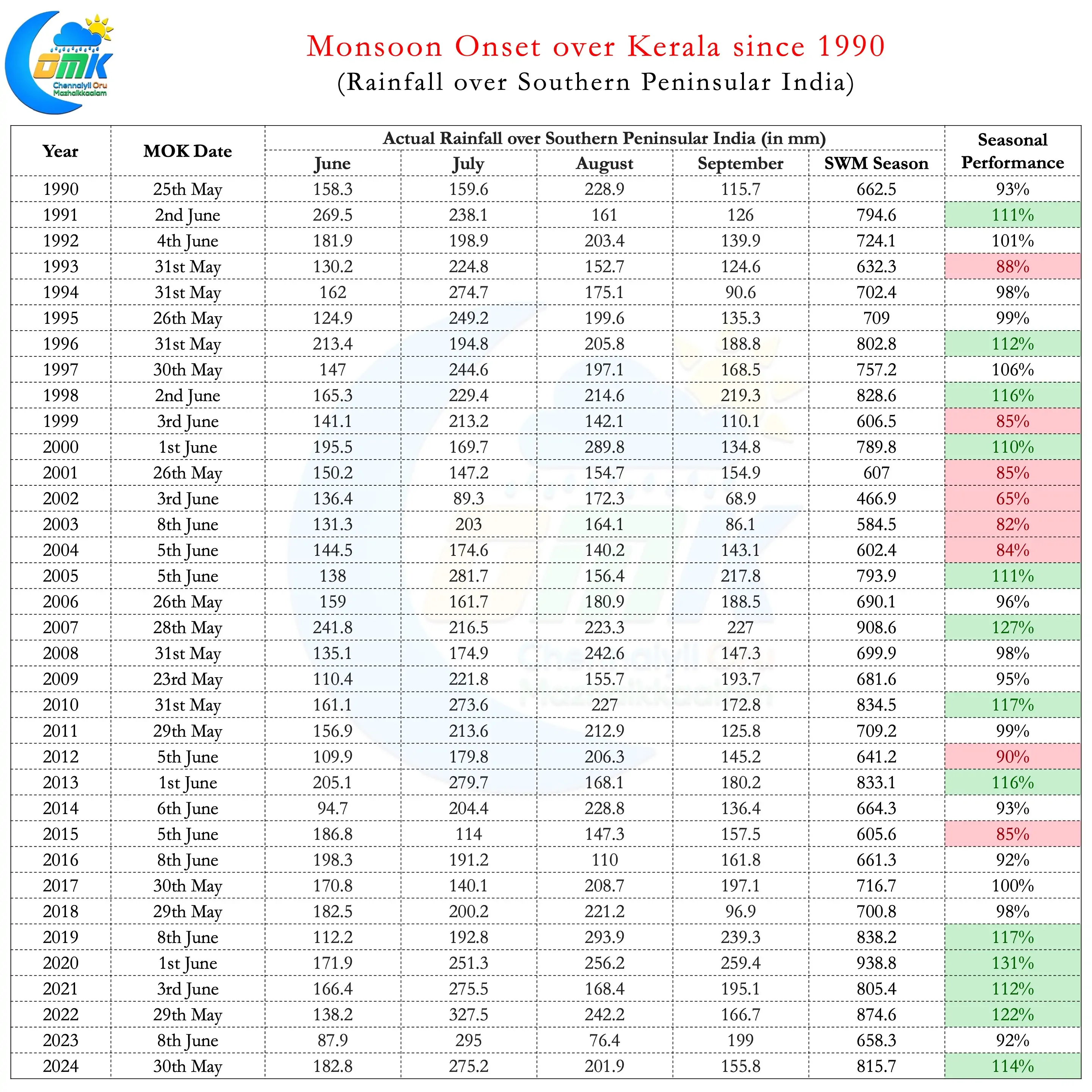
Similarly one can also see there is not much pattern in terms of onset dates and overall performance of Monsoon. Looking at the Peninsular India data during years like 2019 which saw 17% excess rains monsoon reached only by 8th June. Similarly during the year 2001 despite reaching on 26th May the overall seasonal performance ended at 85% of LPA. Interestingly since 2005 Southwest Monsoon has been relatively good over Peninsular India. 2012 and 2015 were the only two years when the seasonal performance has been lesser than 90%. It may be an interesting study though to look at intra seasonal patterns to understand overall performance better.
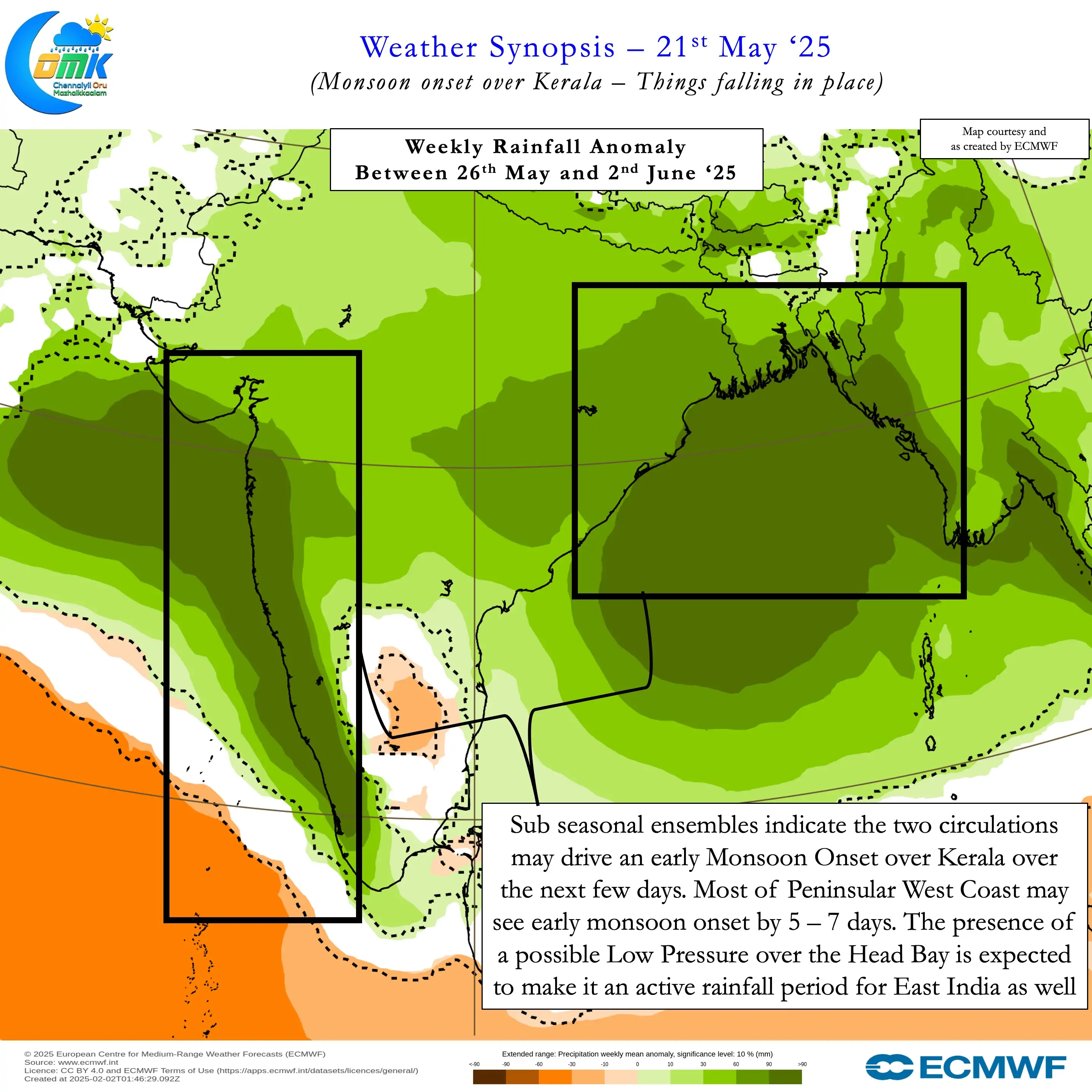
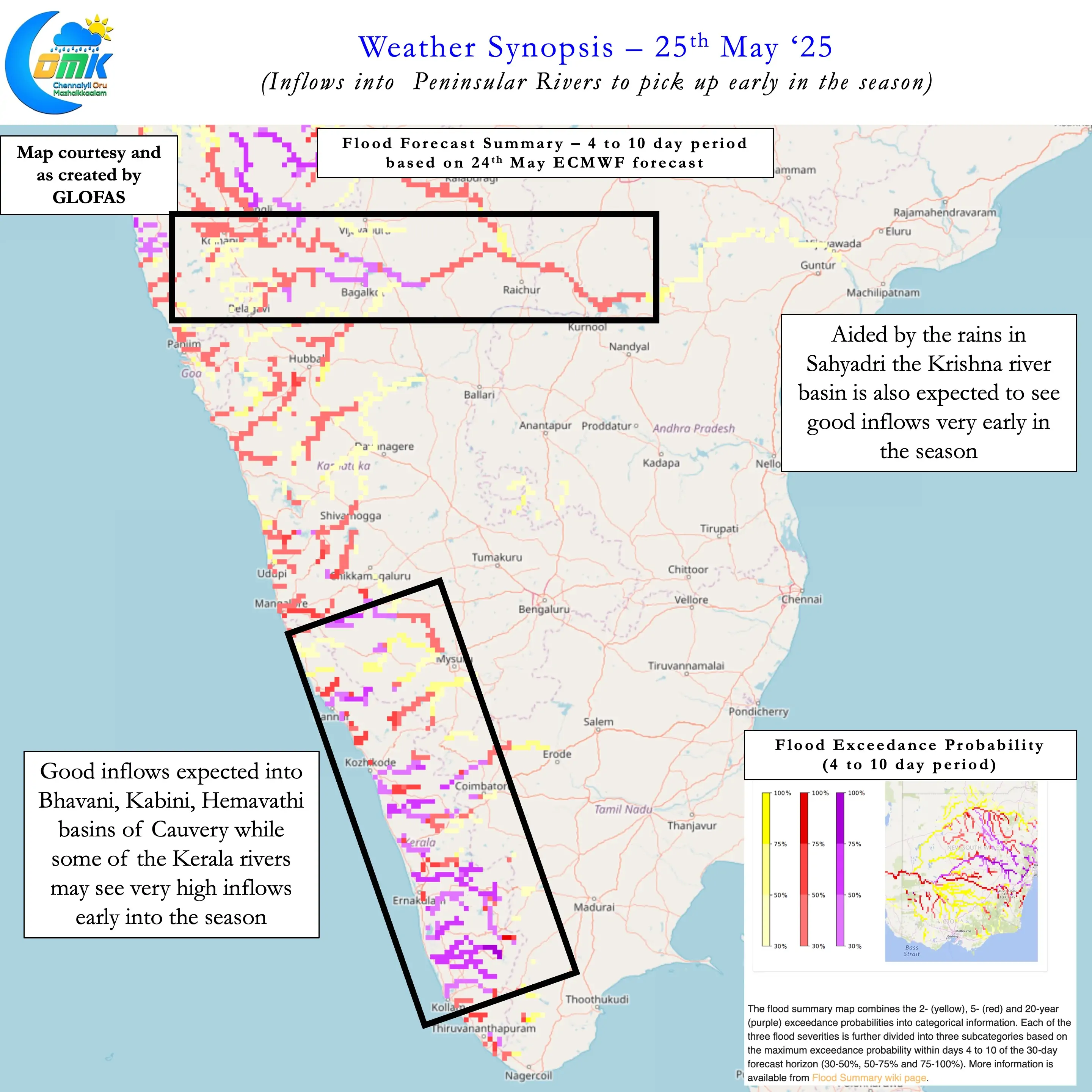
Sub seasonal models picked up this strong onset of Monsoon fairly well. Over the next week to 10 days Southwest Monsoon is likely to aggressively move over most of Peninsular India. During this phase we may see widespread heavy to very heavy rains along the West coast and the Ghats. This phase will also potentially bring very good inflows into basins like Cauvery and Krishna. With Cauvery Basin storage in Karnataka at about 40% this strong start augurs well for the farmers in both TN & Karnataka.
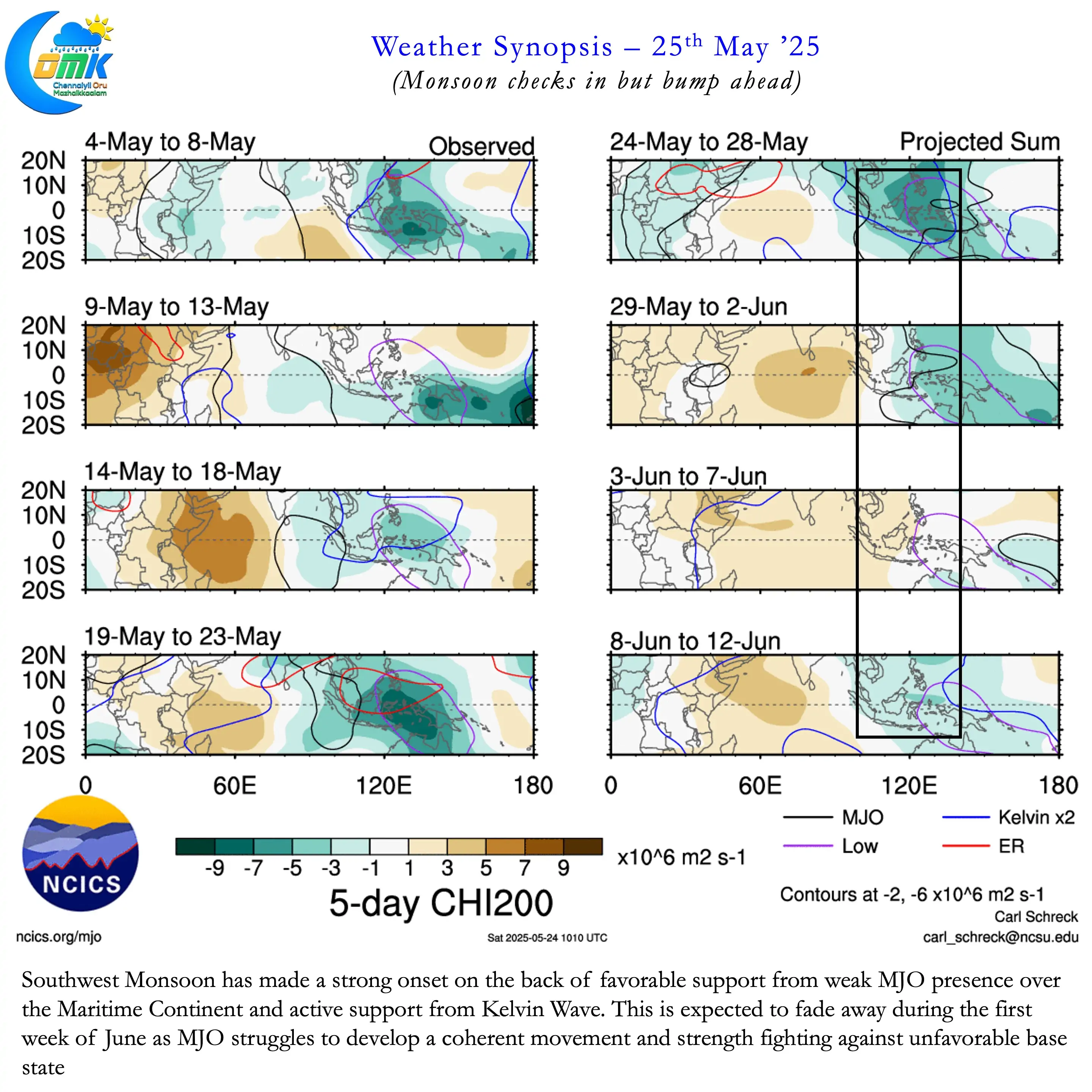
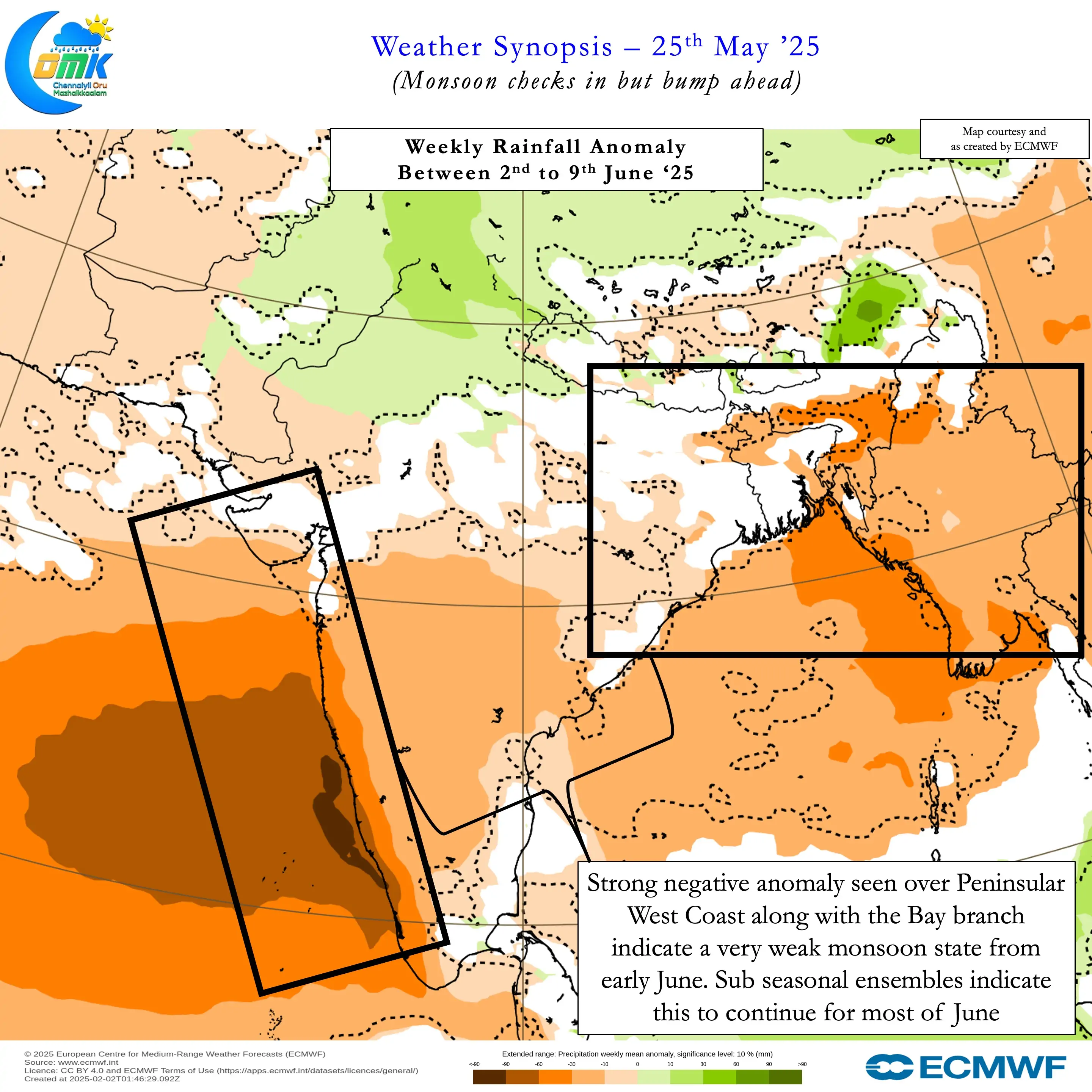
But there is a potential bump ahead for Southwest Monsoon after the strong start. The Pacific base state over the past couple of months has transitioned from La Nina to Neutral. This transition has resulted in incoherent propagation of MJO globally. Currently a weak MJO influence can be seen over the Maritime continent. Additionally support from Kelvin has provided a good platform for strong Monsoon onset. But unfavourable base conditions mean MJO may once again become inconsequential in a couple of weeks time. Unable to propagate further East it may try to start its journey all over once again. During this period we may see a lull in monsoon dynamics.
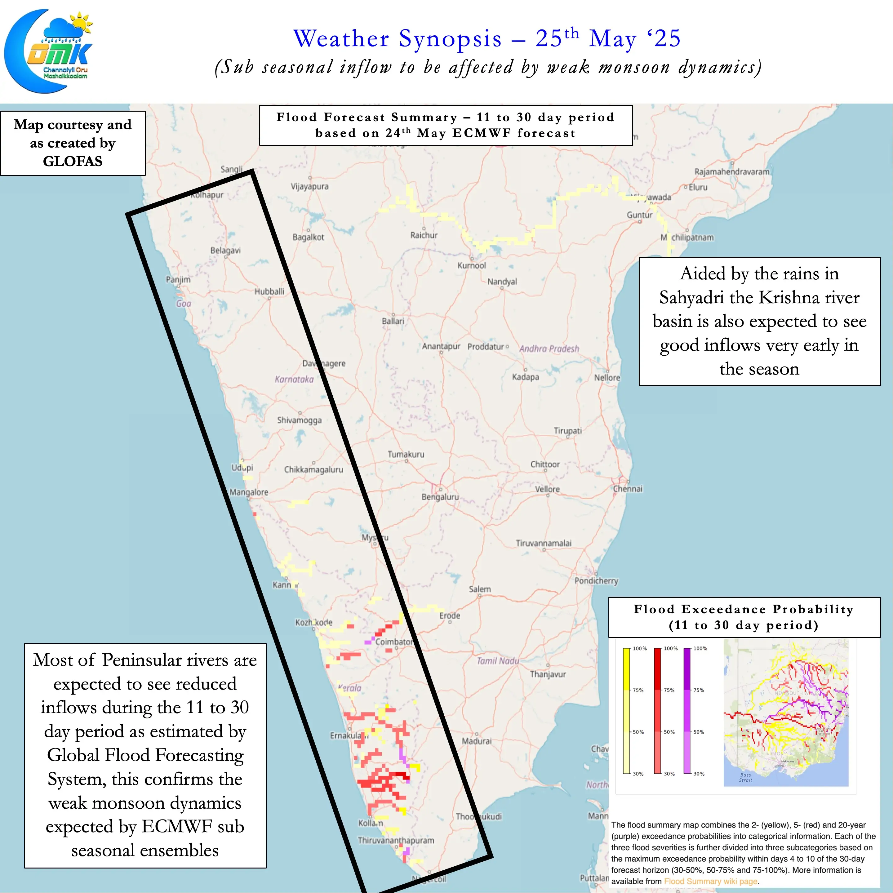
Sub seasonal ensemble forecasts has been hinting at this scenario for the past couple of weeks now. The traditional Monsoon northward propagation period of June will result in possibly a stalled monsoon. As mentioned above before this stall almost all of Peninsular India may come under Monsoon dynamics. Additionally the simultaneous onset over parts of Northeast India may also cover a large parts there. Just as monsoon starts moving into Central India we may see it hitting the brakes.
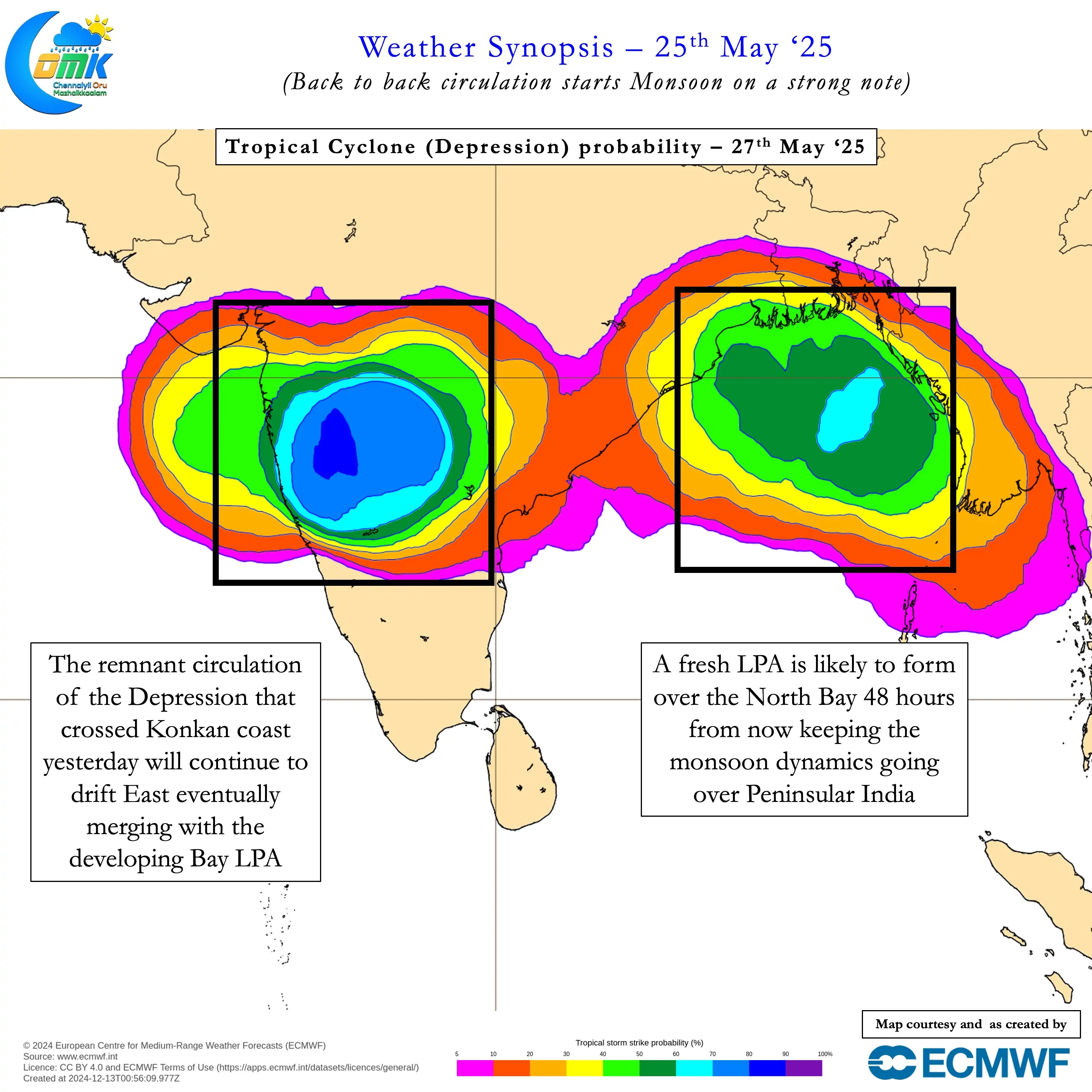
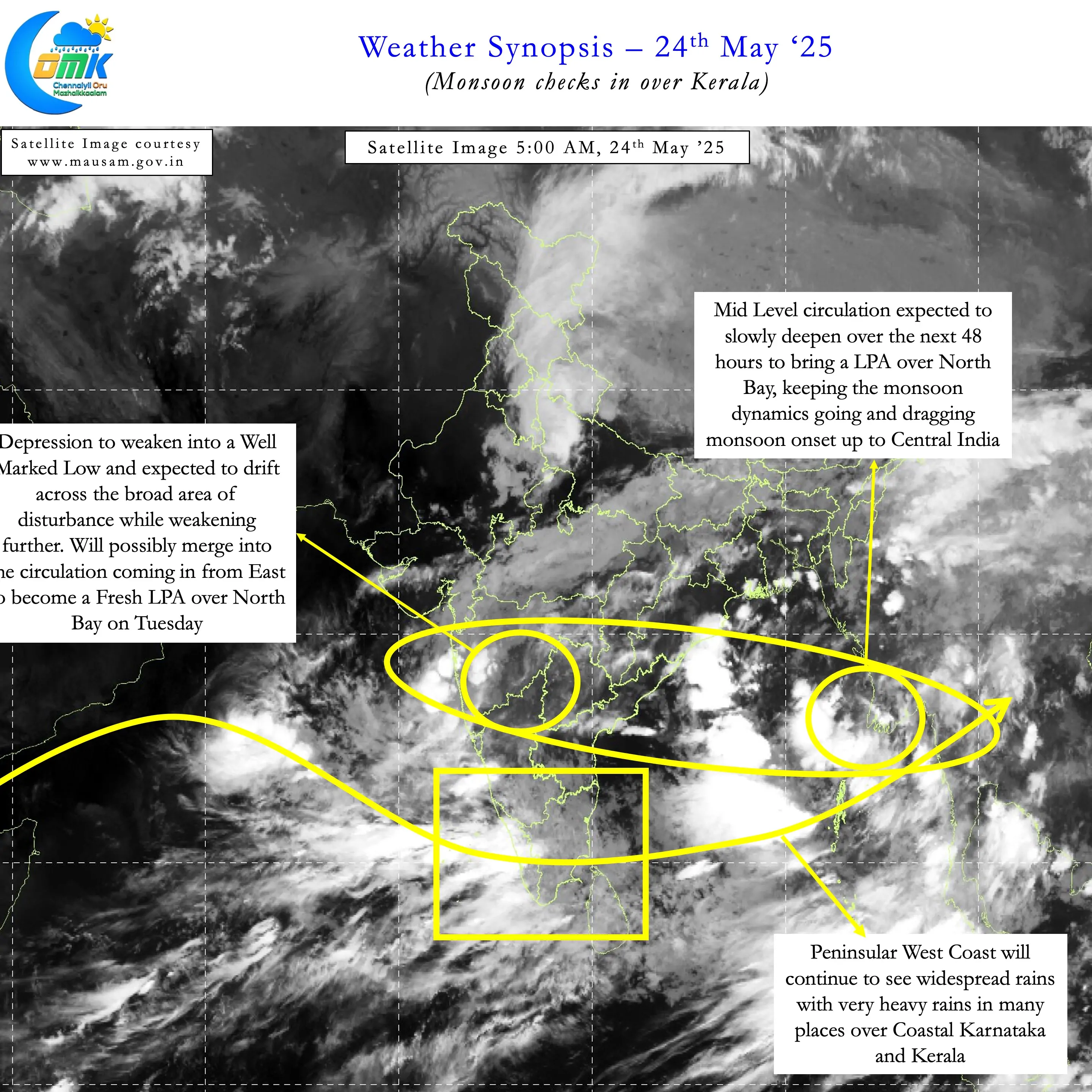
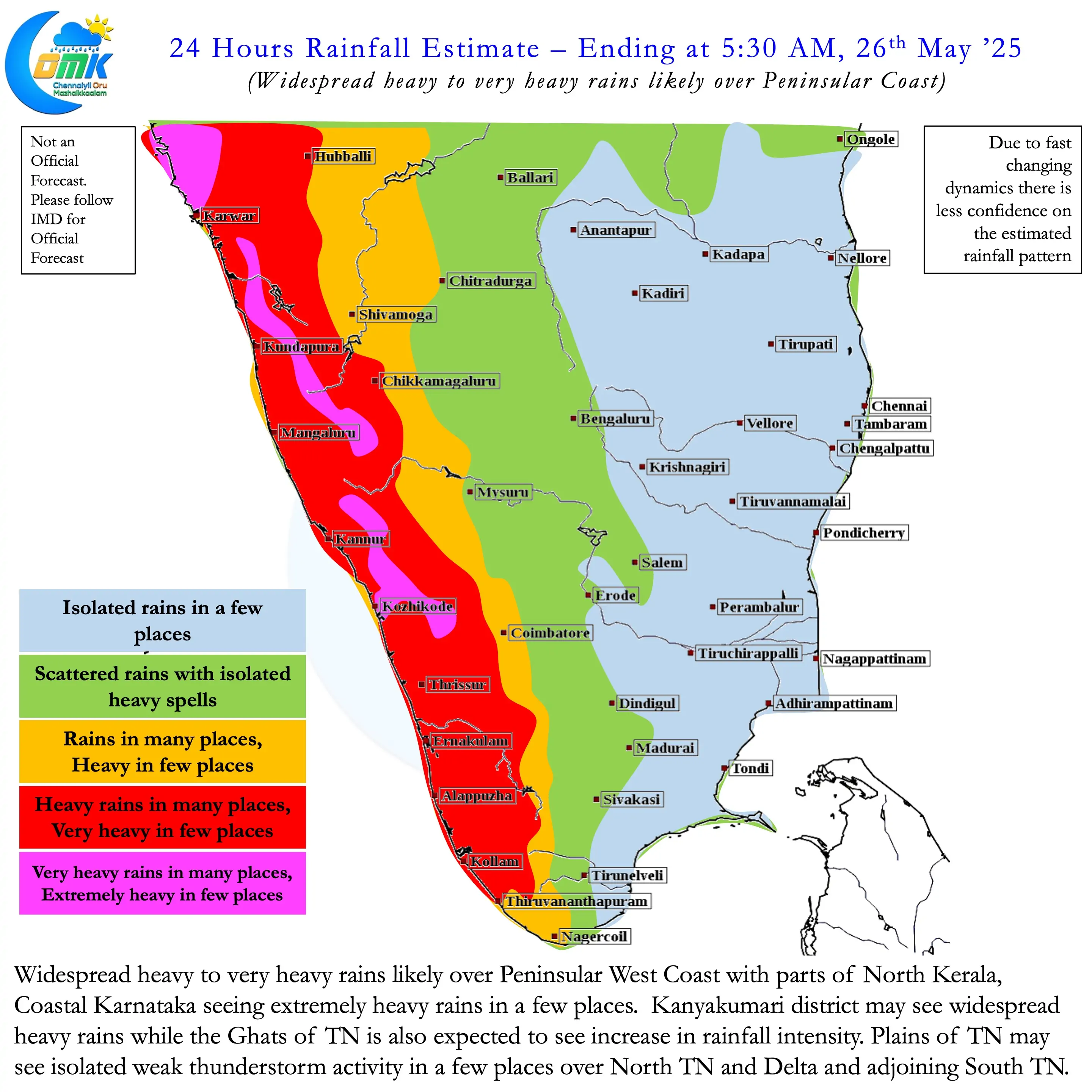
Nevertheless over the next week to 10 days we may see monsoon in full fury aided by twin circulations. The first one currently seen as a depression over parts of Maharashtra and MP. The second one is seen as a mid level circulation over Bay. It is likely to deepen into a LPA over the next 48 hours keeping the monsoon dynamics going. Peninsular West Coast and all along the Ghats need to be on vigil for a strong monsoon surge during this period.