
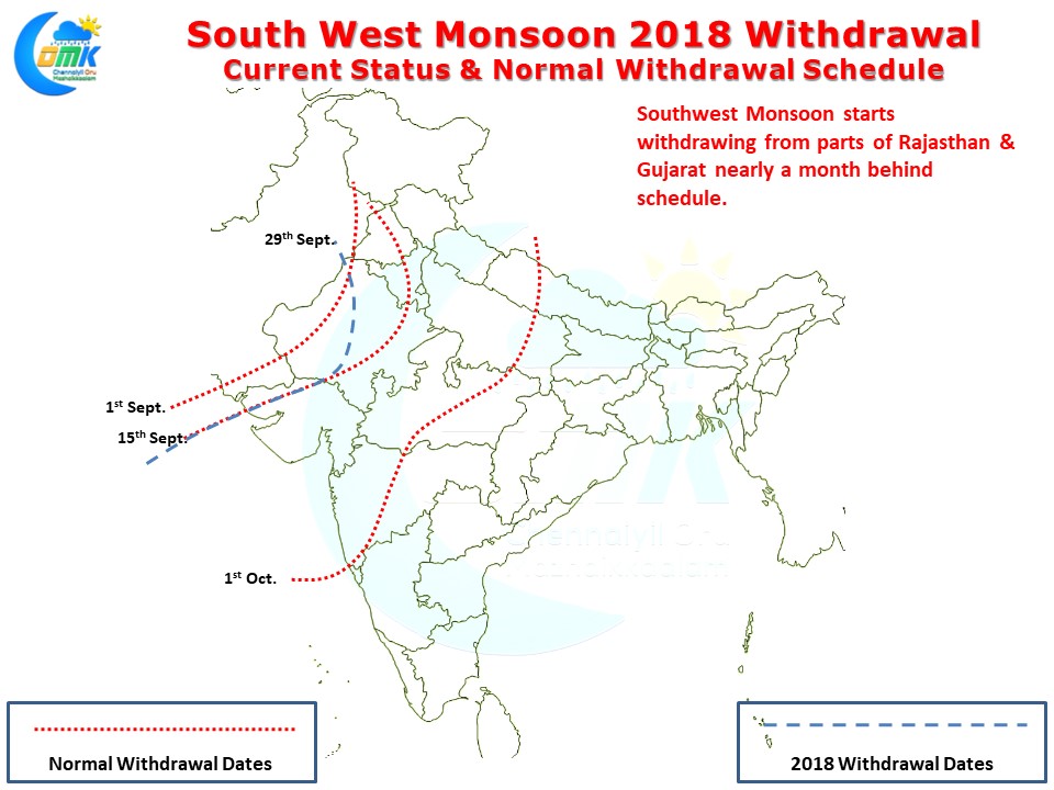
Southwest Monsoon finally started checking out from the Indian Sub Continent yesterday. With Northwest India remaining dry for the past few days and low level anti cyclone getting firmed up over parts of Rajasthan & Surrounding areas IMD officially announced the start of the withdrawal yesterday.
Southwest Monsoon has withdrawn from parts of Rajasthan, Kutch & North Arabian Sea areas as of yesterday with further progress expected over the next few days from rest of Rajasthan, more parts of Gujarat & from places in Haryana, Punjab, Delhi, Uttar Pradesh & Madhya Pradesh. By the normal schedule of withdrawal by 1st of October many parts of Maharashtra should have seen Southwest Monsoon withdraw instead we might be looking only at extreme NW India devoid of Monsoon by tomorrow.
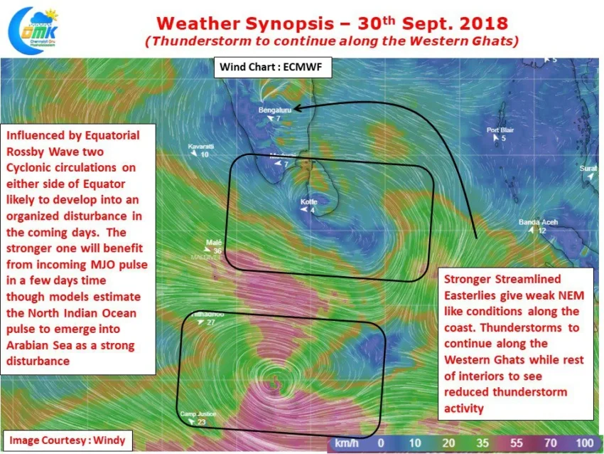
Since yesterday Weather models indicate the Easterlies have strengthened and are more streamlined compared to the past few days. This has reduced the Wind instability over Peninsular India thereby subduing thunderstorm possibilities. While coastal areas will see weak Northeast Monsoon type conditions recording isolated light rains in a few places thunderstorms will be more along the Western Ghats & parts of Kerala rather than most of Tamil Nadu.

On a slightly larger scale one needs to keep watch for a pair of cyclonic circulations either side of Equator. Influenced by Equatorial Rossby waves these two circulations could develop into organized disturbances and depending on which one strengthens better could benefit from the incoming MJO pulse. This interplay could be complex even though most weather models are picking up a straight forward solution in the form of a strong Disturbance (Cyclone) over the Arabian Sea in a week’s time.
As we often say at COMK. Three days at a time