
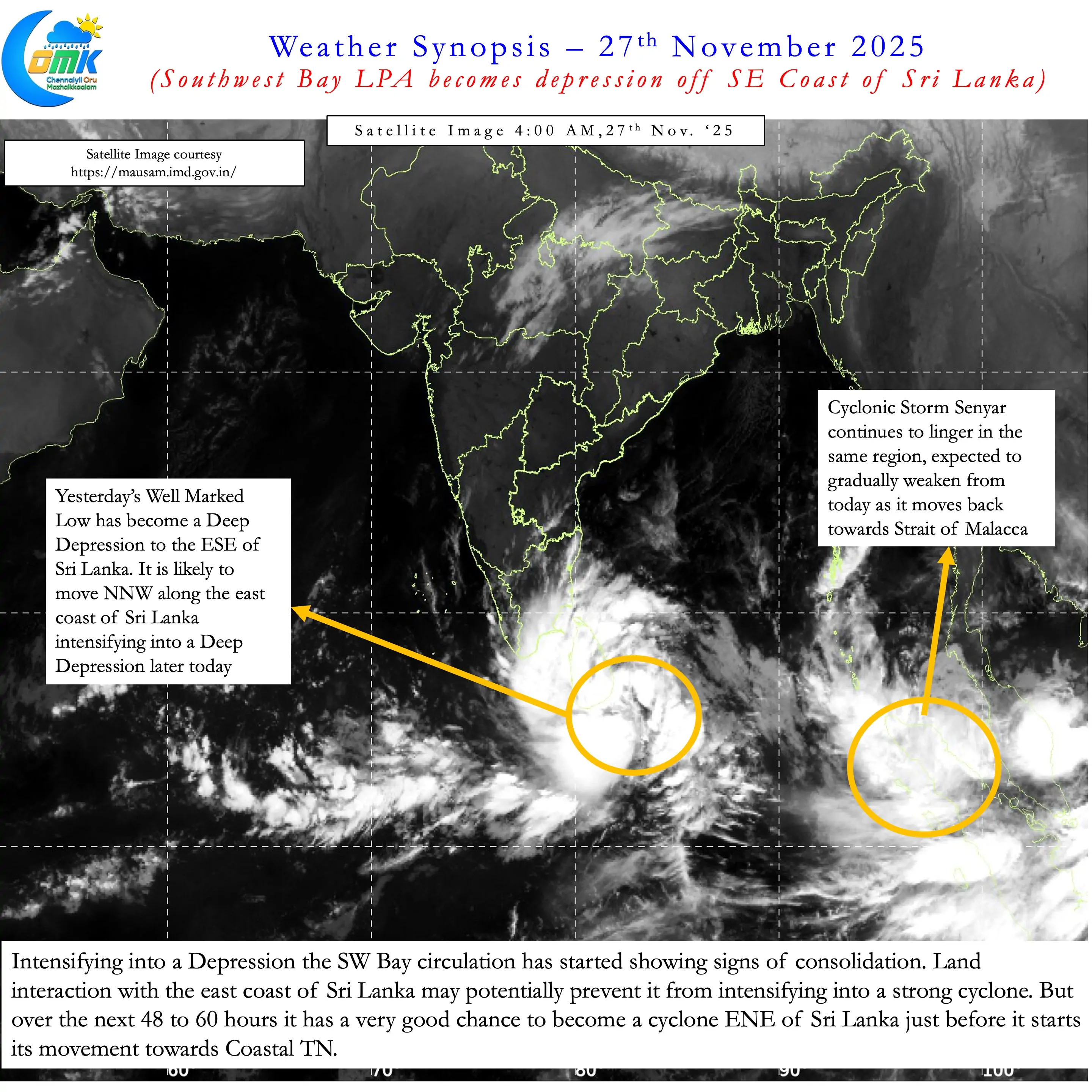
Not often one gets to see two disturbances spinning over Bay of Bengal and adjoining areas. In what is likely to be one of the first instances we now have a Depression over Southwest Bay and a cyclone over Strait of Malacca and adjoining areas. Cyclonic Storm Senyar is expected to drift East from today gradually weakening. Meanwhile all eyes will now be on the Southwest Bay disturbance. Yesterday’s Well marked Low is now a depression ESE of Sri Lanka.
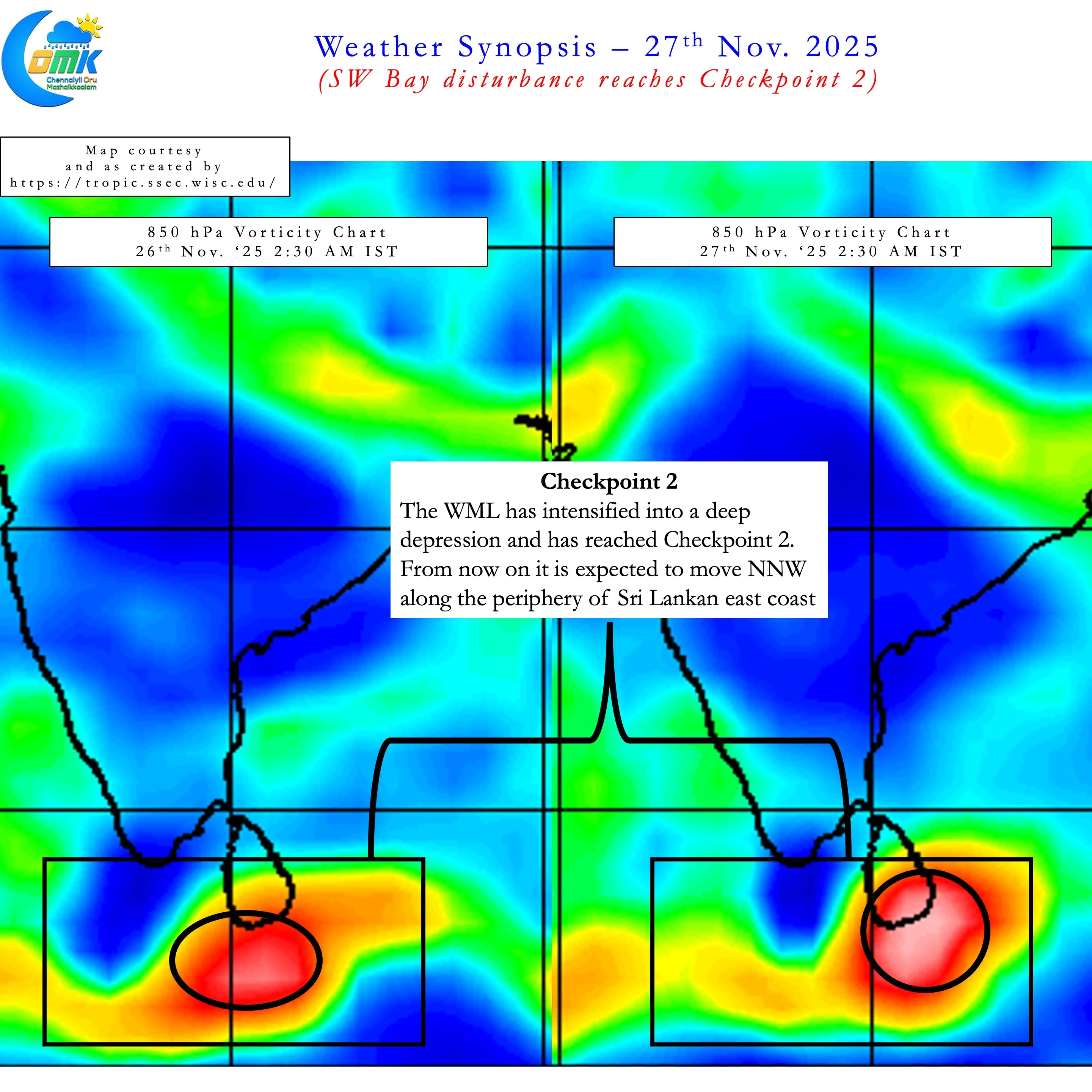
As part of yesterday’s update we had created a milestone map to understand the progress of the Southwest Bay disturbance. With the depression now over ESE of Sri Lanka Checkpoint 2 has been achieved. Over the next 12 to 24 hours it is expected to move in a NNW direction along the periphery of the Sri Lankan East Coast towards Checkpoint 3. While there is now increasing convergence on the overall dynamics of what to expect there are a couple of questions that still need answers. Those questions will be answered when the disturbance reaches Checkpoint 3.
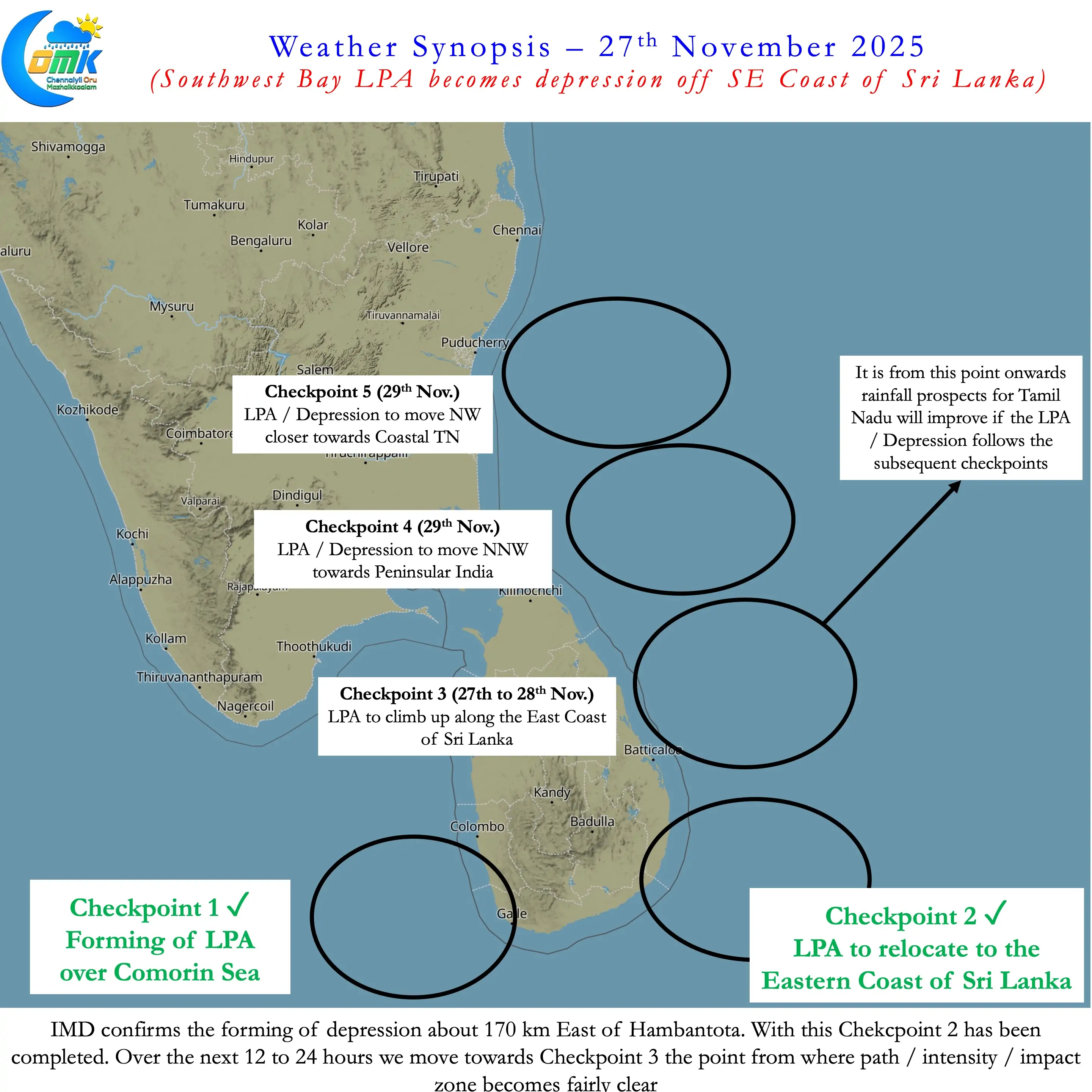
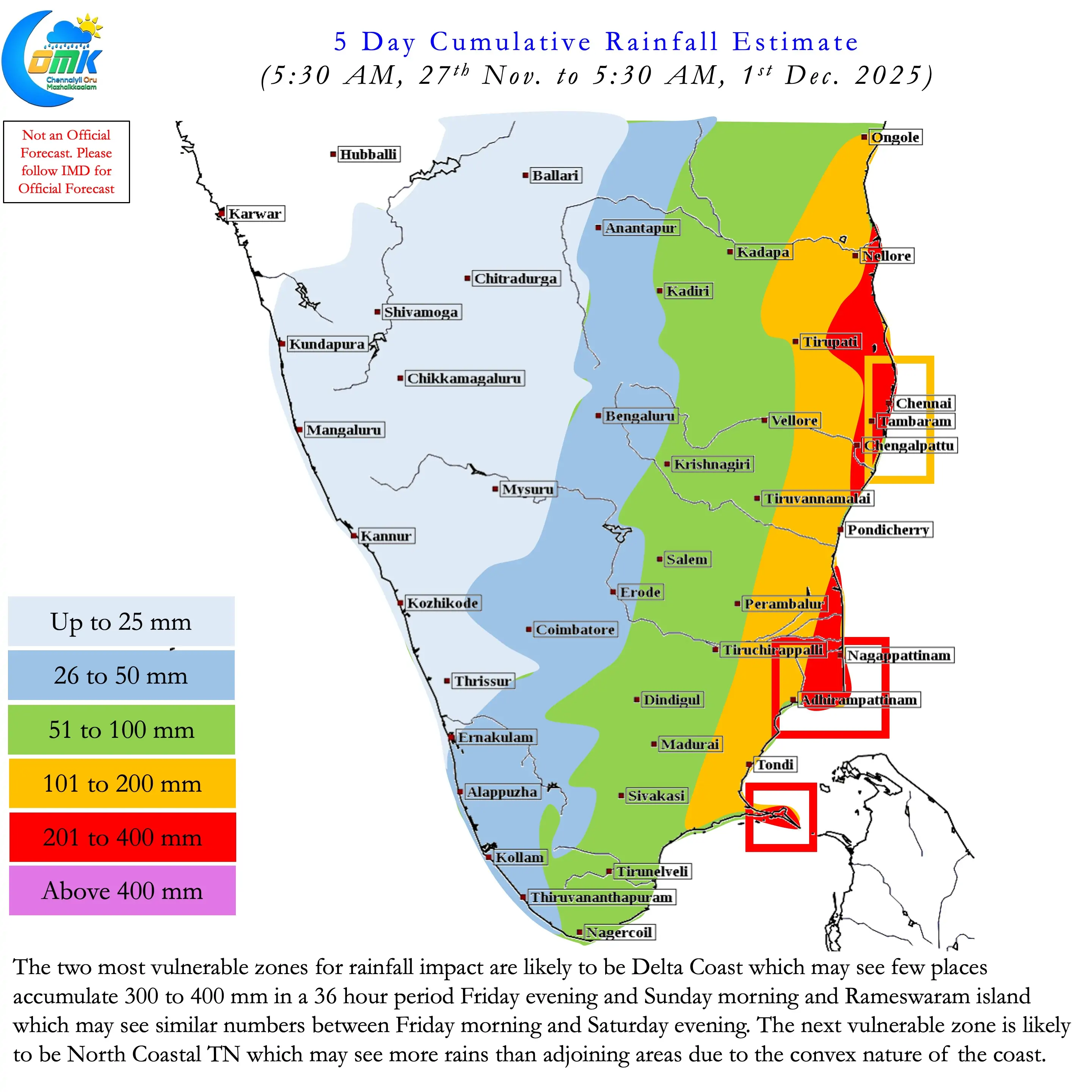
This update is based on the current status of Southwest Bay and its movement against model expectation. There is a fair bit of confidence on the expected rainfall impact for Coastal TN. Though a couple of questions remain unanswered it is essential to understand what could be the likely impact over the next 5 days. The Key Take Aways based on current status of the Southwest Bay Depression.
- Currently the Depression is ESE of Sri Lanka. It is likely to move NNW along the periphery of Sri Lankan East coast intensifying into a Deep Depression later today.
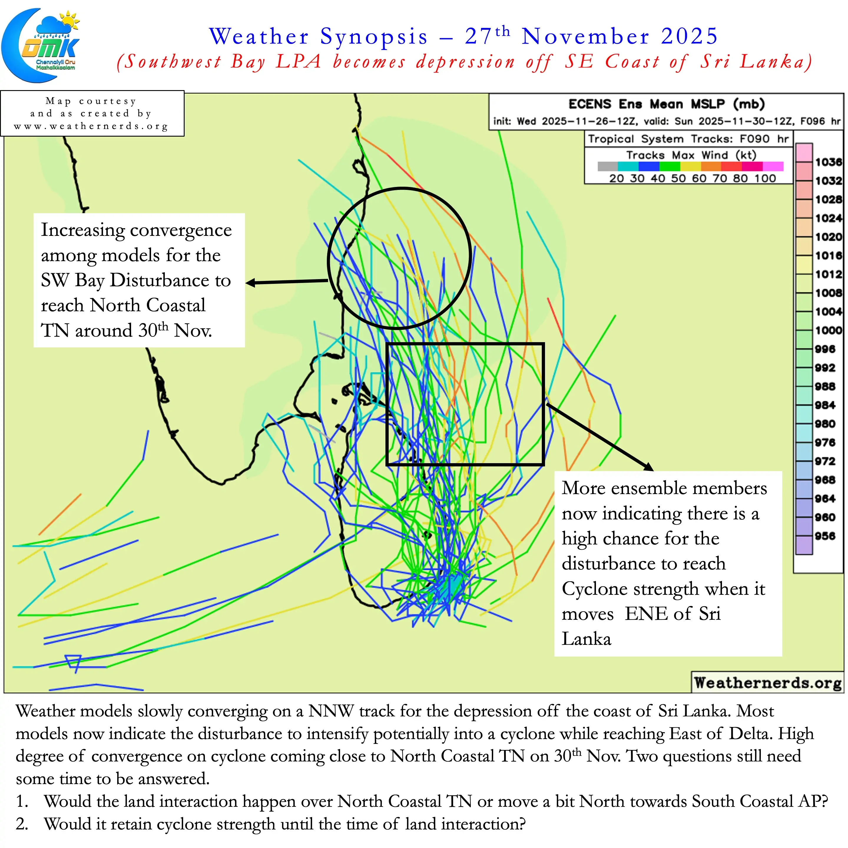
- Increasing alignment among weather models about the disturbance strengthening into a cyclone ENE of Sri Lanka in about 48 hours from now.
- Increasing convergence among weather models about the disturbance moving towards North Coastal TN by 30thNovember. Two question marks remain though which could be answered by tomorrow.
- Would the cyclone retain its intensity during land interaction on 30th November?
- Would the land interaction happen over North Coastal TN or slightly climb up to South Coastal AP?
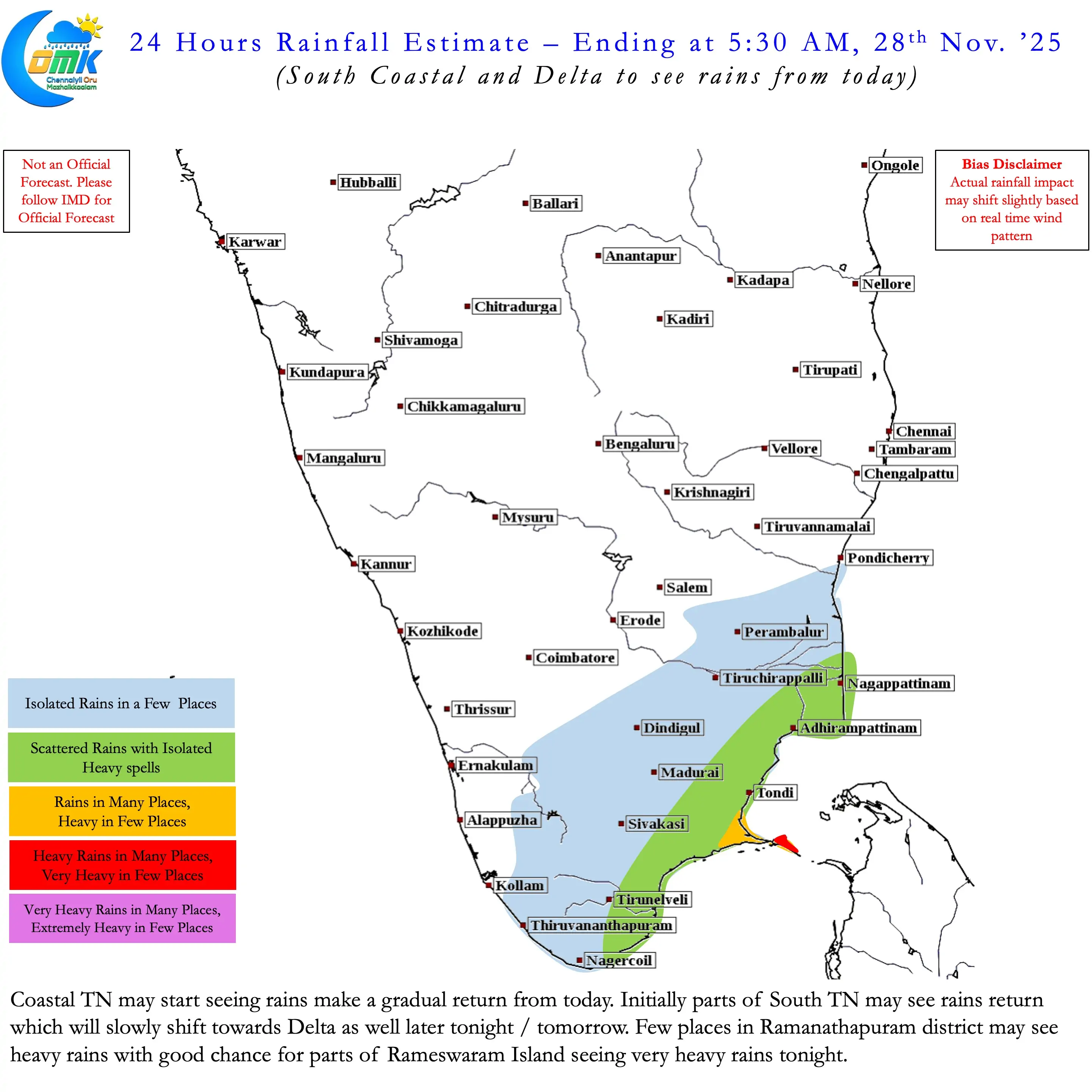
- Rains are likely to start over Coastal TN from today. Initially South coastal TN may see rains which will gradually move North as the circulation climbs up
- The two most vulnerable zones for rainfall are likely to be Delta coast and Rameswaram Island. Few places in delta coast may see 35 to 40 cms rainfall in a 36 hour period starting Friday evening. Rameswaram island may see similar numbers for the 36 hour period starting Friday morning.
- North Coastal TN may be the next vulnerable area due to the convex nature of the coast which may bring more rains to KTCC region compared to the adjoining areas.
- Rains for Chennai likely to start from Friday night with peak intensity from Saturday afternoon. Rains may ease from Sunday late night / Monday morning depending on the movement of the disturbance.