
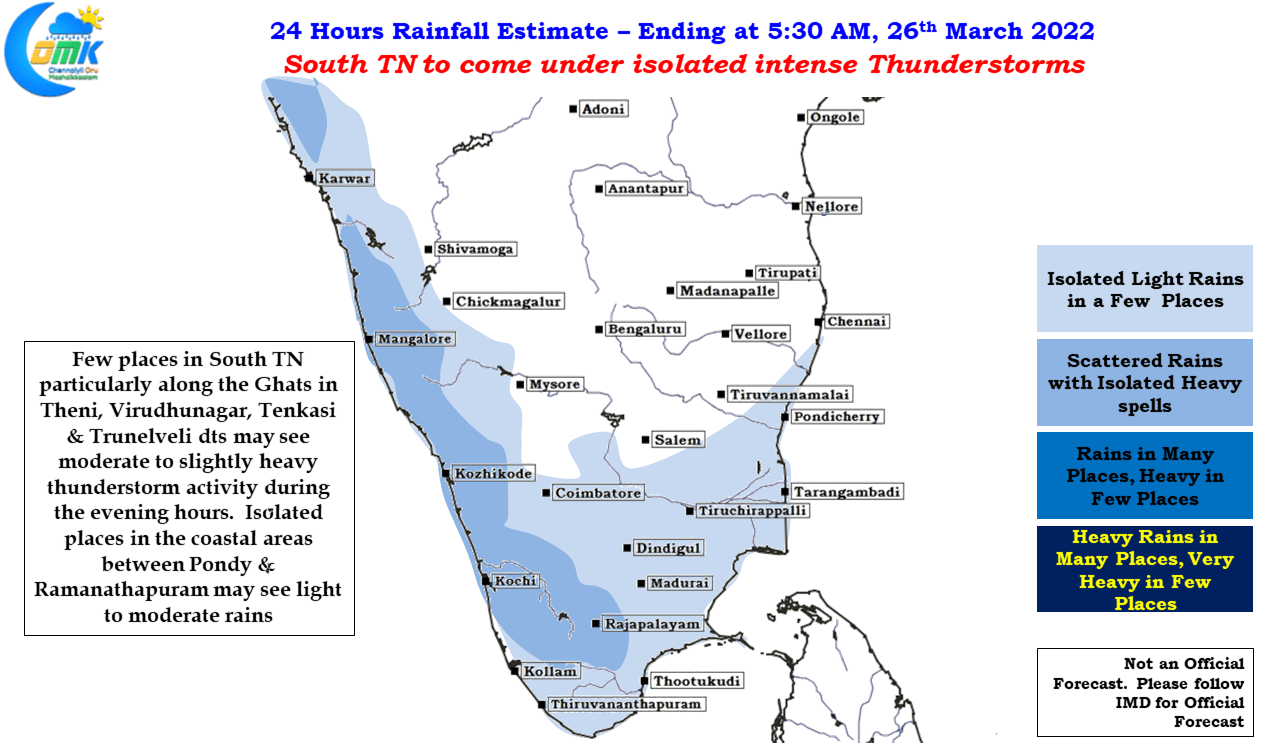
Slowly but surely Pre Monsoon Thunderstorms are picking up pace over Peninsular India. Wednesday saw parts of Virudhnagar & Tenkasi district getting very good rains, along the Eastern Slopes of the Ghats, as wind induced instabililty provided perfect conditions for convective thunderstorms to thrive after a clear sky during the first half of the day. As we mention often these pre monsoon / post monsoon thunderstorms are mesoscale events that are fascinating to track not just from the perspective of tracking rains but they also provide a lot of observation & learning which one cannot derive by just going with global weather model outputs.
In particular the intricate interplay that happens with winds at various altitudes not to forget the underrated role the two Ghats, both Eastern & Western, play in lifting air particles in addition to the day time heating make it a heady concotion of factors that provide for some unexpected outcomes at times in the form of rainfall location / intensity etc. On the one hand Line of Wind discontinuity, seasonal in nature, is seen along the Western Ghats which create the right conditions for thunderstorms to develop.
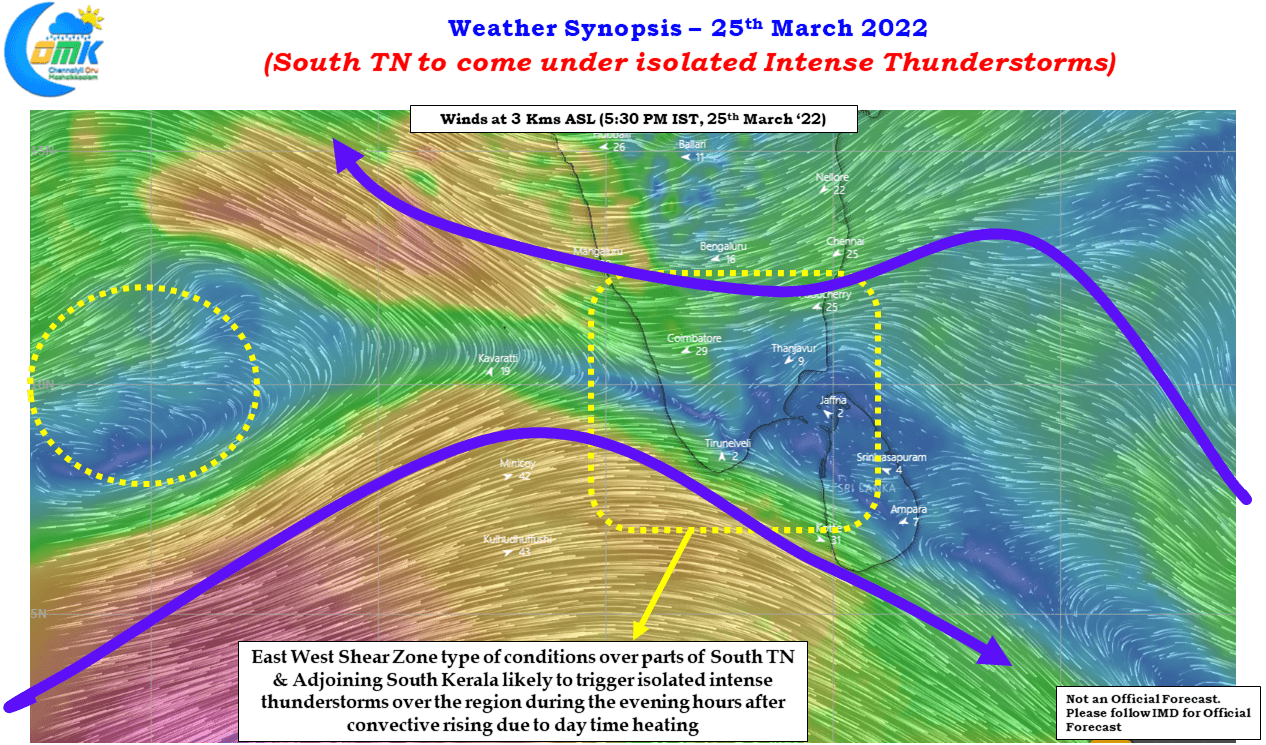
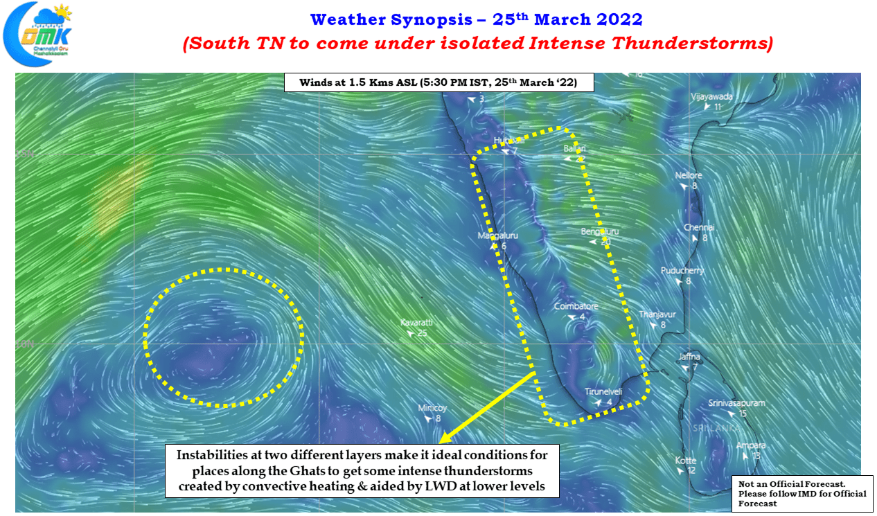
Wind charts also indicate an East West Shear zone type of condition existing over parts of Peninsular India, particularly over parts of South TN & adjoining areas of Kerala, at 3 kms ASL altitude which is likely to amplify the impact of the LWD conditions at the lower levels of atmosphere. This is likely to trigger intense thunderstorms over a few places in these regions during the later afternoon / evening hours.
The East West Shear Zone is also likely to provide for some light to moderate rains over coastal areas of Tamil Nadu between Pondicherry & Ramanathapuram while places like Chennai may see cloudy skies during the evening hours. But dont be surprised if you see isolated places getting a sudden shartp spell that lasts for short duration. The bulk of the action though is going to happen along the Western Ghats with once again parts of Dindigul, Theni, Virudhunagar, Tenkasi & Tirunelveli district likely to see moderate to intense thunderstorms in a few places.