
With the first week of April nearly gone, temperatures climbing up across most of Indian Sub Continent, it is time to look forward to some Pre Monsoon Thunderstorms across the sub continent as the the angle of Sun’s Rays races North towards Tropic of Cancer. As most of us know the Rains follow the sun with a few weeks lag so it is that time of the year where we can start looking forward to increase in rainfall activity through out the Indian Sub Continent though the heat is here to stay as well for the next few months.
While the extreme southern parts of Peninsular India has already seen the back of this year’s Summer for the rest of the Peninsular India, except for places along the West coast, and most of the Indian Sub Continent the summer is just starting. Seasonal models indicate abnormally warm April across Central & North India and possibly the first half of May could mean we might see some early momentum swing towards Southwest Monsoon though there is always many a lip between the cup and the lip.
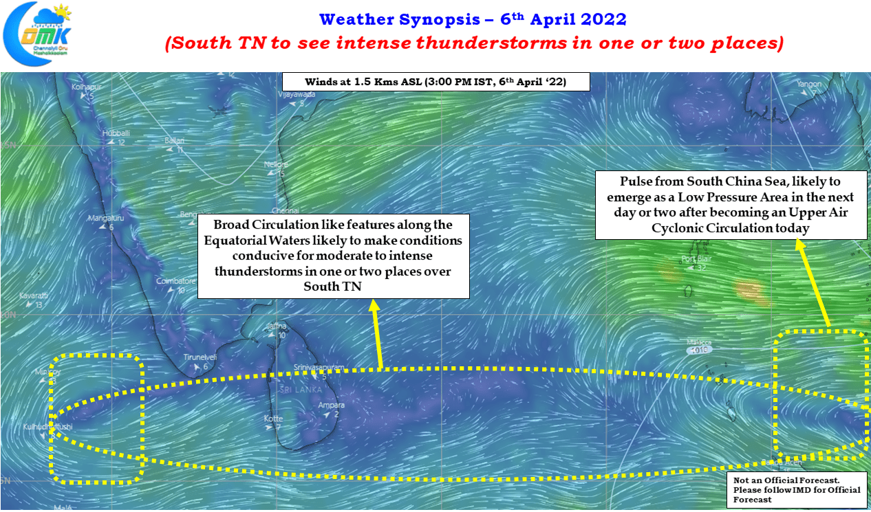
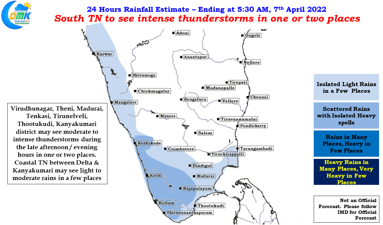
The last couple of days have seen South Tamil Nadu record moderate rains at a few places including places along the coast like Thoothukudi etc. The usual suspects along the Western Ghats like Tenkasi, Tirunelveli & Kanyakumari district has been also seeing decent thunderstorm activity. With a broad circulation like feature seen along the Equatorial waters of Bay conditions look good for some intense thunderstorm activity in one or two places along the Western Ghats today in South TN. The broad circulation also has an embedded pulse which moved west from the South China Sea that is expected to become a Low Pressure Area by most models in the next 24 to 48 hours or so.
While models remain divergent on the life cycle, path & impact of this expected LPA what we could possibly expect is a rainy spell for a few days starting from 8th for places in south of Delta & South TN any potential heavy rainfall episode will possibly depend on the intensity development of the disturbance. With MJO remaining in an unfavorable position will the presence of ER wave already in the East Indian Ocean & the potential influence of Convectively Coupled Kelvin Wave, coming in from the West, compensate for the suppressive conditions due to unfavorable MJO will decide the life cycle of this disturbance and its impact area.