
The Indian sub continent is unique in many ways when it comes to weather, not just hosting one of the most anticipated weather event in the form of ISMR, but also many intricate weather influences due to its location. On the one hand proximity to the Equator keeps the probability for tropical precipitation pattern to happen pretty much right through the year over Peninsular India while the seasonal westerly troughs exposes parts of the country to mid latitude weather phenomenon and in the process at times bring an interplay of both tropical and extra tropical weather events which does not happen at many places elsewhere in the globe.
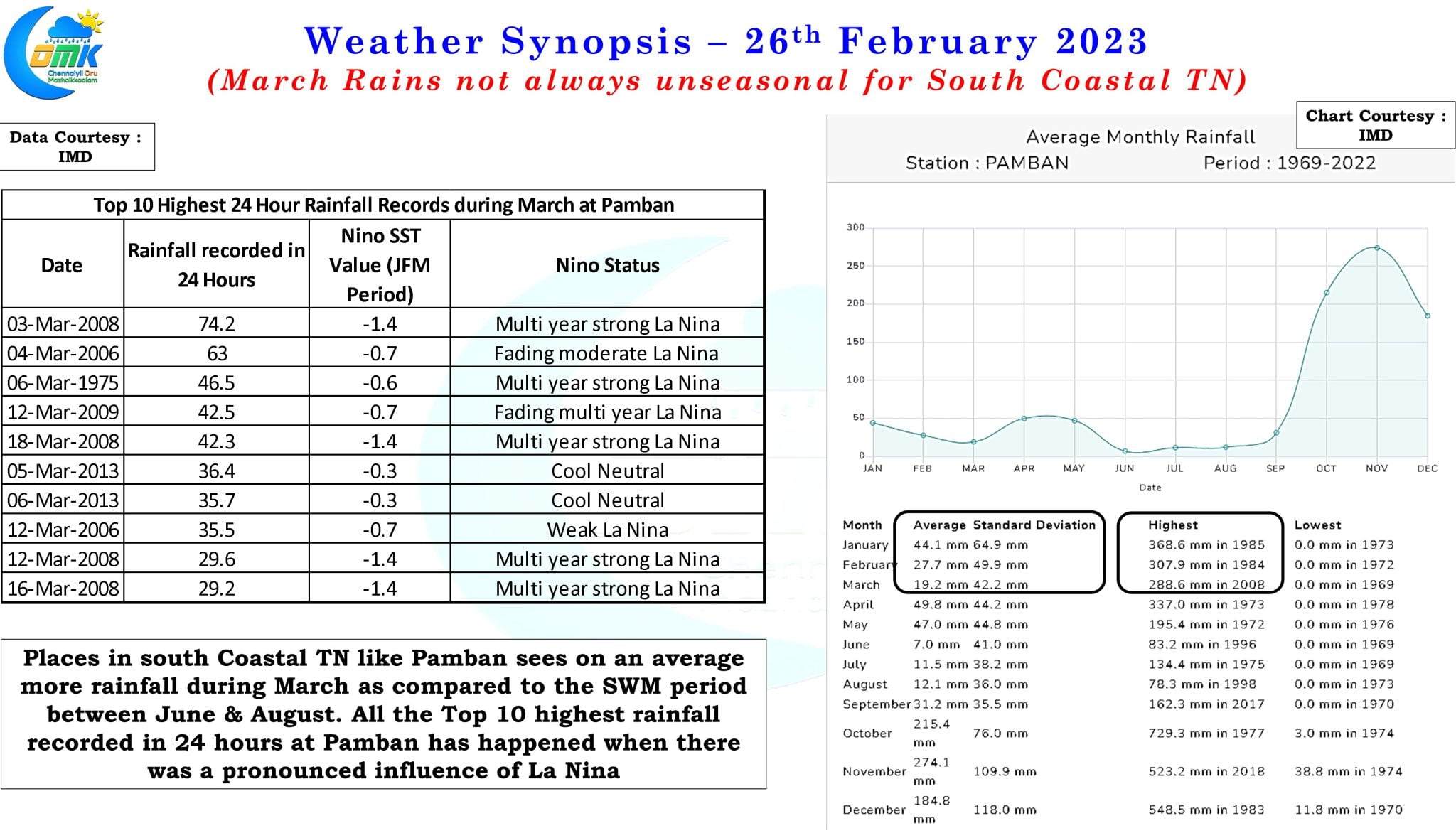
It might surprise many to see a post about rains when the overall weather discussions are trending towards summer and associated heat particularly with the much anticipated arrival of El Nino this on the back of a fading multi year La Nina episode. While places like Chennai in north coastal TN sees its driest period of the year during March, an average monthly rainfall of just 7.2 mm, places like Pamban in South Coastal TN sees higher average monthly rainfall during March as compared to Southwest Monsoon period between June and August. This is more pronounced when there is an influence of La Nina in the background, irrespective of whether it is during a multi year episode or fading, which is visible if one looks at the Top 10 highest rainfall recorded in 24 hours during the month of March at Pamban. While most of these episodes of rains may have coincided with the presence of a tropical disturbance in the region the common connecting thread is the presence of La Nina influence in the background.
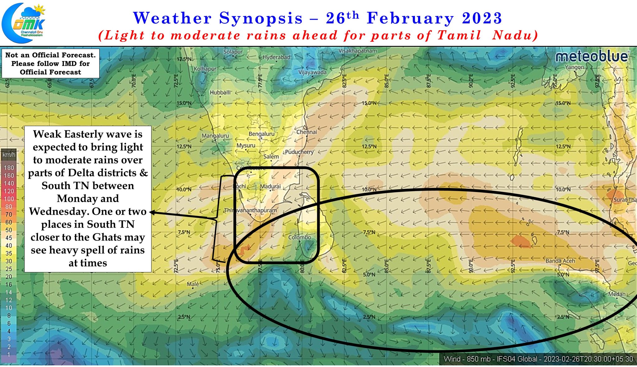
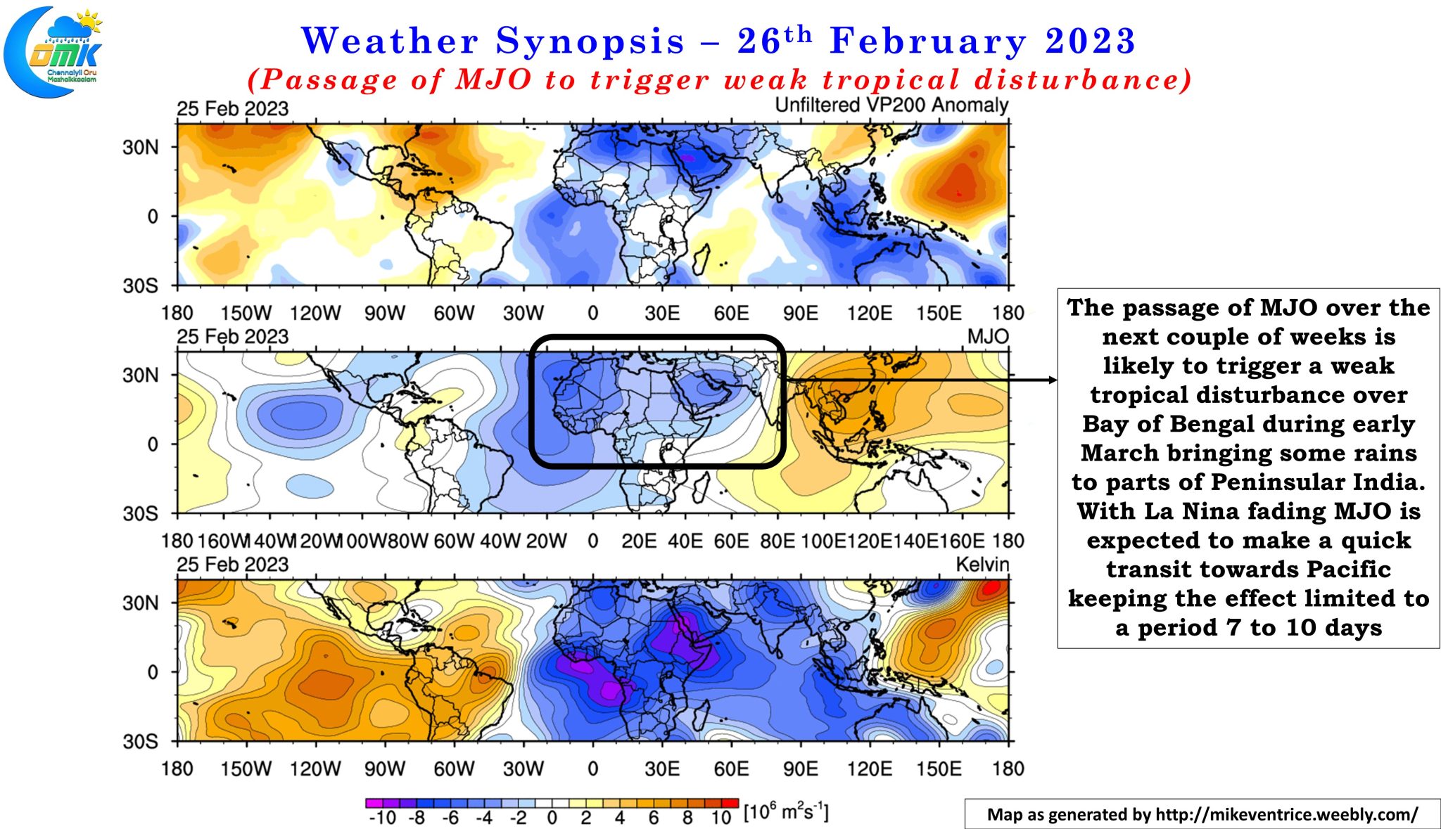
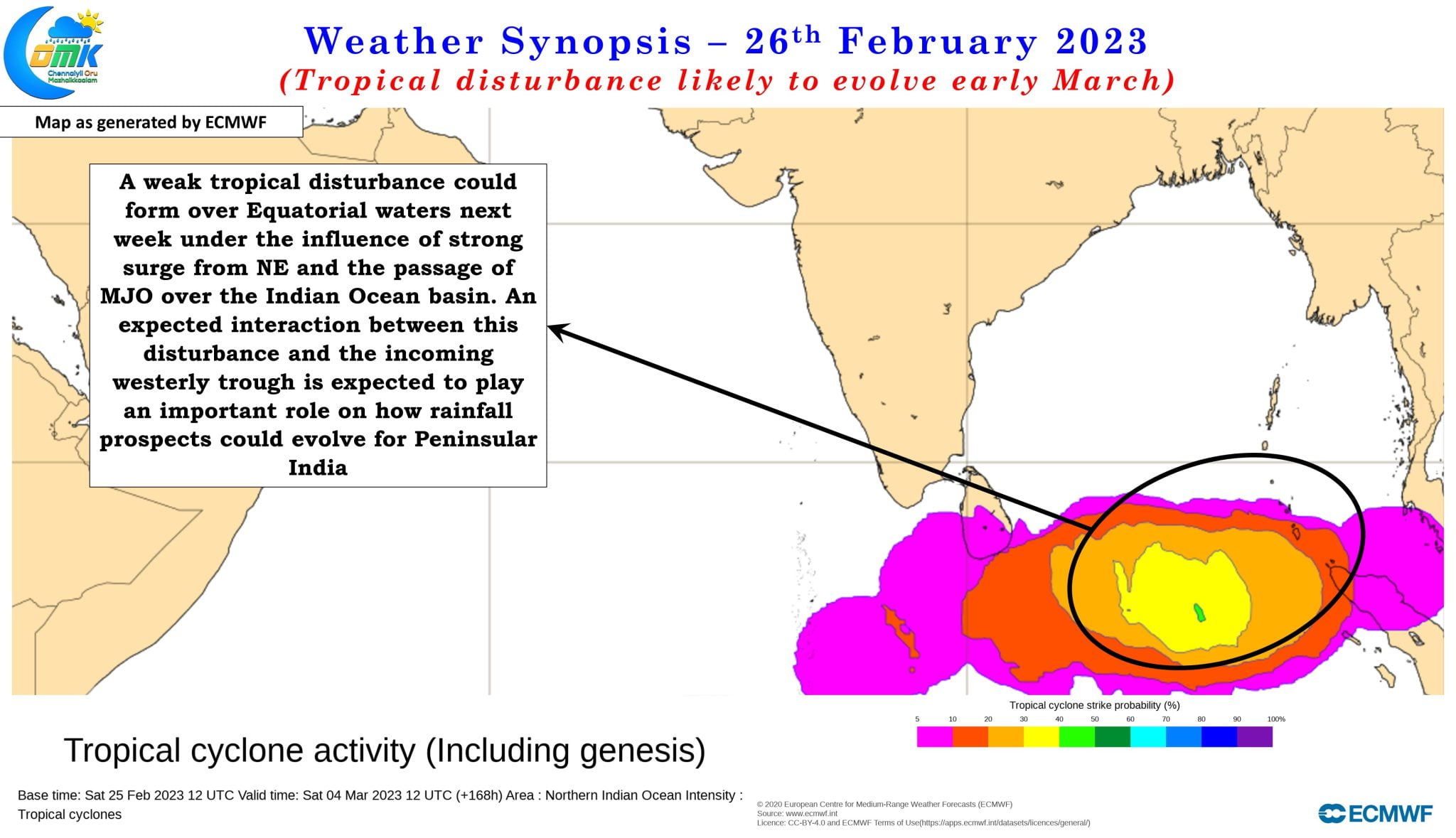
Weather models not only indicate rains are expected to return over Delta & South TN the coming week between Monday & Wednesday due to a weak Easterly wave but also potentially the development of a tropical disturbance a few days further ahead. The passage of MJO over Indian Ocean during the first week of March may play a role in spawning a disturbance out of the strong Easterly surge that is expected to push into Eastern Equatorial Indian Ocean. As has been the case since NEM 2022 an interplay once again between the incoming Mid Latitude Westerly Trough and the tropical disturbance is likely to decide on how the rainfall pattern is going to evolve over Peninsular India.
While we will keep a watch on this over the next few days there is certainly a tight alignment on rains over Delta & South the coming week between Monday and Wednesday with many places getting light to moderate rains while few places along the Ghats may see heavier spell of rains at times as the Easterly wave moves across the equatorial waters. Additionally the arrival of this Easterly wave and the subsequent tropical disturbance is likely to keep temperatures under check over coastal areas of Tamil Nadu like Chennai while not necessarily bringing direct rains to places in North Coastal TN.